
Upper Zarafshon Hiking Guide
A guide to hiking in the Kuhistoni Mastchoh district
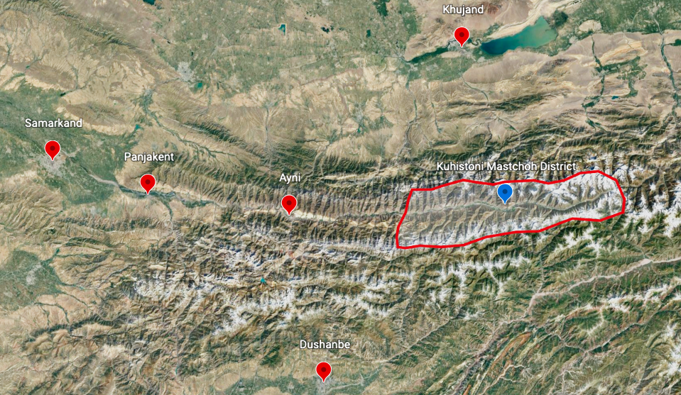
“Upper Zarafshon“ refers to the upper reaches of the Zarafshon River (Zeravshan) that starts in the high mountains of Tajikistan and flows past Samarkand. This area’s historical name is “Mascho,“ and the name appears today as part of the name for the government district that encompasses the upper Zarafshon river: Kuhistoni Mastchoh District. Locals will say “Kuhistoni Mastchoh“ (Mountainous Mastchoh): Кӯҳистони Мастчоҳ
Russian mountain climbers refers to this area as the “Takali Mountain Knot,“ as it is an area where several mountain ranges come together.
The Upper Zarafshon (Kuhistoni Mastchoh District) circled in red below:
Why go hiking here? Maybe you find Tajikistan’s Fann Mountains to be too popular and busy. If you want a valley all to yourself, you can find that here. Or maybe you’ve already visited the Fann Mountains. And perhaps the Pamir mountains are too far away, too expensive, too high in elevation and too cold for what you want to do. And, unfortunately, over the last decade the Pamirs have often been closed to tourists.
Why should you not go hiking here? There is almost no tourist infrastructure here, and very few people here speak English. There are also some rough sections with no clear trails. It is difficult to resupply here with village shops having limited selection. There is also only one formal guest house in the district.
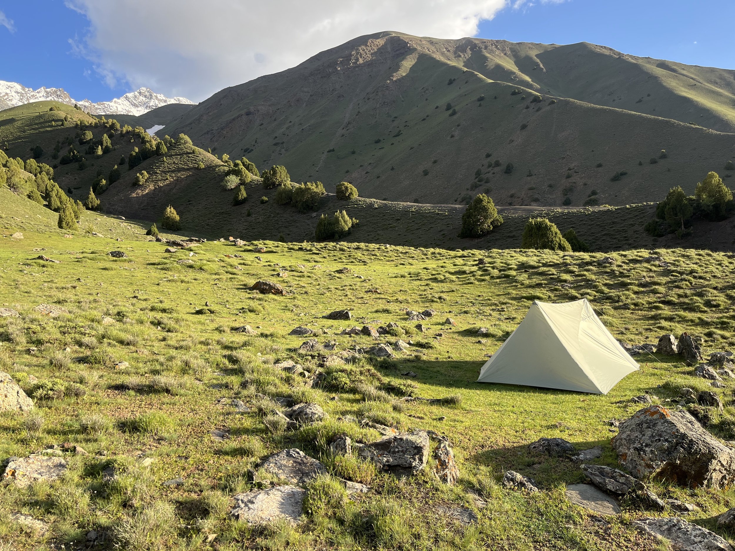
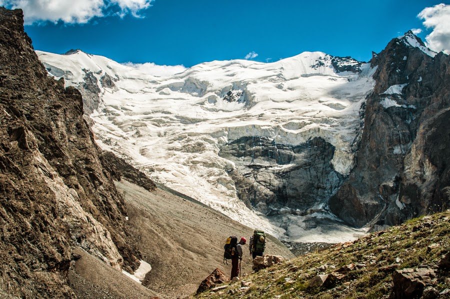
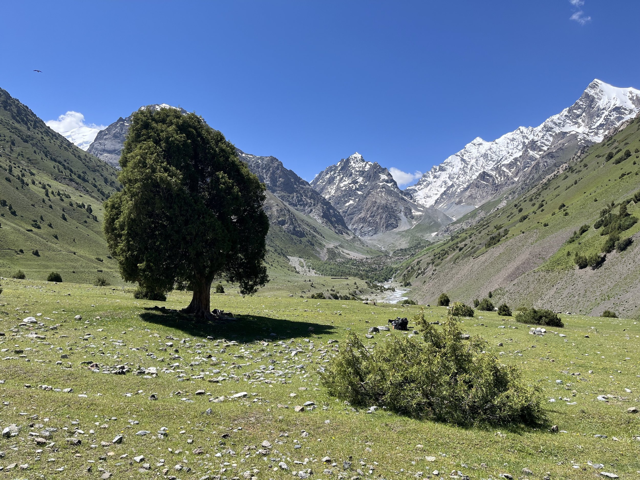
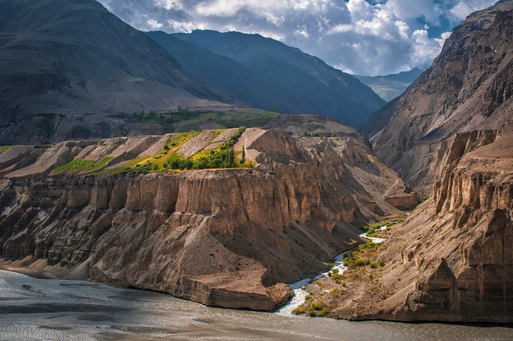
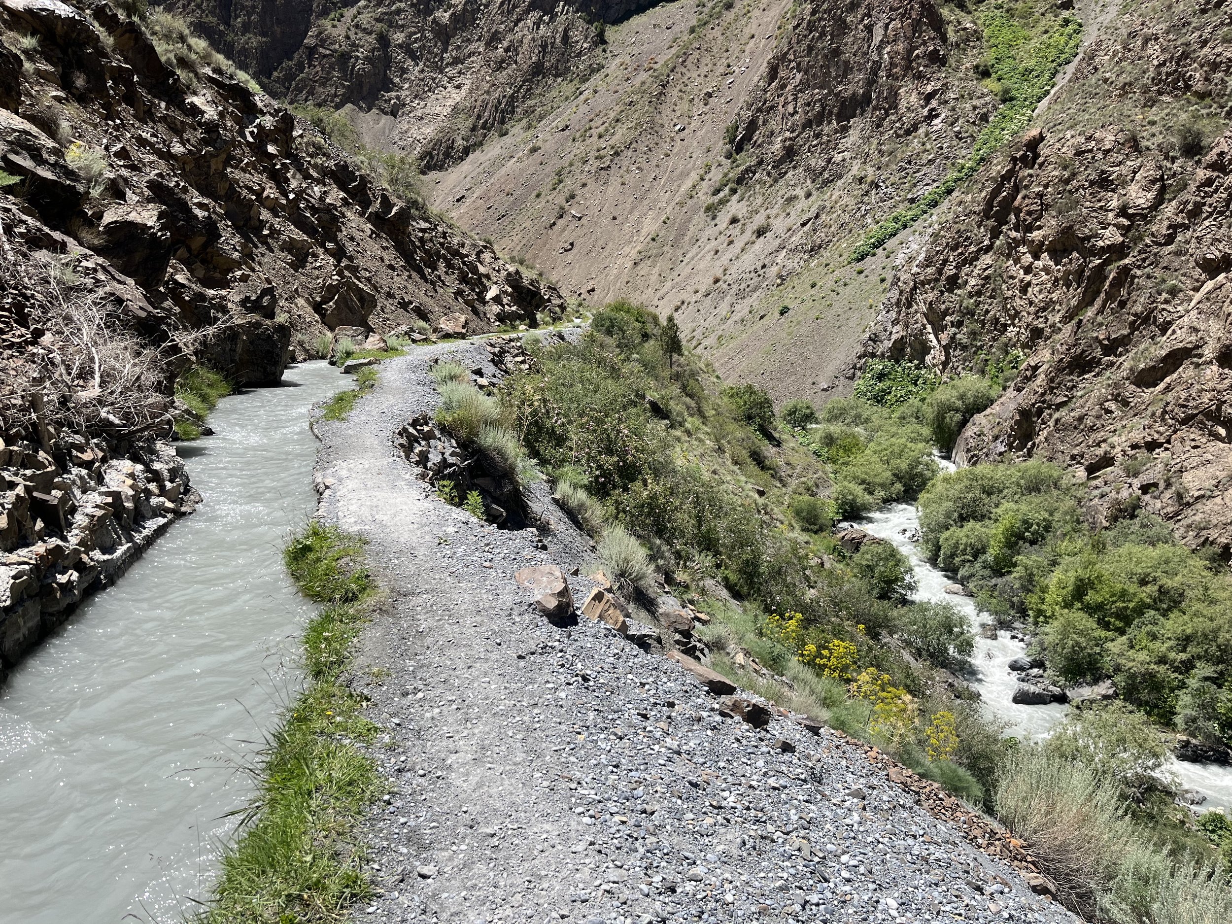
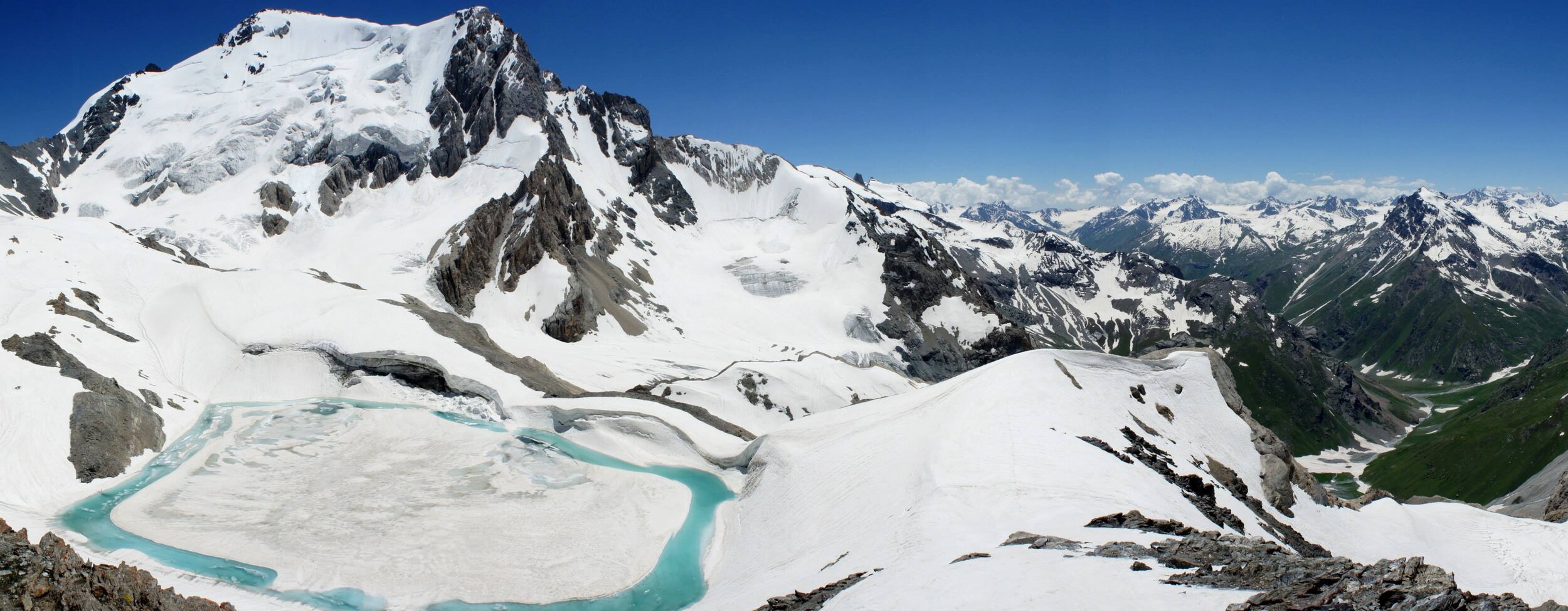
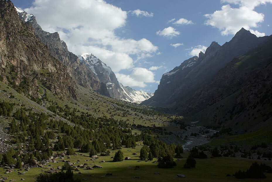
I’ll let these images below give you a good idea of what this area is like for hiking… (some of the photos below by T. Rakshin and V. Ermilova)


If you prefer a video preview, these two videos below were shot in 2021 and 2022. The first video starts in the Yaghnob Valley and then goes over Rost Pass to Ghuzn and the rest of the Kuhistoni Mastchoh District. The second video starts along the Zarafshon River and goes up and over the eastern Zarafshon mountain range through the Ti Shakh Pass. Don’t worry, there are far easier routes than what these videos show.
Practical Information
Information on this area:
Maps of the Upper Zarafshon hiking routes for printing:
Mid-section: Download PDF.
West section: Download PDF.
Accessing the region on foot:
Trip reports and mountain pass descriptions
General Information
What map should I use in general? (short version = OsmAnd Maps)