Padask Gorge Trek
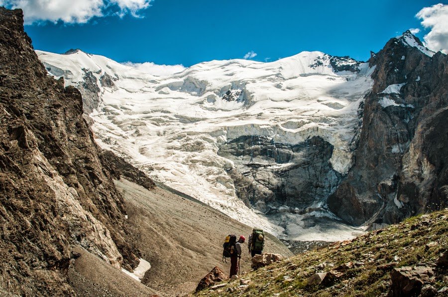
The East Padask Glacier (above), best known for the Youth of Siberia Pass that goes up and over the icefall. Photo by Timofey Rakshin.

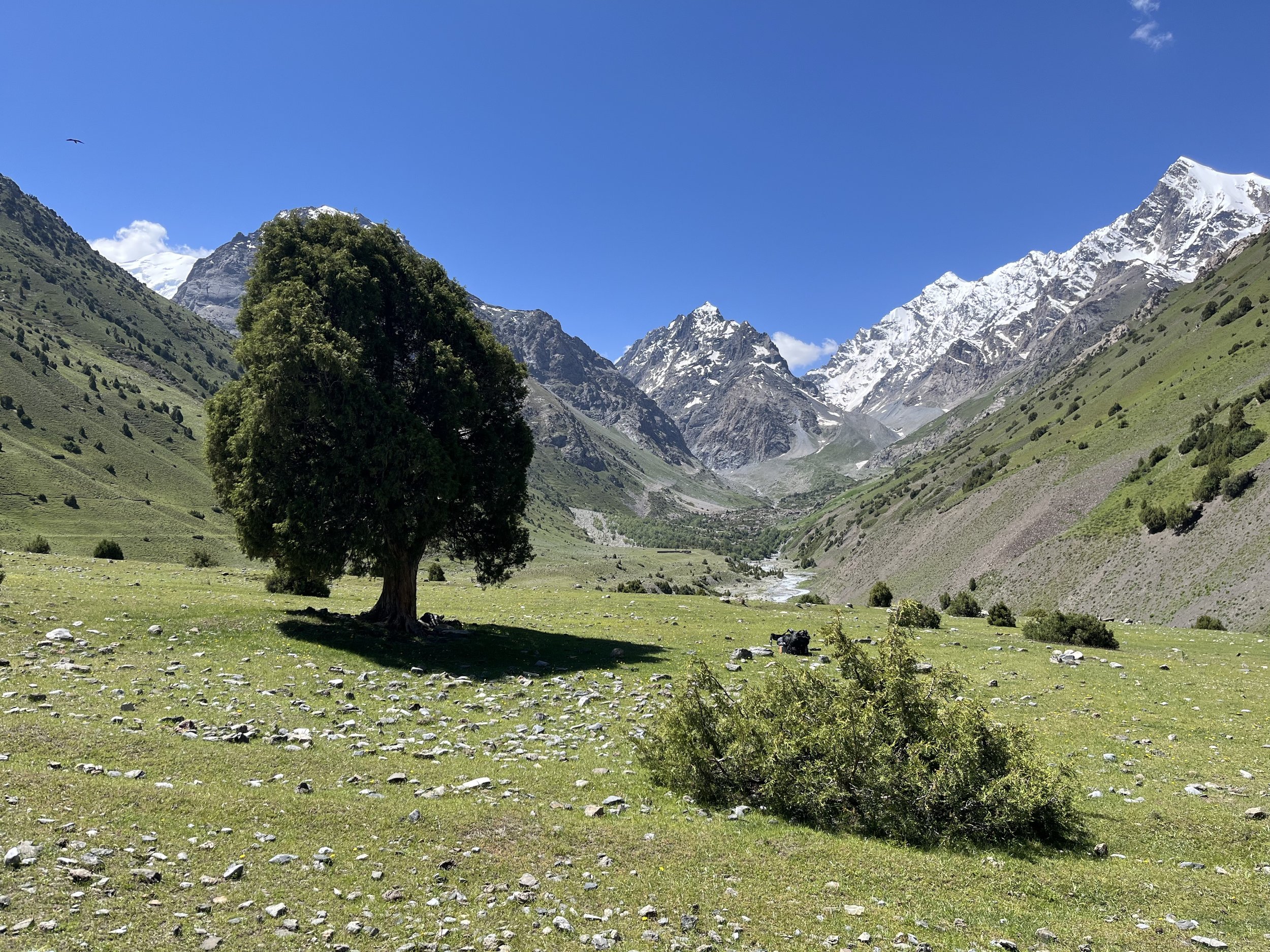
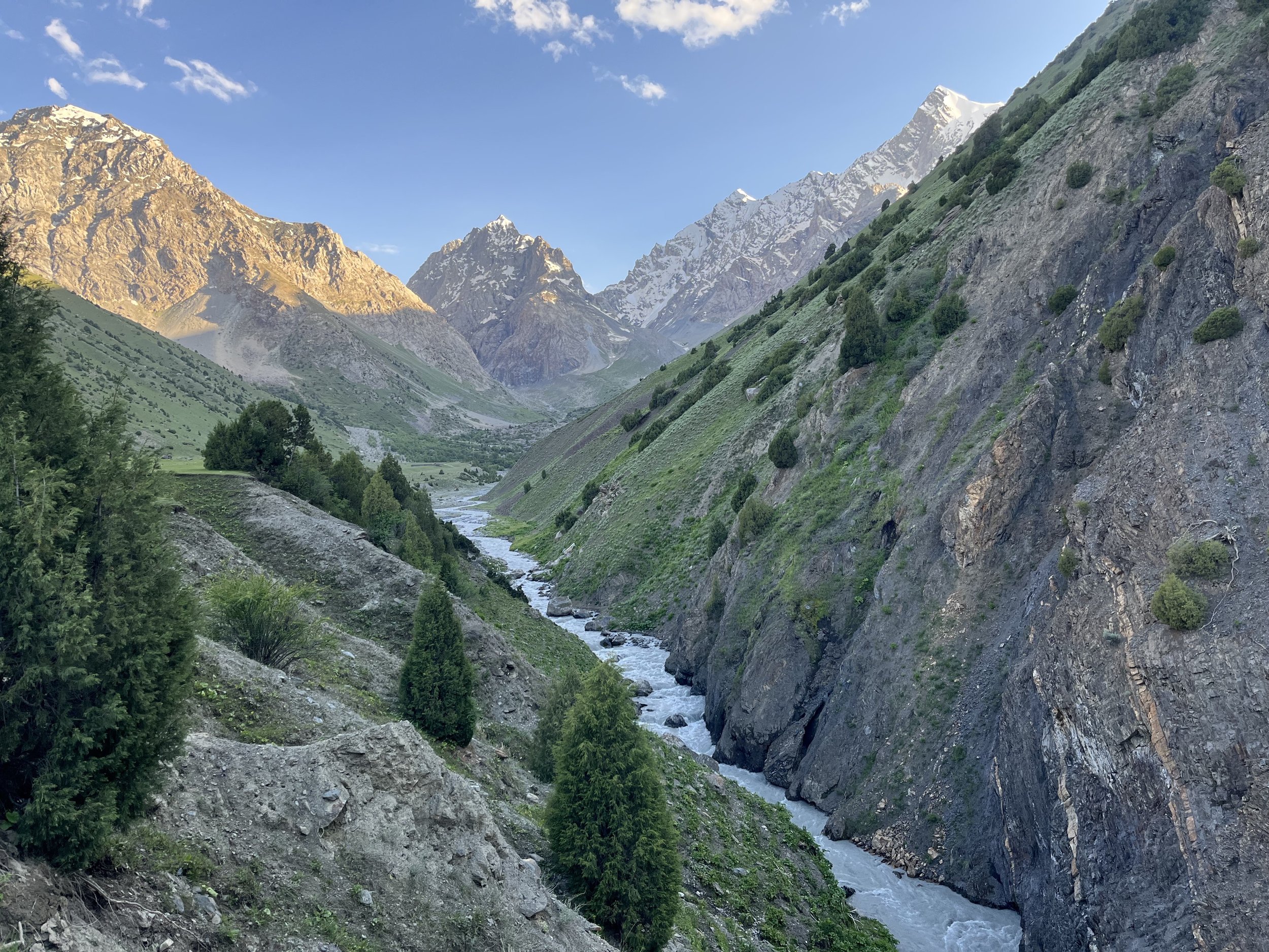
The grassy upper Padask Valley. Photo by Timofey Rakshin.

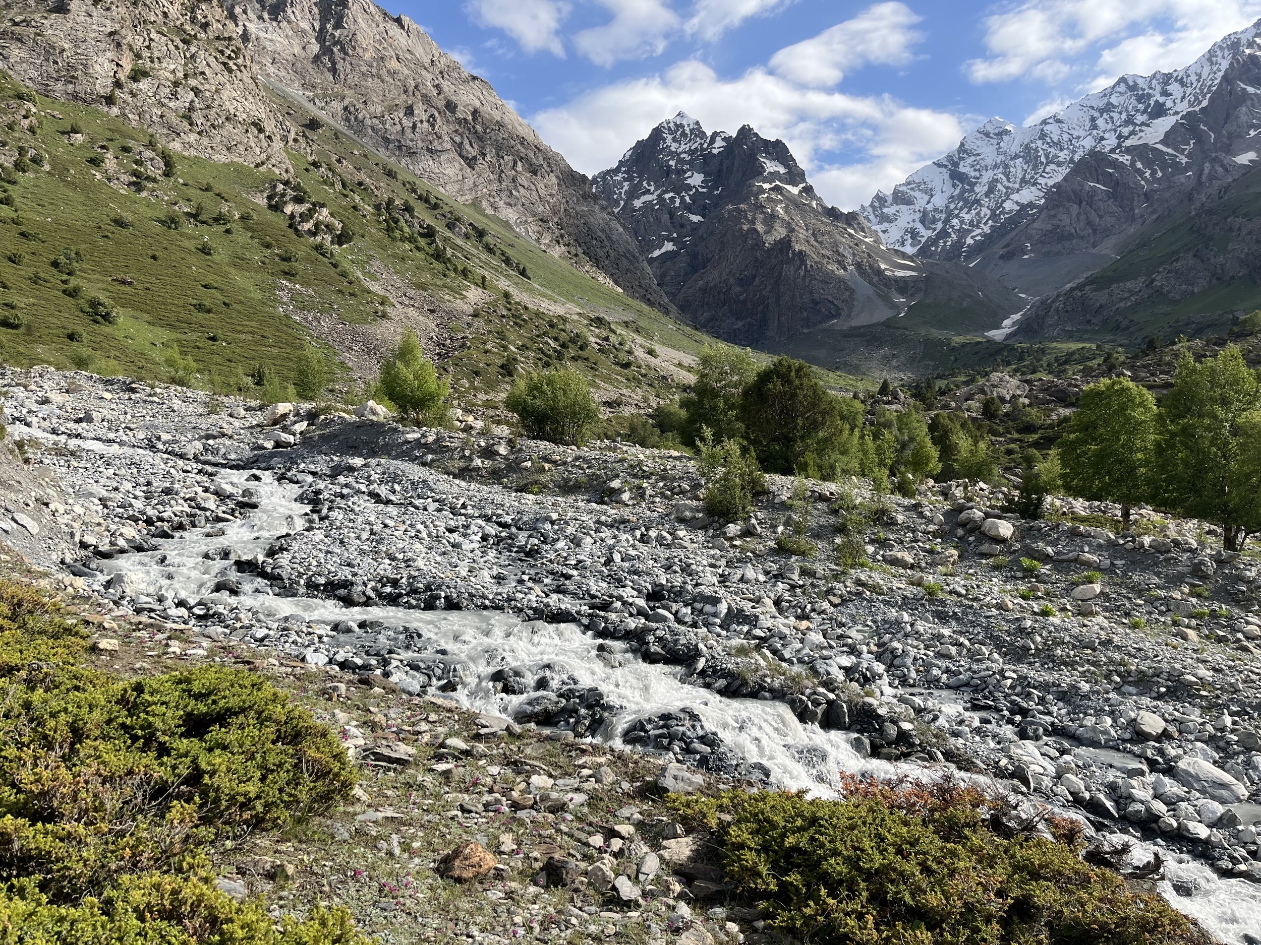
Photo above of the upper Padask Gorge taken late June 2022.
Trip Report
This trip report describes how to hike from the village of Langar (in Tajikistan’s Kuhistoni Mastchoh district), across the Zarafshon river, and onward to the upper Padask gorge. This is, at minimum, an overnight trek as it takes one full day of fast hiking to get from Langar to the upper part of the gorge.
Summary of hike:
28km from Langar to final camping spot in Padask gorge
1000 meters elevation gain
8 hours and 20 minutes moving time
12 hours total (medium pace, acclimatized for altitude)
Season: June through early October
GPS Track: Download GPX
Photo below: The Zarafshon River, downstream from Langar (June 2022).

Starting point: “Ustod Fayzullo’s Guest House” in the village of Langar. Nobody in the village uses the name (Guesthouse “Habib”) that was given to the guesthouse by the Zerafshan Tourism Development Association. The owner is Fayzullo Kholov. Everybody in this village and most people in the villages nearby know him. So just ask for “Ustod Fayzullo,“ or use the map on your phone to get to his house, labelled “Ustod Fayzullo’s Guest House.“
He is a professor of geography. Address him as “Ustod Fayzullo.” Ustod in this context means “professor.” You might instead deal with one of his adult sons. He and his sons speak Tajik and Russian.
This guest house rarely sees tourists, unlike guest houses in the Fann Mountains and on the Pamir Highway. So it would be very helpful if you could call ahead of time. The phone # is +992 928 911051
The cost as listed by the Zerafshan Tourism Development Association is $17 per person for accommodation plus dinner and breakfast. However, I find this price to be out of date considering the massive cost of living increases in Tajikistan (far above what locals have experienced in Uzbekistan and Kyrgyzstan). I think $20 per person or more is fair (bring Somoni, not dollars).
The rooms are excellent and the meals/food is more than enough. You sleep on a “kurpacha” (a soft roll-out mattress). There is a squat toilet (very clean and not smelly) and warm water for washing. Electricity was 24 hours per day when I visited in late June 2022. And importantly – for those who arrive not by car but on foot from the mountains – there are numerous electrical power outlets/plugs to charge batteries and devices. Langar is scenic and quiet. No grocery store (as of summer 2022).
Important note: there are many villages in Tajikistan named Langar. Make sure you have chosen on the map the Langar that is next to the Zarafshon river.
How to get to Langar? Check out our instructions on how to get to Langar.
Photo below: Ustod Fayzullo’s Guesthouse. The sign reads “Village of Langar, 18.“ The house number is 18; there are no street names.

The hike: The first ten kilometers are walking on a dirt road. The views are very nice and there is minimal traffic – only a few cars drove by. You will get a view of the Zarafshon river, and of the irrigated farmland (that belongs to the village of Madrushkat, not Langar) It will, however, be warm by midday. So it’s best to leave as soon as possible after breakfast.
Along this road you will pass a gas/petrol station, two toilets (outhouses/drop toilets). You will also pass several water stand-pipes that dispense clear (non-silty) water. The locals drink this water. But you should be fully stocked on water from the guest house.
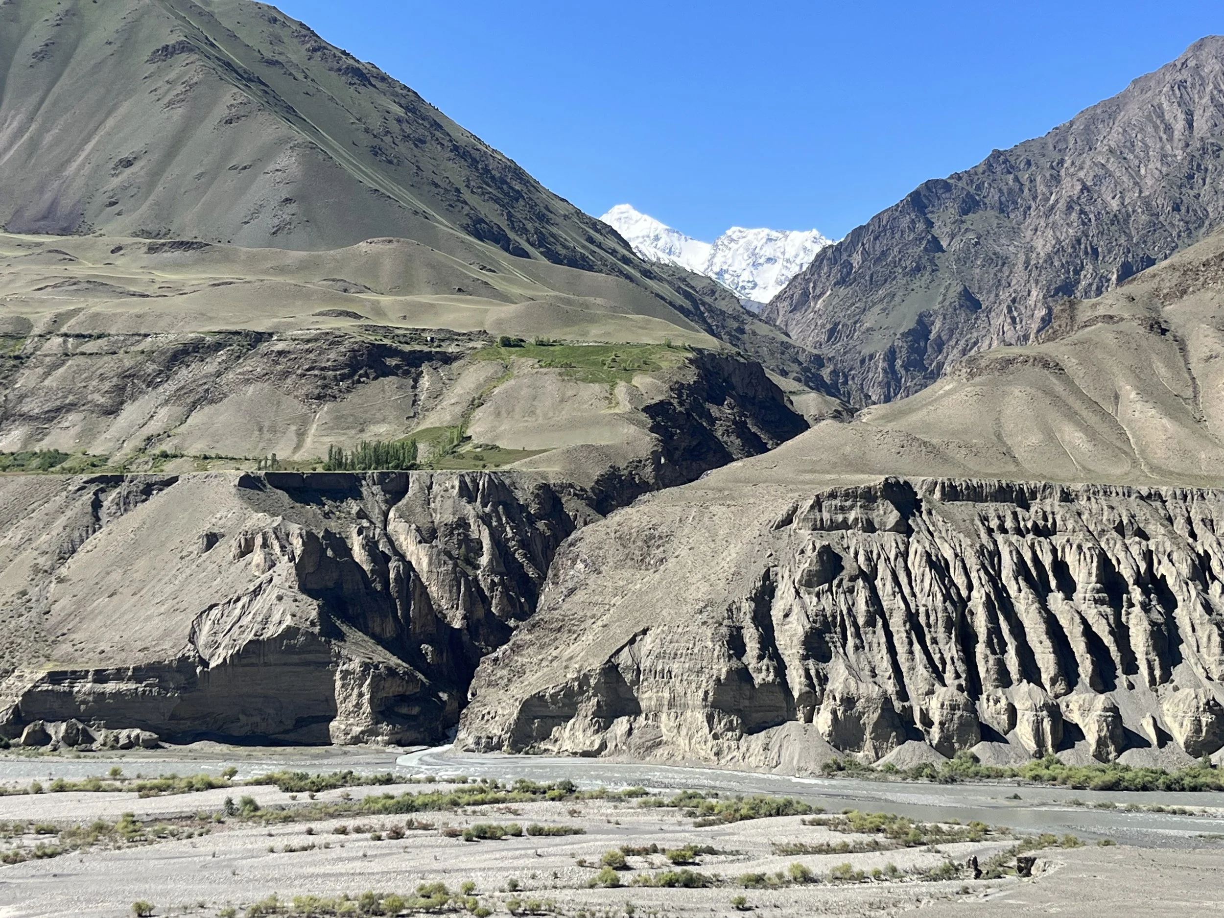
In the photo below (taken from the main road on the north side of the Zarafshon River) you can see where the Padask River flows out of the gorge and into the Zarafshon. You can also see why you won’t be walking in the bottom of the gorge. The main trail starts just above the green patch of vegetation in the center of the photo.
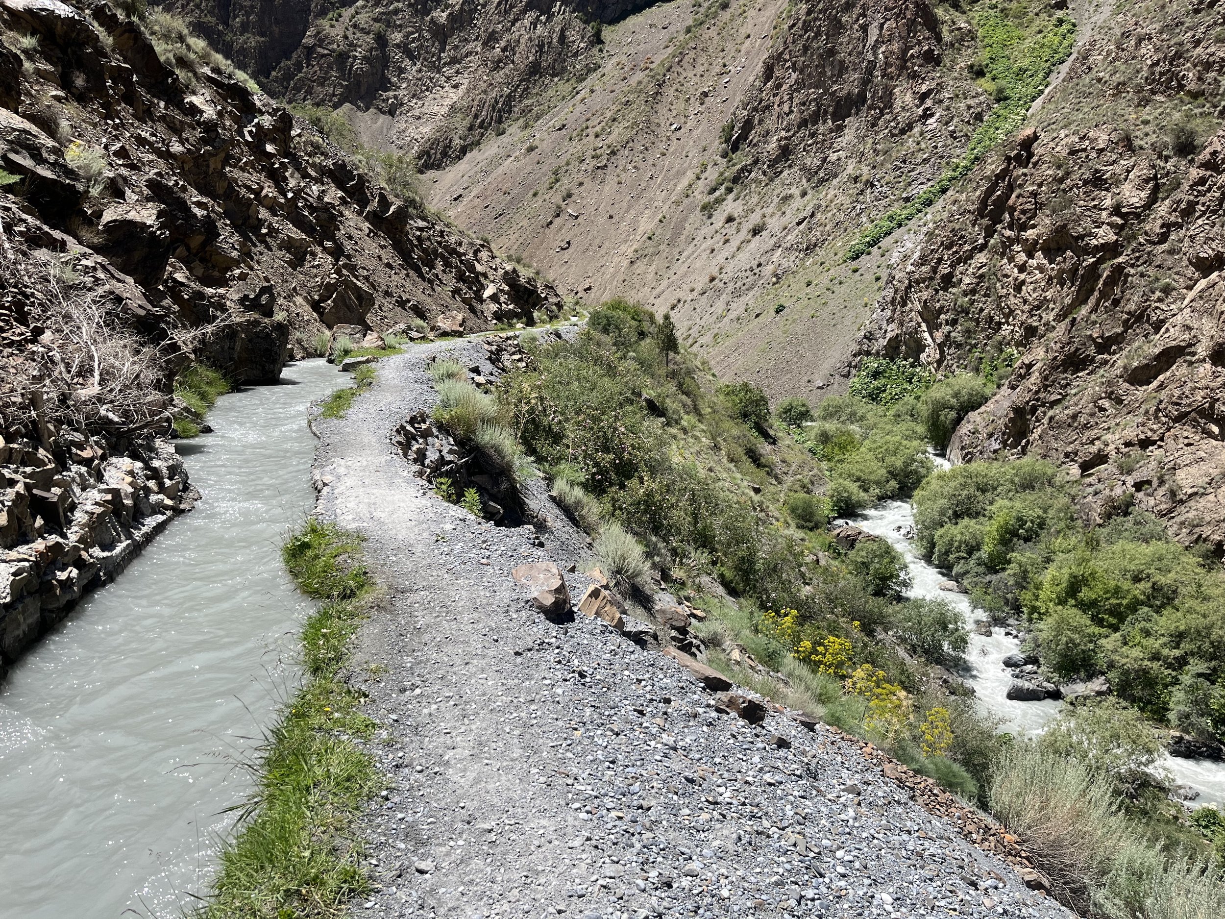
You will have to lose some elevation when going down to the bridge over the Zarafshon river. After gaining elevation walking up the road after the bridge, you will have two choices: walk to the village of Padask and then take the small dirt road that goes directly west to the gorge, or take a shortcut through the farmland and go straight up to the gorge (but sometimes on a trail that is not very clear). The GPS track takes this shortcut. Be warned that about 100-200 meters of this shortcut go through tall grass and vegetation (in early summer) and there is no sign of a trail. But soon you will be on a trail that (mostly) follows the irrigation ditch/stream seen in the photo below (known in this region as an “arik”).
There is very little to say about the trail in the gorge: this is a safe and easy hike (by local standards).
The main concern will be water. I drank a good amount of tea at breakfast and then carried 2 liters in my bag. It was enough to get to the first good spring (I didn’t refill at the stand-pipes as they were right near the beginning of the hike). The water in the arik stream and in the Padask river was very, very silty. Too silty for a water filter, and the type of silty water that must be settled in a bottle before chemically treating and drinking, but which tastes like rock/sand. The locals pointed me to a nice spring at 2410 meters (marked on the map, and in the photo below). The next spring after that is at about 2600 meters (also marked on the map). After this you need to be careful. At 2760 meters you will cross a stream next to a large shepherd camp. This will be your last chance for clear non-silty water before the final camping spot at 2840 meters.

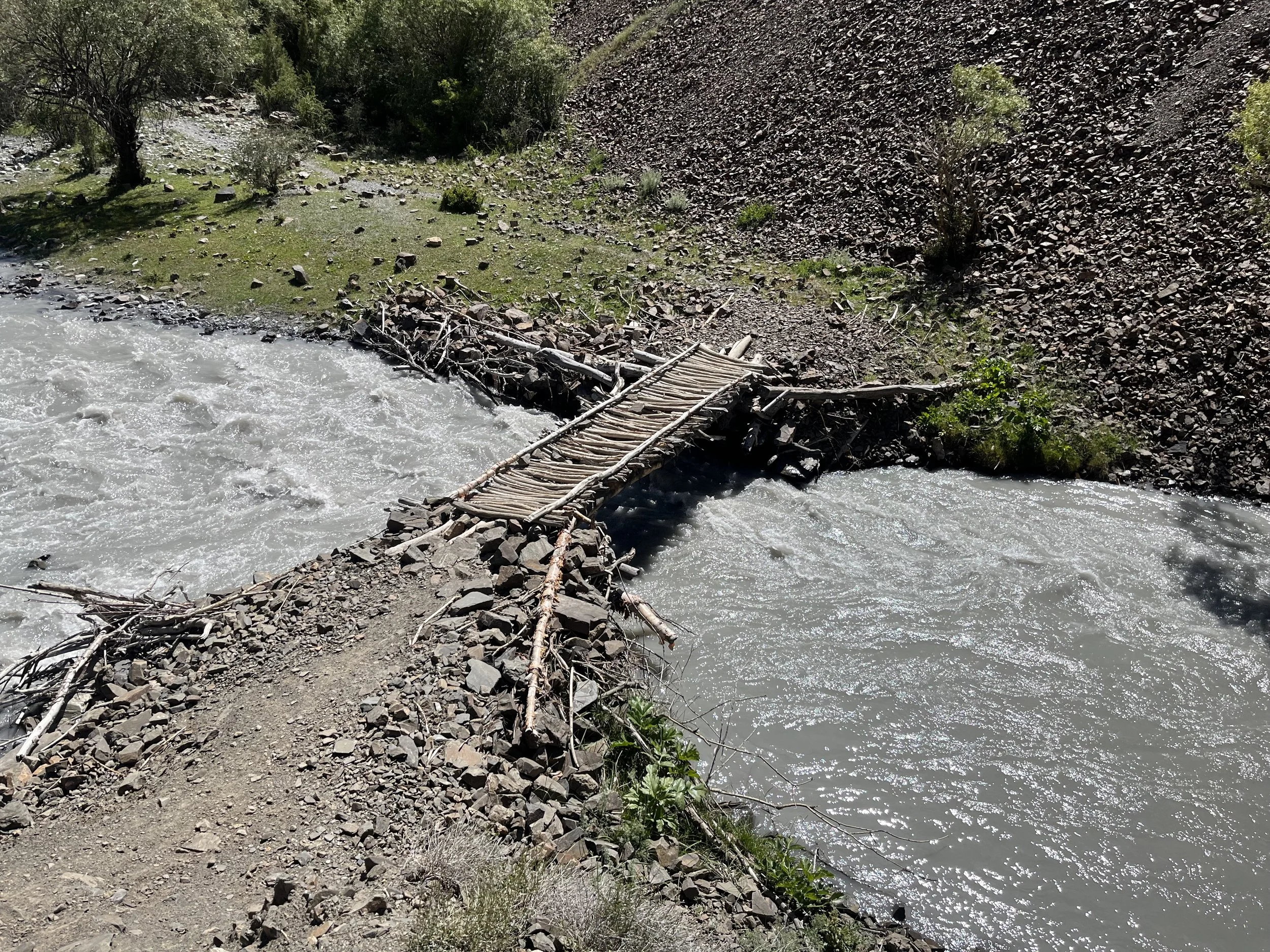
I updated the map based on my trek in summer 2022. Note that occasionally bridges get destroyed and sometime rebuilt in new locations. But it should be obvious where to go if the trail/bridges change in the future – the trail is well-established and used regularly by shepherds.
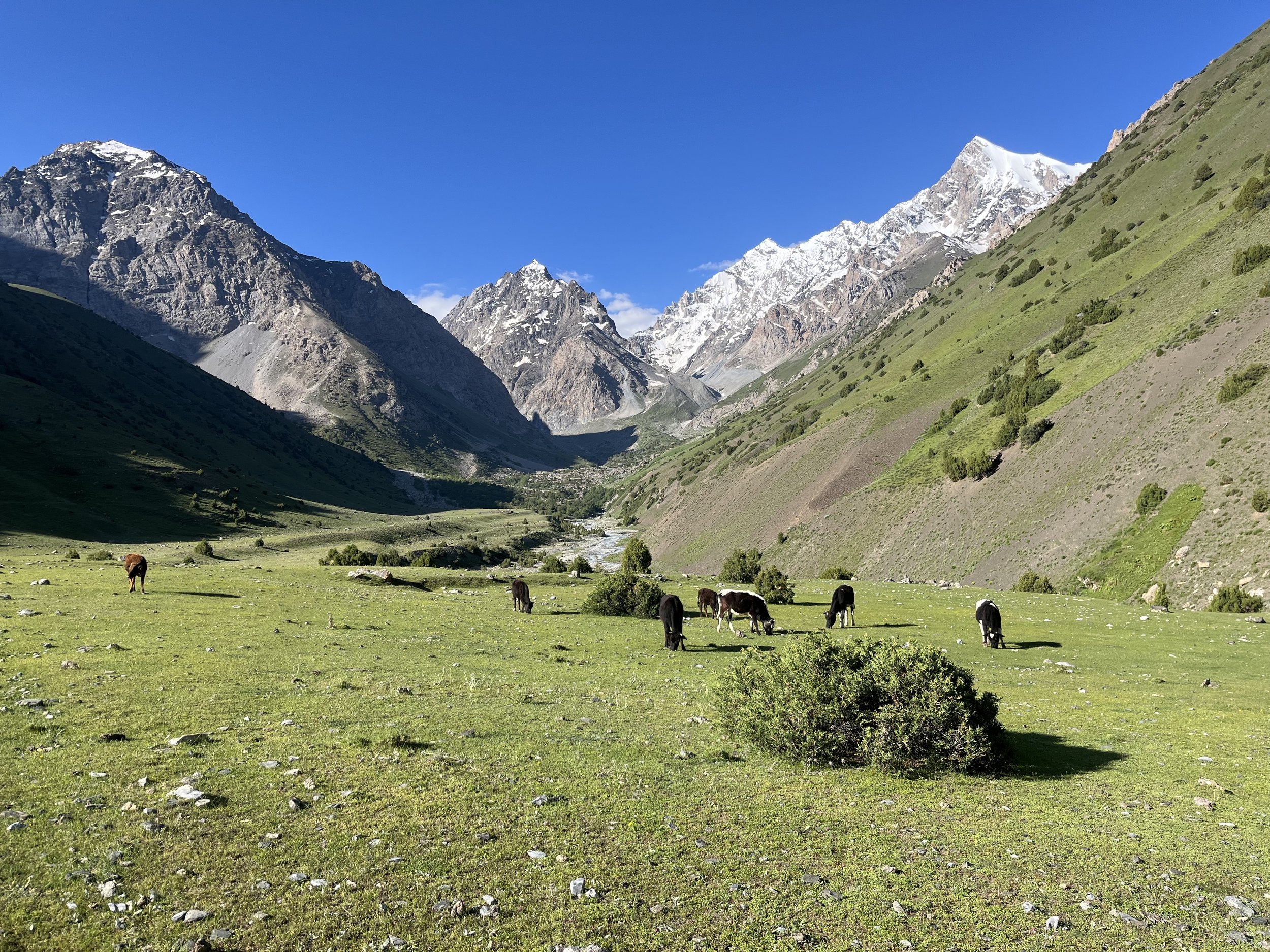
Shepherds and local people: I met locals working on their farm land near Padask village. After that I only met two groups in the Padask gorge – one group with donkeys heading up to deliver food to a shepherd camp, and a group of boys coming down with firewood. All of the shepherd camps along the river were abandoned (last week of June) and the shepherds were at higher camps. However, cows are left on their own and at night some of them come to the shepherd camps to shelter in a barn or behind a rock wall.
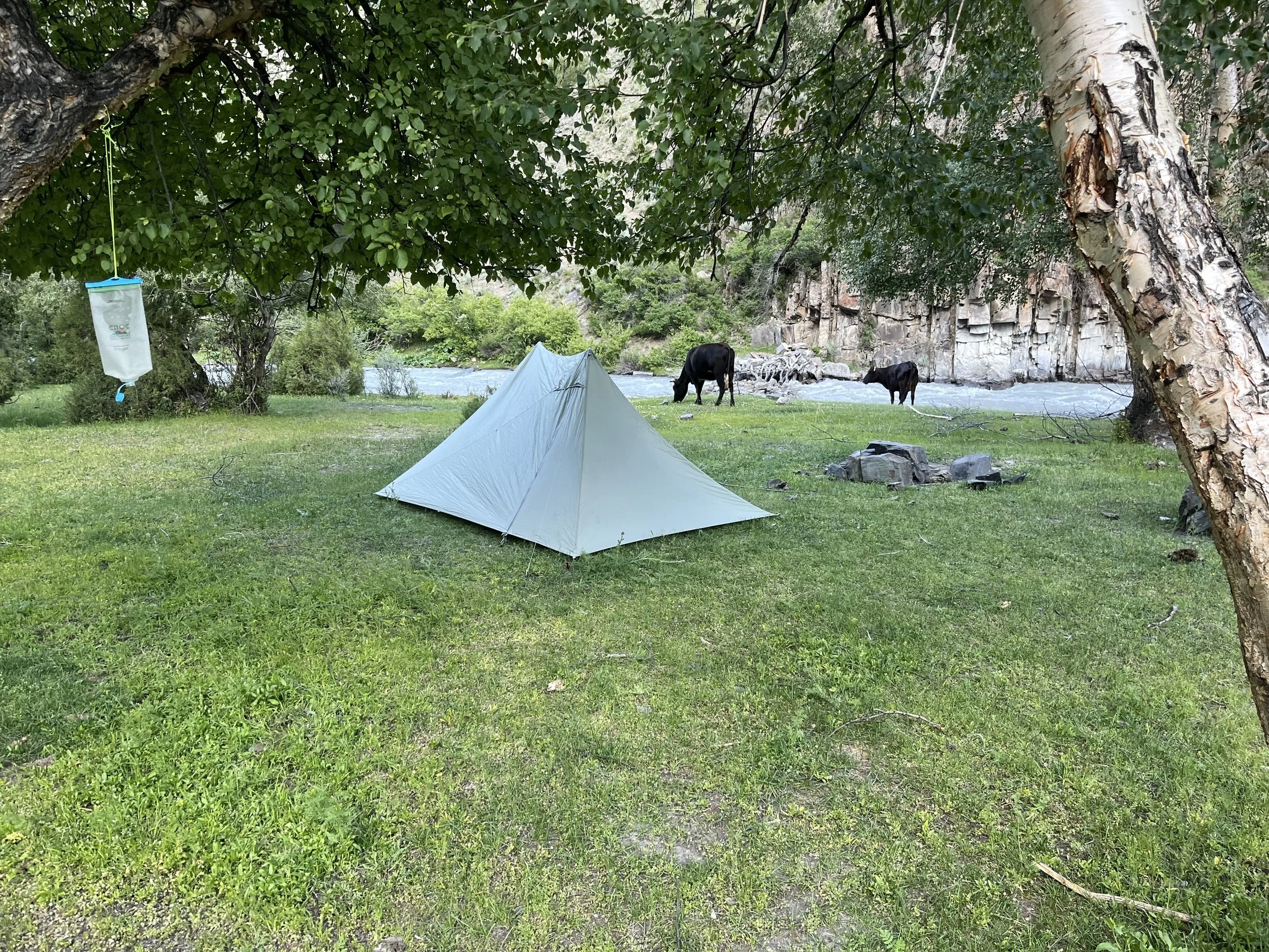
Camping: At 2590 meters there is a good flat grassy spot that is not too far from one of the springs mentioned above. This is where to camp if you are hiking slowly or stopping to enjoy the scenery. Just downriver is a cattle barn and much wider open grass spaces under birch trees. This is where I stayed (photo below). However, you need to share the space with cows. If you are hiking fast, then I suggest one of the camp spots at 2820 to 2840 meters (marked on the map).
What next? (A) Go back down to Langar, (B) take a side trip up to the Padask icefall glacier or (C) over the Surinovi Bolo Pass to the upper Valighond gorge. I had plenty of time so I did B and C. From the Valighond side you can also return to Langar (down via the Valighond Gorge) or go onward to multiple destinations.
For the Surinovi Bolo Pass, read these instructions. It’s very easy (compared to other passes nearby).
For the Padask icefall glacier, it’s simple. Go up the route marked on the map (right bank or north side of the East Padask River). There is a near zero % chance that locals call this side gorge “East Padask.” That designation was given by Soviet mountain climbers who access the Youth of Siberia pass through this gorge (it’s an extremely difficult mountaineering pas; not for hikers). I wasn’t able to talk to any locals nearby, so I don’t know it’s real name. Even the main upper gorge might not be named Padask as gorges and rivers often change names as you go up river, a fact ignored by Soviet map makers who tried to give a river the same name along its full course.
It’s a steep 3km hike to the icefall viewpoint (700 meters elevation gain) and about 10% cattle trail and 90% open terrain. It took me 3.5 hours to the top, including a lunch break and some exploring (with my full pack and 10 days’ worth of food). It can likely be done more quickly by a person in better shape or travelling lighter. Going down took about 90 minutes. The photo below is halfway up, looking back down. At the top of this page is a photo of the icefall.

The really good view of the icefall is from up close at the bottom of the icefall, not from the viewpoint marked on the pass. I walked along the top of the glacier moraine until a point it was no longer passable. My suggestion is to attempt to go up the glacier not on top of the moraine, not on the inside of the moraine, nor on the very rough rock covered glacier, but on the outside of the moraine (east of the glacier). Can you camp up there? The Russian mountain climbers linked below did, but they have a winter set up with their tents and cold weather sleeping gear. Plus, they are used to setting up a tent without being able to get a single peg in the ground. You may have difficulty finding or preparing a spot to camp, and bad weather at night can get real bad at this altitude.
More photos
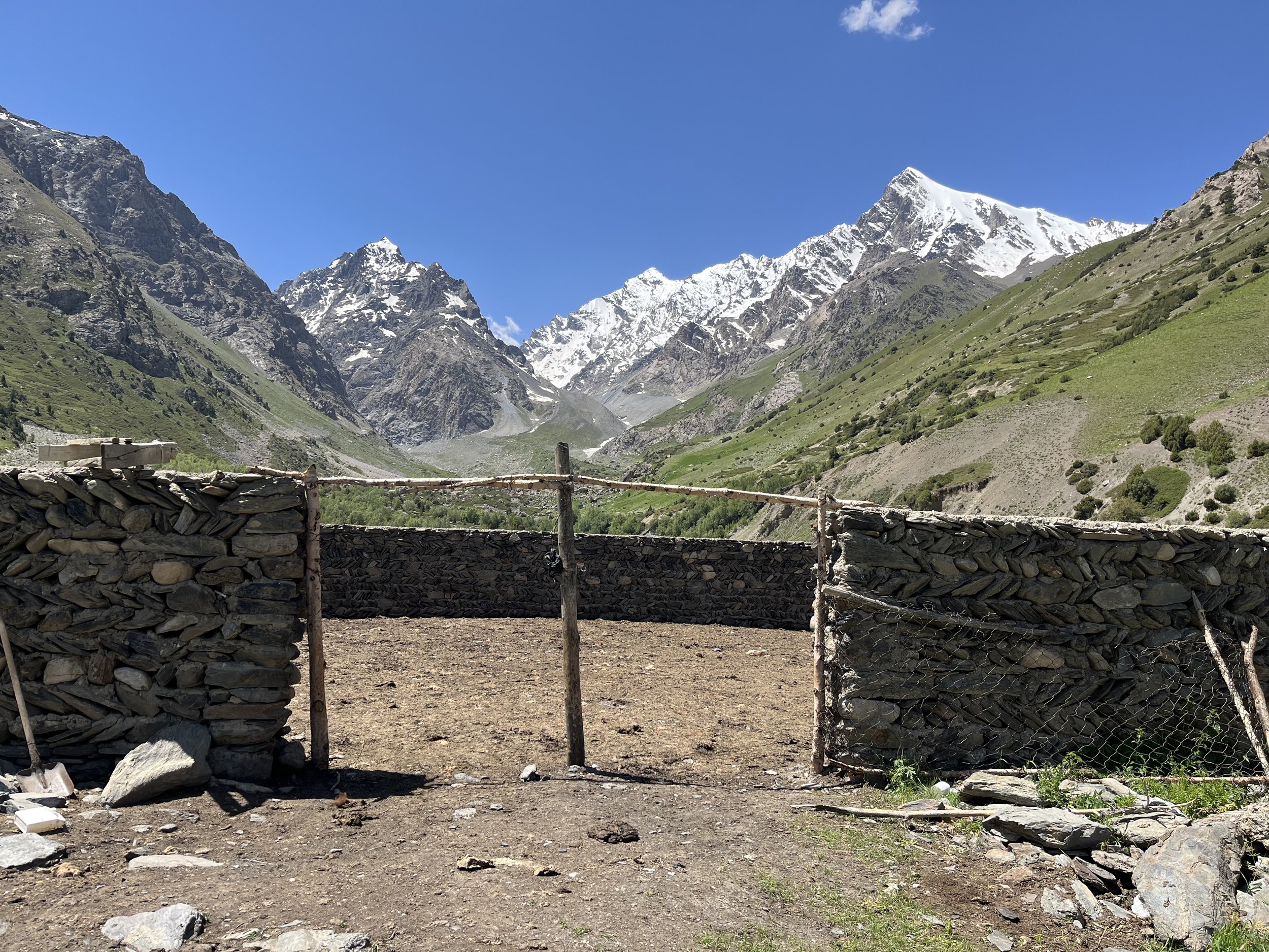
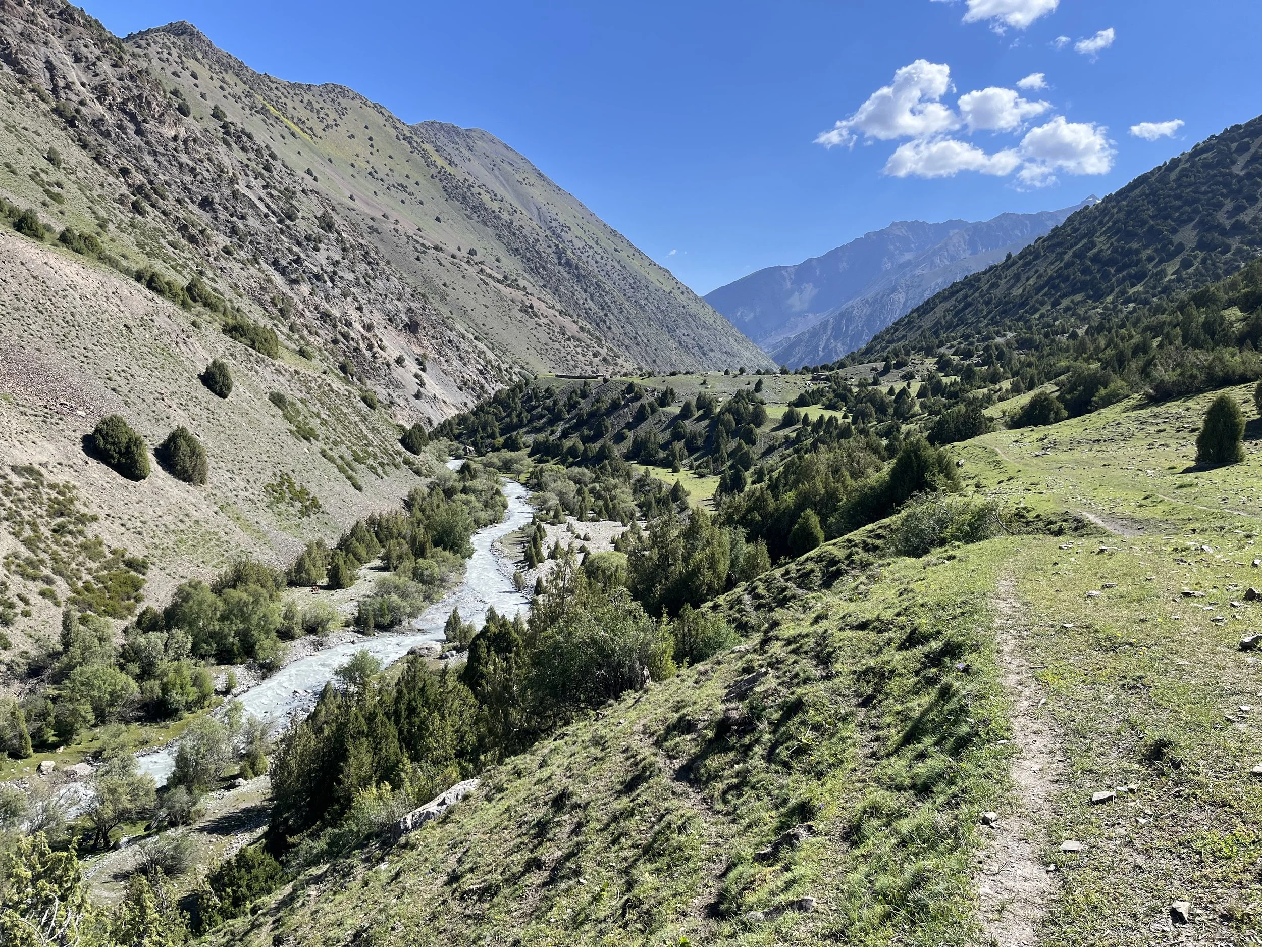
These photos below are from the upper part of the Padask Gorge, after about 2700 meters.
Other reports
If you can read Russian, you can read these reports from Russian/Soviet climbing expeditions who came through the Padask Gorge: the 2019 Lukyanov expedition, the 2014 Borisov expedition, the 2015 Shvedov expedition, and the the 1988 Lazarev expedition. These groups all went up on of the three separate gorges/rivers at the head of the valley and then over a mountaineering pass (far above what a hiker could do). Can you go onward up the valley and follow the Central and West Padask Rivers to the glaciers? Absolutely. But you will be moving over rough, open ground. There is no trail. And no more bridges. And you might have to navigate steep glacial moraines. Stay off the glaciers and accept that all the passes here are difficult mountaineering routes, and not for trekkers. This won’t be a one-night trip, nor an easy one. Here are some photos from Russian climbers to give you an idea of what to expect in this area:


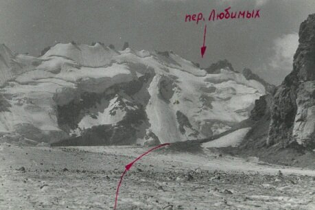

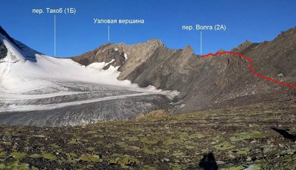
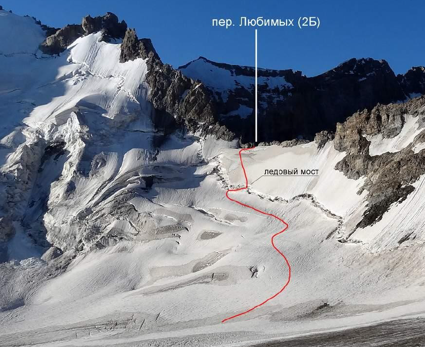
Photo description and credit, clockwise from top left (in desktop view): 1. Olympic, Kuybyshev and Studeny passes above the Central Padask glacier (photo by the 2014 Borisov expedition), 2. Trekking down the West Padask glacier (photo by the 2019 Lukyanov expedition), 3. Lyubimykh Pass from a view near the bottom of the West Padask glacier (photo by the 1988 Lazarev expedition), 4. Crossing the East Padask River from the upper Padask Valley (photo by 2015 Shvedov expedition), 5. The Takob Pass above the West Padask glacier (photo by the 2017 Lukyanov expedition), 6. Lyubimykh Pass from a view near the top of the West Padask (photo by the 2019 Lukyanov expedition).