Vancouver to Pemberton Thru Hike
Vancouver to Pemberton Thru Hike
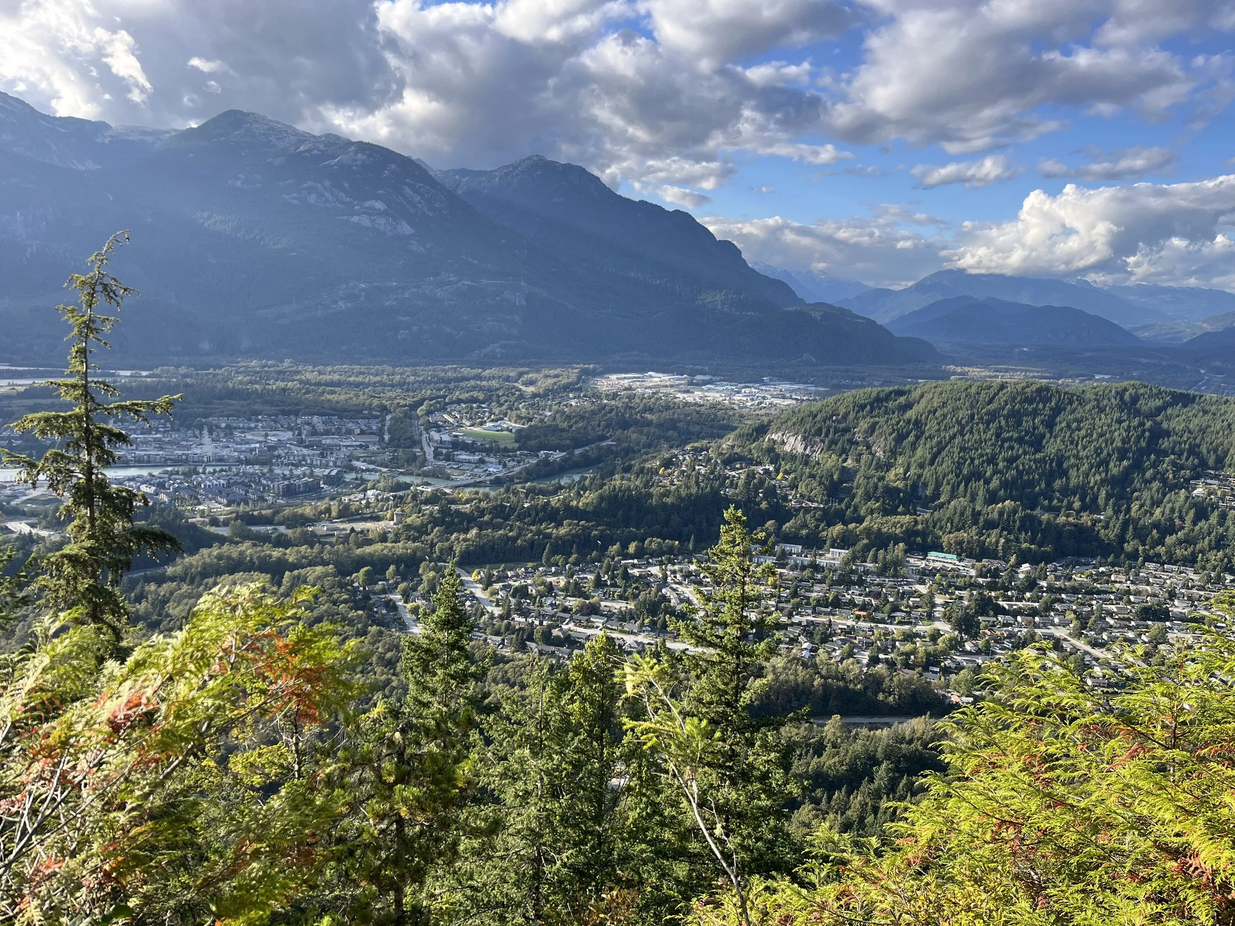
The Vancouver to Pemberton Thru Hike is a 240km hiking route from downtown Vancouver north through Squamish and Whistler to the Pemberton Valley. It’s the first section in a longer route I am planning to fully hike, from Vancouver north to Bella Coola - The Pacific Ranges Low Route.
From Vancouver to Pemberton I followed some well established longer trails such as the Howe Sound Crest Trail (30km), but generally I regularly stitched together shorter trails and occasionally hopped on and off the Sea to Sky Trail, depending on where had the best scenery. There are many options for what trails to take, but I think my route is a good compromise between visiting the scenic spots and not adding too much distance and elevation on side trips. I also did extensive railroad “trespassing” on a mostly abandoned line. More info on that below…
GPS track and waypoints of my September 2025 hike: Download GPX
View the route in Google Earth here.
I hiked the entire route from Vancouver to Pemberton in September 2025, my trip report and guide follows below the trip photos. I did the trip from south to north so my waypoints and instructions are written based on hiking that direction. But there is nothing to stop you from taking a bus to Pemberton and hiking south.
A Warning….
To be clear, parts of this route are dangerous (by hiking trail standards). At the very beginning, the Howe Sound Crest Trail (HSCT) has quite a bit of scrambling, as does the route on the Chief in Squamish. Watch some videos of the HSCT to get an idea of how difficult it is: one, two, three, four, five, six. For the Chief, this video is one of the few to give a look at the backside approach that my route follows.
You can avoid the HSCT by starting the hike north of Vancouver in the town of Squamish. There is no easier mountain hiking trail option connecting Vancouver to Squamish.
Also, I spend plenty of time on railway tracks, which are mostly abandoned. Read the introduction to the Pacific Ranges Low Route for my reasoning for this trespassing and some notes about this tactic. As I said there, this means you can’t post this route to most online hiking forums as it definitely violates their terms of use (as does my stealth camping and watershed violation in one area to get drinking water).
Practical Information
Note: This info is written for people coming from outside this region and outside of Canada, not for locals (I know that you already know well some of the info below). And the information provided has in mind a budget traveler. Prices in Canadian dollars.
Transportation
Getting to Vancouver: It’s a city. It has an airport. I recommend flying to Vancouver International Airport, not Abbotsford International Airport (some booking apps will show you this option when you select Vancouver as a destination). Abbotsford is far from downtown and reserving a shuttle will be an expensive hassle with an irregular schedule. Vancouver International Airport has regular metro train connections to downtown Vancouver.
You can also reach Vancouver by bus from elsewhere in British Columbia and Alberta (Calgary and Banff National Park). At the moment Ebus and Rider Express are the main companies with bus connections to downtown Vancouver. There are also buses from Seattle to Vancouver (FlixBus and Greyhound), as well as regular Amtrak train connections from Seattle. There is no regular train service to Vancouver from Canadian points. That was in the past, and maybe again in the far future, but not right now.
Getting from Pemberton back to Vancouver
A cheap ($4.50) public transit bus goes 10 times daily from Pemberton to Whistler: Route 99 Commuter Bus. In Whistler there are a range of express busses going to downtown Vancouver and to Vancouver International Airport ($35-45).
Getting off the trail
If you get an injury or you run into bad weather, you can get off the trail easily in Squamish and Whistler (search online for express busses and shuttles to Vancouver). There is also a shuttle that picks up in Britannia Beach and goes either direction to Squamish and Vancouver.
Rescue
The area has some of the best and most well-resourced search and rescue teams in the world. Just don’t forget to bring a satellite messenger/beacon/PLB. There are sections with no mobile phone signal.
Permits and Fees
No permits or fees required. But to get through the Garibaldi Provincial Park you will want to sleep at least one night at a backcountry campsite. The cheap fee and reservation for that camp spot is all you need. There is no admission fee to the park or permit required (but only if you are on foot; some days have a permit system for parking your car at the trailhead). More info on the reservation/permit system in the full trip report below.
Yes, you can do the thru-hiker tactic of sleeping just outside the park boundary and rushing through in a single day without the need for a camping reservation inside the park.
When to go
No earlier than late July due to lingering snow and wet trails up high. Of course, some of you are OK with travelling on the lingering late spring and early summer snow. You know who you are and what gear you need.
How many days will this route take?
It took me 7 days to get from Vancouver to Pemberton, but I did not hike full days. Four of my hiking days were half days, and only three were full hiking days. I think my five-and-a-half days could be shortened further by a faster hiker, as I had a very heavy bag, full heavy boots and I was hiking in low-speed mode as I had no deadlines.
Accommodation
Vancouver has plenty of options. For budget travelers there are two hostels downtown as of 2025 (HI Hostel and Samesun Hostel). To be safe, reserve well ahead of time as summer is the high tourist season here and a big event can result in no accommodation being available, or being at extortion prices (example: $300 hotel rooms were $3000 when Taylor Swift was in Vancouver). Note that there are World Cup games in Vancouver in June/July 2026. For other big events that bring in travelers, do some research… Note that some accommodation may cancel your reservation if you made it through second party booking apps. It’s legal in Canada to do that. Book direct with the hotel/hostel to be sure.
Squamish has several campground options (see waypoints in the GPX file). The Squamish Adventure Inn is a really nice hostel with great facilities. For those on a higher budget, there are many other accommodation options.
Whistler is a huge resort, there are many, many places to stay here. At the budget level, there are two hostels to choose from: HI Hostel and the Whistler Lodge Hostel. The HI Hostel is OK as far as large mega-hostels go; however it is not in Whistler, but rather in an area outside of town that I knew of growing up as the place where you go to buy home improvement and construction supplies. It’s basically where all the non-tourist businesses are. But you can take public transit buses into the tourist parts of Whistler. Don’t bother with any campground options. They are either too far away or offer primitive sites at the same price as the HI Hostel (which has showers, kitchen wifi, electricity, etc.)
Pemberton is not very good for accommodation considering its size and location. But you really only need to take the local transit bus from Pemberton to Whistler where you can get accommodation and an express bus to Vancouver.
Vancouver
Consider that Vancouver in the summertime and fall does have things for tourists to do. An online search will fill you in on what there is. You may want to stay for more than one night.
Now for the bad stuff…
Street Safety
Vancouver’s homelessness, mental illness and drug addiction crisis has gotten worse over the last decade with the opioid/fentanyl epidemic and extreme cost of living increases. So that has resulted in the streets (and public transit) feeling unsafe at times in certain parts of the city.
Whatever you do, don’t stealth camp in Stanley Park. At night you will share the forest with some potentially unsafe people.
For the tourist, the main concern will be theft. It is at a very high level in Vancouver. It’s mostly opportunistic theft/grabbing, not gun-point or knife muggings. Don’t leave your bag unattended in the city.
Squamish and Whistler also have high theft rates (of bags, expensive outdoor sports gear and electronics), not just in town but also in roadside campgrounds and at trailheads where people park their cars overnight. Backcountry campgrounds are safe (but not from bears).
Bears?
Yes, black bears and the rare grizzly. There have been a few recent black bear attacks from Vancouver’s north shore all the way to Pemberton, but none fatal. Considering the massive number of tourists outside in nature in this region, a bear attack has a very low likelihood of happening to you. The backcountry campgrounds in Garibaldi Provincial Park have bear proof storage systems. Elsewhere it is up to you whether or not to use a bear bag or canister, or to carry bear spray.
Trip Report and Guide
Before you start…
You need to think about a backcountry camping reservation at Garibaldi Provincial Park before you start your hike. And if it is the high season, maybe also consider reservations well ahead of time at hostels in Squamish and Whistler. Everywhere else is just pitching your tent wherever you want. More info on that below.
Starting the hike
You can start anywhere you want in Vancouver and choose any route to get to the trailhead of the Howe Sound Crest Trail. The route I chose sticks to the scenic highlights popular with tourists: False Creek, English Bay, the Stanley Park Seawall, Capilano River Park, and the Cleveland Dam. From the dam it’s mostly the Baden Powell Trail to the Cypress Mountain ski hill where you will find the Howe Sound Crest Trailhead.
Timing your departure from Vancouver is important. If you do a leisurely late morning or lunchtime start, you likely won’t make it to a place where you can camp legally by the end of the day. The first place you can legally camp wilderness-style (wild, backcountry, wilderness or dispersed) is on the Howe Sound Crest Trail after the Cypress Mountain ski area. I’ve labelled the first campable spot with the first waypoint after Cypress. If you leave right after an early breakfast and hike a fast pace, you’ll make it there. If you leave late or hike slowly, you may have to stealth camp after leaving the West Vancouver suburban area and before entering Cypress Provincial Park. Look for the waypoint labelled “Leave (sub)urban area, enter forest.“ This forest is city-owned municipal land, and it’s not legal to camp there. But I really can’t imagine anybody caring if you pitch a tent at dark and leave at first light. It’s just joggers and walkers from the British Properties neighborhood passing through here. Just make sure to camp far from the houses. The forest here is not great for camping, but you’ll eventually find a spot to pitch a tent. I had good weather and no insects, so I put my inflatable mat on some bare rock and cowboy camped. This place is far enough from the city for there to be no safety problems like you would get stealth camping in a city park. British Properties is one of the richest neighborhoods in Canada, so they won’t be robbing you.
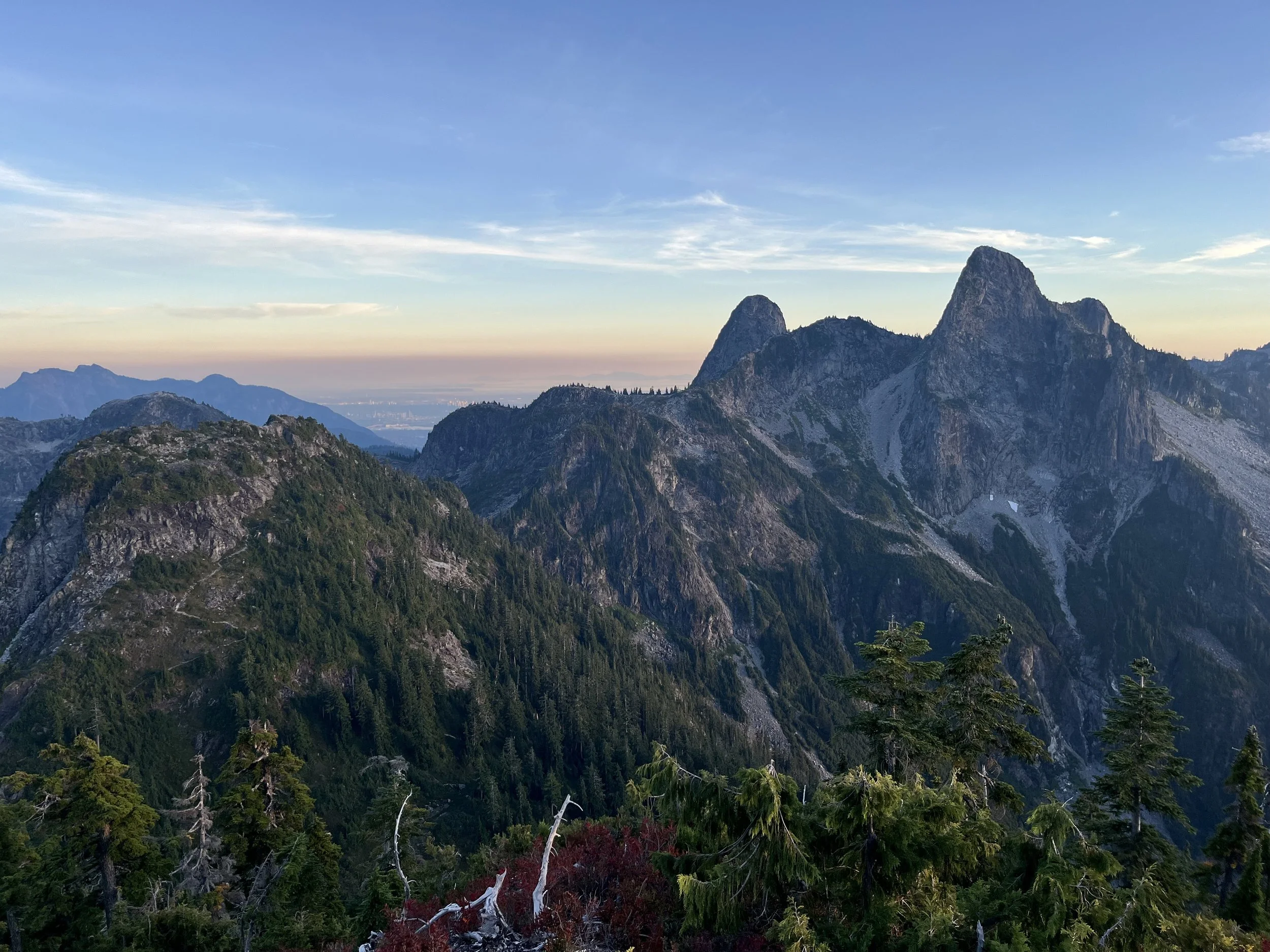
The Howe Sound Crest Trail (HSCT)
This trail is in Cypress Provincial Park, but no permits or camping fees/reservations are required. Just show up and start hiking. Its difficulty keeps numbers low.
This is not a safe or easy trail, especially if it is raining or if it recently rained. The middle section has some rough scrambling that mixes in dirt and vegetation to the calculation. It’s the most difficult part of the entire hike, from Vancouver to Pemberton. It’s only 30km, but it feels much longer, especially the middle section. Watch some videos of the HSCT to get an idea of how difficult it is: one, two, three, four, five, six. You can find some more detailed trip reports online.
Beware of random trails that lead to nowhere, or lead to a cliff. Consider regularly checking your position as there is not always one clear and obvious trail.
The first formal established camping area on the HSCT is at Magnesia Meadows. There are plenty of places to pitch your tent and there is an emergency shelter. It is free and there is no need to reserve a spot. Most people on the trail are day-hikers or trailer runners, so there was only one other tent when I camped there. It is OK here, but I liked the looks of the camping at Brunswick Lake more (a 2nd night destination for the faster hikers).
If you read trip reports and guides online you will notice people discussing drinking water difficulties on the HSCT. It really is a “crest“ trail on top of a ridge. So you won’t be crossing streams or finding lakes on the ridge top. You can fill up on water at Cypress Mountain outside the public restrooms, and you should probably take lots. I drank up as much as I could and took three liters. But that wasn’t enough. So after Unnecessary Mountain I dropped down off the trail to fill up on water from a pond - you can see my waypoints labelled. Legally, you have left Cypress Provincial Park and entered the restricted Capilano Watershed where recreation and travel is prohibited to protect Vancouver’s drinking water. A person in a position of authority/enforcement told me that if they saw a hiker getting water here they could not care less. They just don’t want them camping or defecating here or taking their dog swimming.
If you are traumatized upon your arrival at Magnesia Meadows, don’t worry - the difficult sections are finished, with just a few minor scrambles remaining.
If I did this hike again. I would do a very early start from Vancouver, camp on the HSCT about 1.5km after the trailhead and then make it to the Brunswick Lake camp spots the next day.
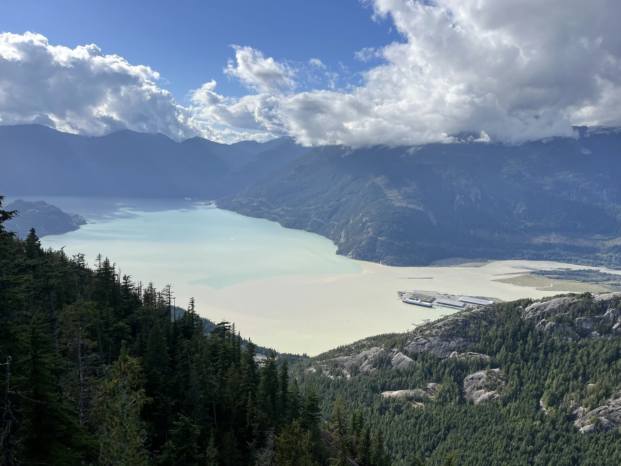
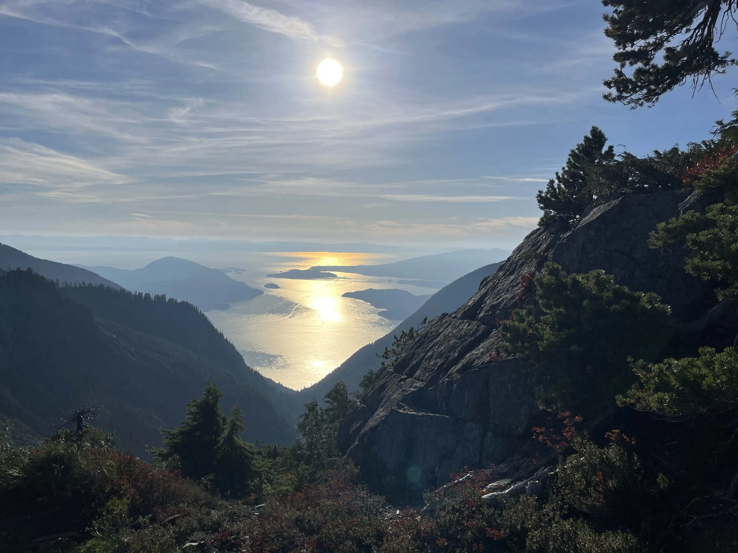
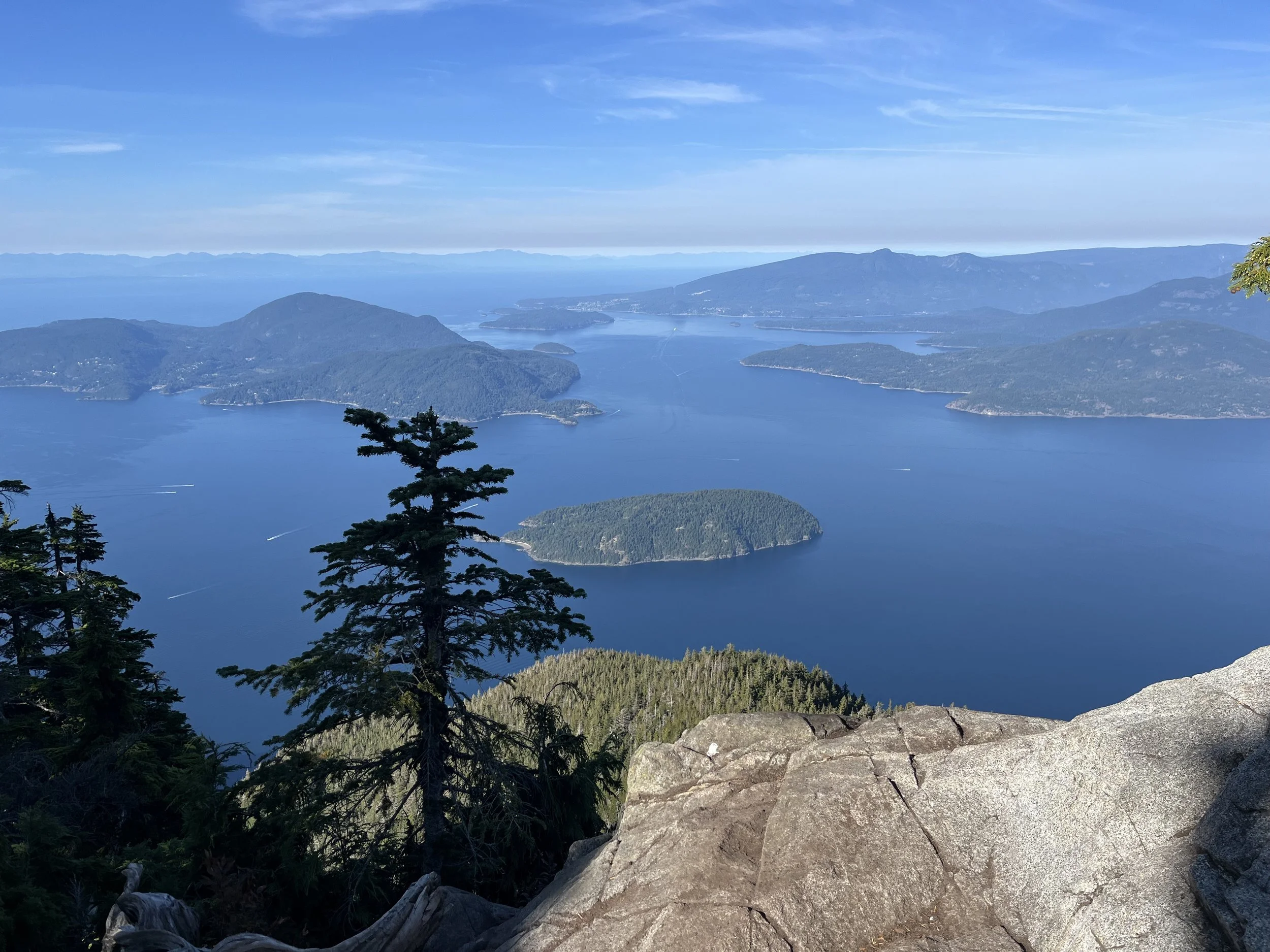
Porteau Cove to Britannia Beach
Right before the end of the HSCT trail there is a waypoint labelled “Lead-free water.“ That’s because the drinking water at the nearby Porteau Cove campground was found to be lead contaminated thanks to old pipes. So fill up at the waypoint I labelled.
There is a campground at Porteau Cove Provincial Park, but it was full when I passed through. For those who camp at Magnesia or Brunswick, you will be here too early in the day to camp anyways. But if you are interested in an early stop, then consider reserving a spot online.
After exiting at the HSCT trail parking lot, you cross the highway and then illegally cross the railroad tracks to get onto a rock beach that leads to Porteau Cove Park. There are well beaten paths here, so you will not be the first or last lawbreaker. For the law abiding citizen, a very unpleasant road walk on a very busy highway is the alternative.
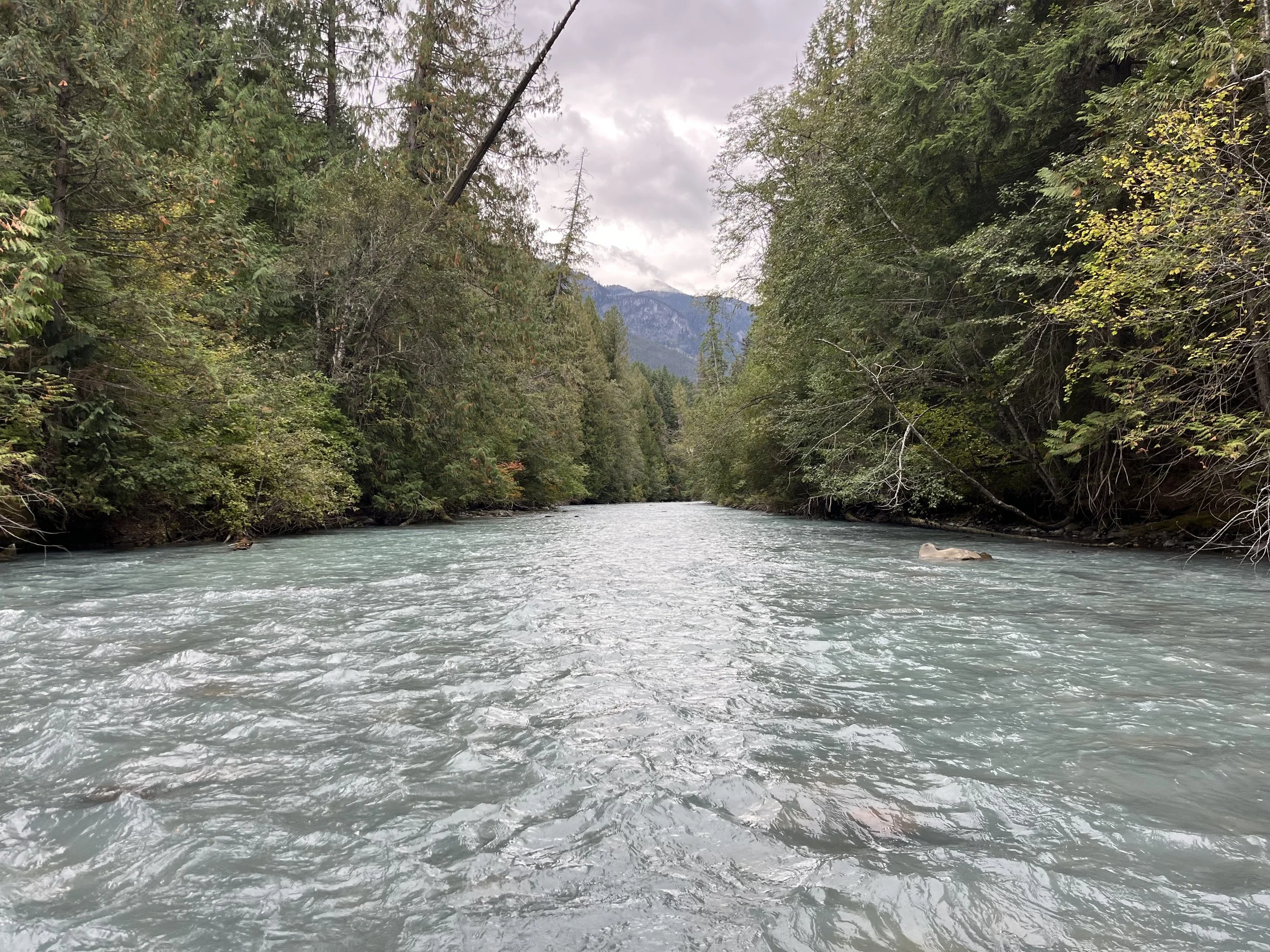
After Porteau Cove it is an illegal walk on the railroad tracks. This railway track is, despite the railway company abandoning freight traffic on this line north of Squamish, still an active railroad (but with seldom traffic). The highway is again the alternative. I walked right by a police officer in his car while on the tracks. I didn’t talk to him but I assume he would rather I be on the tracks than on the tiny slim shoulder of the highway that you find at a cliff chokepoint section north of Porteau Cove.
Next up is the golf course at Furry Creek. Walkers regularly pass through the course, and the operators have maintained public access to the beach area. They are friendly, just make sure to observe golf etiquette. If golfers are getting ready to tee off (hit the ball), wait until they do so and then walk past the tee. After the Furry Creek footbridge there is a section where you need to do this to not be in range of a poorly hit golf ball when you walk the path.
After the golf course it is again a walk on the railway tracks. Taking the long tunnel is your choice. There may or may not be a way to climb and bushwhack up and around and back down to the railway, I don’t know.
Right before Britannia Beach there is a nice hamburger stand, and in the little tiny townsite there are some restaurants, a small grocery store with pizza, and a public restroom where you can fill up on drinking water. This is an old industrial mining area, so I don’t trust the streams in the area.
If you’ve felt like a lawless bandit based on your railway walking, after Britannia Beach you will see how common it is. There were many people parked at Britannia Beach who at the same time as me walked down the train tracks to get to some wild camping and climbing spots. The climbers have built a full-on sauna in there and the trails are very well beaten. The railway tracks are a thoroughfare. I camped at a quiet spot after the sauna (too loud and social for me), and woke up to seals on the rock beach below my tent after mistaking them for bears (“Seal Cove“ is nearby).
Britannia Beach to the Chief
The next day was a short railway walk before leaving the tracks and heading uphill towards Murrin Provincial Park. There were no freight trains the day before, at night or in the morning. But note that, in addition to freight trains, the Rocky Mountaineer tourist train does occasionally pass through. They have plans for a 2026 season, but it seems that this service will end once CN abandons its lease and ceases maintenance. It’s up to you to research whether or not you can expect trains on this line, and when.
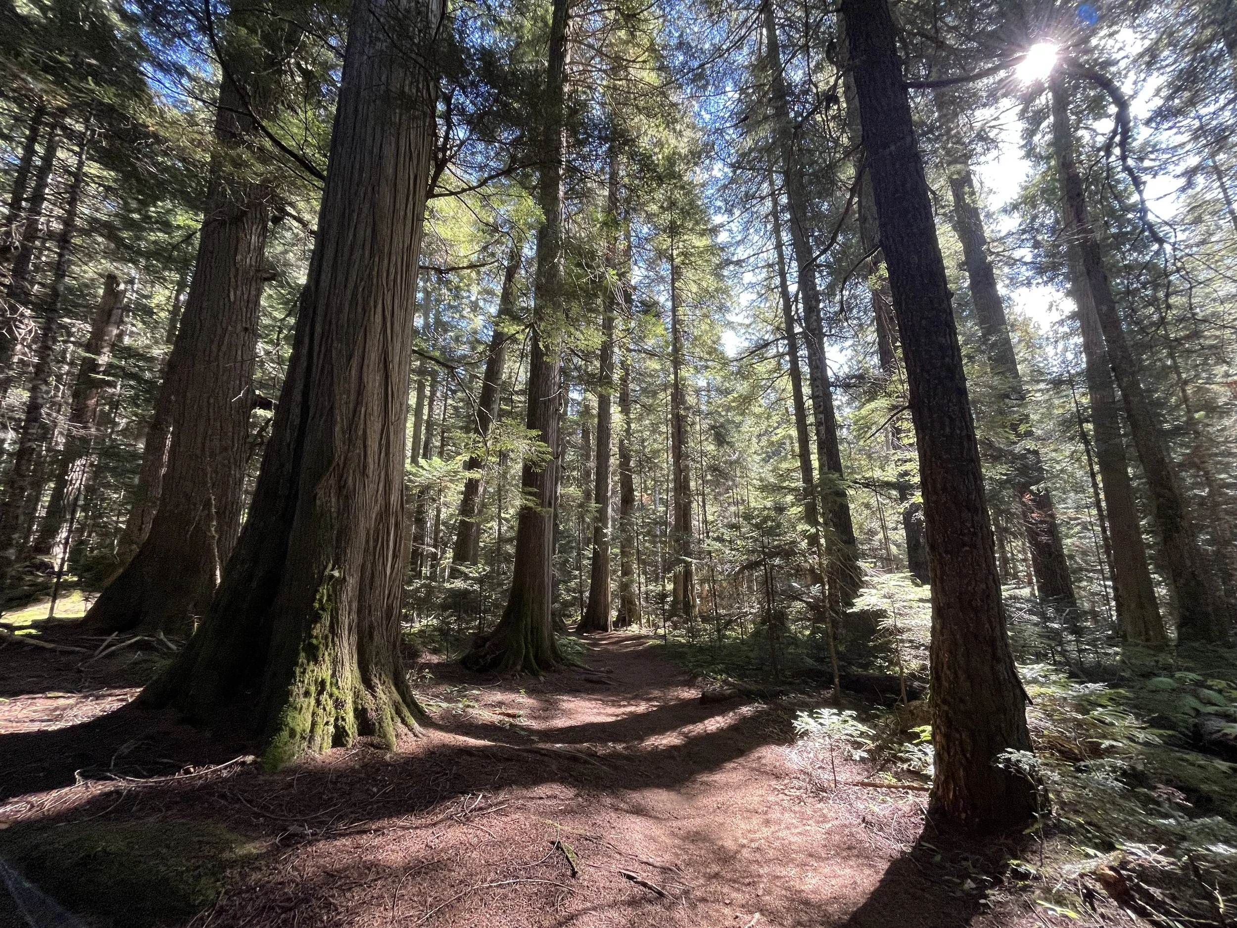
After leaving the tracks you will have a couple of scrambling spots with rope-assists put in place by the rock climbers (who are all over this area). Murrin Provincial Park has no drinking water nor any camping spots. After crossing Highway 99 you start up the Petgill Lake Trail (again, a few easy scrambles). There are some small lakeside primitive camp spots (free, no permits required).
After Petgill Lake you will eventually get on an old road that has been recently cleared of brush. This makes for a quick trip from the start of this road to the Sea to Sky Gondola Summit where you will find public restrooms and plenty of food, from 9am-5pm. Note that they open your beer can so that you can’t take a can or two with you….
After the gondola you should head to the viewpoint before getting onto a faint, vague path through the forest. It appears to be an approach hike trail for rock climbers. I don’t suggest going into the forest if it is starting to get dark, as you won’t be able to find your way easily. If that’s the case, take the Shannon Forest Service Road that is farther uphill.
Eventually you join the “Mischief” mountain bike trail, and it is fast and fun on lots of slickrock and with nice open views. Watch out for fast riders coming from behind. Hikers are allowed on this trail.
Then you enter the Stawamus Chief Provincial Park and wild camping is prohibited. It was getting late in the day and I wanted to get to the town of Squamish as I had reserved accommodation, so I took a fast low route. Somehow, despite being born in Squamish, I still haven’t hiked the top of the Chief. But you should follow the GPS track and do the Chief (the Stawamus Chief mountain). Since I didn’t hike it (I will in the future), use this trip report as a guide. And download and overlay his GPS track in addition to mine, as it’s probably more accurate than the trail trace in my GPX file. He has lots of photos to show the difficulty: rungs, chains, ladders, ropes, etc… But it doesn’t look that hard. You can also see many comments at Alltrails on the First, Second and Third Peak Trails. And this video shows the backside approach.
At the bottom of the mountain is the Stawamus Chief Provincial Park campground. $10 tent sites: first come first serve, no reservations. There were spots available when I walked through at the end of the day, but rain the previous night would have flushed out many of the rock climbers. Other days you may find this campsite full. But I assume most people who hiked all the way from Vancouver will be more interested in a bed and hot shower in town. I stayed at the Squamish Adventure Inn hostel. It’s quite good with great facilities, a good vibe and was much cheaper than the Vancouver hostel.
December 2025 update: There was a large rockfall that destroyed the main hiking trail down from the Chief.
March 2026 update: Everything is repaired and the trail is open again.
Squamish to Garibaldi Provincial Park
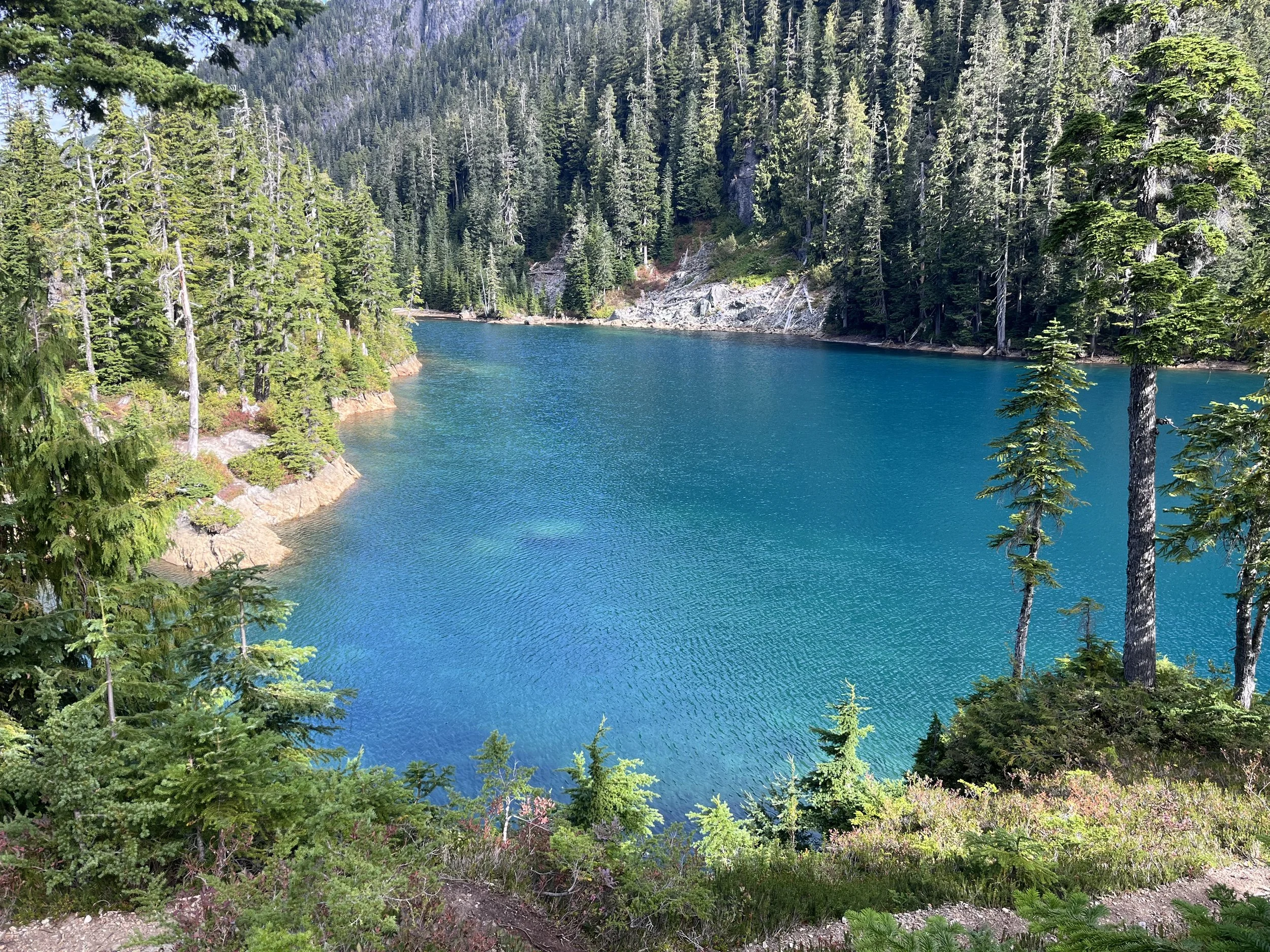
Before leaving Squamish (or maybe even before Squamish) you need to start thinking about a backcountry camping reservation at Garibaldi. A reservation and fee is required. You want a spot at the high demand Garibaldi Lake campground, not the Taylor Meadows or Helm Creek campgrounds. If you are timed to arrived at Garibaldi Lake on Saturday, you are definitely out of luck. When I looked at reservations online the lakeside camp was fully booked long in advance on Saturdays by weekend hikers. Go to this reservation website, and select the “Backcountry“ category, then select “Backcountry reservation“ at top and find Garibaldi in the drop-down menu. Select a date and you will see availability for the various campsites. I waited until I had left Squamish and by that time my preferred campsite was no longer available and I had to settle for Helm Creek. If you can’t get the lakeside camp, you should still make the short side trip to visit, as this is where the best lake view is.
2026 update: by mid-May the most popular camp in Garibaldi (the lakeside camp on Garibaldi Lake) had very few days with spots still available for reservation during the months of July and August.
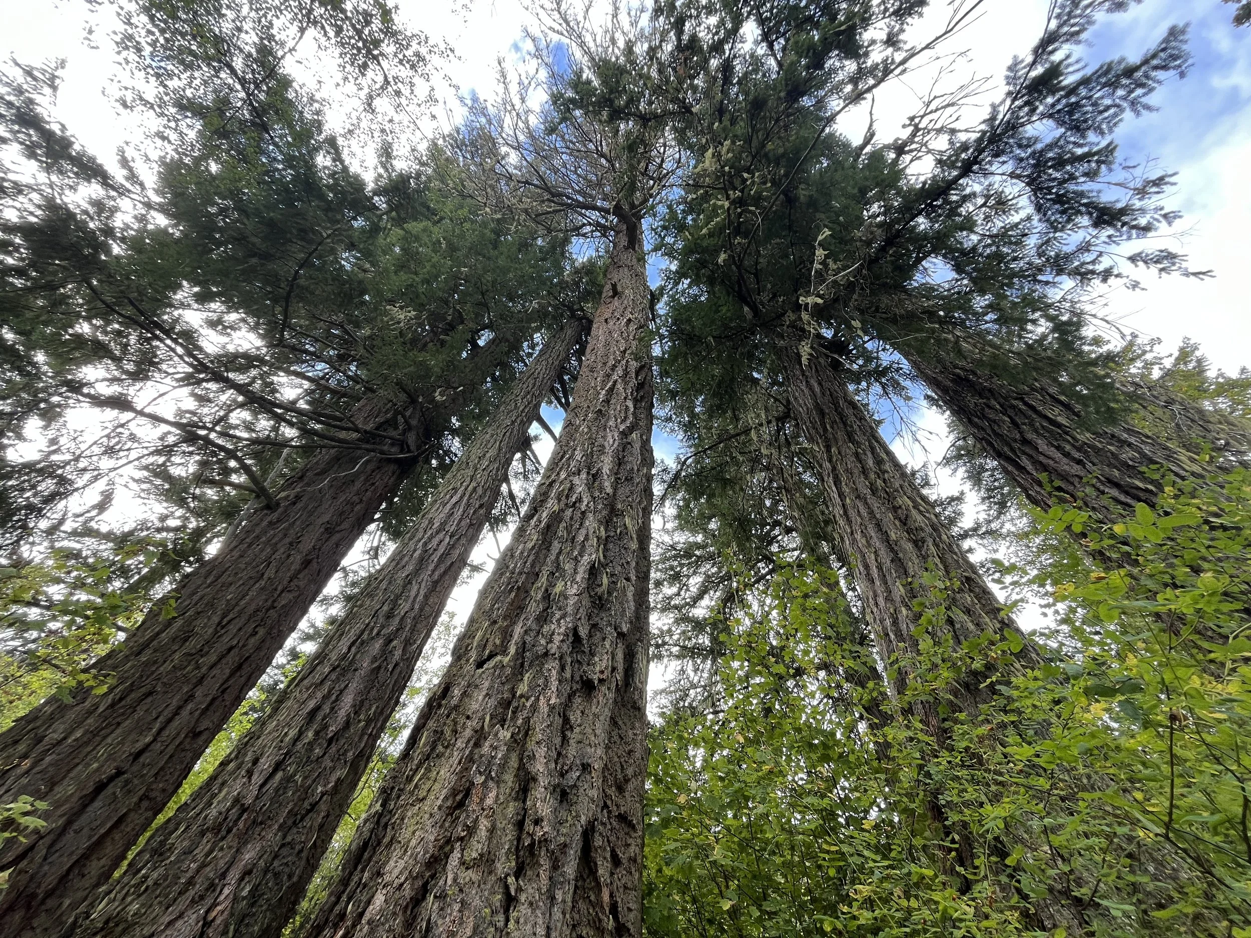
Squamish has good resupply options (supermarkets, Walmart, etc.). There are even some outdoors sports stores where you can track down dehydrated meals.
The walk out of Squamish is leisurely. I left late in the morning and stopped for pizza and donuts in Garibaldi Highlands (not the provincial park, just the part of Squamish with this name). Next is a hike through Alice Lake Provincial Park, which is too close to Squamish to be considered as a camping stop. After a brief road walk you will enter the Brohm Lake Interpretive Forest area. You can definitely go swimming here (good water temperature, nice bare rock shore).
After going downhill you pass by the privately-owned Paradise Valley Campground. It’s still too close to Squamish to be a stop for the day. If you don’t want to go into the private campground to get drinking water, you may want to consider taking water at Brohm Lake. I went in to get water, expecting to not be noticed in a busy campground, but it was almost entirely deserted and I felt like a trespasser. I regretted not filling up at Brohm Lake. And I would filter and chemically treat the water, as both people (viruses) and dogs (cryptosporidium) swim in the lake.
The badly misnamed Paradise Valley is dry, and the rivers and creeks you cross are either very silty, dried up or full of dead stinking rotten salmon. I didn’t find good water until Starvation Lake after leaving Paradise Valley.
Paradise Valley is full of “no trespassing” warnings and threatening signs saying they will call the police on illegal campers (and I think even on legal roadside campers). This is because of tourists who build camp fires when the fire danger is extreme almost every summer. The locals don’t want to die in a forest fire.
Paradise Valley was my least favorite trail section, as it is just a road walk in an area without good scenery. But you can quickly get through it. I camped near the end of the road at the free riverside drive-up camp spots (informal with no infrastructure, no fees or reservations). Most spots were taken by car campers, but I did find a good spot despite arriving in the dark. See my waypoints. Note that the Cheakamus River water smells like dead fish in the fall, so don’t expect to be drinking the water here. In late September I could hear the spawning salmon jumping and thrashing around all night, but I didn’t see the bears that I was expecting. You can also camp right after Starvation Lake.
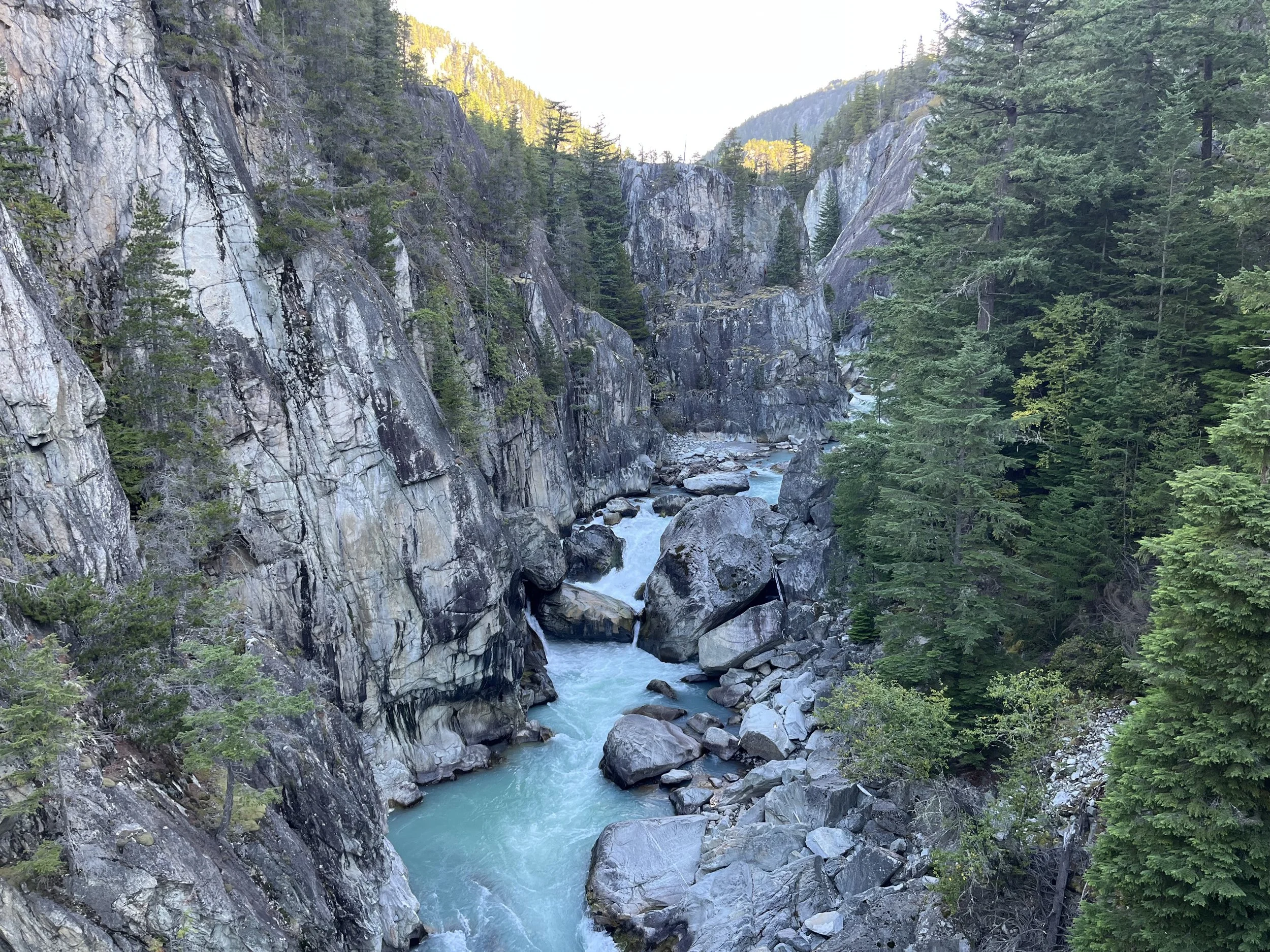
The road soon ends after the riverside camping and you get on the Sea to Sky Trail (built with bikepackers in mind). After a short stretch on this trail you then hike down onto the mostly disused railroad tracks (this trail ends at the highway). The railway tracks give you a great view of the Cheakamus Canyon.
After getting off the rail tracks, the area near the Chance Creek Forest Service road is/was used by Whistler-area squatters and van campers and is disgusting: garbage, random filth and old clothing strewn about, plus abandoned trailers and RVs. Don’t camp here.
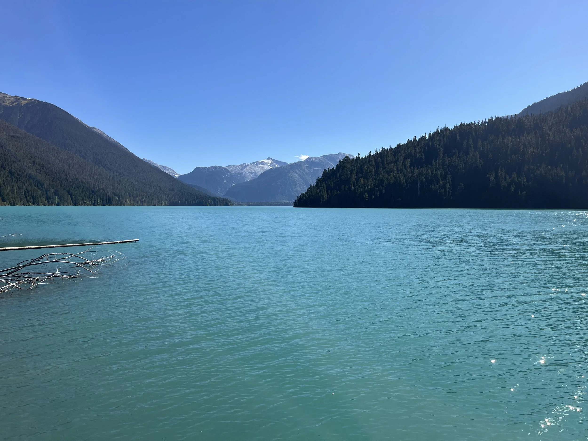
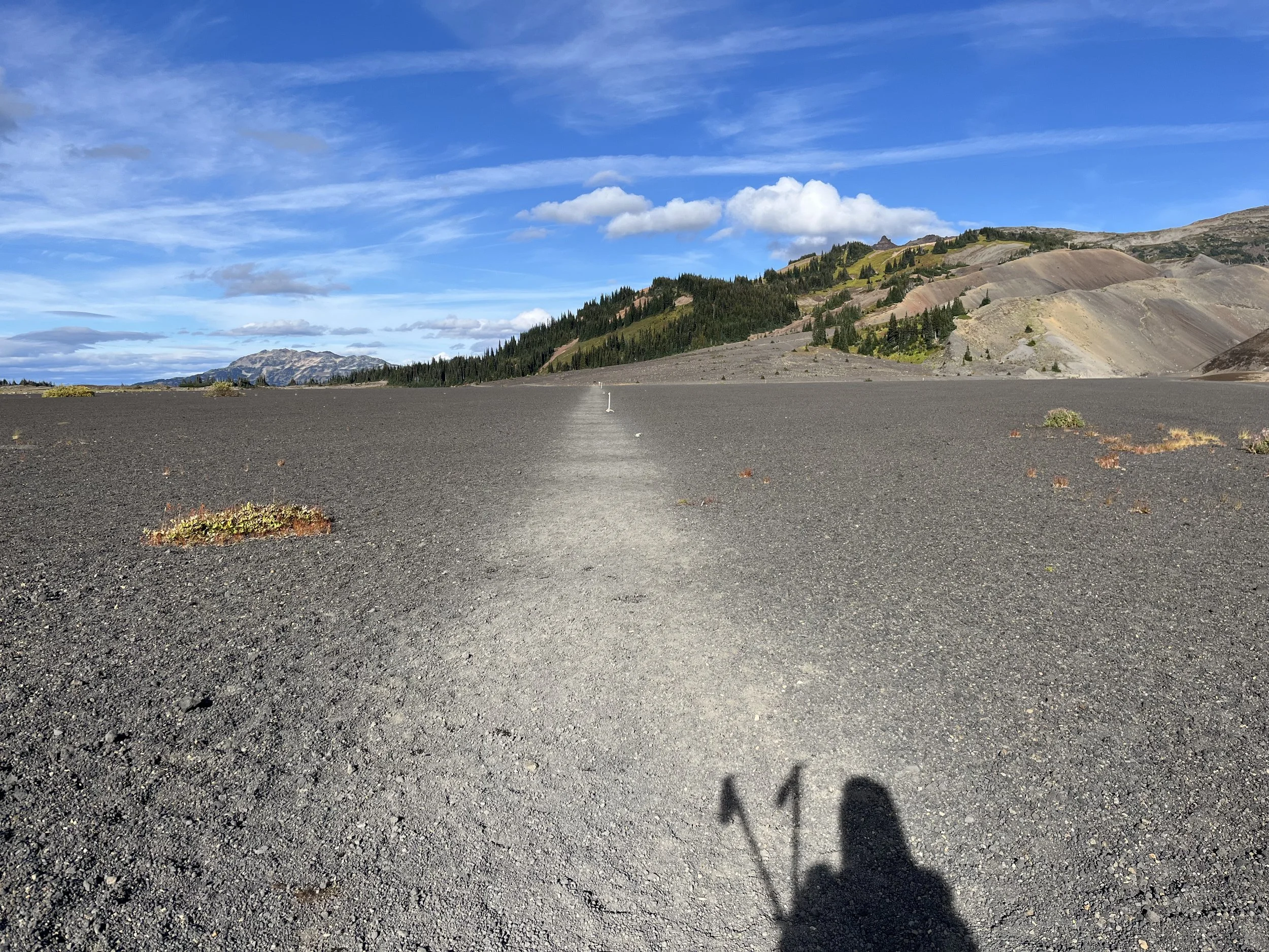
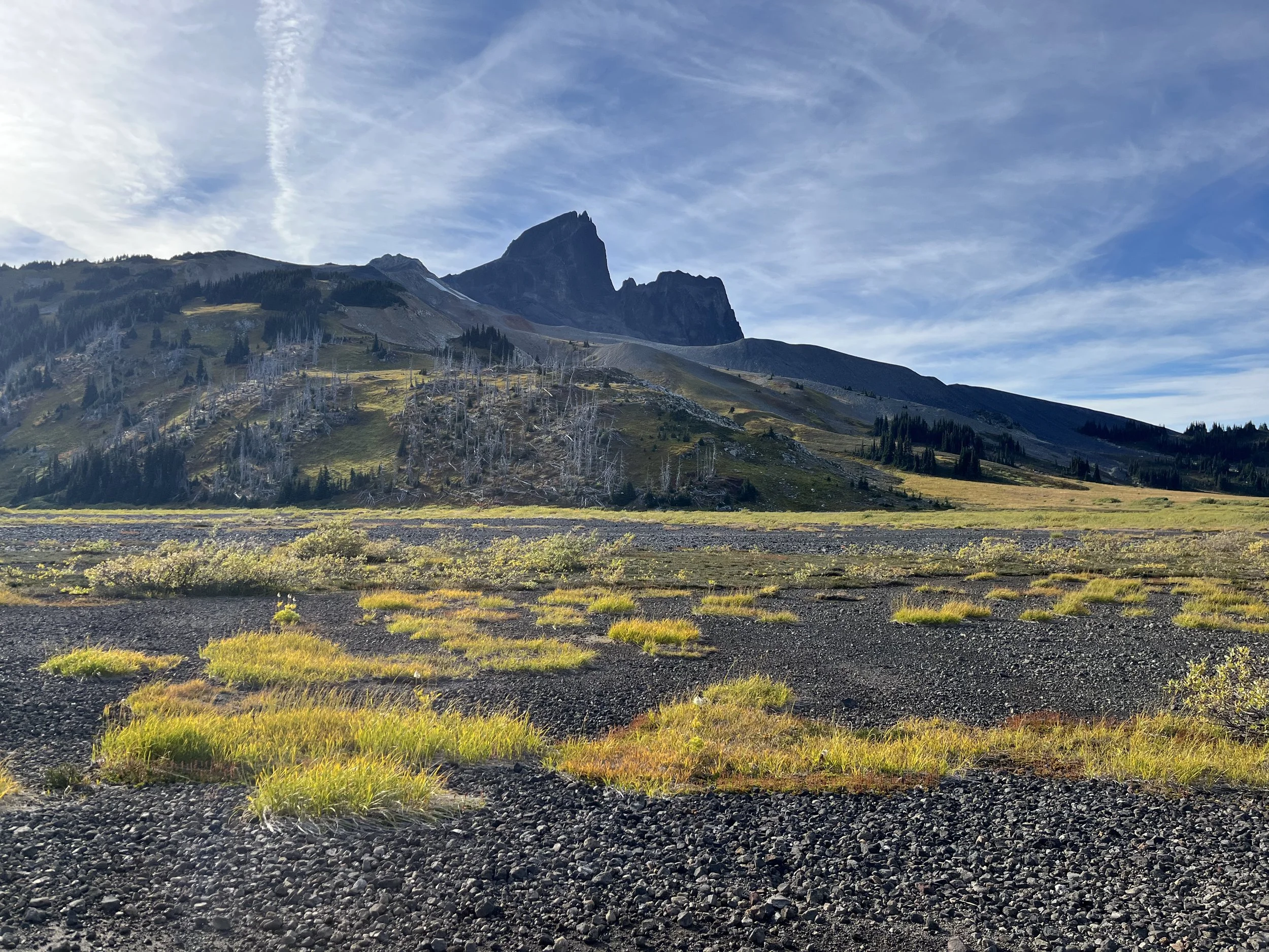
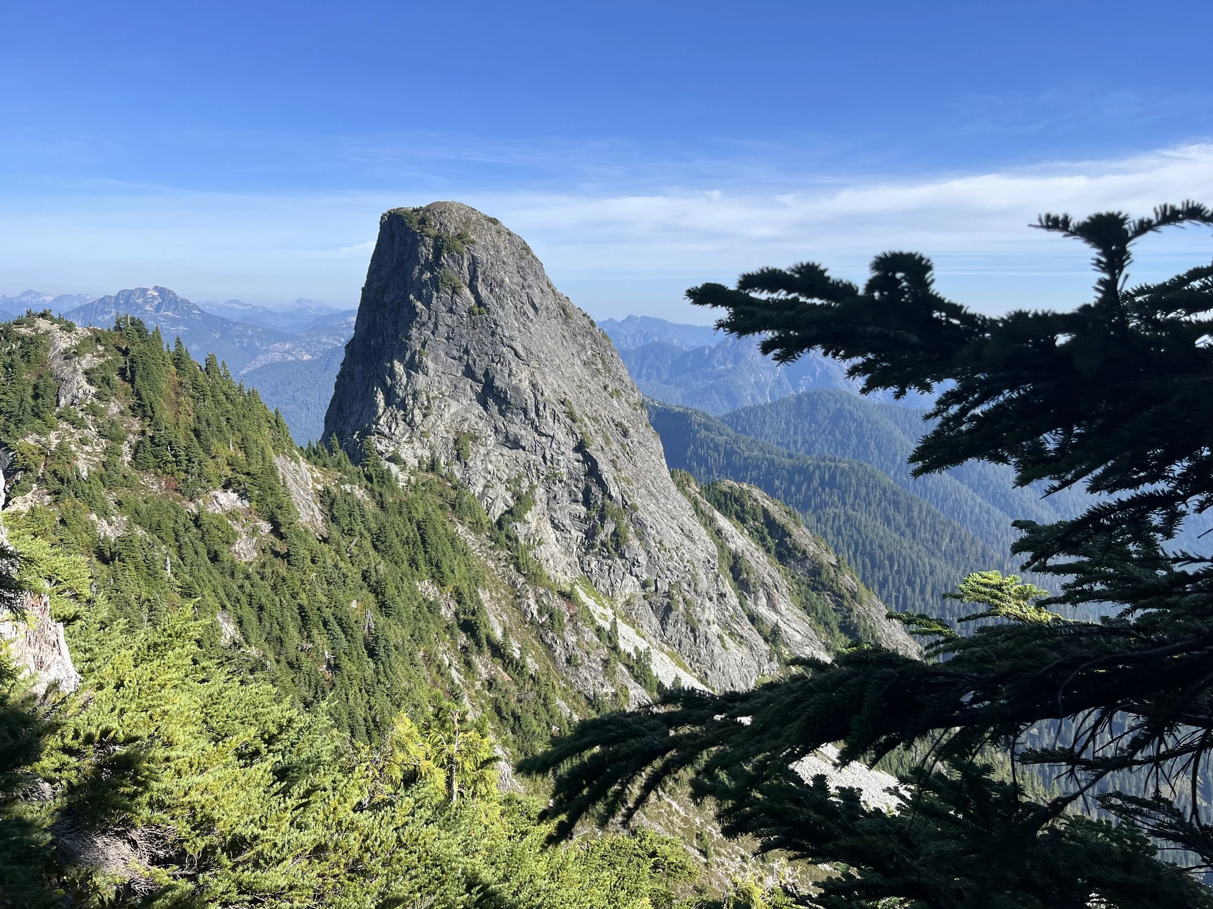
Then it’s a road walk to the Rubble Creek Trailhead in Garibaldi Provincial Park. If everything works out and you can reserve a spot at the Garibaldi Lake campground, I suggest the next day to do a side trip hike up to the Black Tusk. It is the hard lava core of a volcano. To get onto the top of the peak involves a sketchy scramble (leave your heavy pack at the bottom). Search online for trip reports. But you can hike up close to get a good view without summiting.
After descending from the pass, I recommend a side trip to Cheakamus Lake if you have the time. It’s not as spectacular as Garibaldi Lake, but it’s still a nice spot to sit and take a break. Farther down the trail you reach the outskirts of Whistler and the HI Hostel. The alternate hostel is the Whistler Lodge Hostel. The $3 per night (breakfast included) hostel on Alta Lake that my mother managed (and where I lived as a baby) shut down long ago. The site was purchased by the local government and gentrified into an arts and sailing center.
Alternate Route: Garibaldi Lake Circumnavigation
It is also possible to loop around Garibaldi Lake by going off-trail over open terrain. I can’t recommend the high route for most thru hikers, as it involves Class 4 scrambling, peak summiting and glacier travel (which will be more dangerous in the late summer to early fall). This high route is done with small day packs in a very long day (12-24 hours, with 12 being the Fastest Known Time), but you will probably need to do the low route, and to split the circumnavigation into two days.
There is a good trip report for the low route (he did it counter-clockwise, you’ll do it clockwise). The GPS track file he links to is from the parking lot at the bottom, so I’ve edited it to a shorter route that starts and ends on the main trail up by the lake. Download my GPX edit here. He did the full route from/to the parking lot in 13 hours, but he had a tiny fastpack and assume he is faster than you. My plan would be to start from the Garibaldi Lake campground, do a short distance and then stay overnight at the Burton Hut on the east side of the lake - a very scenic area. The hut requires reservations (register and pay the fee here), but it’s usually only used for winter trips by skiers, so you should have no problem getting a spot. However, you also need a Wilderness Camping Permit from Garibaldi Park and for that you need to talk to someone on the phone. Link here. I assume they will interrogate you about your skill level in the wilderness, as the route to and from the hut is mostly off-trail and very rough. If by some chance a large group of packrafters or others has fully booked all ten spots in the Burton Hut, your wilderness camping permit will allow you to pitch your tent.
Whistler Walk-Thru
This 27km section is mostly on paved hike/bike trails and then on well built hiking/biking trails. I can’t objectively say what Whistler is, because I was raised here when I was very young and then later would regularly be in Whistler as my father worked here. I’m a cynical jaded former local, so I think it’s a total waste of time being in Whistler; a sentiment not shared by the tourists who really seem to enjoy their time here. Search online for what you can do here, and decide whether you want to stay for more than one night. For me it was just a stop to charge batteries and buy enough food to make it to Pemberton. The 27km route ends after the last neighborhood - the seemingly abandoned Wedgemount neighborhood (it looks like the luxury housing here has hit a dead end).
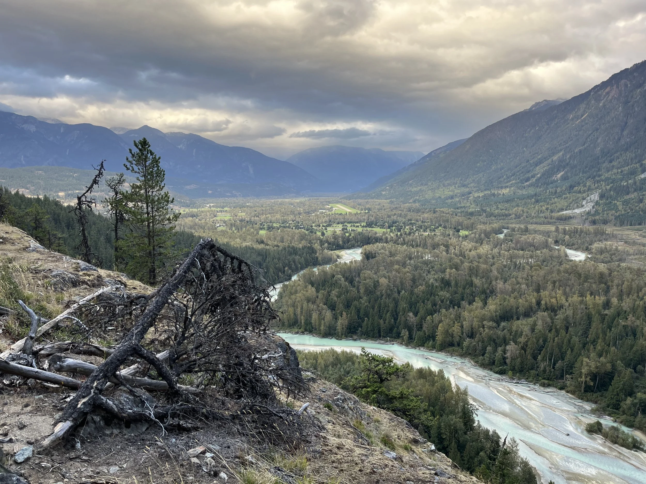
Whistler to Pemberton
I’ve travelled between Pemberton and Whistler hundreds of times, but always on the highway. I’ve only ever briefly hiked, mountain biked and mushroom-picked in some areas near the highway, so this was my first time fully on foot between these two towns. I was surprised. I actually liked it.
There is not much to say that isn’t already in the waypoints, except about the river crossing. It was very easy and safe for me in late September. And in the 1990s I also crossed the river several times in multiple locations (but in mushroom season, not mid summer). How high and swift the water is in mid-summer, I do not know. If it’s bad, there is a road walk alternate that is obvious.
The Nairn Falls Park campground is an option to stay at before Pemberton. I saw plenty of empty spots when I walked through in late September, but July and August will be busier.
After Nairn I chose the “Lumpy’s Epic“ mountain bike trail, built in memoriam for Geoff “Lumpy” Leidel. I rode with him when I was in high school, and it was the first time I realized that there were riders out there who were much, much better than me. We all thought of him as the best local rider, and after he passed his close friends got together and built a trail in memoriam for him. It’s a nice trail with some nice views. My route then diverts over to One Mile Lake, where I spent hundreds of days swimming in the 1980s summers. The water is now much colder than in the 1980s, as glacial creek water is now diverted into the lake.
After the lake, you’re in Pemberton. Read info above on accommodation and transportation out of Pemberton.
I will eventually provide full information on an extended route north of Pemberton. Preliminary information here.