Pacific Ranges Low Route
Hiking from Vancouver to Bella Coola
The Pacific Ranges Low Route
The Pacific Ranges Low Route is an unofficial and unfinished hiking route in progress in British Columbia, Canada. It connects Vancouver to the Central Coast town of Bella Coola via established trails and routes, as well as by venturing out over open terrain. I have hiked much of the southern half, and other parts I have travelled by mountain bike, skis, kayak, horse, snowmobile, car and helicopter. I no longer have access to a helicopter, car, snowmobile, horse, kayak, skis, nor even a mountain bike, so the route will be a hiking route.
Warning: this is a personal project, not a suggestion for a thru hike. This route is not a single clear trail, and it is much, much more difficult than the popular thru hikes in the US. I don’t recommend it unless you have experience scrambling, fording rivers, bushwhacking in the coast mountains (an unpleasant experience), hiking in grizzly bear country, suffering through mosquitoes and black flies, dealing with regular rainfall, avoiding snow, and doing long and heavy food carries with few opportunities for resupply and battery charging. And then there are the road walk sections…
I’m posting the information here as an unfinished/planned route, and I will slowly update it in the years ahead.
The Route
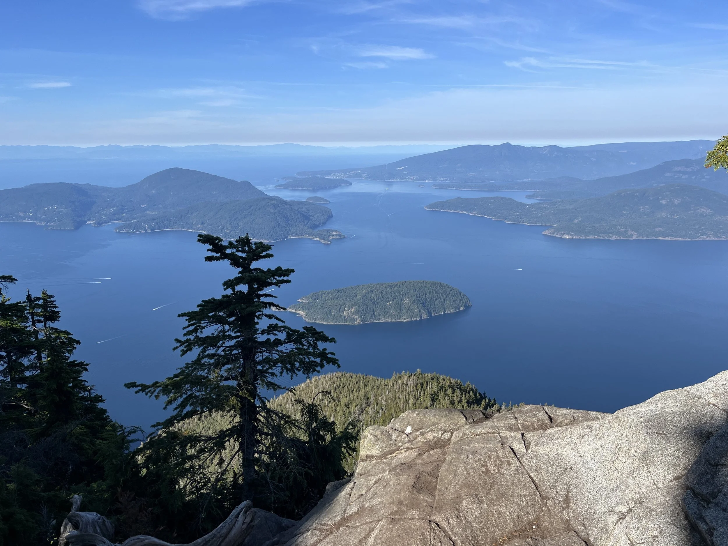
Vancouver to Pemberton is straight forward - you are funneled northward on established trails. North of Pemberton I have, since the 1980s, hiked many locations that almost make a complete route to the town of Gold Bridge. North of there I mountain biked and hiked in the south Chilcotin mountains in the 1990s. I figure now I could just keep going north, keeping to the edge of the Chilcotin Plateau next to the coast mountains and then cut over to the coast to the town of Bella Coola after a detour through Tweedsmuir Park’s Rainbow Range. For packrafting alternate routes, I will leave that to you to look at the map to see what your obvious options are.
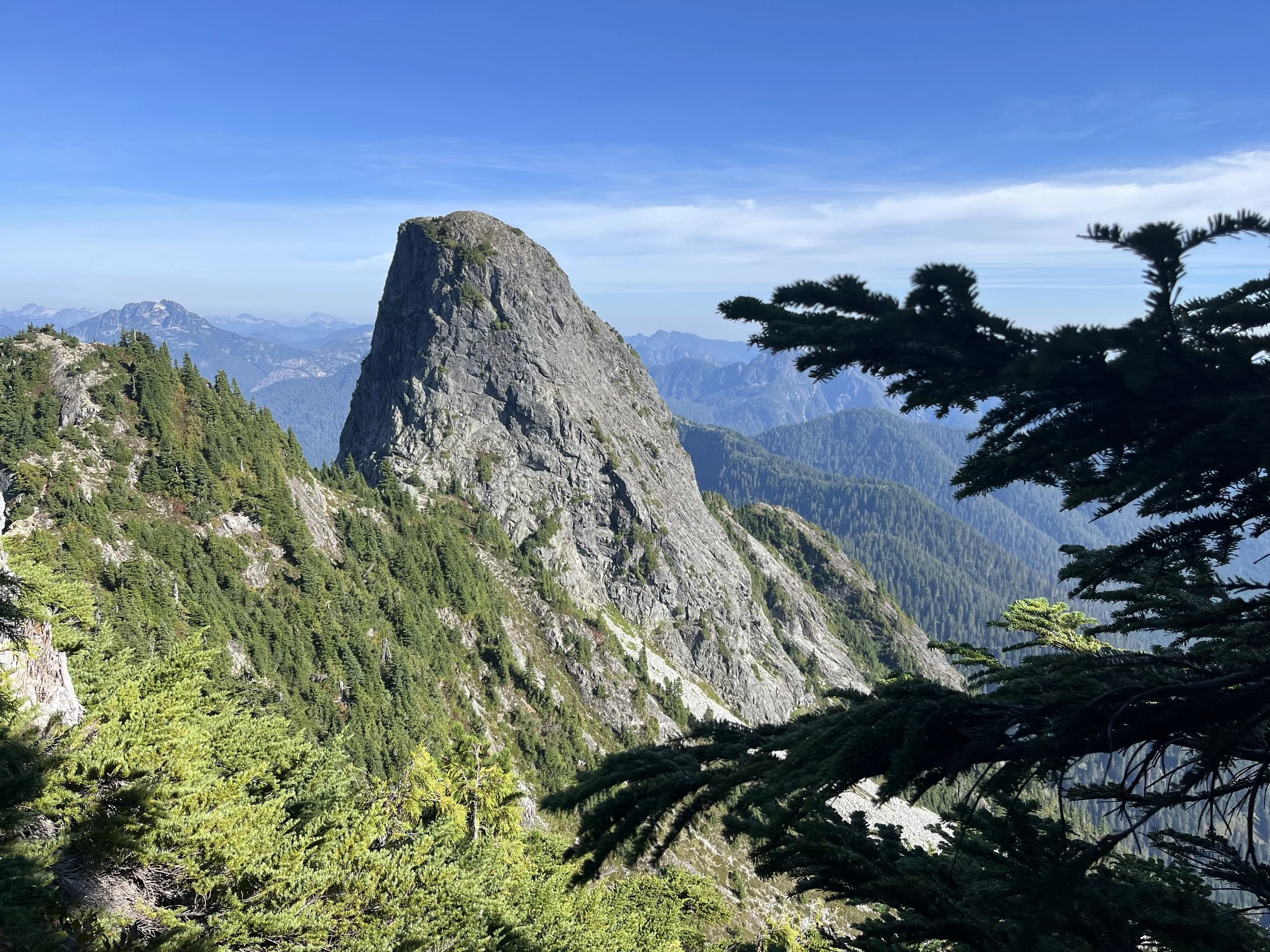
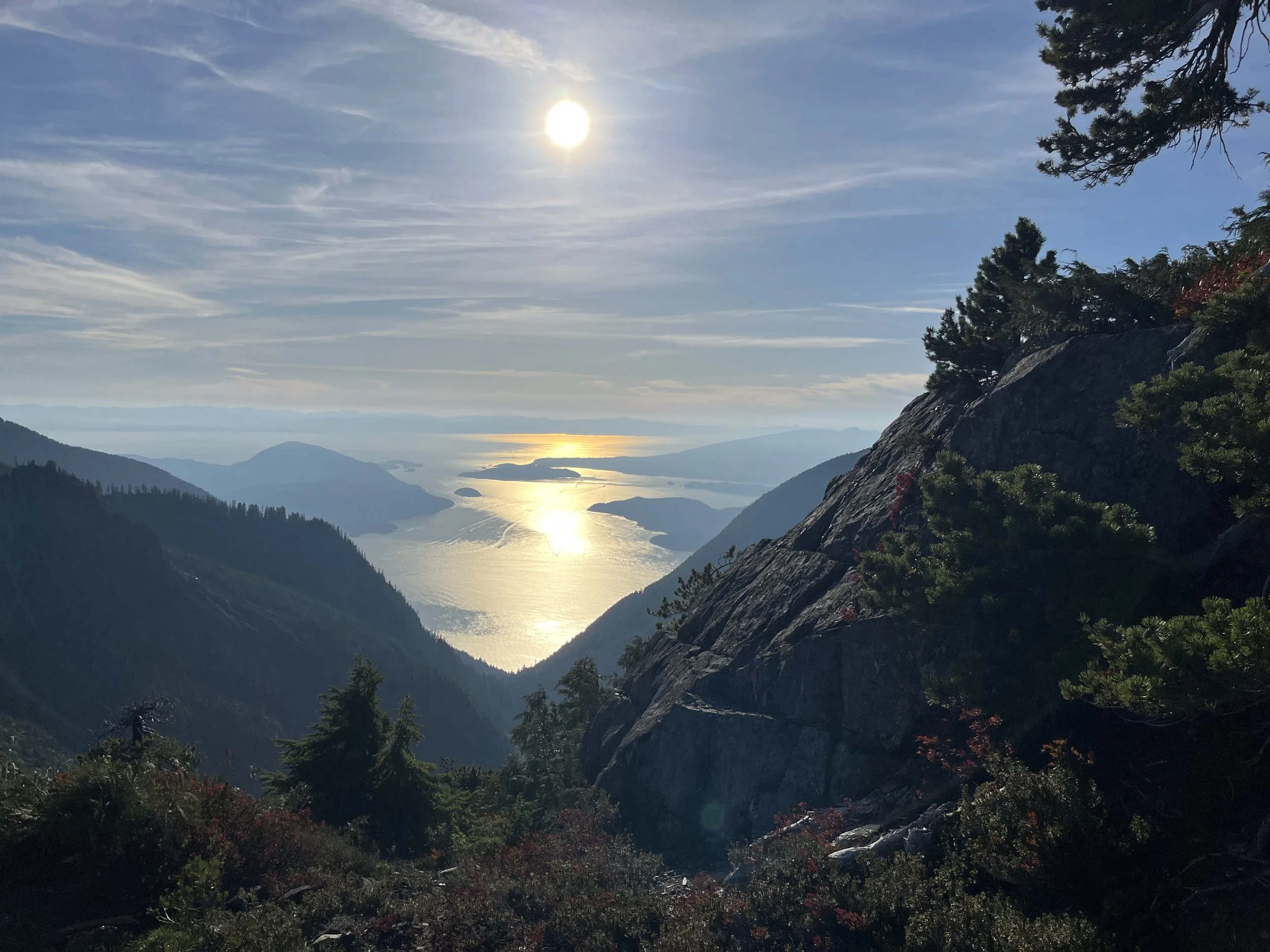
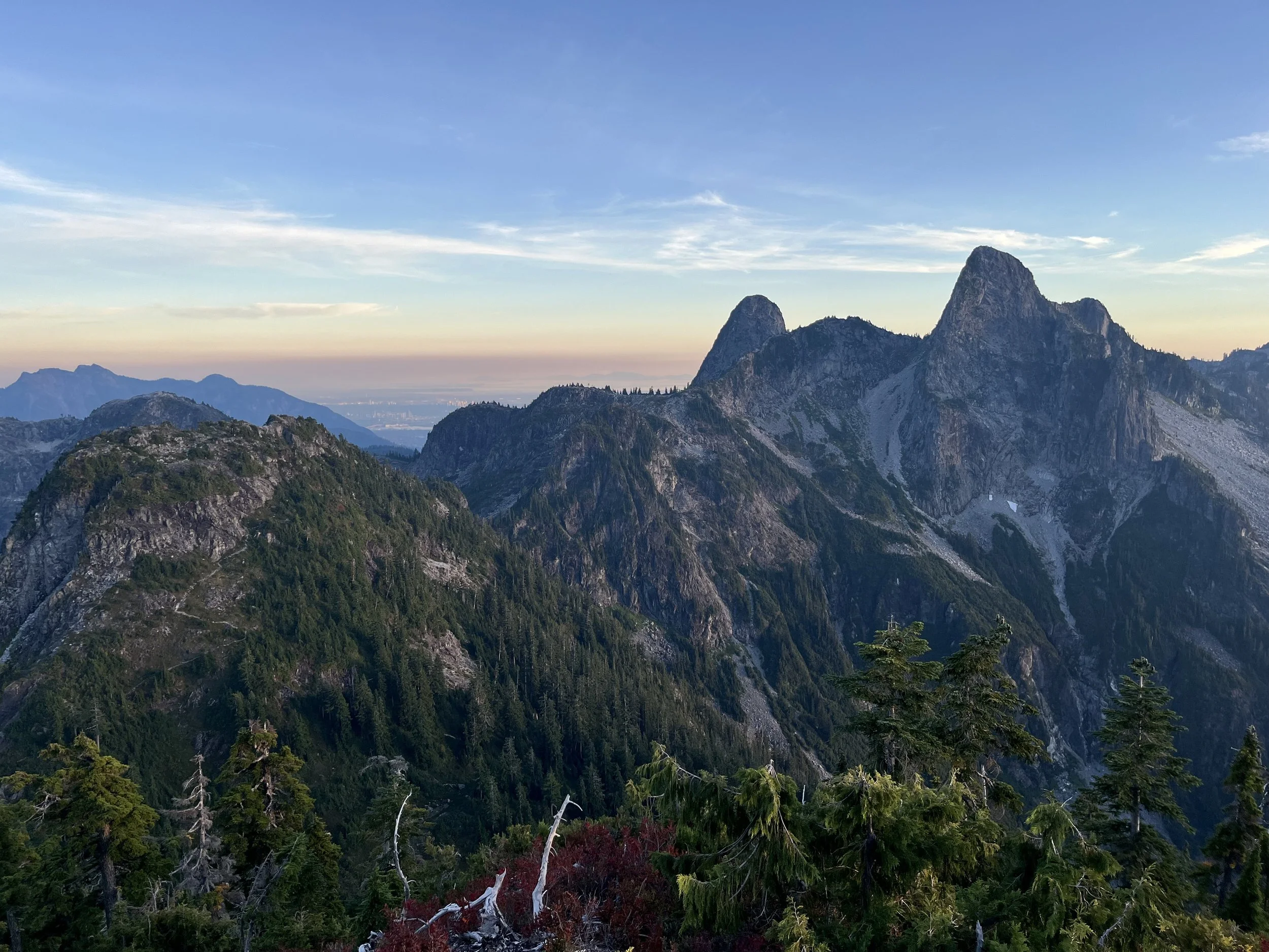
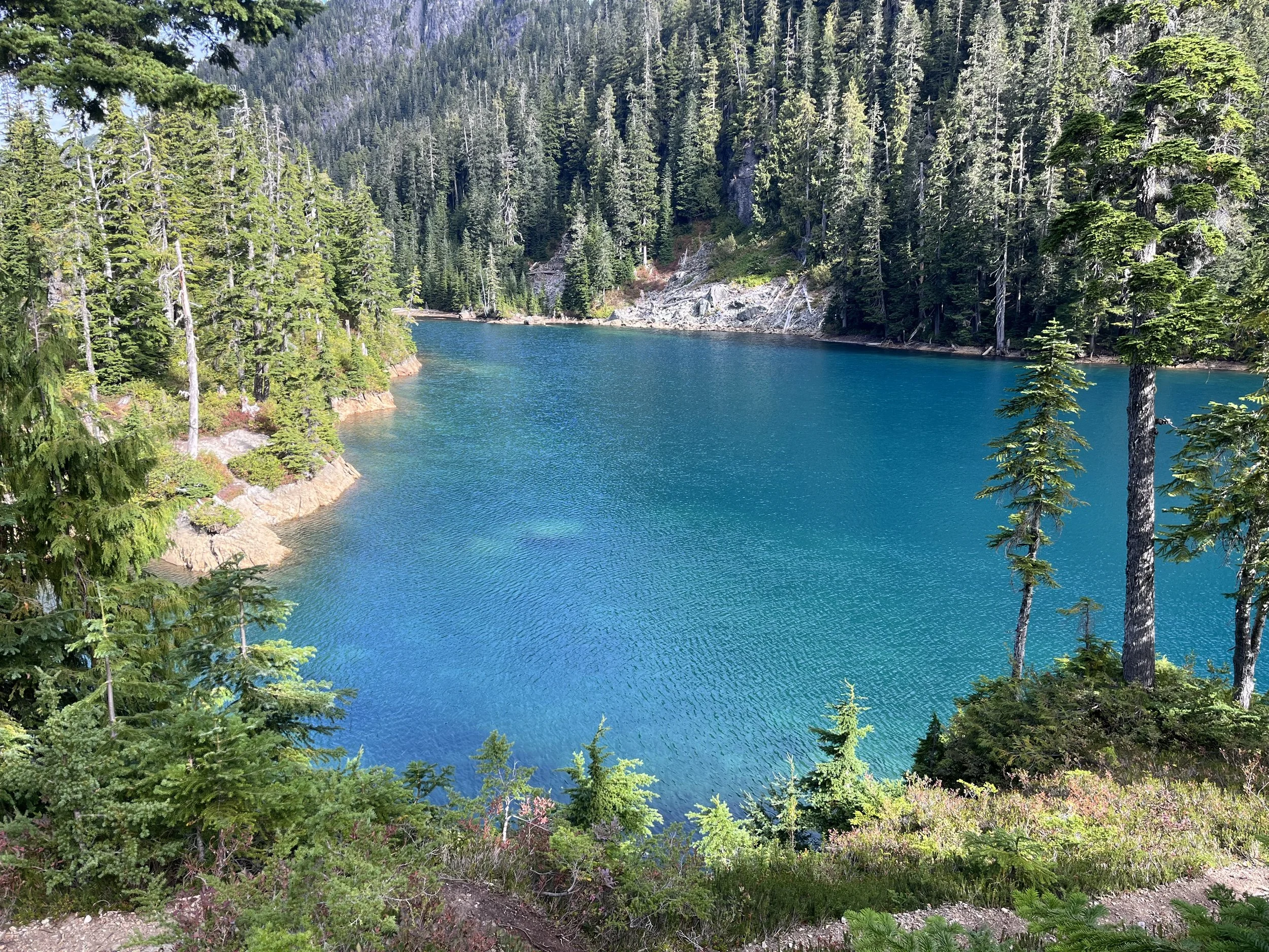
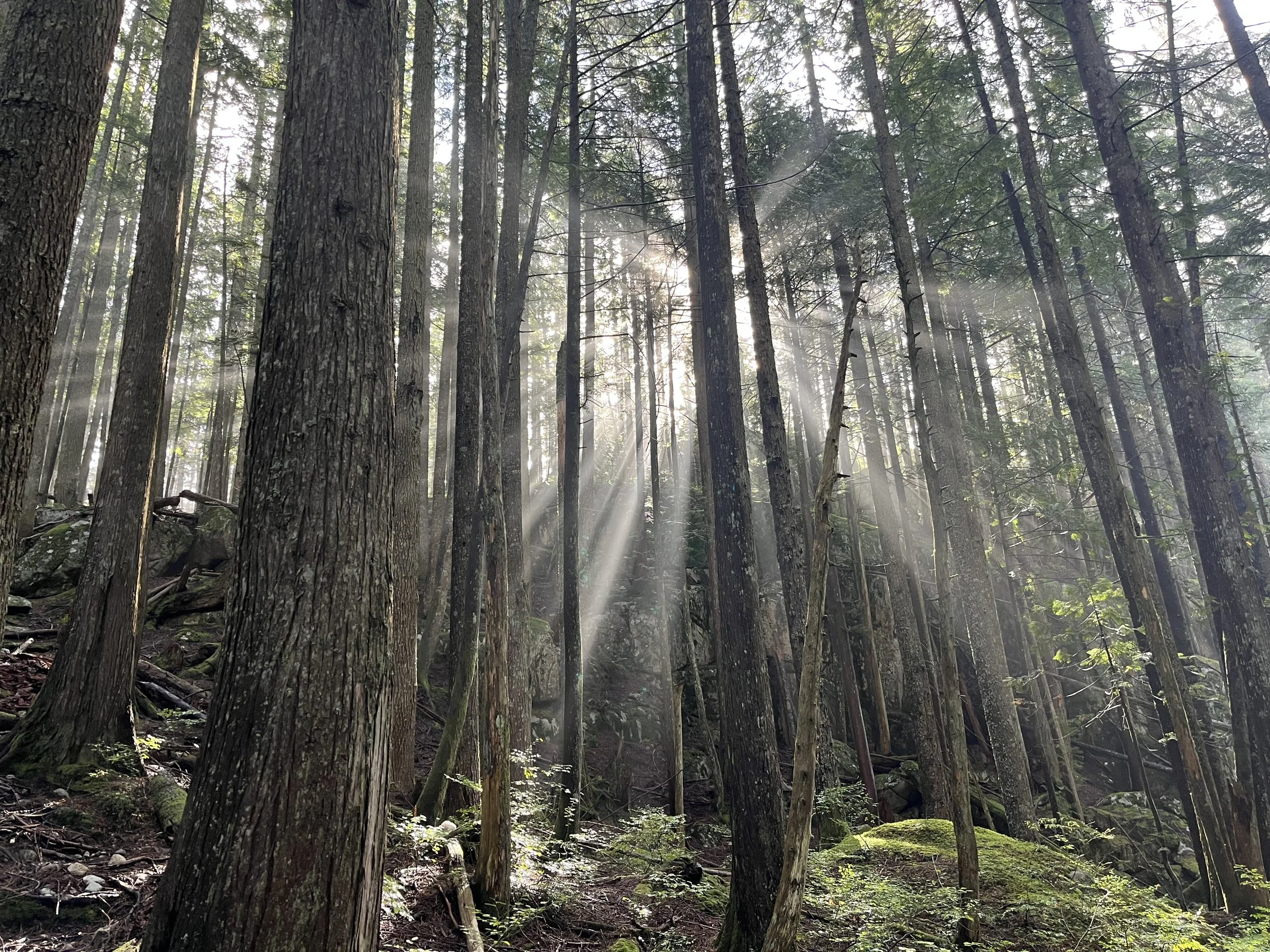
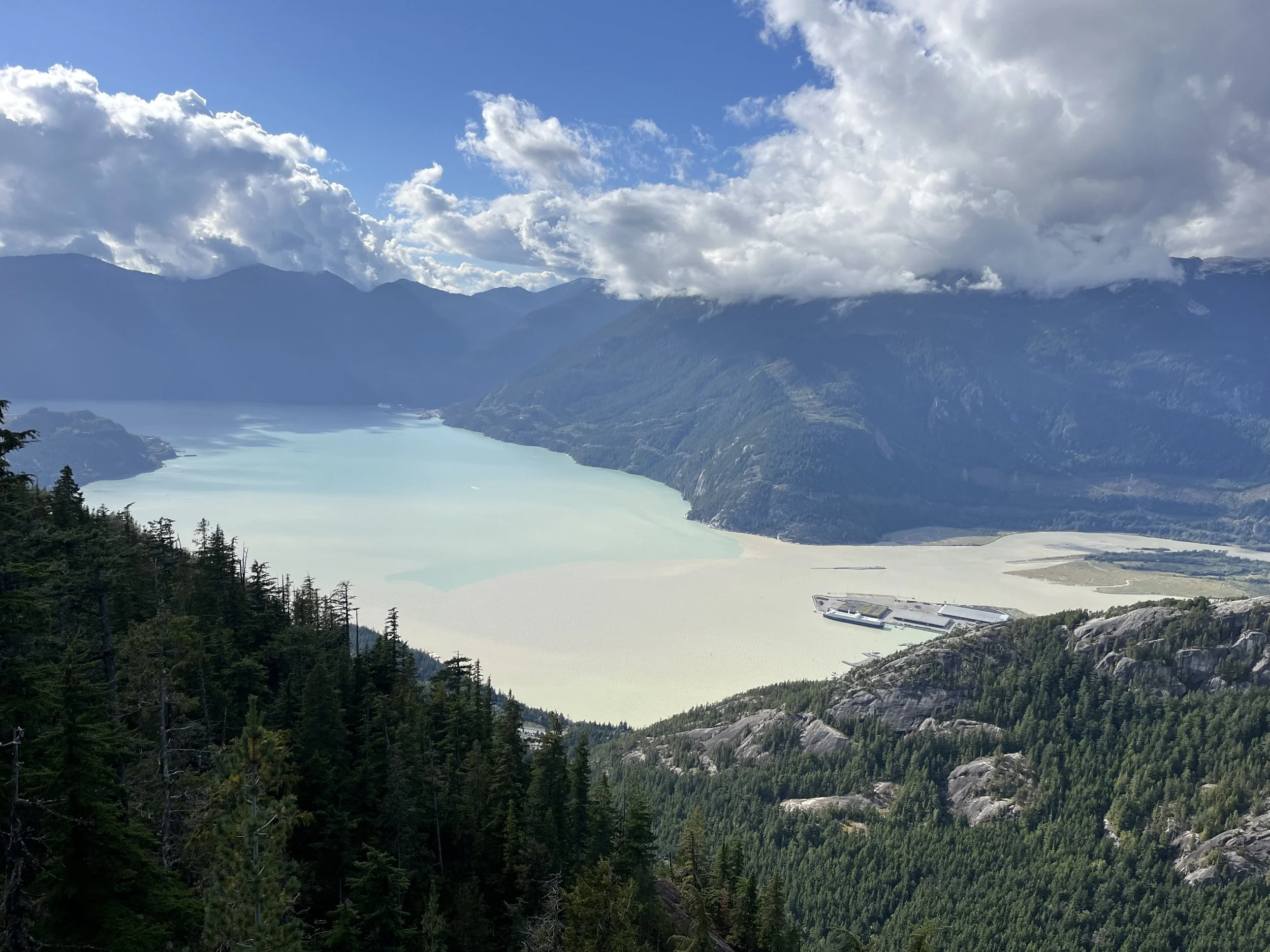
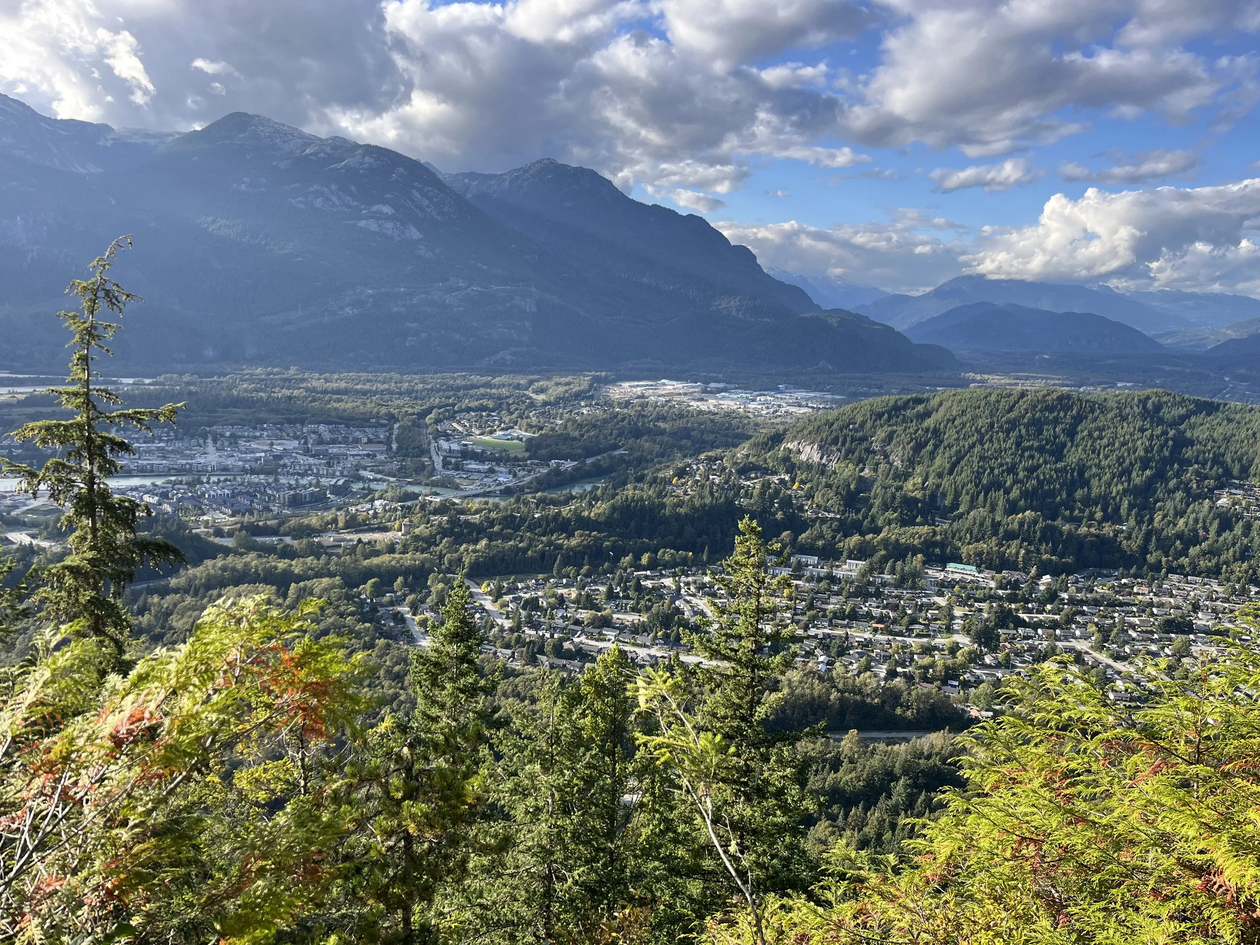
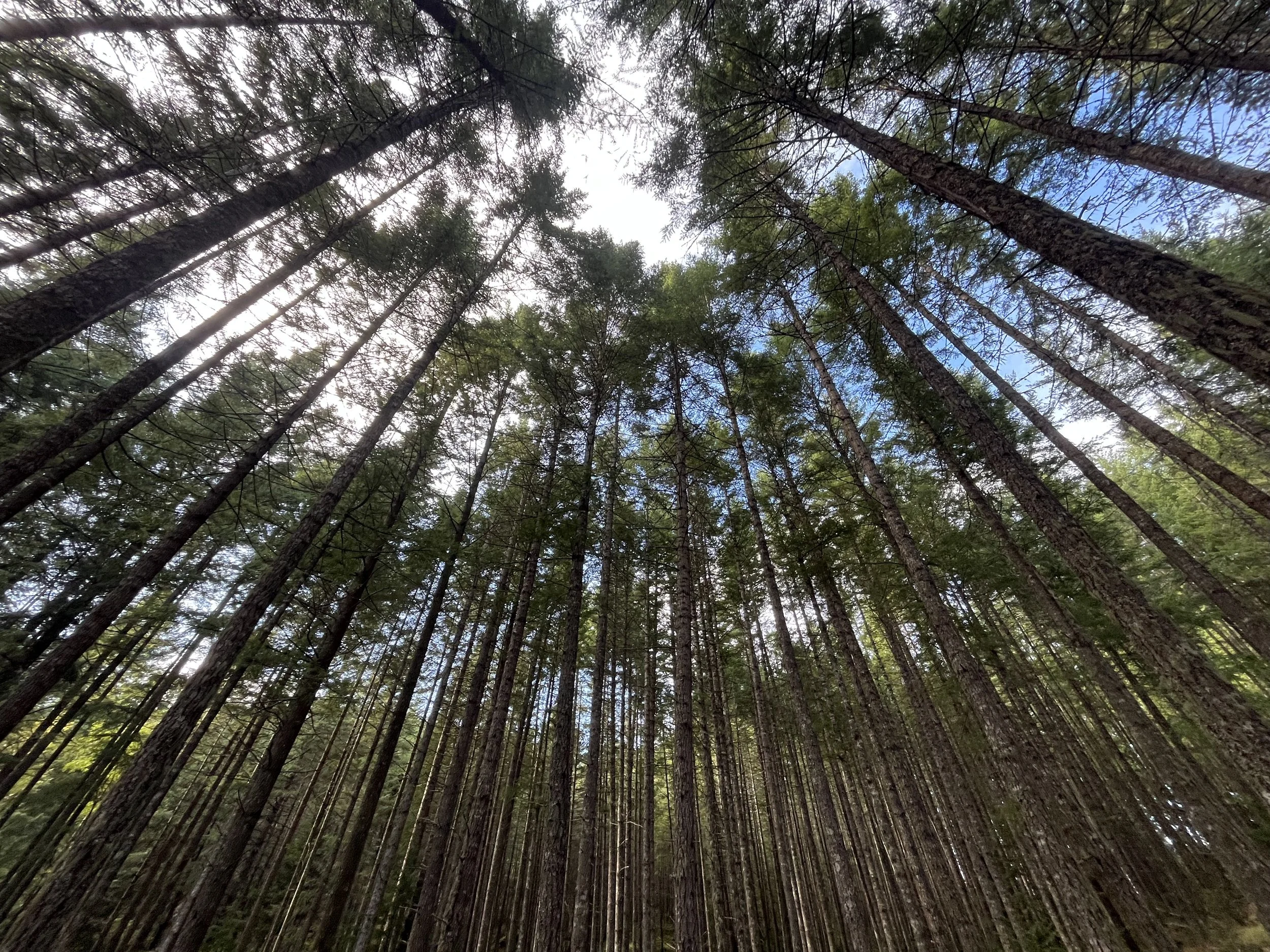
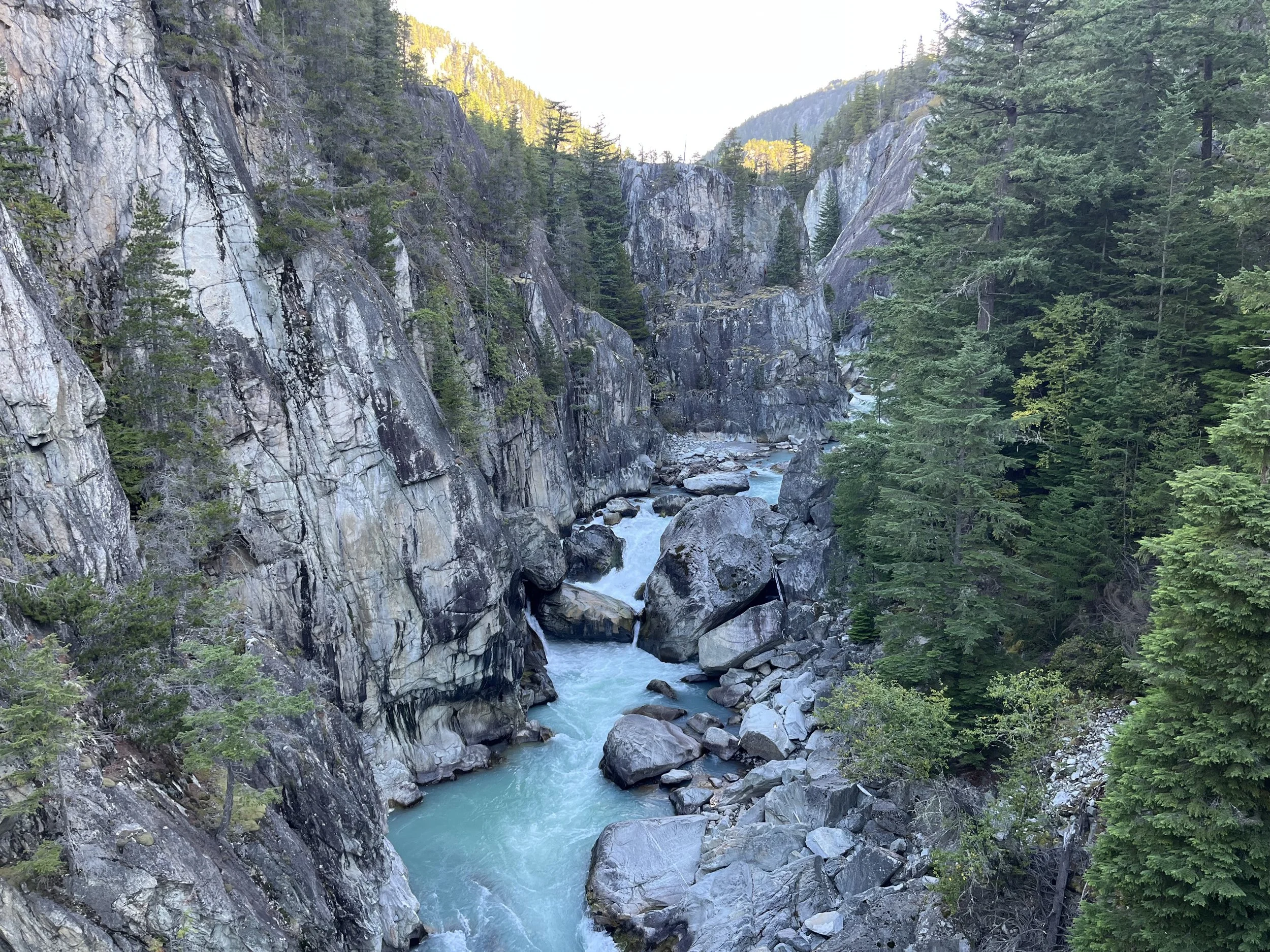
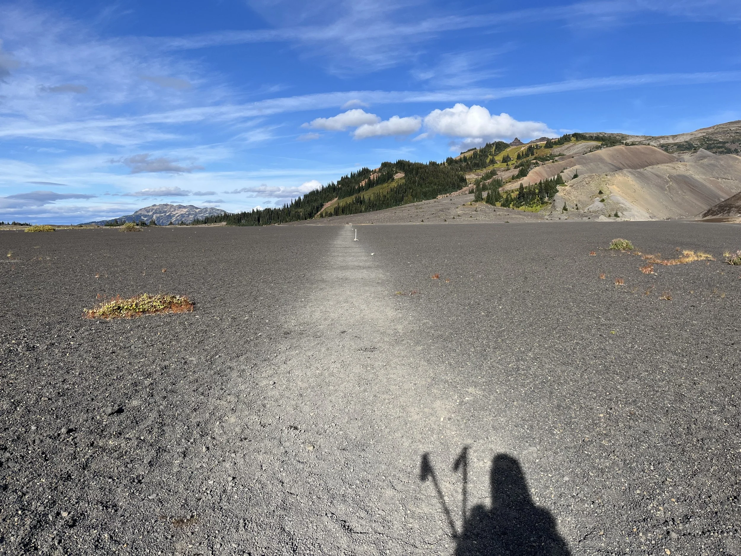
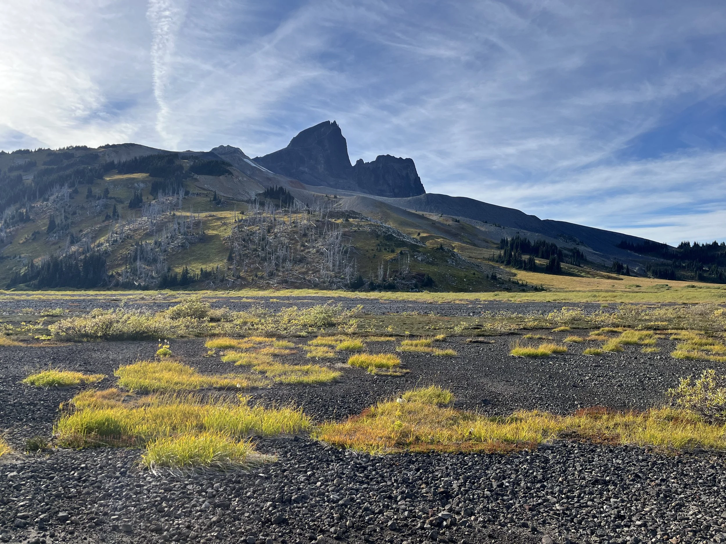
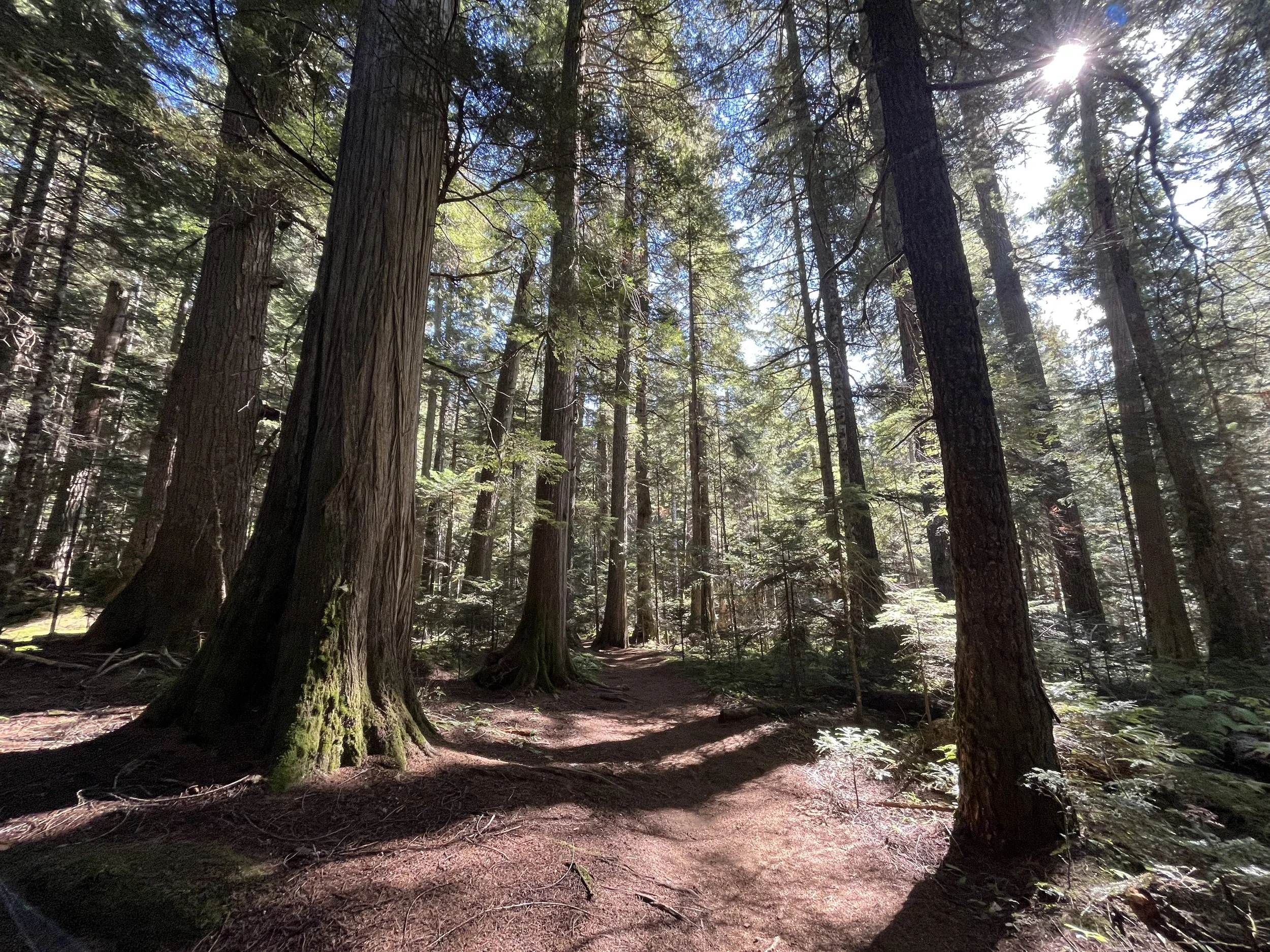
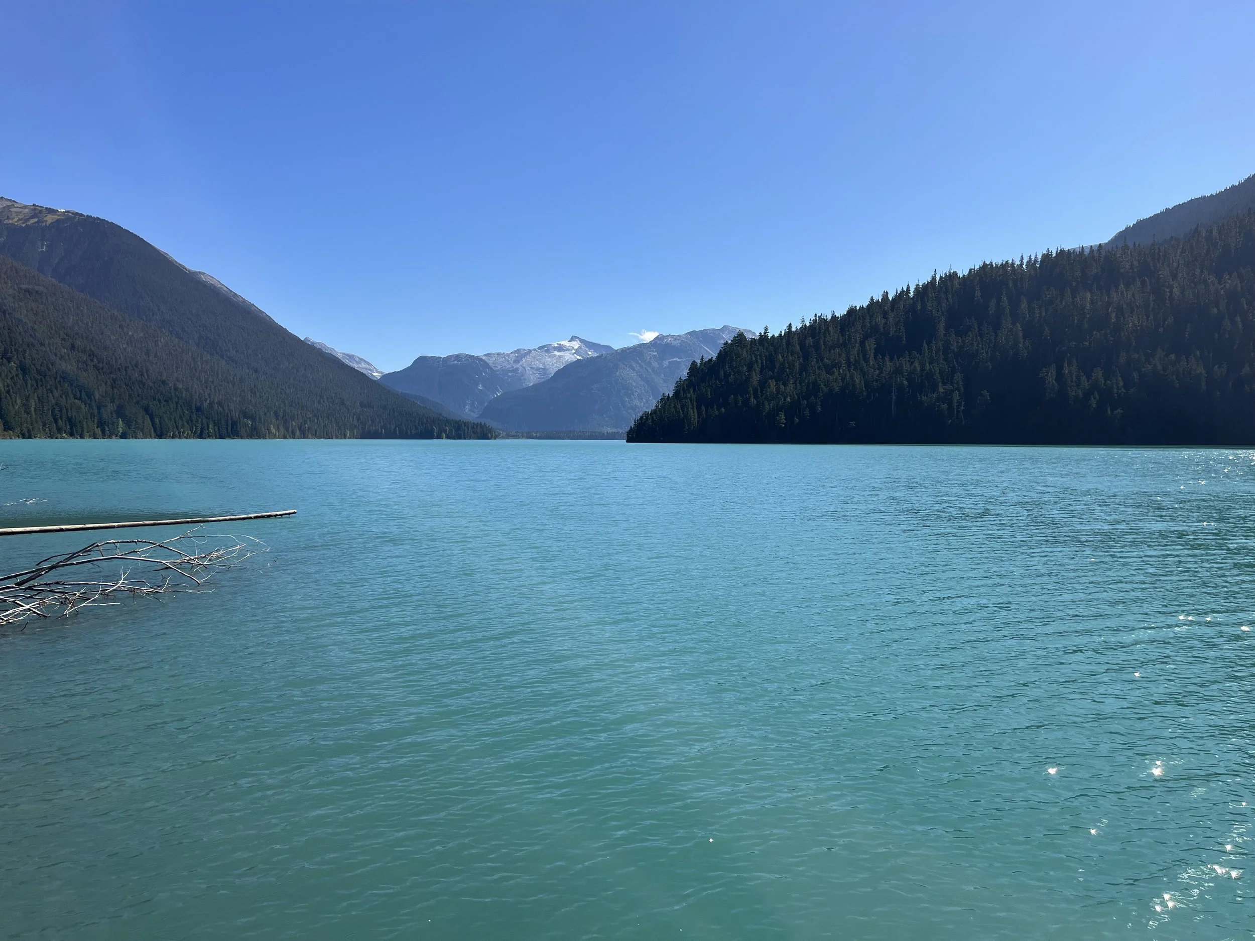
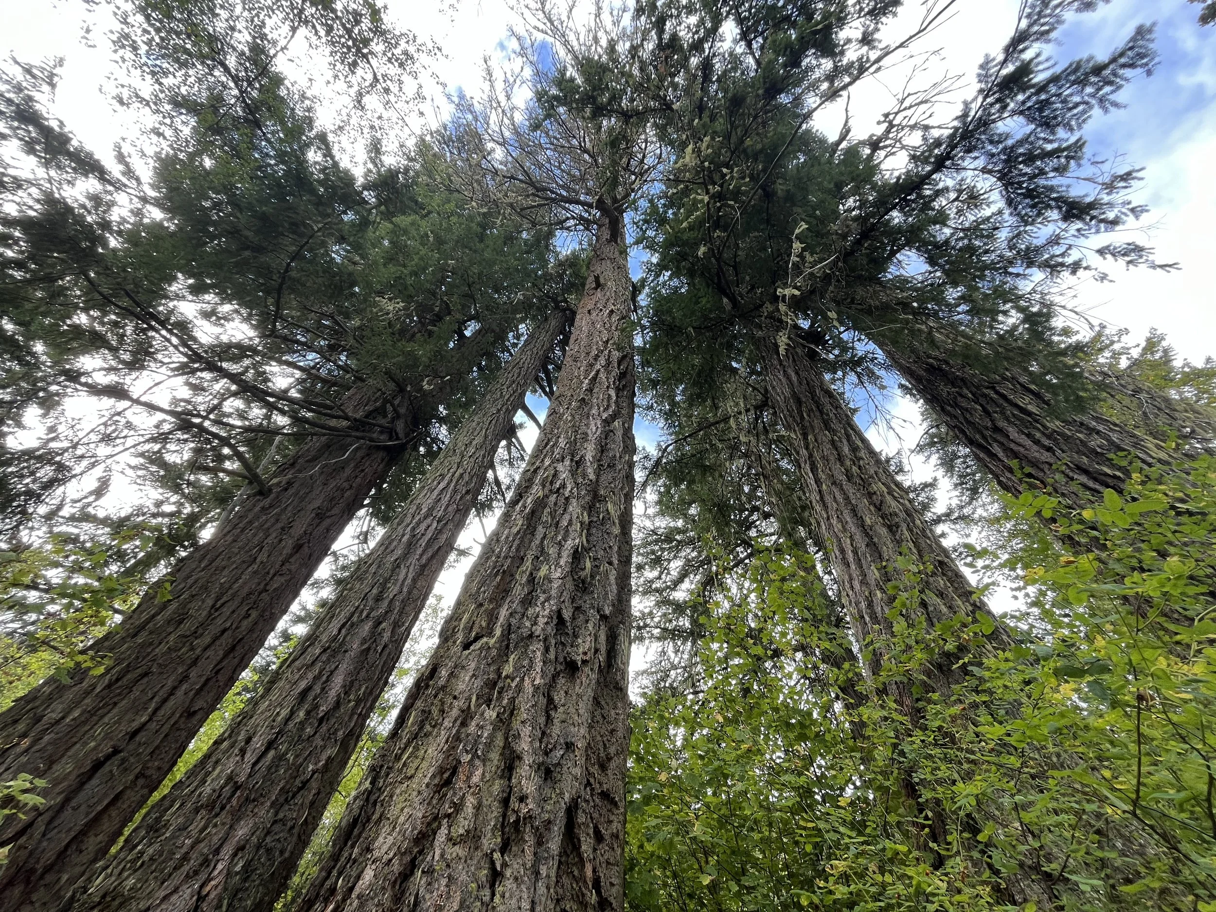
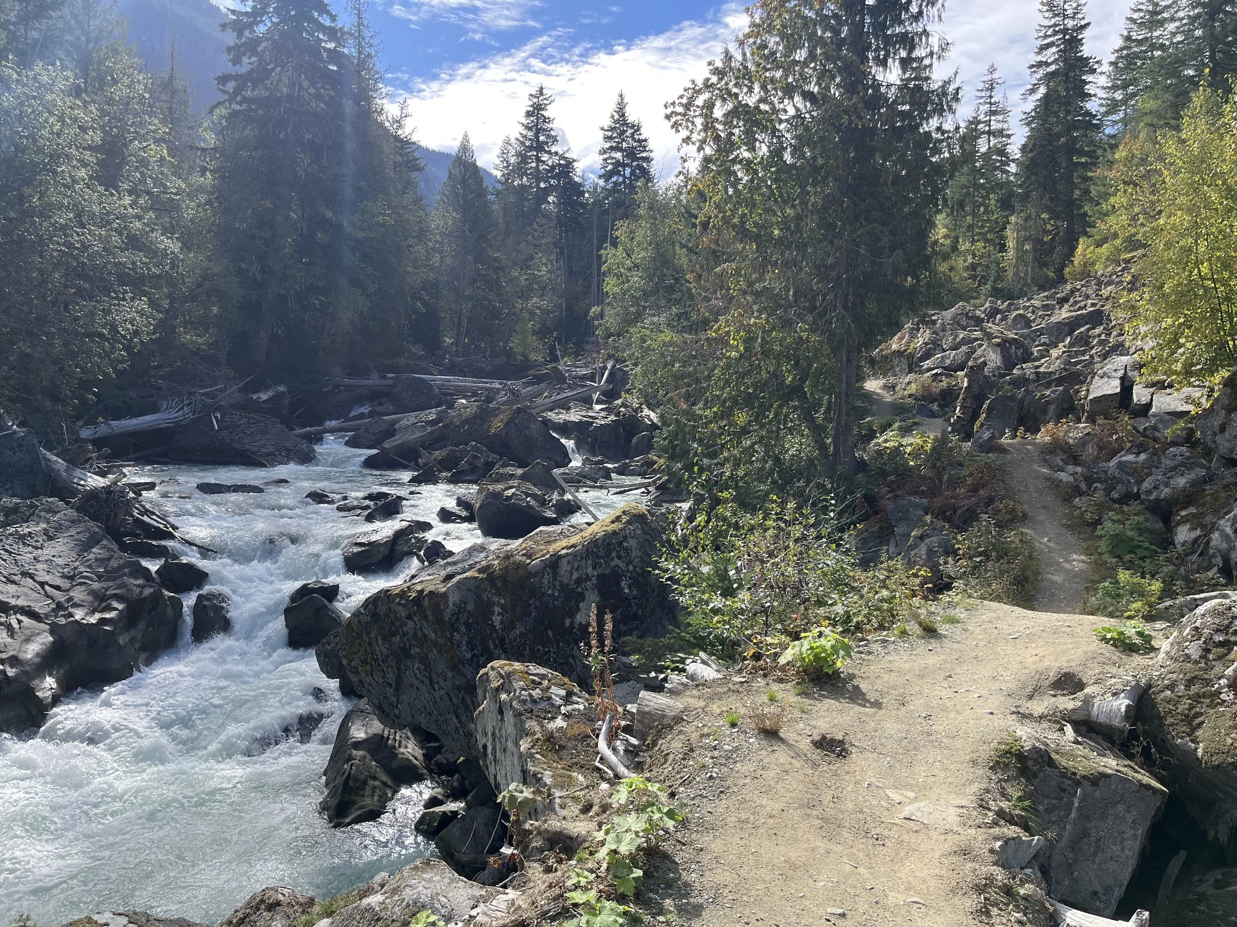
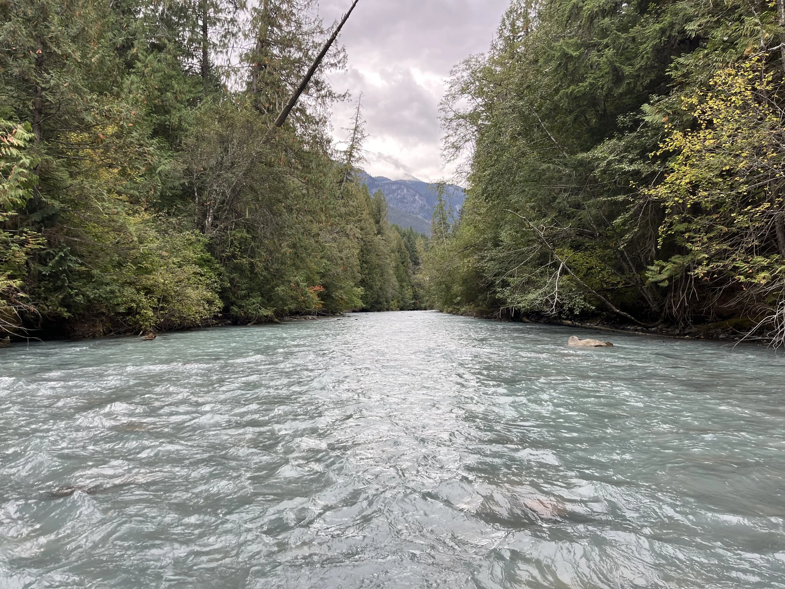
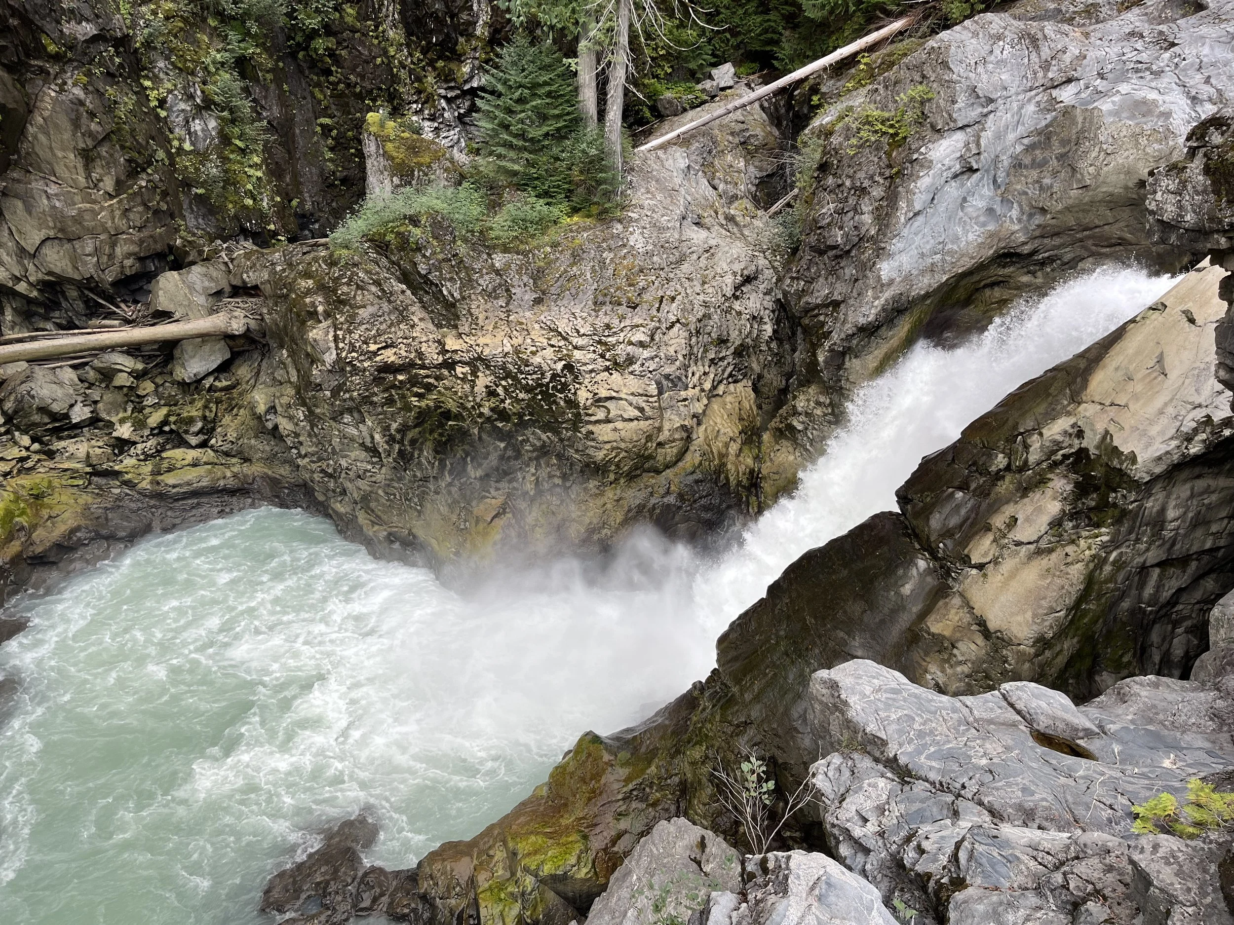
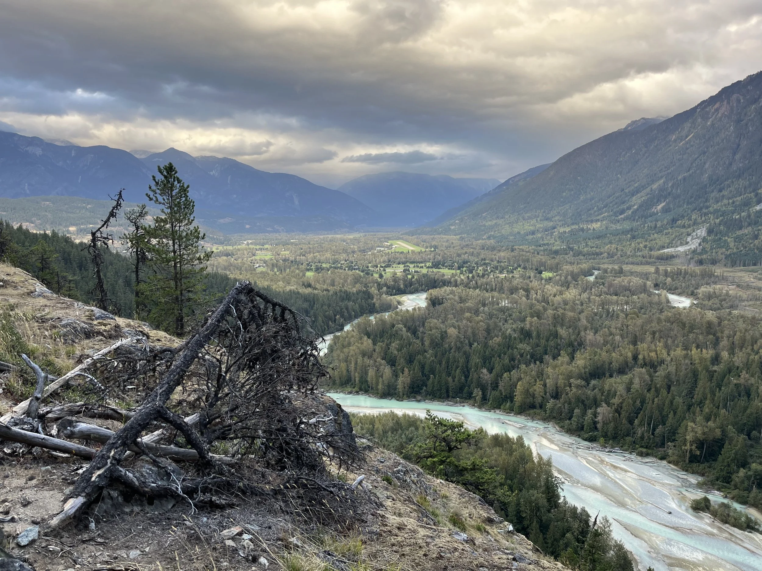
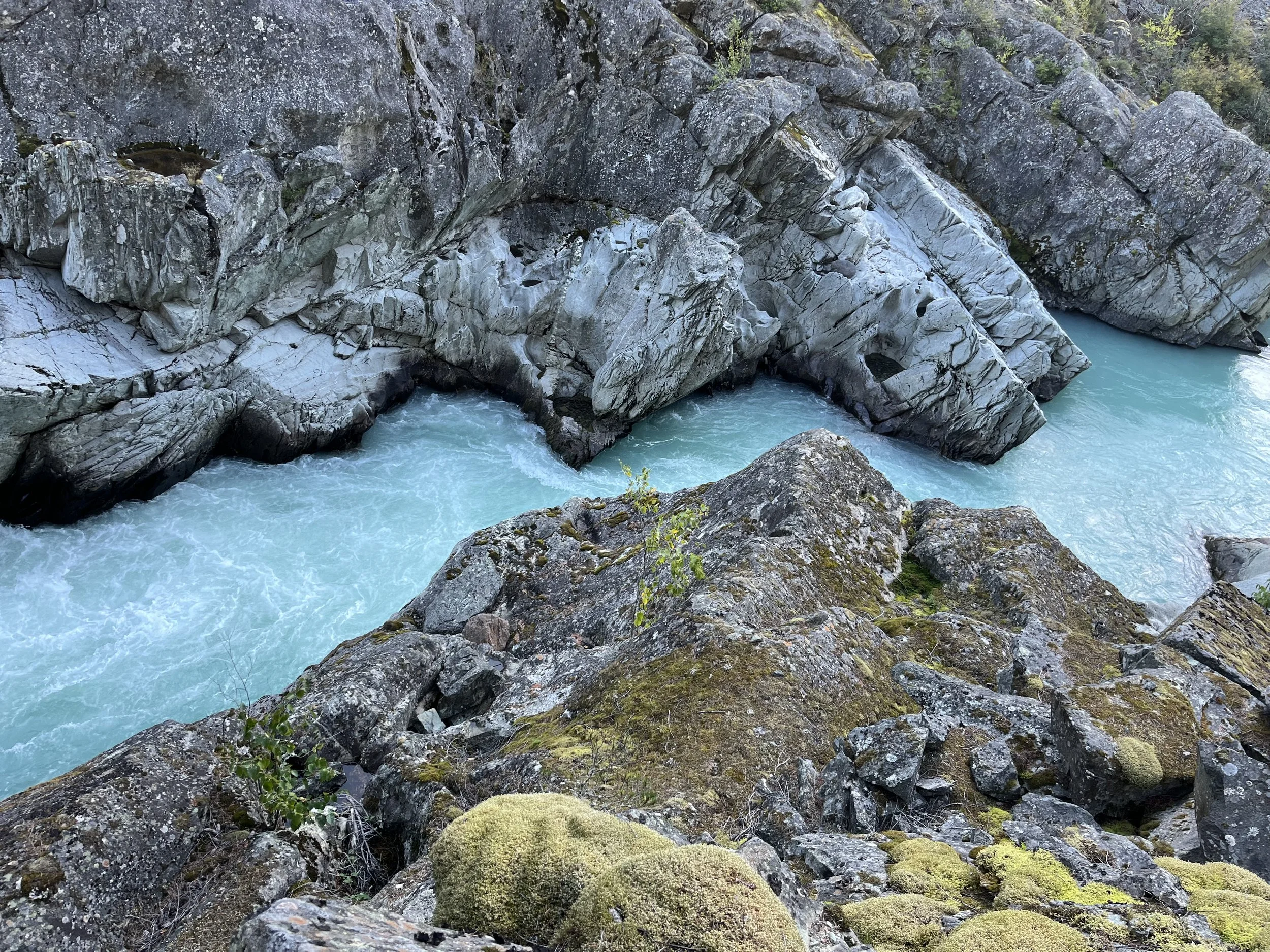
Many of my visits were a long time ago and things change. To do a full thru-hike of this route would require some exact information and lots of planning (especially for food resupplies), as well as a recent hike to collect up-to-date information. So in 2025 I hiked from Vancouver north to Pemberton, where a weather forecast of ten days of rain in a row convinced me that I had better places to be. Read my trip report here. In coming years I will hopefully hike the rest of the route. For now I have collected some exact information on the route between Vancouver and Pemberton. Below are a selection of photos. I only have an old phone with a wide angle lens, so keep your expectations low for photo quality.
High Routes and Low Routes
I named it the Pacific Ranges Low Route to distinguish my route from “high route“ options between Vancouver and Bella Coola. For example, ski touring routes or those hiking routes outlined in John Baldwin’s book Coast Mountain High Routes. Baldwin’s routes include some climbing, scrambling and glaciers, and even if you think you can handle mountaineering in the coast mountains (brutal bushwhack approaches and exits), you couldn’t connect those routes to Bella Coola in a single trip (not without plane/helicopter or boat resupply drops of food, boat ferries across inlets, world-class river crossing skills, and John Clarke-level bushwhacking tolerances).
If you get Baldwin’s book, and you should if you like hiking off-trail in British Columbia (link to online seller), you’ll see some overlap of my plans with the book routes in the southwest Chilcotin. I planned my route before the book came out (based on my previous trips there, plus online trip reports and satellite imagery), and I don’t plan on making any changes based on the high routes in that book, but some of them are an alternate option while doing my planned route if you are (1) very fast and (2) comfortable with some difficult scrambling and climbing. For everybody else who is a thru-hiker without a support driver that can resupply you, you will never make the next food resupply point if you go off scrambling along every high ridge instead of making good time along an established lower trail. Many of these routes are for people with cars or boats waiting for them, not for thru hikers.
I’m tired of hiking with crampons and an ice axe strapped to my backpack, and I’m done with dangerous river crossings that may turn into an involuntary swim. I want to do a route where I can go lighter and in less dangerous places. So I planned the low route to avoid snow and ice, difficult sketchy scrambles and dangerous river crossings.
Maps
If you are curious about the route, you can see my planning in progress that I occasionally update. Click here for map. Red lines = planned hiking route, Yellow lines = hiking alternate routes, blue waypoints = packrafting alternate notes. Some if it is based on other people’s hikes. Some is just based on seeing a possible route over open terrain in satellite imagery. Some of it is based on my vague memory from decades ago. Do not rely on this map for navigation. The route is untested.
Dangers, Annoyances and Other Difficulties
This is an unofficial route that attempts to connect established trails and routes.
To be clear, parts of this route are dangerous. At the very beginning the Howe Sound Crest Trail (HSCT) has quite a bit of scrambling, as does the route on the Chief in Squamish. Watch some videos of the HSCT to get an idea of how difficult it is: one, two, three, four, five, six.
You can avoid the HSCT by starting the hike north of Vancouver in the town of Squamish. There is no easier mountain trail option connecting Vancouver to Squamish.
After Pemberton you will be in increasingly isolated areas. Look at the map. There’s nothing out there in most places.
The farther north you go from Pemberton, the more grizzly bears there will be. And there have been a lot recently with a growing population. There have been attacks by both grizzlies and black bears all along this route.
I’ll try to minimize river crossings, but there will be a few that are unavoidable.
There will be some bushwhacking. Sorry, I’ll do my best to keep it to a minimum.
Seasons and when to go
Early summer still has snow up high. It is also bug season. Then mid-summer is boggy wet trails and extreme bug season. Mid to late summer is the worst of the forest fire danger. I prefer an August to early September start in Vancouver for this route. This will be the optimum time for the least insects, dry trails, dropping temperatures, lower water levels in creeks and rivers, and lower forest fire danger. But you can go earlier if you have higher tolerance for bugs, heat, wet trails and the chance of a fire chasing you down.
Every year is now a “bad fire year“ or “worst fire year ever.“ You should definitely check the fire danger levels before you go (for each region, as the fire danger varies heavily between the wet coast and dry interior). Consult the wildfire map for current fires.
As for “bear season,“ my totally unscientific belief which you should not rely on is that once the salmon start spawning in the fall, the bears will be spending less time grazing in the meadows waiting for you to surprise them, and more time sleeping by the riverside in a salmon-induced coma. But this may be wishful thinking.
Road walking or packrafting alternates?
Anybody who has ever had any sort of plan to travel in a northward direction in Canada over a long distance soon comes to a realization: due to the geography (lakes, rivers, swamps, extreme bushwhacking, isolation from where people live) you will soon run out of trails and be forced to walk on a road or get on the water and start paddling. If you don’t have a packraft and you don’t want to buy and carry one on your back, you will need to do some road walks once you get north of Pemberton. In some places it may be a bushwhack in the forest next to a river or lake. Check out the map.
Volcanoes?
Yes, but dormant. The route goes through the Garibaldi Volcanic Belt, with views of strato volcanoes, such as Mount Garibaldi and the chance to climb up the Black Tusk, and then farther north past Pemberton you pass by the Mount Meagre volcano massif and walk through volcanic areas with interesting geology by Athelney Pass. Farther north the route swings through the Anahim Volcanic Belt with a visit to the Rainbow Range shield volcano.
Photos, videos and trip reports along the route
If you want to see examples of what it’s like on the ground, there are some trip reports and videos. See links below.
Vancouver to Pemberton Valley
North of Pemberton
South Chilcotin Mountains Park
Chicotin Plateau
Packraft Across Plateau (plus hike + hitchhike)
West Chilcotin
Itcha Ilgachuz Park
Tweedsmuir Park
Bella Coola
Practical Information
Resupplying and battery charging
Resupplying (food, battery charging) gets difficult after Pemberton if you don’t have someone driving out to deliver food to you. There will need to be some long “food carries.“ Tolerances to heavy carries vary, so this route may not be for you (e.g., you go ultralight and don’t want to get a backpack appropriate for heavier loads). Exact info on resupply points coming eventually. As for mailing resupply packages, there will be some difficulties and certain post offices along the route are only open two to three days per week. If you are American or you got accustomed to the US Postal Service while thru-hiking in the US, you need to know that “general delivery“ also exists in Canada, but in a way that makes it unusable for travelers. You need to use Canada Post’s FlexDelivery service. I think all successful uses of American-style general delivery by tourists and travelers are probably just a small town post office knowing what you are trying to do with your package and ignoring the rules in the tourist’s favor. Note that from the date of delivery at a post office, you have two weeks to pick it up before it gets sent back. So you can’t send them out all at once. You will need someone to send out your resupply boxes to the farther northern resupply points after you are already on trail.
These are the food resupply starting in Vancouver and going north: Squamish, Whistler, Pemberton, Gold Bridge, Xeni (Nemaiah Valley), Tatla Lake, Nimpo Lake, Anahim Lake, Hagensborg, and Bella Coola. Squamish, Whistler and Pemberton have supermarkets open seven days per week and post offices that are open every day but Sunday. Gold Bridge has a small grocery store open seven days per week and a post office that is only open two days per week. Xeni Gwet’in (Nemaiah Valley) only has a very, very small convenience store in a gas station and a post office open three days per week with limited hours. Tatla Lake has a very small convenience store and options for mail delivery nearby. Nimpo Lake has a grocery store open seven days per week and a post office open three days per week. Anahim Lake has two small grocery stores and a post office open three days per week. Hagensborg has a small grocery store open seven days per week and post office open five days per week. Bella Coola has a grocery store open seven days per week and a post office open five days per week.
The resupply strategy is very easy between Vancouver and Pemberton. You have access to supermarkets, accommodation and places to charge batteries.
Then it gets difficult north of Pemberton. You will need to do a heavy food carry between Pemberton and Gold Bridge (170km). You can break this section into two if you have a packraft - float back down to Pemberton on the Lillooet River for a resupply and then hitchhike (slowly, eventually) back up the valley to where you started floating. Without a packraft you could just hitchhike both directions.
Between Gold Bridge and Tatla Lake you will have some difficulties. It is 300km. You could do a very heavy food carry, or you could try out a range of these options: 1. take a chance on what you will find in the tiny gas station convenience store in Xeni, 2. attempt to time your hike to be at the post office in Xeni (Nemaiah Valley) when it is open on Monday, Tuesday or Thursday, 3. time your hike to be at the Tatlayoko post office on Monday, Tuesday or Thursday, 4. Get in touch with the Chilko River Lodge and see if you can send them a resupply package to pick up here when you stay as a paying guest (offer to pay for the service, as they pick up their mail at the post office in Tatla Lake) - this option is only a suggestion, I have not yet talked to them, 5. Increase your chances of being on time for a resupply package at a post office by sending two packages (one to Tatlayoko, and one to Xeni/Nemaiah) and assume that one will have to be returned after not being picked up (or you get lucky and are in time for both, and do some big meals).
My strategy north of Pemberton will be to not bother with a mail resupply in Gold Bridge as the post office there is only open two days per week. Instead I will resupply fully from the small local grocery store. Someone has recently uploaded some very helpful photos to Google Maps from inside the store, and I see that I personally can easily resupply here.
I will then do a 140km loop in the South Chilcotin Mountains and Big Creek provincial parks and then resupply in Gold Bridge again (check out the GPX track - it’s obvious how you will be doing that).
From the Gold Bridge grocery store it will then be 190km (120 miles) to the reserve/reservation at Xeni (Nemaiah Valley). FYI, these will not be fast trail miles. Here in Xeni there is a tiny snack shop at the gas station, and a post office open three days per week (Monday, Tuesday, Thursday). I will have a package waiting for me here, and I’m hoping I arrive on an open day. If not, I will speed up or slow down to aim for one of those days. But if I’m out of food and I have to arrive on a day the post office is closed, I will buy some survival snacks at the gas station and then camp nearby until the post office is open. Worst case scenario is that I arrive on Thursday after the post office has closed, and I have to wait until Monday morning.
Next is a 73km section to the Chilko River Lodge. I had though about contacting them about mailing them a resupply package, but I will have enough food from my Xeni resupply to make another 68km to the post office in Tatlayoko. But the same problem will be encountered here (Tuesday, Wednesday, Friday open hours only). So timing will again be an issue.
From Tatlayoko to Tatla Lake is 75km. In Tatla Lake I will plan on a mail resupply as the convenience store here has very limited selection. The good news is that the post office here is open Monday-Friday, and there are motel and inn options for accommodation.
After a mail resupply in Tatla Lake, I no longer need to do a mail resupply again, as distances between grocery stores are manageable. Of course, if you have special dietary needs or preferences you may want to continue doing mail resupplies.
From Tatla Lake to Nimpo Lake is about 160km, and that is doable for anyone with a backpack that can carry heavy loads. I only plan a small resupply in Nimpo Lake as the next resupply is only 25km away in Anahim Lake. But some bikepackers report that Nimpo Lake has better food selection.
From Anahim Lake it is about 180km to Highway 20. Here, at Burnt Bridge Creek at Tweedsmuir Provincial Park, you can request the local transit bus extend its trip to pick you up (but not on Sunday). This bus will take you into Hagensborg for a resupply and accommodation (then request again a drop-off at Tweedsmuir Park the next day if you are staying the night). Or try your luck at hitchhiking in and out.
You could attempt to split this 180km up by hitchhiking back to Anahim Lake when you cross the Dean River Road about 90km in. But I make no promises about how many vehicles you will see and how enthusiastic they will be about giving you a ride.
The final section is a loop that crosses Highway 20, goes up the Talchako River, via Ape Lake and eventually to Bella Coola. This section requires some scouting and it may not be doable. If it is, in the middle there is the opportunity to make an resupply run at the midway point by walking/hitching down the Nusatsum-Noeick Forest Service Road to Hagensborg.
Hitchhiking to resupply points will not be as reliable here as it is on American thru hiking trails. Here in this part of Canada it is comparable to the difficult hitchiking spots in the US (e.g., national parks with tourists who don’t stop for hitchhikers, fast highways, or near the larger upscale gentrified towns). The problems are: (1) loggers, miners and workers who would pick you up in the 1980s will be far less likely to do so now for reasons of insurance liability, work regulations and personality, (2) the cultural phenomenon of luxury trucks and SUVs with spotlessly clean and delicate interiors on backroads having replaced the old dirty banged-up pickup trucks (guess which vehicle is more likely to pick up a dirty sweaty hiker), (3) the newer demographics of tourists are less likely to pick you up than back-country tourists in previous decades (for a variety of reasons), (4) new trends in crime, mental illness and drug addiction in rural areas of British Columbia make picking up a stranger a risky proposition, and (5) the low level of traffic on roads in this area.
Food Caching
If you have a car and time to drive around you can make food caches for yourself. But this will be problematic.
First up is the North Creek Cabin (between Pemberton and Gold Bridge). You will need a strong 4WD vehicle to make it to the trailhead that is on a spur road off of the Upper Lillooet Forest Service Road. Then it is a 12km round trip to the cabin, with 900 meters elevation gain. The rules for the cabin are unclear about food storage. You could send the Club that administers the cabin an inquiry here. The could be plenty of reasons why they won’t allow this (rat/bear attractant, hikers leaving behind storage container as garbage, etc…). I don’t plan on trying this option as it would be easier to just carry a heavy food load on my back than go to all this trouble.
Next up is just north of Gold Bridge at the Spruce Lake North Campground, that has bear-proof storage lockers/caches. You would need to drive to a trailhead in the South Chilcotin Mountains Provincial Park and hike to Spruce Lake. You should probably add a note explaining that you have not abandoned the food and give a rough estimate of when you will pick up the food. Is this permitted in the park rules? I have no idea. And I won’t be making any inquiries as I am happy to resupply at the small grocery store nearby in Gold Bridge - where you could also just hand over a box of food to the motel or hotel that you plan to stay at when you hike through (if you don’t want to take your chances with heavy grocery store food).
I don’t advise hiking into the Tchaikazan River cabin to cache food as reports vary as to whether or not it is locked or not. And there are several reports of a rodent infestation. You could use rodent-proof storage, but the outfitter in the area says that grizzly bears have broken in to the cabin in search of food. In the past (and maybe still) the cabin was used as a storage facility by a hunting outfitter, and you should assume that you do not have permission to store food here. There is a similar issue with cabins on Yohetta Lake - they are private and I doubt they want people storing food. Plus, the road to this area has a gate that is sometimes locked.
Finally, there are cache box/lockers next to both the Rainbow Cabin and the nearby Crystal Lake campsites. These are both in Tweedsmuir Provincial Park and would likely be an overnight hike from the trailhead. For permissibility, see what I wrote above about South Chilcotin Mountains Provincial Park. I don’t plan on attempting to cache food here as the drive is so far away (followed by a long hike).
That is it for bear cache boxes/lockers and cabins that are not too far way from roads. None of these options are convenient or guaranteed, so I won’t be using a caching strategy.
How about burying a cache like hikers do for the Hayduke Trail in Utah? There are spots you can drive to that are on or near the trail, but you will have two problems: it not easy to find ground suitable for digging a hole. This is not Utah and there is often very rocky ground or shallow soil followed by bedrock. And then there is the bear problem. The bears here will get the tiniest scent and dig up and destroy or move your cache.
High elevation caching is an option that frees you from worrying about rodents or bears. If you are rich and can afford the helicopter trips, then go for it…
Accommodation Options (plus battery charging)
Vancouver has plenty of options. For budget travelers there are two hostels downtown (HI Hostel and Samesun Hostel). To be safe, reserve well ahead of time as summer is the high tourist season here and a big event can result in no accommodation being available, or being at extortion prices (example: $300 hotel rooms were $3000 when Taylor Swift was in Vancouver). Note that there are World Cup games in Vancouver in June/July 2026. For other big events that bring in travelers, do some research…
Squamish has several campground options (see waypoints in the GPX file). The Squamish Adventure Inn is a really nice hostel with great facilities. For those on a higher budget, there are many other accommodation options.
Whistler is a huge resort, and there are many, many places to stay here. At the budget level, there are two hostels to choose from: HI Hostel and the Whistler Lodge Hostel. The HI Hostel is OK as far as large mega-hostels go; however it is not in Whistler, but rather in an area outside of town that I knew of growing up as the place where you go to buy home improvement and construction supplies. It’s basically where all the non-tourist businesses are. But you can take public buses into the tourist parts of Whistler. Don’t bother with any campground options. They are either too far away or offer primitive sites at the same price as the HI Hostel (which has showers, kitchen wifi, electricity, etc.)
Pemberton is not very good for accommodation considering its size and location. It never has been, and it might never be. Tourists want to stay in Whistler, and it’s too close to Vancouver to be a town with a bunch of roadside motels as you find in the interior of BC. There are two hotels (and a smaller inn). I did see some reasonably priced AirBnB accommodation online. The two I saw are located conveniently on Snob Hill (newer transplants and real estate agents may refer to this place as the Benchlands). What you can also do is take the public transit bus back to Whistler to stay there for the night and then return back to Pemberton. It’s a quick trip. If your only concern is battery charging (to top up after a two-day hike from Whistler), check out the restaurant options and see who has wall outlets (the unfriendly McDonald’s has a short time limit at tables and only one electric outlet).
Gold Bridge has one hotel, one motel and a new B&B inn nearby on Gun Lake. In Gold Bridge and points farther north in the Chilcotin you may need to worry about a work crew being sent to the area and booking out all of the rooms. It does happen occasionally (example: a September 2012 hiking group found no rooms available in either Gold Bridge or Bralorne on a Thursday). Note that there are two more options up the road in Bralorne, and nearby at Tyax Lodge if you have the money. My strategy here will be — once I’m confident of what date I will reach Gold Bridge on - to send a satellite message to someone who will call and make a reservation on my behalf. I consider this to be an important battery-charging stop, and I really need a room for the night to do that.
The Chilcotin Plateau is, until you hit Highway 20, an extremely expensive place catering to wealthy fly-in tourists who book week-long all-inclusive packages at luxury lodges for upwards of $10,000+ per person. Basically it’s the Canadian Wyoming. The “mid-range” is for those who don’t have an airplane - but they charge around $500 per night. There is an ongoing purge of tourist/outfitter operations in this area (tourism licenses are being revoked), and some have shut down recently. Notably it is the lower/mid range going out of business, not the wealthiest operators. For now, the best affordable option is Chilko River Lodge, which offers a small lodge, cabins and tent camping. For battery charging, call ahead to the Chilko River Lodge as they are off-grid. They have solar power and a generator. If you camp there you would need to hand them you powerbank, cable and adapter for recharging. Contact them and see if this is still an option (it was mentioned once by a visitor who was there years ago.)
Next you have the accommodation options along Highway 20. Tatla Lake has a motel and an inn. Nimpo Lake has a range of lakeside resorts, with Vagabond RV Park looking like a good affordable option with cabins, tent sites and a range of services.
For Anahim Lake you won’t find accommodation in the little town/rez itself, but you will find affordable places to stay at the lake of the same name nearby. The options here are Eagle’s Nest Resort (rooms and cabins), Escott Bay Resort (cabins and camping) and Anahim Lake Resort (cabins and camping). All options have electrical outlets for battery charging.
Hagensborg has several mid-range guesthouses (see Google Maps), plus two affordable options: Rip Rap Camp (cabins and camping), Bella Coola Valley Campground (cabins and camping) and Bailey Bridge Campsite (cabins and camping). All these places places have camp sites with electrical outlets.
Bella Coola has the affordable Valley Inn and the (prices not advertised but probably more expensive) Cumbrian Inn. There are also luxury options in the Bella Coola area.
Transportation to/from the start/end of the route
For getting to Vancouver, and all public transportation options as far north as Pemberton, see the Vancouver to Pemberton trip report. After Pemberton there is no public (bus, train) transportation. There is only hitchhiking, and that will be difficult.
Once in Bella Coola you have a range of options, none of which are easy or cheap. First, check out the Facebook rideshare group for Bella Coola. People in this paid rideshare group are offering or asking for rides to/from Williams Lake, Kamloops and Vancouver (note that sometimes “Van“ is Vancouver and “WL“ is Williams Lake in the Facebook posts and comments). Williams Lake and Kamloops have the inter-city bus service Ebus, and that can get you to Vancouver. It’s clear that Williams Lake is the main destination for ride offers (with the Walmart Supercentre in Williams Lake as the end point).
You can fly out of Bella Coola with Pacific Coastal Airlines (the airport is 14km from Bella Coola). The prices for their daily flights range from $200 to $600 (Canadian Dollars) for a one-way flight to Vancouver (that’s looking at prices 6 months ahead of time; buying a ticket a week out may be more expensive). Be careful to not book a flight from Bella Bella. That’s a different place.
Note that the same airline also flies 3 days per week from Anahim Lake to Vancouver (an option if you need to leave the route while in that area).
There is also a ferry from Bella Coola, but it only goes as far as Port Hardy on Vancouver Island and it costs $200 for a foot passenger. From the beginning of October there is only one ferry per week - on Friday. In September there are 2-3 departures per week (alternating Monday + Wednesday and Saturday + Sunday + Tuesday).
From Port Hardy you would need to take a bus toCampbell River ($90). From there there are regular bus options to Nanaimo ($55), where there is a ferry to Vancouver ($21 to either the Horseshoe Bay or Tsawwassen terminal). You could also get on the Vancouver Island Trail in Port Hardy and walk your way south to the city of Victoria (but more likely you would be blocked by snow late in the season).
Charter Floatplanes and Helicopters
If you are rich or if you are desperate (but it’s not an emergency) there are some charter flight options along the route north of Pemberton. Float planes can land on lakes of the right size in the right conditions and helicopters can land on any reasonably open flat spot. These flights could be used to exit the route, skip ahead to an interesting part of the route, or deliver a resupply (if you are really rich). First, flying out of Tyax Lodge near Gold Bridge is Tyax Adventures. They fly a 5-passenger float plane to lakes in the nearby region, and it’s not cheap (because it’s a 5-passenger plane). Their location on the map. Southwest of Tatla Lake is White Saddle Air, and they offer charter helicopter flights (email or call for rates - helicopters are not cheap). Their location on Google Maps. Tweedsmuir Air flies floatplanes off of Nimpo Lake, and they have three different sizes of plane (including a cheaper option for solo passengers). Their location on the map.
Native/Indigenous/Indian/First Nations Land
Land claims negotiations and court challenges are ongoing and very confusing. But it’s clear you can walk this entire route without bothering the locals. There is occasional confusion expressed online by tourists wondering about the Chilcotin/Tsilhcotin Declared Title Land and Rights Area. This is a legal agreement since 2014 as a result of a court challenge. You can see the area map here: PDF (note that the “rights“ area expands beyond the smaller “title“ area). The “rights“ here are mostly concerned with commercial activity (logging, mining, commercial tourism operations) and hunting/fishing. As for tourists, their website states “Visitors are welcomed to the title area but are asked to be respectful of the land, waters, and people.“ You enter this land on the northern part of Chilko Lake (Tsilqox Biny) and at the same time you will be inside Tsilos Provincial Park. The Chilcotin website states “Please check the BC Parks website regarding camping within Tsʼilʔos Park. For camping outside of the park, please refer to recreation sites on the BC Forest and Lands webpage.“ Their tourism page makes it clear that you are very welcome to walk into the tiny village of Xeni (Nemaiah Valley) to go to the convenience store, government post office and laundromat: “The Tŝilhqot’in Nation welcomes visitors to the Tŝilhqot’in territory to enjoy all that the pristine wilderness and local businesses have to offer.“
Map Resources
Copernicus - regularly updated bi-weekly satellite imagery at low resolution.
Nakarte.me - switch between several different map layers (Esri, Google, Bing, OSM, etc.)
Canada government topographic maps - out of date roads, inaccurate glaciers; but free to use
Service Road Atlas - very up to date info on back roads (logging, mining, decommissioned, etc.)
Parcel Map BC - map of public/crown versus private land
iMapBC - many layers and data point available to add to map
BC Wildfire Map - current forest fires and their status
Anybody selling you a map (digital or physical) or a map app service is just the middle-man for freely available government map data and Open Street Map data. Those paid mapping tools may be worth it to you for reasons of convenience and ease of use (e.g., you like to use Gaia on the trail or Caltopo to plan for the backcountry). Every off-line map app uses Open Street Map data, for example. Along this route I have done extensive Open Street Map updates for shrinking glaciers, destroyed bridges, new roads, new trails, backcountry cabins, commercial services (accommodation and resupply), etcetera. So it’s important that you have an offline map app that uses Open Street Map data (Gaia, OsmAnd, etc). I find Caltopo and onX useful, but they are catered to an American user in the US. They are less useful in Canada. America-centric tools are selling features such as public/private land maps, US Forest Service and BLM Maps, and satellite maps that are quite bad outside of the US.
Briefs acts of lawlessness
You can comply with every possible government rule and regulation without too much difficulty. However, if you want to do the best route…
The Railway Tracks
My route includes some scenic short-cuts that involve a bit of trespassing on American/British-owned corporate private land, from Porteau Cove until Pemberton. This is the (almost entirely) disused CN Rail railway (formerly the BC Rail line). If you want to 100% follow the rules, you will need to walk on Highway 99 in some places. It will not be enjoyable. And walking the highway is more dangerous than walking the railway.
This rail line is used “illegally“ for purposes of access by climbers, mountain bikers, anglers, kayakers, campers, squatters, photographers, graffiti artists, walkers, random tourists, mushroom pickers, hunters, the actual town mayor and 500 people per weekend in one location, native people accessing their traditional lands, etc. Everybody uses it, despite the “no trespassing“ signs. The trails alongside and across the rails are very well used. It’s been 20 years since I’ve heard of anybody being fined for trespassing on the railway, but I haven’t lived locally for a long time so who knows….
This railway is mostly owned by American and British investment funds and the rail company has ceased freight traffic and announced its intention to abandon its lease on this line, from Squamish through Pemberton and onward. So it may eventually be owned by the government of British Columbia or another company. But if you, as a Canadian or a visitor to Canada, have some sort of deep respect for an $11 trillion American investment fund from Pennsylvania that handed $2 billion to Donald Trump, who regularly makes threats to Canada’s territorial sovereignty and economy, then by all means bow down and respect their ownership rights.
If you want to, in Pemberton, avoid using the train bridge out of respect for the railway company, know that they were, through their negligence, responsible for the worst of the flooding in the 1984 Flood. They never compensated anybody or paid a fine, despite making people scramble to save their guns, chickens, snowmobiles and liquor.
For now there is still a luxury passenger train in the tourist season that goes on the rail line. It’s called the Rocky Mountaineer. They have plans for a 2026 season, but it this service will end once CN abandons its lease and ceases maintenance. It seems that the rail company is legally required to do certain maintenance on the railway for a certain amount of time into the future (so you may encounter a maintenance crew on the tracks). It’s up to you to research whether or not you can expect trains on this line, and when. Also note that the railway lease by CN will still be active from Squamish south to Vancouver.
So it’s a victimless crime unless you are the victim - getting run over by a train because you were listening to music. The decision to go through a tunnel or detour up and around is yours. Think you can out-sprint an unexpected train on a bridge or in a tunnel? Your choice. Hopefully you don’t recreate the train bridge scene from the movie Stand By Me.
Stealth Camping
As for other grievous acts of lawbreaking, you may need to do some brief stealth camping on West Vancouver city-owned forest land (far from homes, well into the forest) if you don’t perfectly time the section between downtown Vancouver and the start of the Howe Sound Crest Trail. After this, legal camping (wild or backcountry) is easy and plentiful.
Watershed Restrictions
And for a final act of extra serious crimes against society, you will probably need to hop off the trail at one location to take drinking water from a pond that is in a restricted (no recreation) watershed zone. I don’t want to identify anybody, but one person in a position of authority/enforcement told me that if they saw a hiker getting water here they could not care less. They just don’t want them camping or defecating here or taking their dog swimming. Details in the Vancouver to Pemberton trip report.
All other rules…
Aside from the above crimes it is easy to follow the rules, including in the provincial parks you pass through.
As for residential, farm and ranch private property and reserve/reservation lands, I used the government’s ParcelMap tool to avoid that.
A full British Columbia Thru Hike?
Vancouver to Yukon is easily possible….. if you walk the highway (as some people have done in the past). Away from the highway, the logging and mining roads are dead ends and any trails are also dead ends. If you think you can hike off-trail over open terrain you will see the reality of the north. As you get farther north you will encounter a problem that has stopped ever person with the idea to hike north: the bush is impenetrable, the rivers are not crossable and swamps and lakes block you. In some places the distances are just not doable, unless you can afford helicopter/floatplane resupply drops. In a few locations a packraft can assist you, but eventually it’s rapids or dangerous open water. Sticking to the rivers won’t do you any good, as the drainages go in different directions (multiple drainages to the coast and one to the arctic), so you can’t connect them (a northward canoe trip is only possible once you are already over halfway north through British Columbia).
The ways to get north without flying or driving are by walking or cycling the highway, sea kayaking the coast (the “Inside Passage“ route), ski touring from Vancouver to Alaska, or going back in time about 100 years. Back then there were actually more resupply points that were spaced to account for slower travel - not cars going 120km/h. There were even routes back then that have faded away and grown over, such as the Yukon Telegraph Trail. The bush has swallowed most of it and there are no longer resupply locations along the way as there were in the past when the first “tourist” did it in 1927-1928. See the crazy story of Lillian Alling for background on that. As for indigenous routes - they were mostly over water or east-west land routes (long faded trade routes to and from the coast such as the Grease Trails), not so much south-north.
That all being said, there may be a way to get from Vancouver to the Yukon border on foot (and packraft) and not on the highway. But there are some possible obstacles that may block you or just plain kill you. I looked at the most feasible route and the obstacles are: trails and old roads are swallowed by the forest in many locations, many river crossings, possible dangerous packraft trips across the Nechako Reservoir, Babine Lake, and Takla Lake, a section along the abandoned and never completed railway to Dease Lake that is 400km between resupply points, and a section of the Yukon Telegraph Trail that has been swallowed by the forest and hasn’t been hiked since 1956. To even think about doing this route would require years of short exploration trips (driving and hiking) and probably committing to having a very good friend do car support for you, or to caching food and batteries along the route. Here’s the info I collected (continuing north from Bella Coola). I won’t be doing any more work on that, as I don’t have the money or time for that sort of thing. But feel free to take that info and run with it…
Then there is the question of whether or not northern British Columbia is worth a visit (by which I mean the northern 2/3 of the province). Many people in BC feel that a visit is not worth it - even by car. Spectacular scenery is rare and generally you are in endless monotonous forest with the best scenery unaccessible except by floatplane or helicopter.