The Scythian High Route
Scythian High Route
[webpage under construction, updates coming by end of 2026]
The Scythian High Route is a trek between the Ferghana Valley in Kyrgyzstan and the Afghan border in eastern Tajikistan. The route is entirely inside Kyrgyzstan and Tajikistan.
The Scythian High Route is a work in progress. I’ve hiked most of it, and other sections have been hiked by people who provided detailed trip reports, but I don’t have a full route yet. Every time I visit I add to the route, or delete a section that I don’t think is good enough (or is too dangerous).
As an introduction, see this video further below of the cross-border section from 2025, from Sary-Tash in Kyrgyzstan to the Muzkul Mountains south of Qarokul Lake in Tajikistan. This is the “plateau section“ after which you truly enter the mountains.
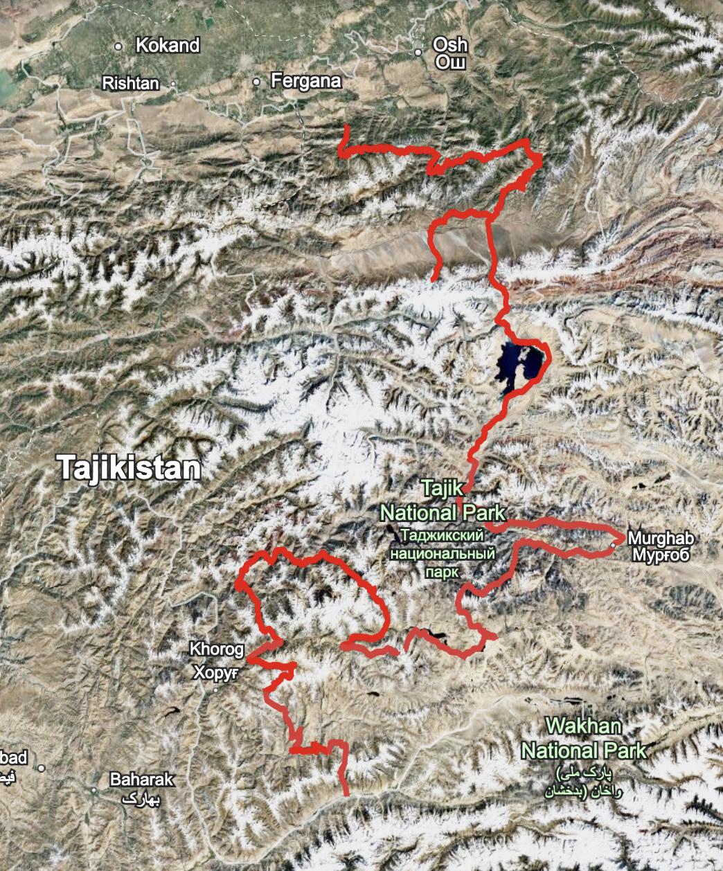
This map provides an approximate overview of the route. You can use this link to Google Earth to explore the route and zoom in. Obviously, do not use this route to navigate on the ground. Use the full guide.
There is a preliminary GPS track with waypoints for the full Scythian High Route. View here. DO NOT USE THIS GPX FILE TO NAVIGATE THE SECTION BETWEEN MURGHOB AND ALICHUR. I have not done that section yet, there are no trip reports from anybody else, and I anticipate that if it is possible, it is only possible in the fall after the river levels have dropped.
You can see my trip reports and videos (below) for two other sections: the Baju-Baghu Loop and the Jizev-Rozhak Pass.
For some other sections I do not need to feel the need to do a full separate trip report for. But you can see videos I made for those sections, such as (uploads coming soon) the Bartang Valley, the Bachor-Bardada trek, and others.
The Kyrgyzstan section has two different routes, one that can be hiked in early summer and late fall, and one high route that can’t be hiked until late summer to early fall. I’m calling the Kyrgyzstan section the “Alay Traverse.“ You can find a full trip report for the low route here (info on high route coming later).
The Missing Section
Only one section remains to be hiked. Someone has hiked most of it, but they didn’t leave a trip report. This section is the Bazardara High Route between the towns of Murghob and Alichur.. I believe that it is only possible once the water levels in the rivers have dropped in September. So for now it is a speculative route that should be consider exploring (with high chance of failure).
This (very rough) Google Earth map of the route shows the Bazardara High Route in black, versus red for the rest of the route. This map is not to be used for navigation. You will die if you use that map. It’s just to give a general overview of the route.