The Alay Traverse
A long distance thru hike of southern Kyrgyzstan’s Alay Mountain Range
The Alay Traverse
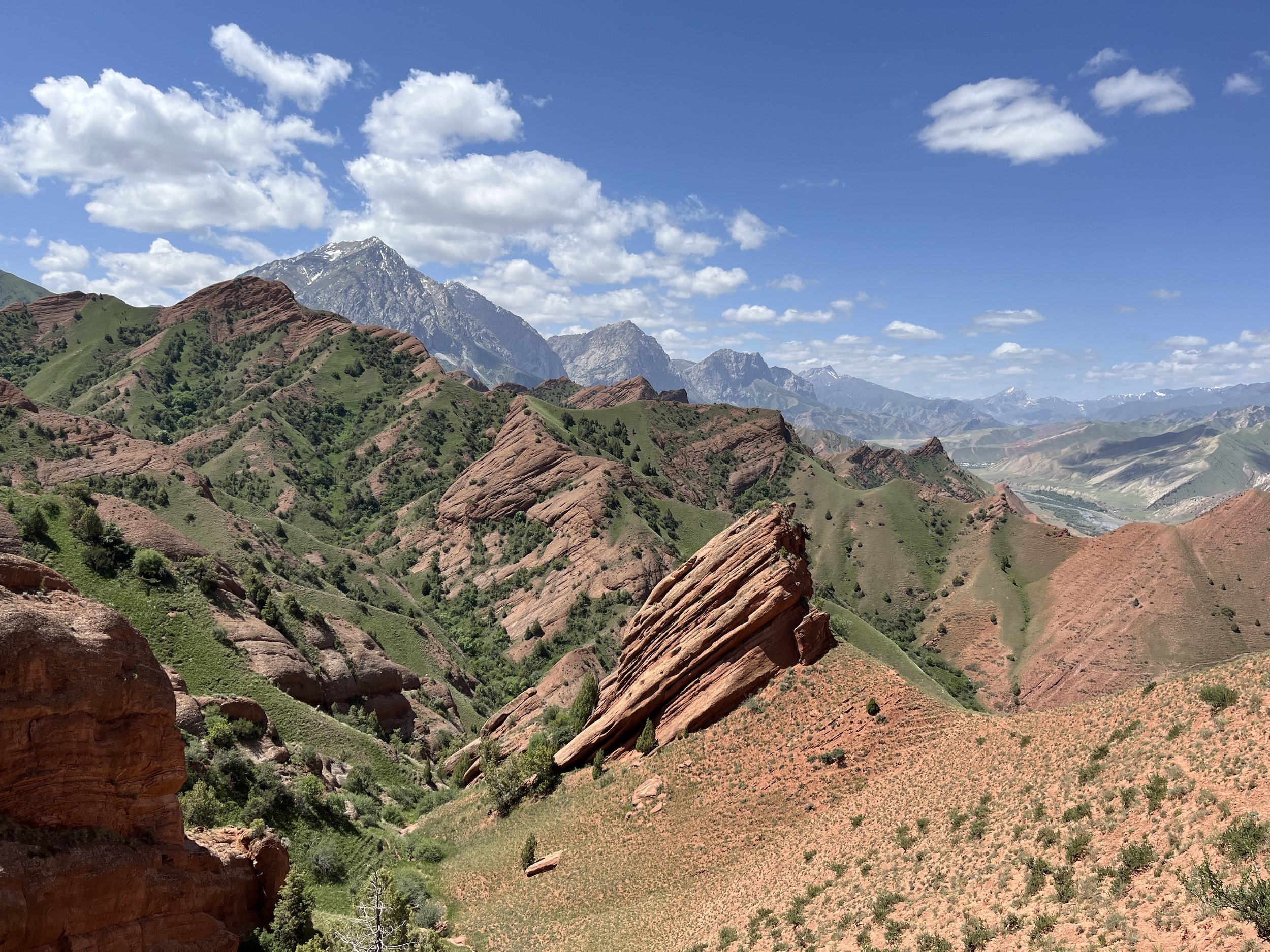
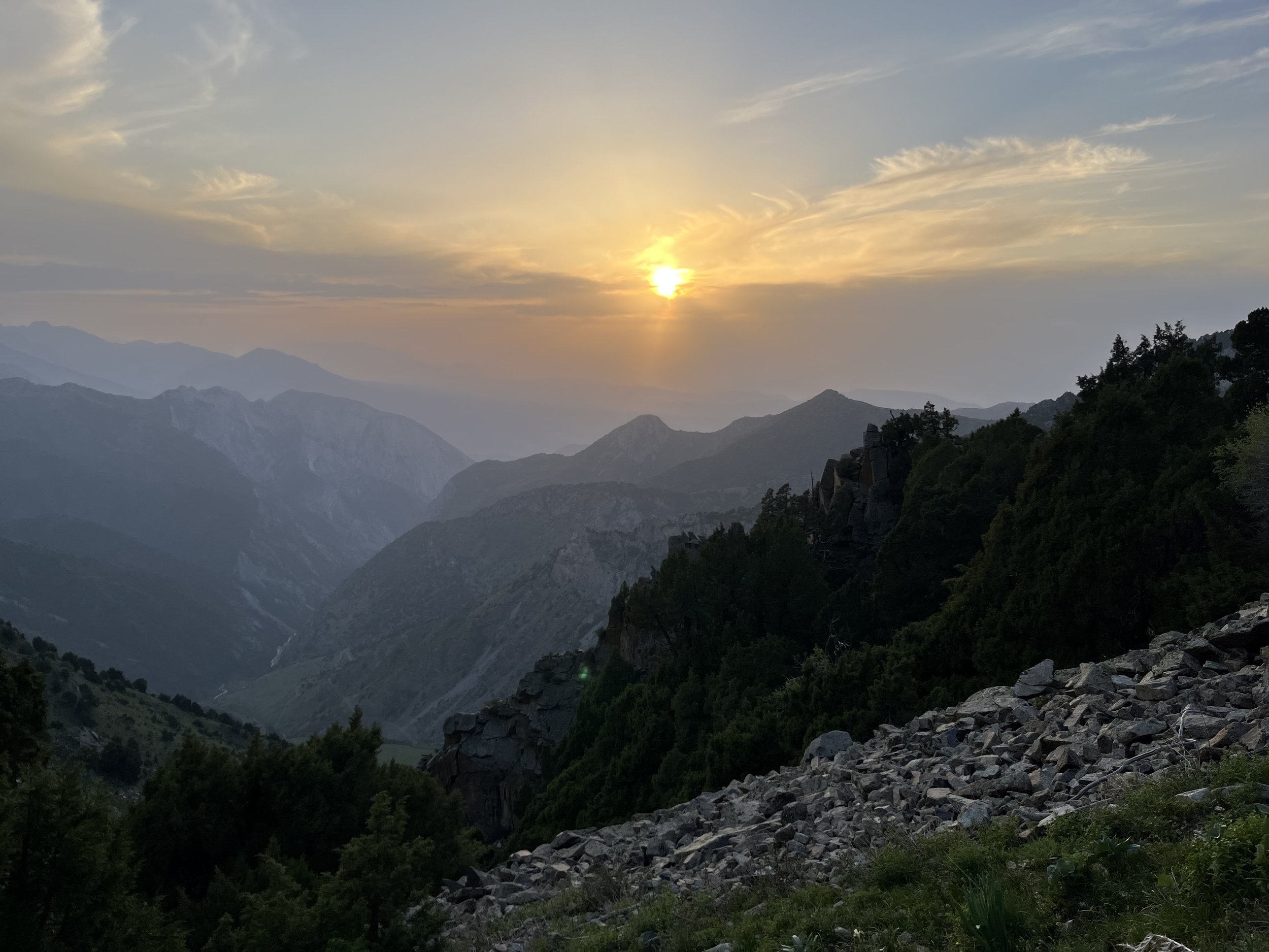
The Alay Traverse is a long distance thru hiking/trekking route in the Alay Mountain Range of southern Kyrgyzstan. There are two main route options, depending on what time of the year you begin your hike: an early season low route (from early June), and a high route with passes that are clear of snow by late July to early August. The low route is about 350km and the high route under development will be about 600km, with the choice to easily make shortcuts or access certain sections for a shorter hike.
Download GPS track and waypoints:
High Route (unhiked, send request for my planned route)
The video below is the highlights of the low route, which I hiked in early summer 2025.
Alay Traverse trail facts
This trail is totally unofficial, and based on my thru hike of this area in 2025 (plus earlier visits dating to 2018). The route follows shepherd trails, village roads and open terrain. There is very little tourist infrastructure or support in some sections. There are no other trail reports for the full route.
This is not the “Heights of Alay“ trek. An internet search will direct you to the various sources of info on that hike (a 100km loop). But the Alay Traverse does overlap the most interesting sections of that route.
The longest distance between food resupply points is 75km on the low route, 120km on the high route.
There are no extra long water carries that would be considered difficult, as there is plenty of water here.
There are some guesthouses, homestays, and yurt stays. But this is not like Nepal; you can’t hike from guesthouse to guesthouse every day. You need a tent.
For the low route, no special fees or permits are required.
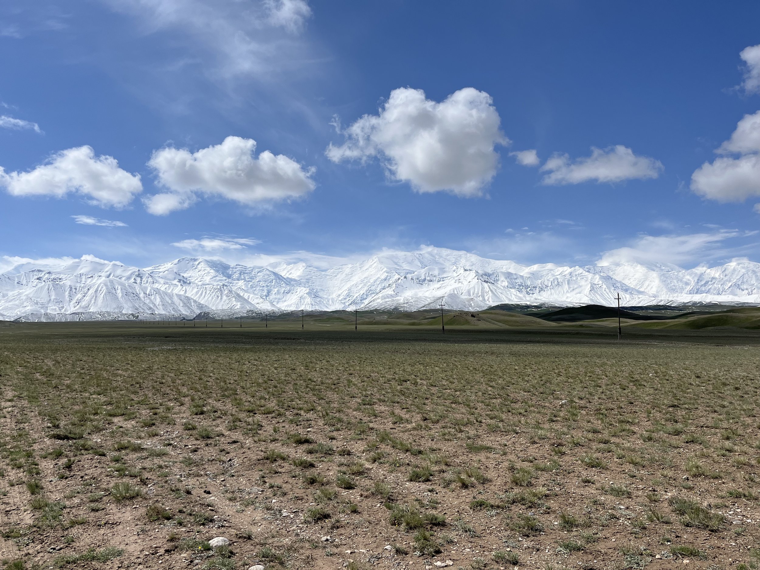
There is however one zone at the very end of the low route where a permit is required, but never checked or enforced for hikers. That is the bonus/extra hike between the Tulpar-Kol yurt camps and the viewpoint at Traveller’s Pass below Peak Lenin.
For the high route, you can get a border zone permit if you want to explore or if you want to keep your options option for an escape/exit route in case of bad weather or injury. The boundaries of these zones are not clear (despite any maps you see online). Neither route goes through the currently (as of 2026) fully restricted border zones in western Batken region. More info on border zone permits further below.
For visitors from North America, Europe, Australia, Japan, etc., you have 60-day visa free entry to Kyrgyzstan. Just buy a plane ticket and show up. However, the “visa-run” has been abolished. So you have 60 days, and then you can’t re-enter again until you are out of Kyrgyzstan for another 60 days. 60 days is plenty of time to do even the longest version of the Alay Traverse.
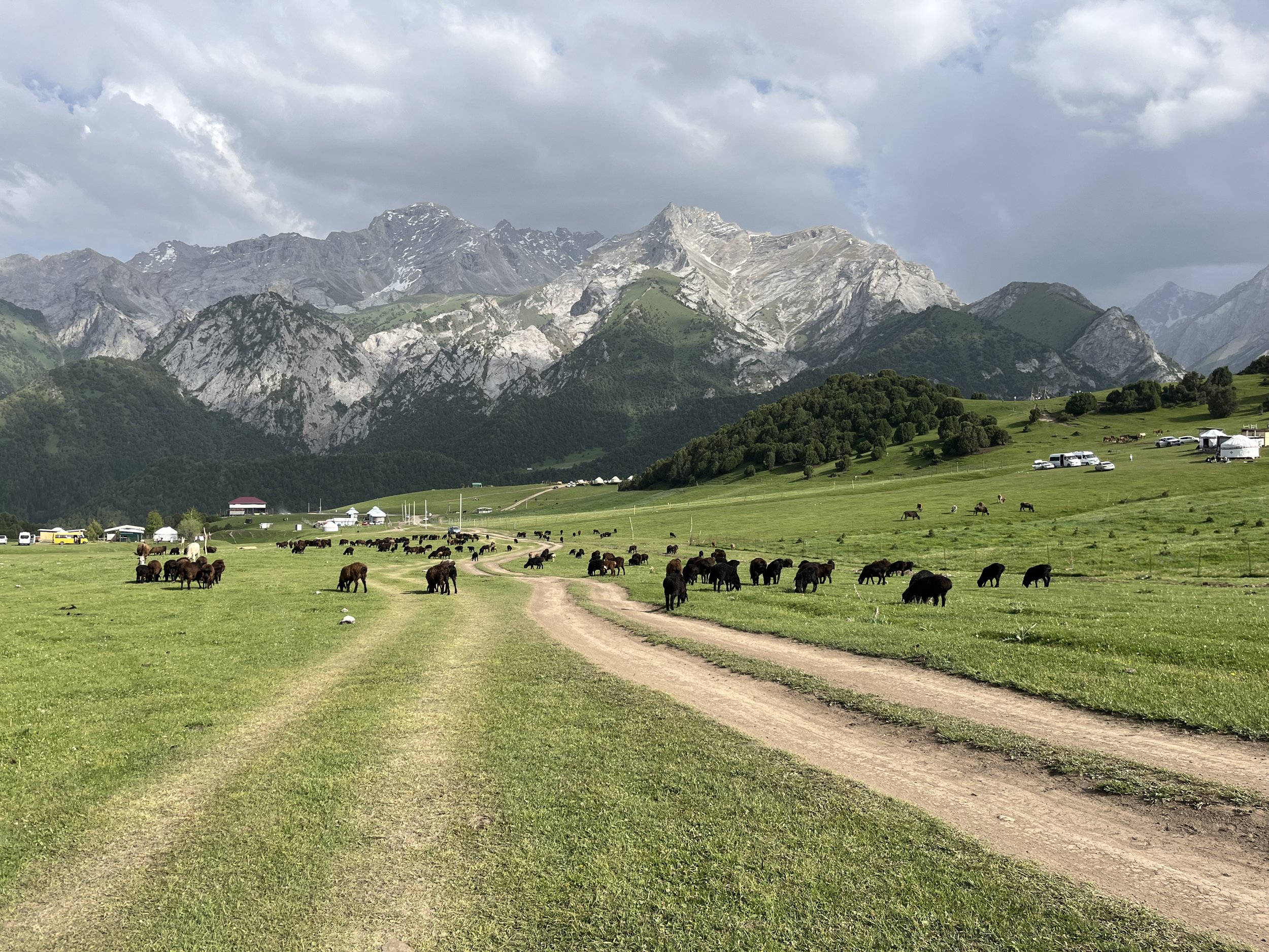
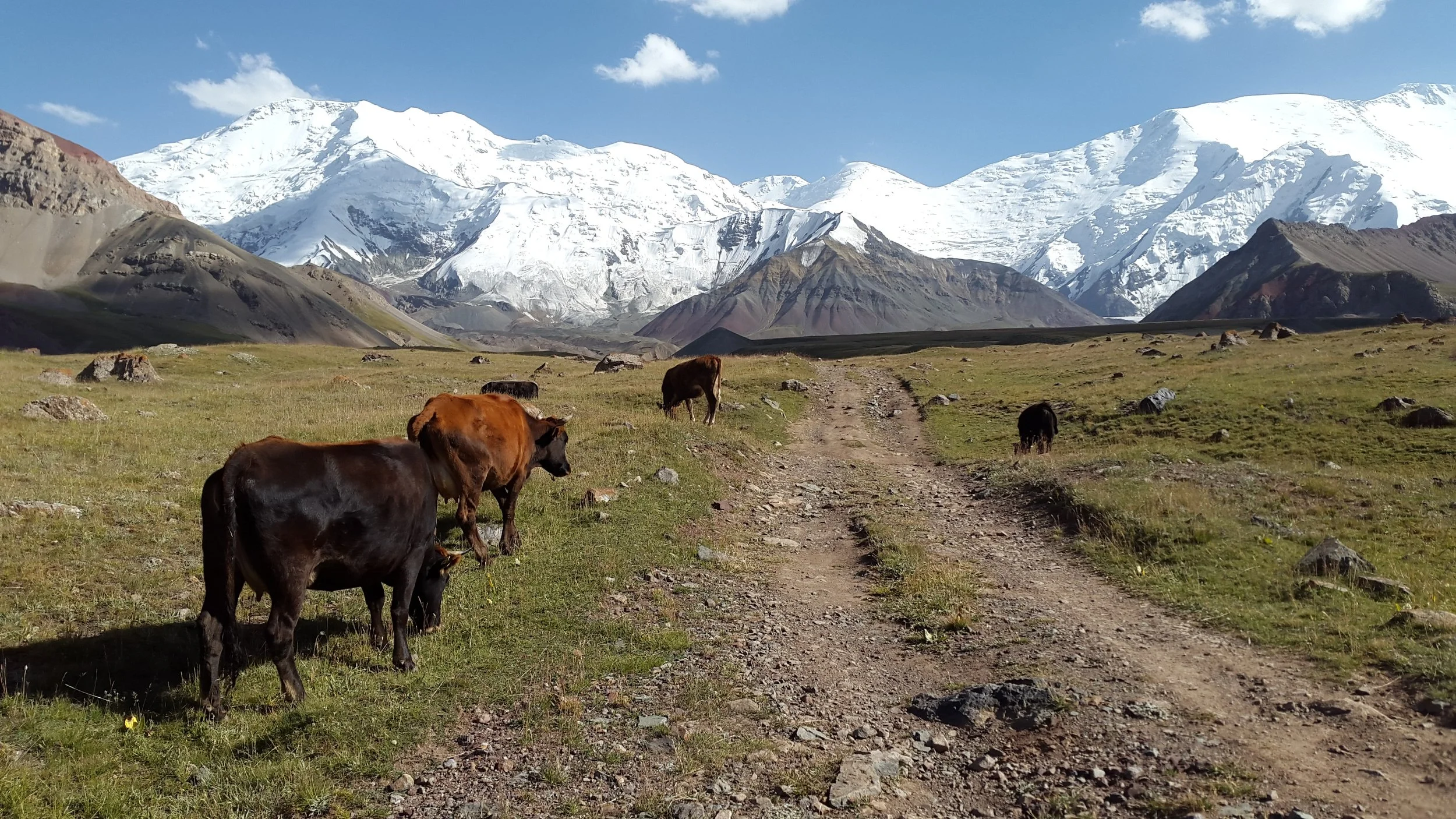
The mountains are alive with shepherds, their livestock and their dogs. The guardian dogs mostly just stop short of you and bark, but this is not a place for people with a phobia of dogs. However, there are far less dogs here than in Tajikistan and Uzbekistan. Also, as the route dries out by late summer through early fall, the number of livestock, shepherds and dogs drops.
Many of the shepherds and mountain dairy camps get resupplied and have their dairy goods taken down by 4-wheel drive cars on rough mountain roads (and get food/resupplies driven in). You can easily get off the trail in many locations. You will often have the opportunity to leave the mountains on one of these roads (to resupply, take a break, or quit the trail). This is less so in the late season when shepherds leave the high camps and return to their villages.
Elevation is probably more than you are used to, but lower than a place like Nepal. The east-to-west direction of high route has been planned for acclimatization. The highest pass on the high route is 4550 meters, and you won’t reach that until about the half-way point. The low route has no issues with acclimatization to elevation.
The city of Osh in southern Kyrgyzstan is the hub for regional transportation. Here you can resupply at large supermarkets, stay in a range of accommodation, take a break from the trail, and store your extra gear (at certain guesthouses and hostels). You can get direct flights to Osh from Istanbul and from Almaty (Kazakhstan), so it’s possible to stitch together a flight itinerary that avoids going to Bishkek first (unless you want to hike the northern ranges first). Bishkek to Osh is a 12+ hour drive.
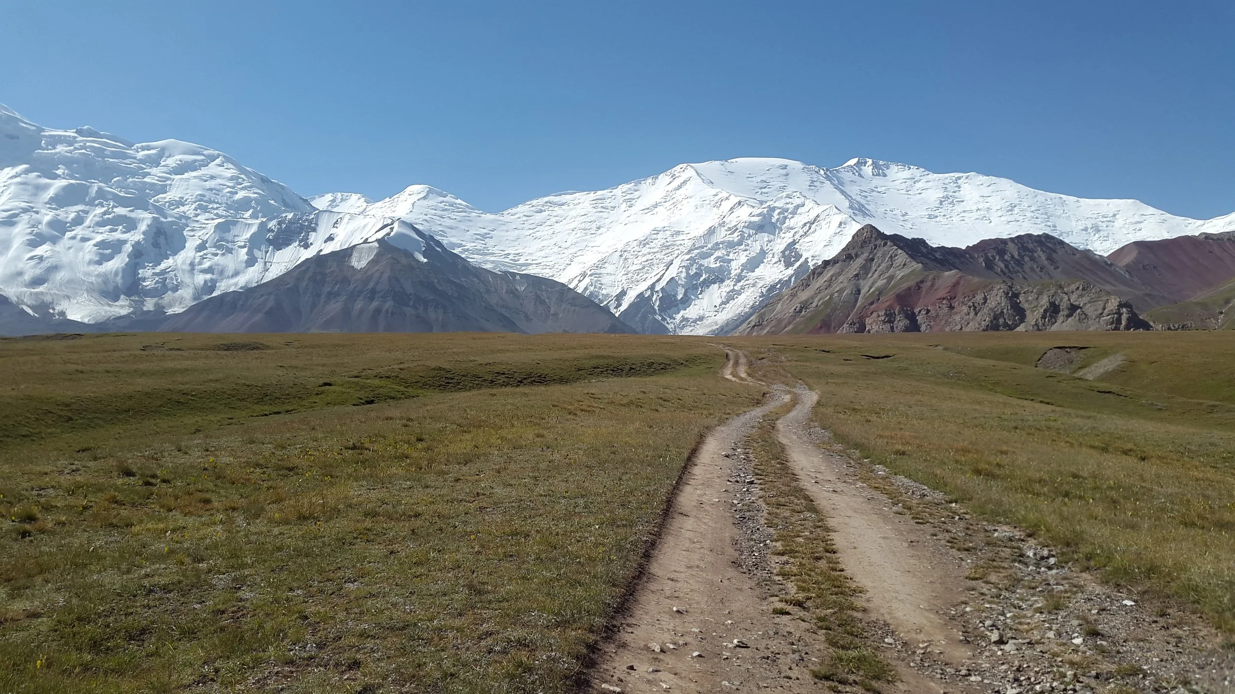
The trailhead for the low route is accessibly by a quick taxi ride or with a public transport minibus (“marshrutka“).
Alay Traverse High Route or Low Route? And when?
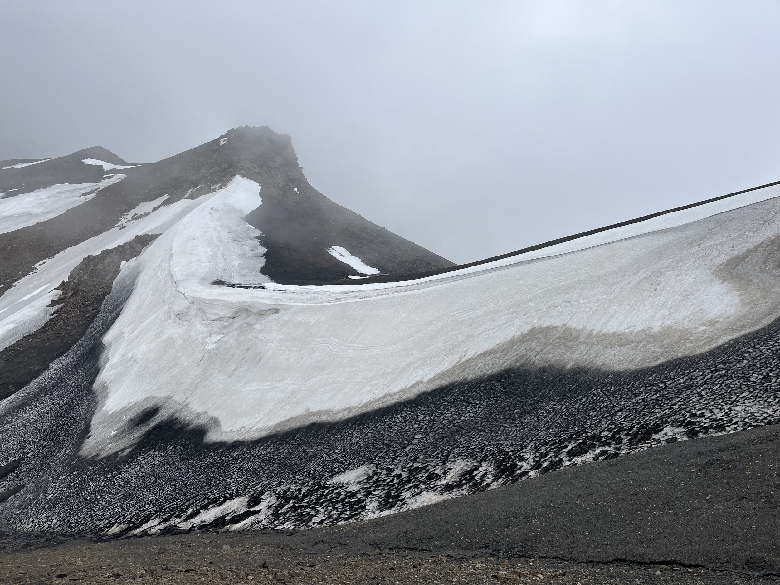
You can’t start the high route until late July or early August. There is lingering snow and ice on the north-facing sides of passes through mid-summer. You can of course do these passes earlier in the season if you have some experience hiking on snow, but you will need crampons and an ice axe on certain passes as the slopes are steep. By August you should no longer need this type of gear - but that is not always true of certain passes if there is fresh summer snowfall at high elevation (or if there was a heavy snow winter preceding your hike). Conditions can vary from year to year, so it’s not possible to give exact date ranges. For a look at snow conditions on the north-facing side of a pass, check out this hike over Sary-Mogul Pass in the second half of July 2019. These sort of conditions really do call for crampons and an ice axe.
On the high route there are no trails in about half of the passes. Just some cairns or brief sign of hikers and climbers passing through. The trails usually stop when the grass stops. Above this point it is usually open terrain and you can find your own route. This will be rough terrain, but there should be no difficult scrambling.
The high route should not be your first long distance hike in this sort of terrain (high elevation off-trail). It can be very difficult and even dangerous, especially if the weather turns bad.
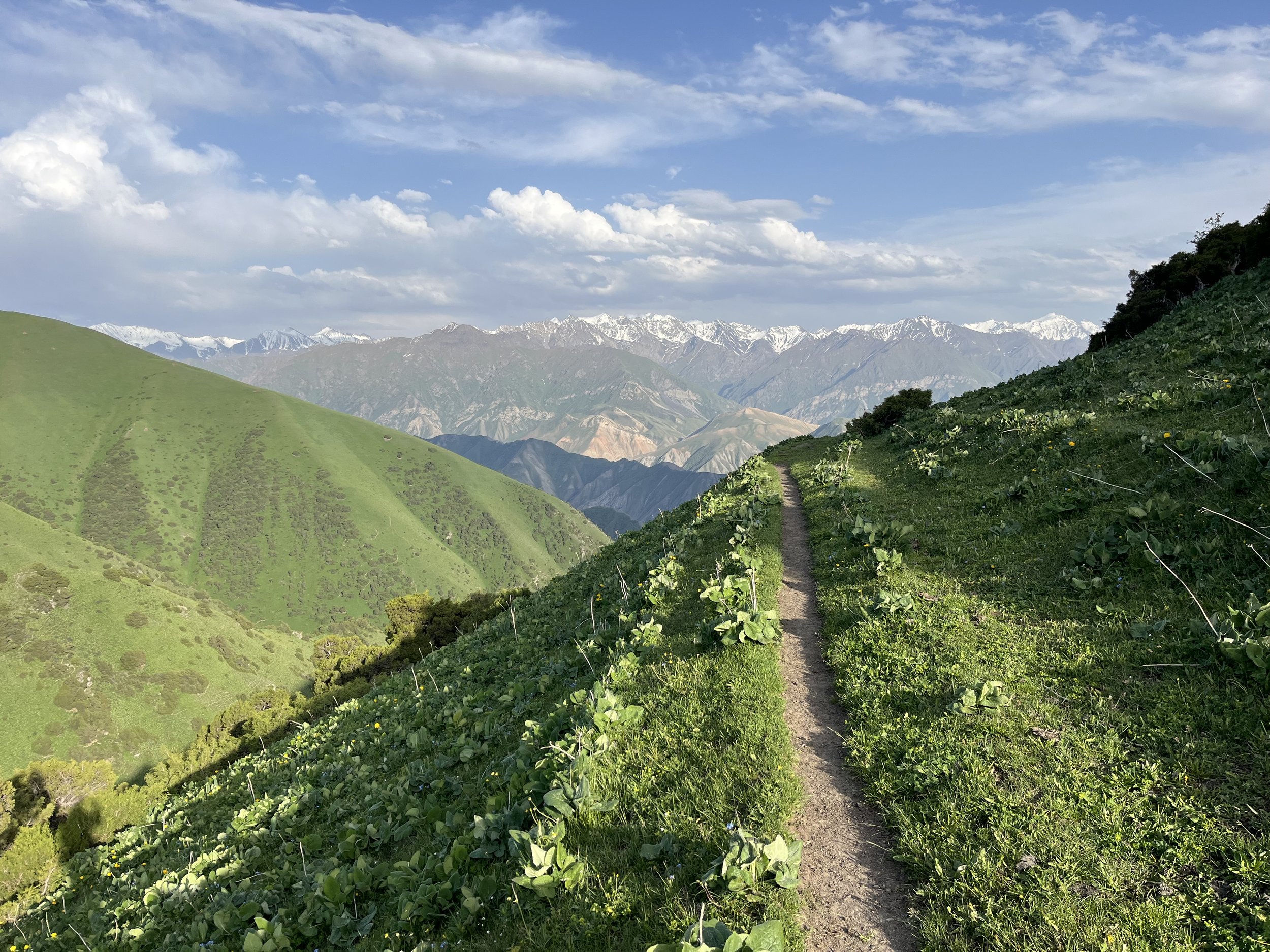
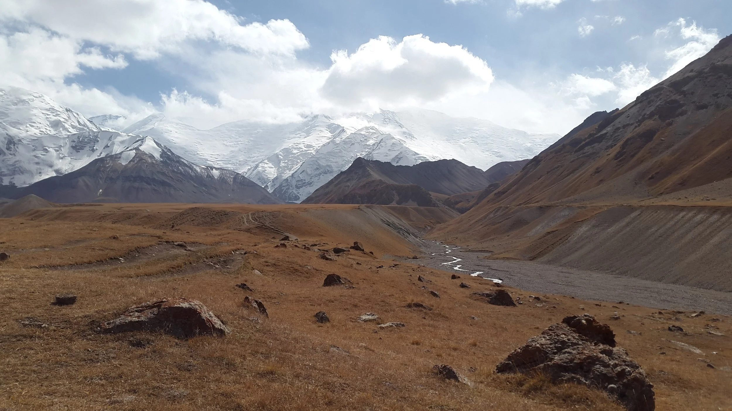
The much safer low route is best for an early season start - the beginning of June at the earliest, and mid-June to late June being the best start time. April, May and early June are the rainy season. And by “rain“ I mean about half the average precipitation you would get in the same month in the Vancouver area and the Pacific Northwest, and significantly less than the European Alps. The rain is, historically, brief and comes in small isolated storms that don’t last very long. But this pattern has been disrupted in the last few years in this region, so a harder and longer rain is possible. A hiker will do fine with a rain jacket, rain pants and a good tent. Of course, this rain, above a certain altitude (usually about 3200-3500 meters), comes down as snow.
Both routes go through villages and towns, but you can expect to see more shepherds on the low route, especially in the spring and early summer. For the high route, expect very few shepherds to be still in the mountains after late August.
When to start?
For the high route, you need to wait until after mid-July (in the average snow year) to get over Erkech Pass (4010 meters). So the earliest start is the first week of July - and this can vary due to snow levels.
For the low route, a mid-June start is good. This gets you green grass, flowers, and no more (or far less) snow patches and wet meadows at the higher elevations. Before this your chances of walking on the snow in the rain increases. Kum-Bel Pass at 3870 meters is the key to determining how early you can start, as snow will block the pass and the approach before mid-June (it can vary year to year based on winter snow levels.)
Consider the viewpoint at Traveller’s Pass (at the very end) to be a bonus hike, as it is at 4130 meters and may block you from hiking up with unmelted snow in some years into July, and at any time with fresh snow.
Low route in early summer or fall?
The low route in early summer is good for green grass and flowers. But in the spring you will have some rain and will be at the lower to mid-elevations for peak-livestock times. There will be a maximum of sheep, goats, cattle, horses, shepherds and their dogs during the spring and early summer. The low route in fall will be dry, and the livestock and shepherds will be much more scarce. If you want to meet people and see shepherds and livestock doing their thing, then fall is not the time for that.
If you are on the trail later in the fall, there is a chance of snow blocking the higher passes. July through February has very low precipitation. So there is a chance for a hike late in the season. But the cold will probably push you out of the high elevations by mid-October (if you haven’t already been stopped by fresh snowfall blocking a pass).
For a fall start on the low route, it would make more sense to hike from south to north (doing the highest elevations first).
Getting to the trailhead
Low Route trailhead: Starting from Osh you can take a “marshrutka” (minibus) from the “New Central Bus Station” to the town of Kyzyl-Kiya and get off before that town in the village of Kök-Jar. The cost in 2025 was 170 som. Pay for your ticket at the ticket window and then go find the mini-bus with Kyzyl-Kiya written in the front. Kyzyl-Kiya in the local alphabet is Кызыл-Кия.
In Kök-Jar the taxis headed to the south are parked just south of where the road to Abshir-Ata intersects the main highway. If your offline map is based on Open Street Map data and is regularly updated, you will see the taxi stand I added, labelled “Taxis to Abshir-Ata Waterfall.” The drivers will understand that you as a foreign tourist want to go to the Abshir-Ata waterfall, not the lower village of the same name. But to be sure you can add the Russian word for waterfall to your request. The drivers who drop you off will be returning empty, so you will be paying the cost equivalent to a round trip. I paid the asking price of 1000 som as a single passenger and with the driver agreeing to leave immediately.
Tourists in previous years reported a fee station where they paid a small fee to go see the waterfall. I saw nothing and paid nothing. The driver stopped me off in a small parking area a 30-second walk from the waterfall.
High route trailhead: Starting from Osh you can take a “marshrutka” (minibus) from the “New Central Bus Station” to the town Kara-Kulja (Kara-Kuldzha). A mini-bus leaves to Kara-Kulja every 50 minutes between 8:20am and 5:30pm. Buy a ticket at the ticket window, not from the driver. Kara-Kulja in the local alphabet: Кара-Кулжа.
From Kara-Kulja you need to find a way to get up the Kara-Kulja River. The only village up the river that will have regular taxi connections is Birinchi May (locals may still use the Russian name Pervoe Maya). But this only gets you 8km out of Kara-Kulja, leaving another 25km to get to the trailhead at the end of the road. There are no more villages, only small farms and summer shepherd camps, so traffic will be minimal for hitchhiking. So it would be best to make a deal with a taxi driver in either Kara-Kulja or Birinchi May to get all the way up river. However, about halfway from Birinchi May to the trailhead there will be some road crossings of streams and rough rocky gorges. A city taxi will not want to drive through these sort of places. You need a car with a higher clearance (not necessarily 4-wheel drive, there is nothing steep here).
To skip all of this, hire a driver in Osh. If you can speak Russian or Kyrgyz, then this is easy. If not, you can make arrangements ahead of time for a driver through the Visit Alay tour company. Or the day before you can walk into the office of Destination Osh and get a driver for the next day. The trailhead is not a known destination. You can show them this Google Maps location to assist in directions (and a price quote). It’s 100km from Osh to Kara-Kulja, and then about 35km more to the end of the road.
I have not yet done this route. But my plan, based on how I travel (low budget, figuring it out as I go), is to take a mini-bus from Osh to Kara-Kulja, then a taxi to Birinchi May. Here I may get a driver to drive me to the end of the good road, and then walk the rest of the distance to the trailhead. As happens on occasion, a beekeeper or farmers with a hay truck or locals on the way to a picnic pick me up…
Alternate routes
The alternates, side trips and (some of the) shortcuts on the low route are included in the GPX file as waypoints (with the trails/roads making for obvious alternate routes). The shortcuts are obvious (but this means missing out on a scenic highlight). All passes can be avoided by a lower route if snow blocks your route. There is only one pass on the low route that can’t be avoided - the 3575 meter Kosh-Bel Pass. So if snow blocks you here, there is no alternate.
High route alternates are few. These will probably be needed if there is a fresh summer snowfall or if you are still early enough to be bothered by unmelted snow from the previous winter.
The high route has two very brief sections between passes where a downhill exit (instead over going through the second pass) puts you in a border zone you need a permit for. So an escape from a snowstorm in these two locations may result in a fine (I have no idea how much). This can be easily avoided by not going through the first pass if precipitation seems imminent. The two areas are - in the far east - between Kyzyl-Agin Pass and Erkech Pass, and in the far west between Aylama Pass and Gaumysh Pass. At the moment the easy-to-obtain border zones permit may not include the border zones you could be forced to descend to. There is no clarity on this issue (Russian climbers get different answers from different tour companies), and I would not trust the seller to be able to provide accurate information.
There is a possible acclimatization hike in the far eastern section of the trail: the Kulun-Ata Nature Reserve and lake. At the moment I’m doubtful about this section, as there is no information on how to get a permit independently of a tour company, and if you can show up in the village of Konduk and find a guide and permit on the spot.
All other options for shortening the route are obvious. Just look where the route crosses a road that provides an opportunity for a roadwalk or hitchhiking.
Kyrgyz-Ata National Park
This area on the low route is packed full of local tourists, cars and yurt camps of a style that do not cater to solo travelers or small groups. It is very, very loud with lots of alcohol and parties that go through the night. There is a 250 som (about $3) entry fee for foreigners as of 2024. One tourist was told it was 2000 som ($23) to set up a tent in the park. If you stay the night in a guesthouse nearby in the hamlet of Kalday, you can easily day-hike through the park and avoid the loud parties and high camping fee. You can also camp just before this area and easily hike thru in half a day. The fee station is 5km down the main road, far away from the route you will walk. I did not pay a fee or see a forest ranger.
Locals call this area "Kara Koy," not the official name (“Kyrgyz-Ata“), which is only known locally as the village far below. Search for the hamlet of Kalday. This is the Kara-Koy area.

Difficulties
Language. People in the mountains here speak Kyrgyz, and many of the older men in the villages can speak some Russian - but not all. Russian mountain climbers increasingly report meeting shepherds who can’t speak any Russian at all. Most of the guesthouses outside of the city of Osh will not have an English speaker. Generally people who run guesthouses are getting good with translation apps on their phones. Experiment with offline translation apps as you will be in very isolated areas with no signal.
Food. Resupplying is not easy. The small village stores do not have specialized trekking food, obviously. You will need to live off pasta, instant noodles, bread, canned fish/meat, candy, chocolate, nuts, potato chips and dried fruit. Fresh fruit and some vegetables are available (I usually eat those immediately because they are heavy and will bruise easily). However, the smallest village stores sell only candy and snack food. Guesthouses, homestays and yurt stays are an opportunity to get meals. Kyrgyzstan is not an easy place for vegetarians. In the city of Osh you can go to a large supermarket that has more international food.
Payment. Cash only outside of the city of Osh. Some of the bigger villages have ATMs, but they may not work with your bank card. There are no currency exchanges either. Bring local currency on the trail.
Dogs. As mentioned above, they are scary, but mostly “all bark, no bite.“
Marmots. One group of Russian climbers did report their food being raided and mostly consumed by marmots, but that should only be a concern if you cache food. Another Russian group that cached food seemed to consider marmots as a regular pest, and covered their food cache in pepper. The marmots here are not like the marmots that get fed by tourists in the US, Canada and Europe. They will be shy and keep their distance. I doubt a marmot would raid your tent if you are nearby.
Yaks. Some people have reported aggressive yak bulls charging them, but nobody has been gored. Anecdotally, yak bull charges happen when you walk up close to a bull and put a camera in his face. But you may have no choice but to walk close to a herd of yaks if the route restricts you from making a wide diversion over open terrain.
Isolation. The shepherds don’t go up through the highest passes, so you will be there with no chance to be rescued by a friendly passing shepherd. And climbing groups go through some of these passes at a rate of one group every 2-10 years. Bring a satellite rescue beacon and SMS device. Make sure it works internationally (Garmin, Zoleo, etc.).
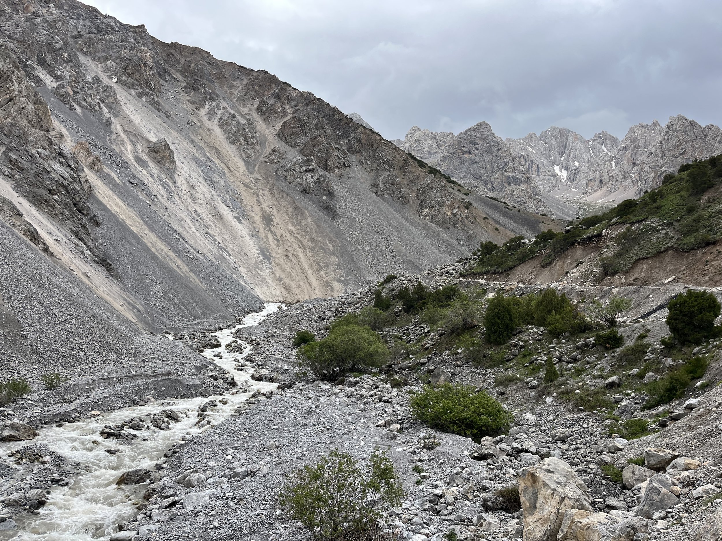
Stream crossings. Shepherds have an incentive to maintain bridges, but a heavy rainfall can destroy them, and in some places the shepherds rely on their horses to get across a stream or small river. These may be difficult crossings for a hiker, particularly on the high route.
Changing climate. Short intense rains even in the dry season are now possible. Flooding at mid and lower elevations accompanied by mudflows is not uncommon.
Dry season. Some high valley streams are dry in late summer and fall. You’ll need to be careful with drinking water on the high route in the late season.
Difficult high elevation sections. The off-trail sections of the high route are not easy. At the highest points is where the route is the roughest.
Gear recommendations
You should’t go too “ultralight“ on the high route. You should have a sleeping bag with a -10°C (15°F) rating to comfortably sleep in nighttime temperatures that may go a few degrees below freezing at higher elevations. For a worst case scenario (hiking through a storm at high altitude), you need mid-weight base layers, and both a mid-layer (a fleece) and an insulating outer layer (a “puffy jacket“). On the low route you could use at -1° Celsius bag by timing your camps to avoid sleeping up near the higher passes.
Boots versus shoes? It depends. A personal comparison: on the Continental Divide Trail I met people with feet that could take extreme abuse, and they wore trail runners with ease even on difficult alternate off-trail routes in Wyoming (whereas I needed to manage my daily distances and downhill speed, avoid asphalt, and constantly apply leukotape to my feet). Those people with stronger/tougher feet can wear trail runners here in this terrain without worrying about blisters or foot health. But most people will need something stronger for a long hike here in Kyrgyzstan - either hiking shoes or hiking boots (especially on the high route). It is steeper here, and the trails don’t have nice switchbacks and an even surface. It is steep. And your backpack will be heavier if on a long food carry. Only show up with trail runners if you are a regular trail runner or have plenty of long-distance thru hiking experience and know how your feet will manage.
Expect brand new trail runners to be completely trashed by the end of the high route (tread almost worn down, no cushion left, sides ripped open, etc.). While the distance seems OK for a single pair of shoes, there are lots of steep sections and abrasive rocks and scree. I know from experience, having done entire seasons in this region with different types of footwear (trail runners, hiking shoes, boots). The low route should be much easier on shoes.
If you are undecided on trekking poles, bring them. It can get very steep and very loose. Plus, shepherd dogs are scared of sticks (even ultralight trekking poles).
You don’t need a heavy tent that is designed for winter storms and very strong winds, but you shouldn’t go too light, because brief storms and strong winds do happen. Basically, bring what is good enough for the European Alps, the CDT in the US or the hiking routes in the Canadian Rockies.
Consider the length of food carries and gear requirements when making your backpack choice. 60L should be the bare minimum on the high route, and a frameless ultralight pack is probably a bad idea unless you already know that you can do a heavy carry with this type of bag. I have an 80L bag to allow for long food carries and minimum resupply trips off-trail. 50L ultralight bags will probably be fine on the low route when being used by someone with experience using this set-up on hikes of similar distance.
Inflatable mattress or closed-cell foam pad? Shepherds drop all sorts of metallic junk in the pastures, and broken glass is sadly common in the lower pastures thanks to car roads bringing in drinking parties. You will be taking a chance with an inflatable mattress, so definitely bring a repair kit. A closed-cell foam pad is worry free, but the ground here can be rough. You won’t be very comfortable on some nights, depending on your tent spot selection and availability.
If you plan to fly to the region with only a carry-on bag, then you can’t bring trekking poles and tent stakes. You can buy these on arrival in Bishkek, but not in Osh, and finding these elsewhere in Central Asia is risky (not including Almaty, Kazakhstan, where there are plenty of camping gear stores in the city). Google Maps will direct you to these stores in Bishkek and Almaty. Note that some of the items on their websites must be ordered well ahead of time for pick-up, and not everything is in stock (but at least two shops in Bishkek have plenty of stock on hand). Knives are also an item you can’t take in your carry-on bag. Buying a knife is easy everywhere in the region.
At the moment, it’s hard to find gas canisters in Osh or elsewhere in southern Kyrgyzstan. Only in northern Kyrgyzstan (Bishkek and Karakol) can you easily find them. And you can’t fly with gas canisters. So what gas canisters you bring from Uzbekistan or northern Kyrgyzstan is all you will have. At mid elevations there is lots of wood and it is culturally/socially acceptable to have a small wood fire - but the forest rangers may have a different opinion on that. Higher elevations and the far southern sections have no forests or brush. The lowest elevations are grassland foothills that get dry and you should not make a fire here.
Don’t expect to find quality sunscreen available for sale. I see sunscreen for sale in Central Asian supermarkets, but they are not brands that I know and trust. I once found a bottle of SPF 45 sunscreen for sale in a supermarket, and it ran right off my neck and arms (it couldn’t deal with the sweat). I was quite well sun burned after four hours in the sun. So I now bring all the sunscreen I need, which is not very much as I wear long pants, long sleeves, sun gloves, a hood and a neck gaiter. I really only need sunblock for my face and nose.
I always carry a mosquito head-net as they are so light and small when packed. I’ve very rarely needed insect repellent hiking anywhere in the mountains of Central Asia. The locations with mosquitos include alpine marshes and wet meadows that don’t drain and next to marshy-shore lakes in grasslands. That type of terrain is mostly non-existent on this route except for brief periods. Of course, you can always get bit by fleas at shepherd camps and at shadier hotels. On rare occasions I encounter horse flies - almost always right next to livestock. But I make no guarantees, so bring insect repellent if you want to be safe.
Food resupplying on the low route
Most of the resupply locations area obvious - the route goes through a town or a village with a food store. The distances are not far enough between resupply points to create any food-carry difficulties.
Food resupplying on the high route
The distance between food stores is manageable (for any hiker who has done a long distance thru hike with these sorts of distances). You will have to accept that you won’t have the best selection of food. I have had days where my diet was ramen noodles, peanuts and low-quality chocolate.
The border zone permit is something you can get for the high route. Should you get it? To be safe, sure. But do you really need it? For the low route you don’t need it (aside from the optional short trip at the end to Traveller’s Pass near Peak Lenin where nobody has been permit checked in many years). For the high route the “5 border zones permit“ (see further below) could come in handy in three areas where you may need to exit down a valley in case of a weather or medical emergency. The exits will require you to walk past a border guards base and checkpost. Sticking to the route will require you to go over another high pass. It may also come in handy if you happen to meet any roving border guards or others (law enforcement or government employees) who want to check your permit, even if you are not in a border zone.
Getting the border zone permit
The “all border zones“ or “5 border zones“ permit (35-50) is what you should get. It takes about 14 days to prepare, but some advertise it quicker for a higher price You can pick it up in Bishkek, or have it delivered to a hotel or guesthouse in Osh. Several local tour agencies are selling this permit online, but you need the original document. You can pay and fill out the info online, but you still need to pick up or get the original document delivered. A scan, copy or electronic copy is not acceptable. But you can make photocopies of the originals to hand over to border guards to keep (Russian climbers report that this makes the process go faster).
Do not trust the border zone maps on the websites of the companies selling these permits. They are all different and contradictory (all the more reason to have the permit in your hands). You may think that an area is not in a border zone because there is not a single border zone map online showing that area inside a border zone, but I’ve seen multiple anecdotes from Russian climbing teams in those areas being checked for permits, and one being significantly delayed because a low-ranking soldier had no idea what he was supposed to do. And these groups had border permits - imagine what could happen if you do not even have a permit.
Consequences and fines
Pre-2020 I know of tourists who went into border zones without a permit. They were arrested, taken to a border guards base for detention, then transferred to a prison in a regional center, eventually sent before a judge who fined them (hundreds of dollars) and made them buy their own deportation flight plane ticket.
More recently, the process has been to be arrested by border guards and taken to their base for one or more days. Here you are questioned and then one of two things may happen: they release you and warn you to stay away from border zones and/or return with an official permit. Or they transfer you to a regional center for interrogation/questioning. The most recent people who went through this process were eventually released without a fine or deportation.
The problems with the permit system
For the high route I initially planned a route where the border zone permit would be required. But then I thought about how there are two other projects attempting to stitch together long distance thru-hikes in the Alay Mountain range, and both of them go through extremely complex border zones where you would need three separate permits: one easy to buy (the 5 zones permit that you need to pick up in-person in Bishkek), one permit officially prohibited at the moment (the two western districts of Batken Province), and one that needs to go through a specialized local company (the Karavshin permit). To be fully legal, once - if and when - the western districts re-open, you need to go through one of two tour agencies that specialize in Russian mountain climbing teams and do the process in Russian. They will require proof of special mountaineering high-altitude medical and rescue insurance, an exact itinerary with exact dates and a GenShtab map with the exact route drawn on it. The permit for Karavshin requires you to show up in the area and secure a permit in person from a local tour company - not very handy if you are approaching from the opposite direction. Even when the western districts were open before the border war, Russian climbing teams spent quite a bit of time, effort and money securing these permits.
And for those of you planning a long hike, and perhaps wanting to take breaks in towns, there is the issue of the border zone permit’s 30-day validity. So everything needs to be hiked within a 30-day window. The border zone permit is only good for 30 days from the date you provide for entering the first border zone. 30 days is fine for the high route, but it will be a little tight for completing the high route if you don’t get your start date correct. So don’t provide the date you enter Kyrgyzstan, but rather the first day you start hiking. More info coming on that (exactly where is the border zone entry?) in the future.
You can actually read the law on border zones (cached original version here), and if you can cross reference the place names with a GenShtab map (in Russian only) you can get exact specifics. But as Russian climbing teams have learned on the ground, the border zones as enforced on the ground by border guards may be far more expansive than the written law. Climbing teams asking different tour companies the same question have gotten conflicting answers about certain rules and certain areas. The most honest answer I saw was “We can get you your permit, but we don’t know if the border commander will accept it.“ Lower ranking people refusing to accept official documents from their own headquarters is a thing that happens.
Supplemental info on border zones
As noted above, the low route does not go through any border zones. For the high route, I’ve selected a route that can be done without a permit. But like I said, if you want to be as careful as possible, you can get the 5-zones permit for a scenario where you exit the route in certain areas due to weather or injury. If you want to go into other border zones (for example, farther west in Batken and maybe to Karavshin), then you need the special permit that Russian mountain climbers get through a local tour company.
The border zone permit advertised by Bishkek travel agencies ("all border zones permit" or “5 zones“) does not include the two westernmost districts in Batken province. For these two districts the climbers are getting permits from two different local tour companies: Osh Travel and Asia Mountains. The process is unclear, and it may still be fully prohibited, but I think it may be a difficult permit to secure as you need to share exact dates, route itinerary details and rescue insurance information. Regular evacuation insurance may not suffice - only a special high altitude rescue insurance coverage made for climbers. The process seems more suited to mountain climbers with exact dates; not thru-hikers who have no exact idea when they will arrive in a certain area. As noted above, the route I set does not go through these two districts.
A final note on border zones - having a permit in your hands does not mean you can walk right up to the border of China or Tajikistan in the mountains. There is probably a trail, valley or road near the border that the border guard commander does not want you to go past, even with your permit in hand. Worst case scenario? Chinese prison. For now, the worst things I know about are two different tourists (Austrian tourist on the Chinese border and Japanese tourist on the Tajik border) without permits being detained and deported for drones and photography too close to a border, but that was in 2015. I know of more recent cases of hikers being caught in a border zone, being detained, transported to regional headquarters, and then eventually released after some light interrogation (and not being fined).
A final final note on border zones: you planning your own route without any sort of local knowledge, language skill or insight into the experiences of Russian/Ukrainian climbing/trekking teams may lead to an extreme outcome. In 2025 a couple of foreign trekkers went into the fully restricted far western border zones (which my route totally avoids) and then hiked right through the territory of Tajikistan. In and out. Being shot dead is not an unrealistic outcome in this scenario. Stepping on unexploded ordinance and blowing off your legs is also a possibility. But these guys had no idea what they did. And so if you follow their route, the above bad things may happen to you - in addition to being imprisoned in Tajikistan.
Special battery considerations for hiking in Central Asia
Rural areas can have electricity rationing, outages or shortages. Guesthouses may have a single electric outlet for multiple guests. You may want to watch your power bank while it charges in the hostel or guesthouse as for some reason foreign tourists and guesthouse family members here do steal on the rare occasion. There are long distances on the trail. For these reasons, you need certain specification for your power bank, charger and cords.
You will need lots of spare battery capacity - a 20,000mAh power bank at a minimum. The high route has a 160km section between battery charging points (guesthouses). If you are a heavy user (video, photography, drone, music, reading, internet, etc.), then bring more. To play it safe, two 10,000mAh power banks are safer than one single 20,000mAh power bank, and two 20,000mAh better than one 40,0000mAh (your could drop it in a river, it could die on its own, it could get fried by a power surge, it could get stolen while charging, etc…). If it gets close to freezing, sleep with the power banks (and your phone) inside your sleeping bag. And a sealable plastic bag or dry bag is good for protecting your batteries and electronics if you get wet from rain or a river crossing. As for quality, the Anker brand is very consistent.
Make sure your power bank supports 30W charging. And I don’t mean that the battery pack outputs 30W to your phone or other electronics, I mean that 30W is going to your power bank from the 30W charger. This takes some investigating, as manufacturers and sellers focus on telling you how quickly your battery charges your devices with how many watts (W), or “output,” but they often hide or don’t mention the info on how many watts their battery can “input” from a charger (important info for a hiker with limited time to charge their battery, and who may be competing with other tourists for limited electric outlets).
And bring a 30W charger. A regular charger (usually 5-10W) will take ~20 hours to charge a 20,000mAh power bank. You need a Euro plug, not North American plugs (you can buy an Anker Nano 30W charger with European plugs from Amazon Germany or any European seller who delivers to the US/Canada/Australia etc.). You could just use a travel adaptor, but that’s adding a low quality item that can fail (or, like I’ve experienced, slip loose at an angle and stop charging). You should also have a 30W USB-C to USB-C cable so that your battery pack will actually charge fully overnight (the longer the cable, the better, some electric outlets are unreasonably high on the walls in this region). And an extra cable is always a good idea.
Do you just want a recommendation for a set-up? Sure, here you go:
Anker 537 Power Bank (24,000mAh), or two Anker Nano Power Banks (10,000mAh each)
Anker Nano 30W charger (European plugs)
Anker 643 USB-C to USB-C Cable
According to the manufacturer, this set-up above will allow you to recharge a dead 24,000mAh battery in 3.5 hours (I can confirm this is how fast it is for me). Note that sellers sometimes don’t mention the Anker model number (537, 643, etc.) so you may need to compare specs from the Anker website to whoever you are buying from (if not buying directly from Anker). If you want to take my advice from further above and combine two smaller power banks, then get two Anker Nano Power Banks (10,000mAh each) that support 30W charging.
Can you go higher than 30W? Sure. Look at power banks targeted towards laptop users. Generally you will see 65W charging input being advertised for that. Anker claims their 65W charger will fully recharge a 25,600mAh power bank (the “747” model) in 2.5 hours. The main consideration for this is that, for this small improvement in charging speed, the 65W charger will be significantly heavier (almost 4x) and bulkier if you are counting grams and ounces in your bag.
Be careful with your charging set-up (and other valuable items) in the city of Osh. 15 years ago I would say that travelers in Central Asia were a very honest group of people. I think that has changed (with a small minority), and European and American travelers have gotten trashier (increased popularity of the region, discount carrier flights, dark tourism, different traveler demographic, etc.). A $150 Anker set up is a tempting target for another traveler with a $20 five watt set-up that is failing them badly. Add to these people some other foreign hostel dwellers who are not tourists and who may be desperate. Finally, there are the hostel/guesthouse’s family members and their children and their children’s friends from the street. One hostel has online reviewers complaining about random local people walking into the common areas of the hostel (with the young employees too scared to kick them out). And then there are employees and cleaners… You have much less to worry about in your mountain homestay.
Extra notes and information
There is no standard transliteration (converting Kyrgyz alphabet into Latin/English) being enforced in the Open Street Map community in Kyrgyzstan. You will find various places spelled differently at different sources. In Kyrgyzstan there are multiple competing styles of transliteration and naming conventions (example: Gulcha, Gul’cha, Gulcho, Gülchö). There is no standardization yet on the Open Street Map data for Kyrgyzstan. Names I provide here may be edited in the future and appear in slightly different form on your map.
If regular cars can drive up an easy road to scenic pastures (“Jayloo“ in Kyrgyz) there is a good chance that local tourists will be there. You may walk by a friendly group of family members or friends and be called over for some tea and something to eat. You may walk by a group of very drunk men. Experiences vary, and it is possible to meet some aggressive angry drunks.
If anybody in the pastures offers you a drink of “kumys“ (fermented alcoholic horse milk) be polite and drink it. It looks like milk. It is not - you won’t like it (95% of foreign tourists share this feeling). But be polite. And don’t worry, they expect a reaction (similar to taking a shot of a really strong alcohol).
There are many livestock trails here. They appear and disappear. Sometimes there are multiple trails at different elevations going in the same direction. Sometimes you will be in open terrain with no visible trail, at other times you will be confused by the presence of a dozen trails in your field of view. In these areas just make sure you are going in the same direction as the GPS track.
A Russian climber with lots of experience in the Alay mountains noted in 2024 that he saw fewer shepherds at the same locations than in previous years (his route went through more marginal grazing areas in the high western Alay). The reason for this is unknown (could be that the shepherds have given up on the poorer pastures and found work in one of the newer mines, or gone to Russia to find work). Whatever the reason, this means that you may see less shepherds in the higher pastures than earlier visitors did.
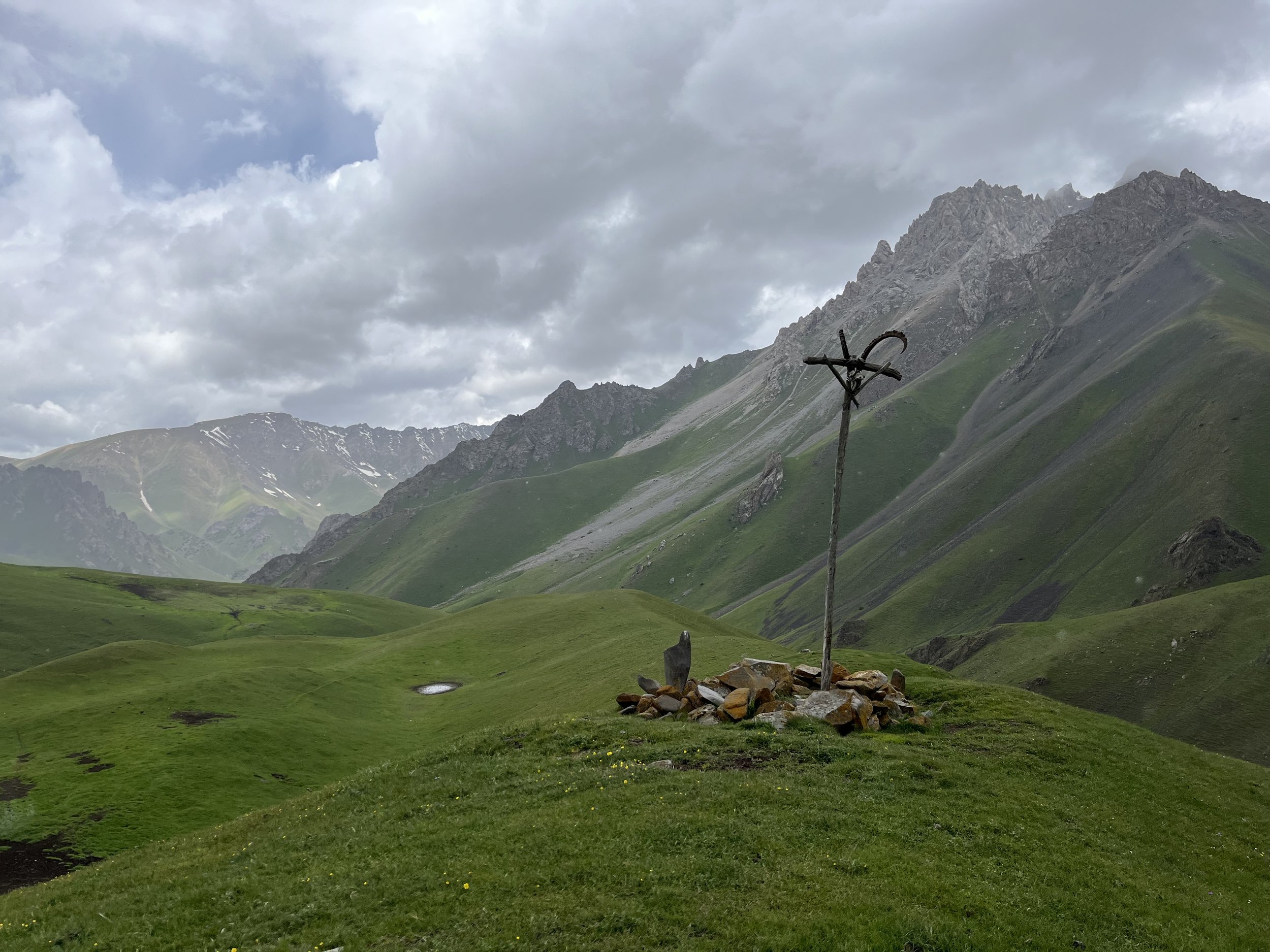
Don’t camp near graveyards and religious sites (shrines, graves of saints, etc.). Don’t go close to these places dressed inappropriately. Don’t go to the toilet anywhere in the immediate area.
Don’t camp in hay fields. Don’t walk through hay fields. How will you know it (a grass area) is a hay field? It will be near a village or road, and livestock will not be grazing it. If you trample it, it makes it harder to cut and dry the grass. Campers who thought they had found a nice meadow to camp in have been told to take down their tents and leave. Some campers have been told to take down their tents and leave the vicinity of a village entirely. You can see an example in this (Russian) PDF report.
I like to bring some (lightweight) souvenirs. If someone helps me out or feeds me and refuses payment (they always do), I have some flag patches to give away. Any souvenir from your country that doesn’t add too much weight to your bag will be fine. If from a country with a flag that is too commonly seen (Russia, USA, China), then maybe bring a regional/state flag, a national park patch, or a sports team souvenir of some type.
Russian and Ukrainian mountain climbers have reports several times that small and very curious children have grabbed some of their gear (ice axes, ice screws, etc) and ran off with it. They got it back but it took some effort and time.
Drivers should always be paid. On roads near towns and villages they will likely ask for payment (the minibuses/marshrutkas 100%). But some drivers, especially in the high mountains, need the money and are just being a bit shy. You must offer payment and insist multiple times. Only take “no“ for an answer if they have pushed the money away multiple times. But they never refuse a souvenir… Which rides are free? Some drivers are well off financially and are just being hospitable and will definitely not take your money.
Get an e-SIM and a mobile data plan before you arrive. When you are in the region add the Yandex Go taxi app. This will make thing much easier. No Yandex taxis in isolated mountain villages, but in the bigger towns they will make your life much easier. There are are actually quite a few taxi apps in Kyrgyzstan, but I’m not familiar with all of them.
Many travel stories are out of date. Homestays and guesthouse prices in rural areas have increased (expect them to ask 2000 som per person per night with dinner and breakfast). The city of Osh, and the villages of Sary-Tash and Sary-Mogul are more predictable, as accommodation here can be booked online with fixed prices.