
Sangvor National Park
Sangvor National Park
Sangvor National Park in Tajikistan was created in 1992, but left mostly unvisited by outsiders due to security reasons for the next 20 years. It was carved out of the westernmost areas of the Tajikistan (Tajik) National Park, plus some additional low-lying areas. You can see a map of the park’s approximately boundaries here, or you can explore from a Google Maps pin of the park headquarters (all areas to the east upriver).
The park is accessed by road from the town of Tavildara, a notable stop on the original Pamir Highway route. Sangvor National Park is located in the Sangvor District, formerly known as the Tavildara District. The historical name for this area is Vakhyo, a name that is still in use by local people.
The highlights of the park include the Hazrati Burkh shrine, climbing routes, glaciers, huge glacial rivers, the Pamir Trail hiking route that crosses the park’s territory, plus numerous natural attractions.
The park includes two regularly expanding gold mines within its territory, one Tajik-owned and the other Chinese. No satellite image shows the true extent - they are all out of date. This affects where the roads are, as they are occasionally rerouted around new mining areas. There is also trophy hunting inside the park, but only in the fall season. This is done by the Saidi Tagnob hunting conservancy. This conservancy is based and operated in another region of Tajikistan, but they do employ local hunting guides.
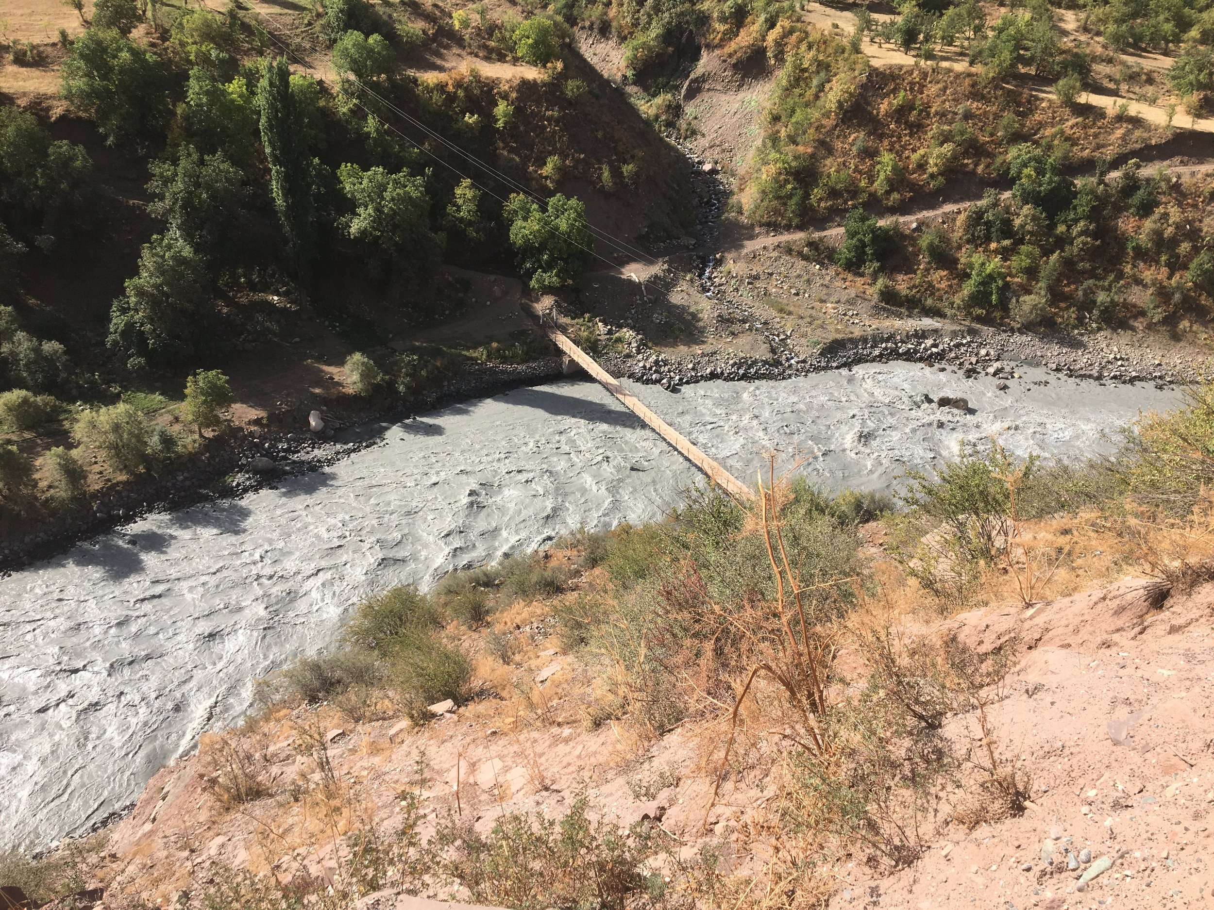
Overall, the park is difficult to access if you do not have your own 4-wheel drive vehicle. Once there, you must pay a daily fee - even when on the main roads and next to the gold mine operations. Accessing the most beautiful locations requires some extreme river crossings and hiking through very difficult terrain. Even just the Hazrati Burkh shrine requires a 4-wheel drive with high clearance for the the river fords.
Hiking in Sangvor National Park
The very challenging Pamir Trail crosses the park, with both an easy low route, and a very difficult and dangerous high route. The Pamir Trail has all the info you need to hike through this area on their website. Link to the exact trail section here. There are not many photos of the trail here at the moment, but you can see some on Instagram here.
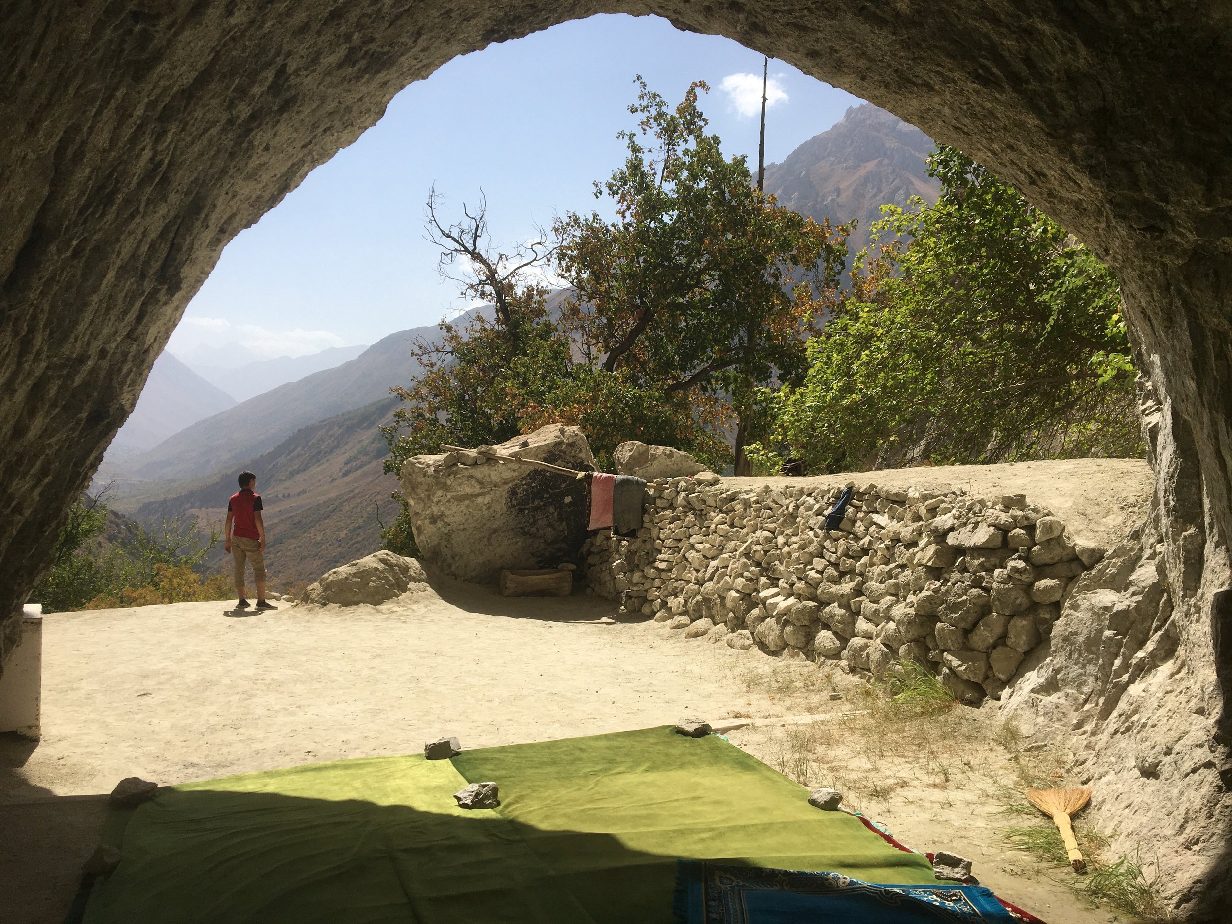
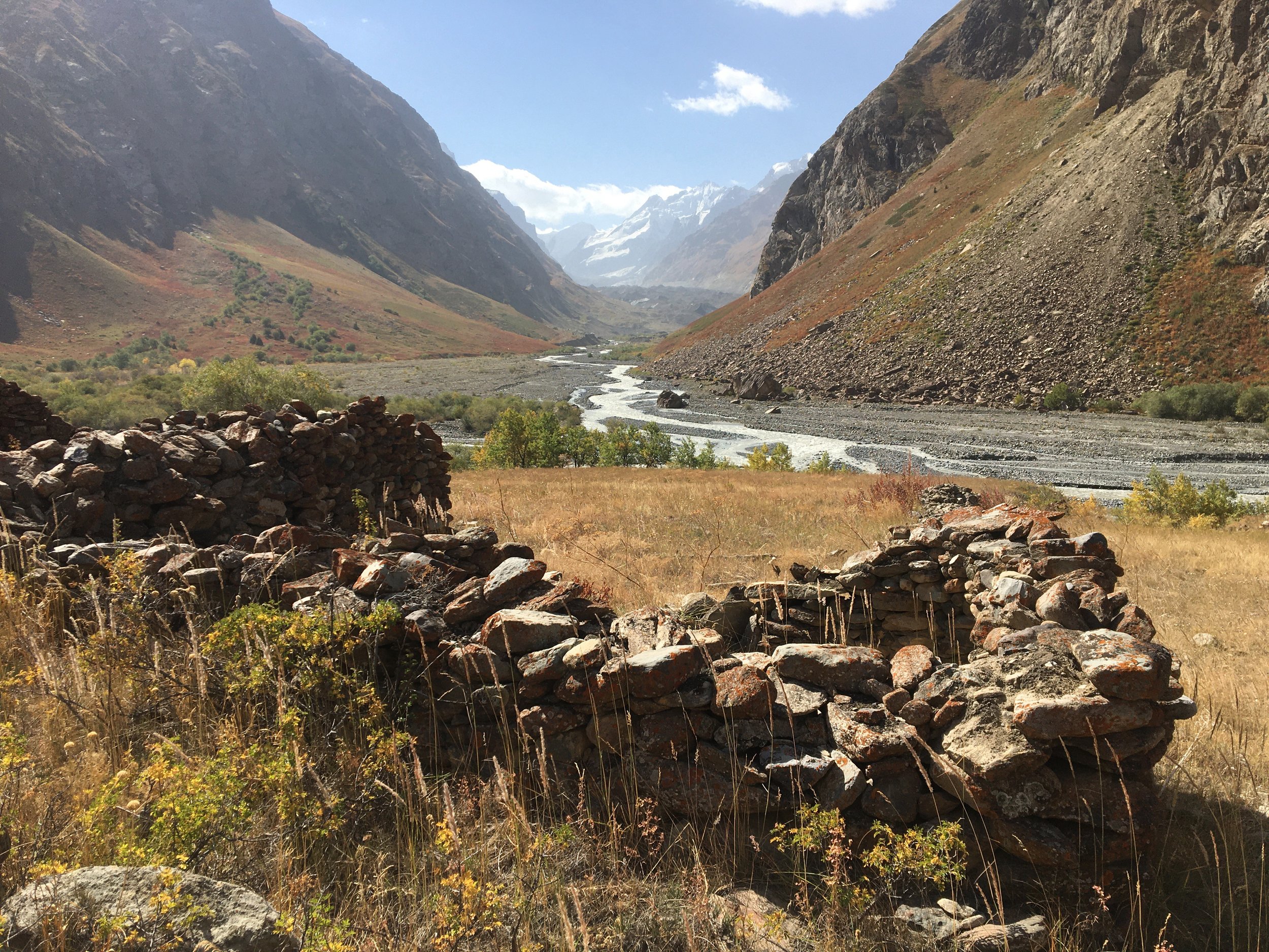
If you are looking for a full day hike or an overnight hike, then the best choice would be to drive up the Obimazor River to the Hazrati Burkh Mausoleum and then walk upriver to the abandoned village of Borshid. The video below offers a view of that hike.
Mountain Climbing
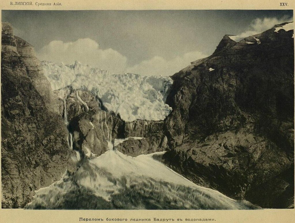
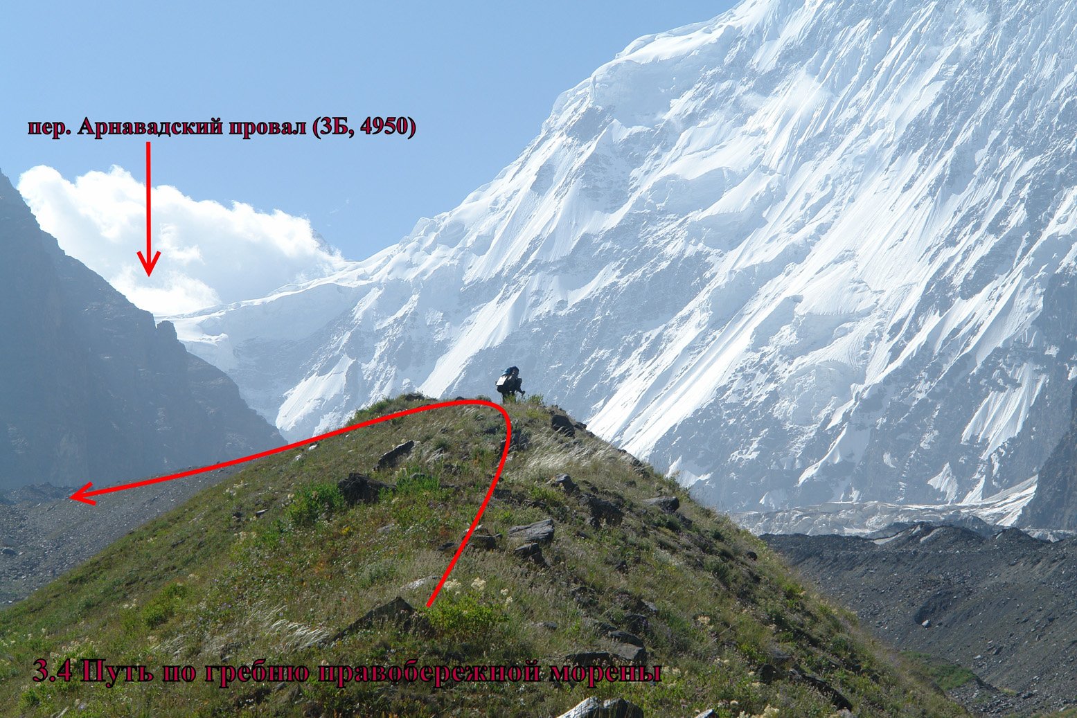
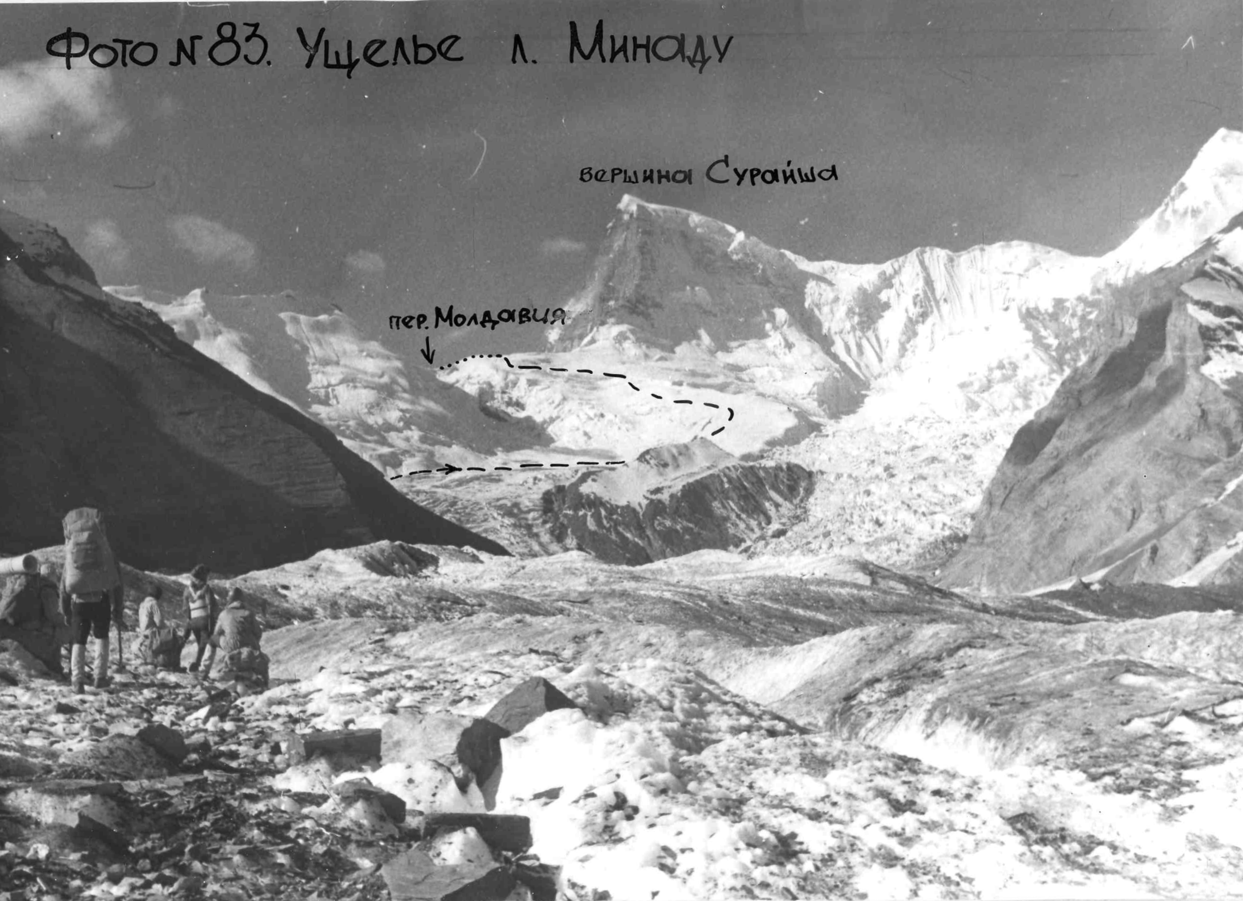
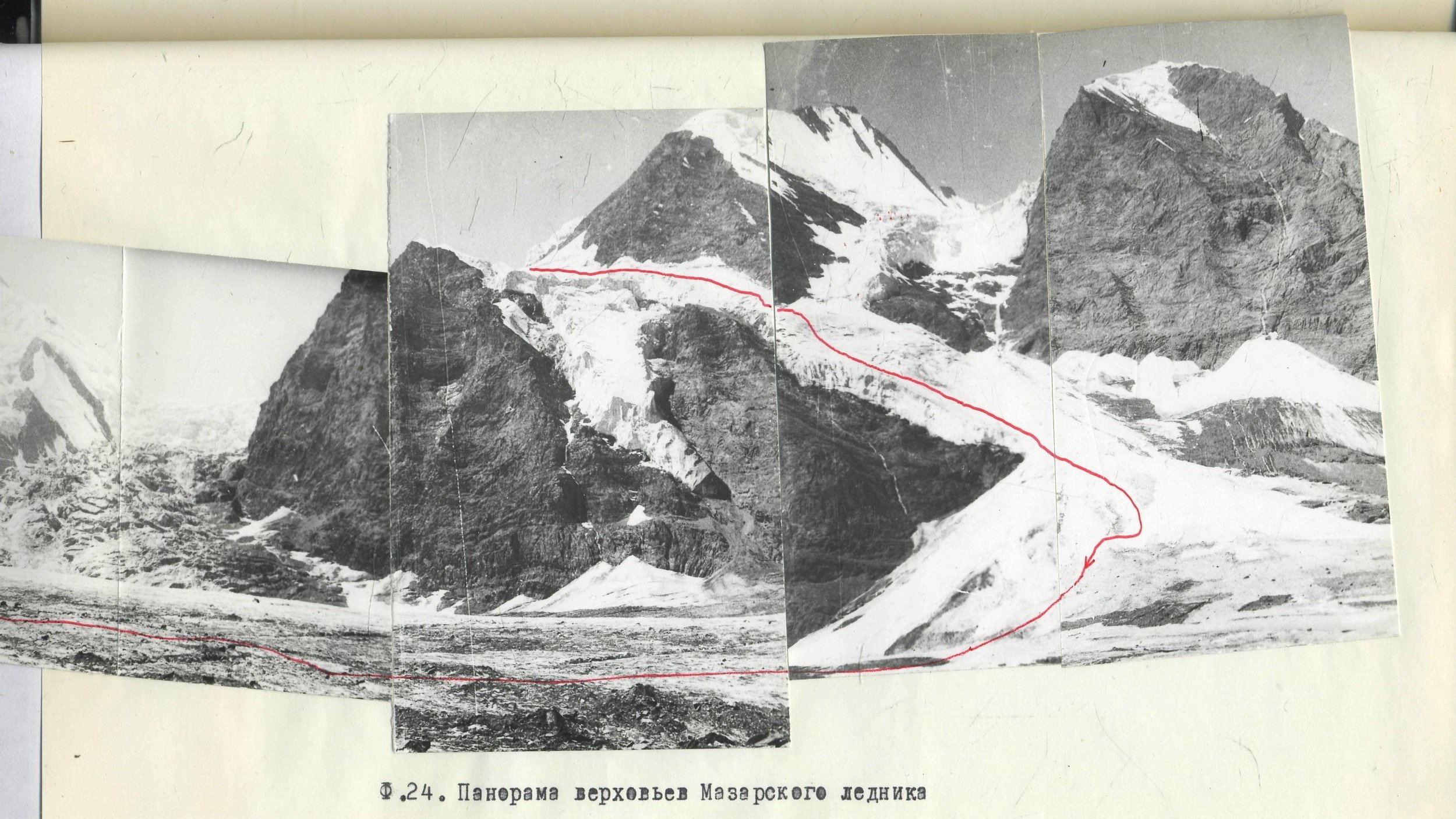
Soviet climbers began exploring the ridges, glaciers and peaks in this area in the late 1960s, with one notable British expedition. But since 1991 this region is very rarely visited by climbing teams, as climbers now use the road up the Vanj valley to access the Fedchenko/Vanjyakh Glacier area (a good strategy for climbers, but not for hikers). The extremely rough river crossings have done a good job of keeping the newer generation of climbers away from this area. If you can read Russian and know climbing terminology in Russian (current online translation tools do a very bad job), there is a description of this region by a mountain climber, as well as a map with passes that link to climbing reports.
The photos below show what the mountains here have to offer. Sources, clockwise from top left: Lipsky, Scherbakov, Rastegayeva, Polyakov, and at bottom Vorobyov.

Religious Pilgrimage Sites
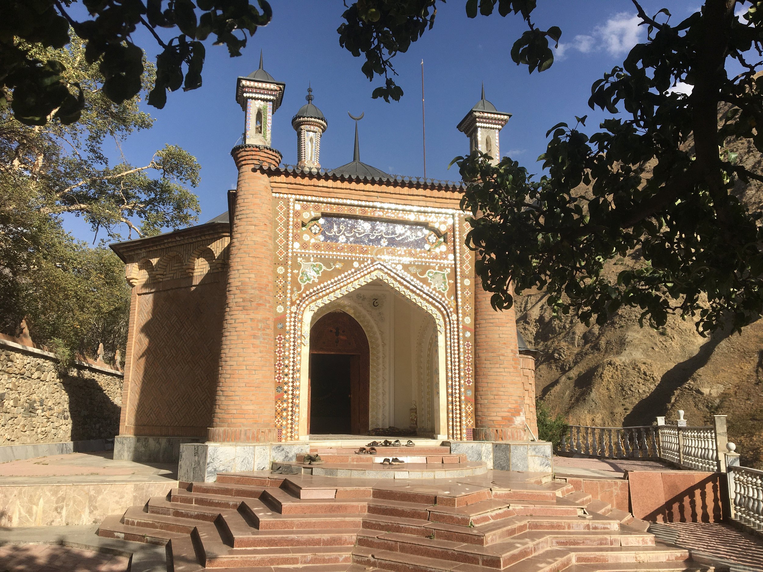
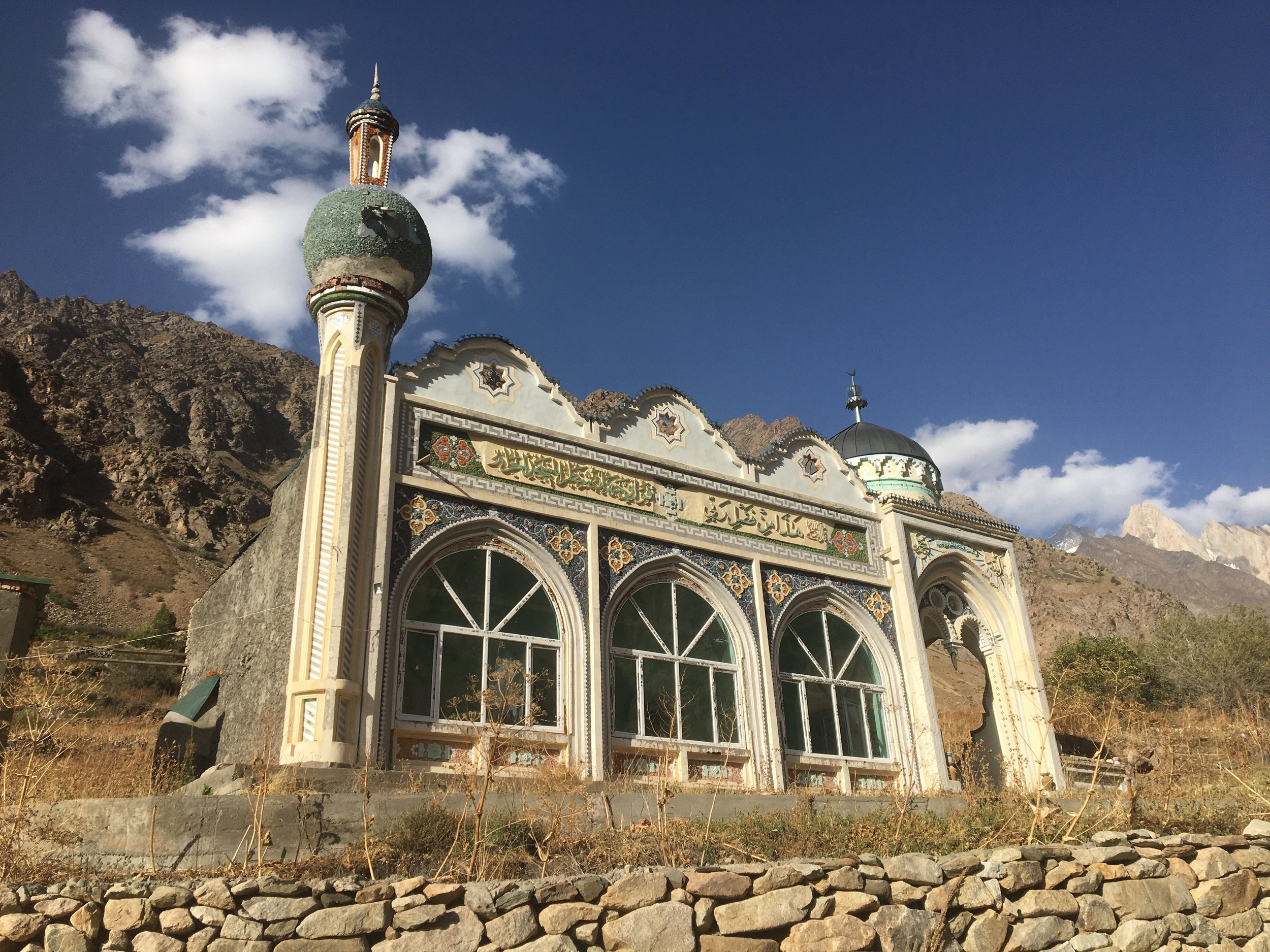
The most well-known religious site here is Hazrati Burkhi Vali (Google Maps pin), a mausoleum that attracts pilgrims from the nearby region. Before the communist destruction of this religious site and the village nearby (whose existence was supported by pilgrims), Hazrati Burkh was far more famous and well-visited than now. The current revival is small and with low numbers. The village was never rebuilt, but there is a mullah and a cook/host here for the high season in late summer and early fall. Non-Muslims are welcome to visit if dressed appropriately, and the mausoleum is the start of a nice hike (see above). A second smaller site is Khoja Aloviddini Guldasta (Google Maps pin). Khoja Aloviddin has a spring and a grotto attended to by a mullah. Again, non-Muslims are welcome to visit if dressed appropriately. Both of these site exist by donation. Visitors should tip. Note that you need a 4-wheel drive with high clearance to make it to the shrine. Photos below: Hazrati Burkh and then Khoja Aloviddin below.
Exploring
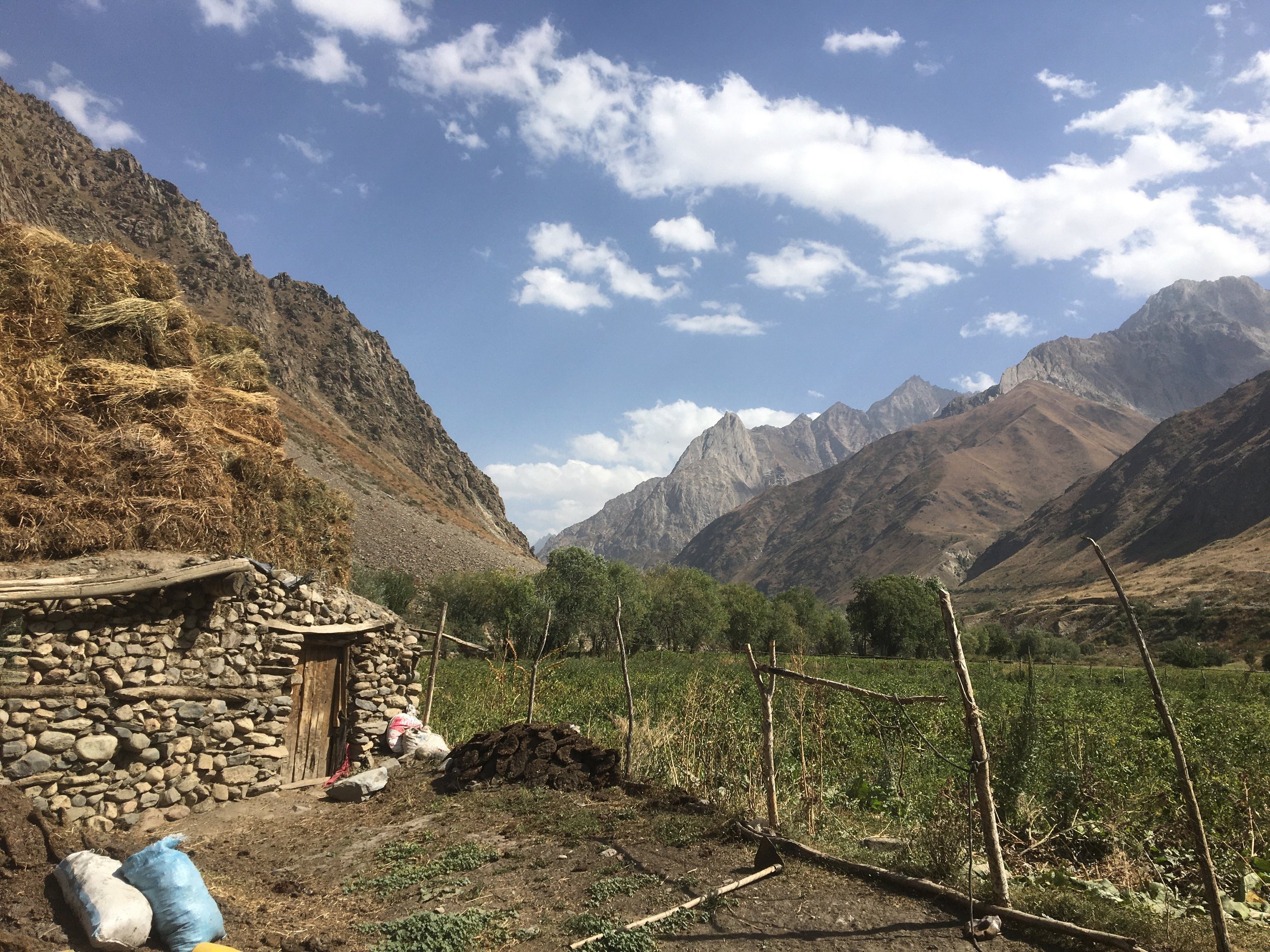
The villages here are very friendly, and usually have short livestock trails leading into the mountains and up rivers. You are welcome to go anywhere.
Best time to visit: Spring and early summer is flood season, and road and creek crossings may be destroyed or impassable. A visit is best from mid-July until early October.
Permits and fees: Collection of fees is inconsistent. There is a park headquarters office between the villages of Ghovd and Alisurkhon, but it may not be staffed when you pass through. Just up the road somewhere in the village of Langar is the head park ranger and homestay owner: Munir Chobirov, +992939365913. In the past fees have been collected in the village of Langar from hikers arriving over the Gardani Kaftar Pass. This fee was approximately $2, but in 2024 the fee for the Tajikistan national Park was increased to approximately $10 per day per person. A 2025 trip confirmed that Sangvor National park has matched this price.
Maps: Google Maps has terrible coverage for roads and villages. Instead, use an offline map download for a map that uses Open Street Map data.
Accommodation: No official accommodation after leaving the town of Tavildara. There is an unofficial homestay in Langar at the forest ranger’s house, and the Hazrati Burkh shrine has very simple accommodation of pilgrims. There is an informal guesthouse in the village of Sangvor owned by Akai Sherali. He also owns the small convenience/grocery store. Both are right next to his house.

Final Advice and Trip Reports
For exploring in general, the local people were consistent in their advice: don’t show up until the last week of September to the first week of October. Before this the glacier melt rivers are too high to cross safely. I agree based on my experience.
For information on specific long distance hiking routes, first check out the Pamir Trail website, specifically Sections 6A and 6B. 6A is doable anytime during the summer and fall hiking season (I did it in August 2025). Section 6B as it stands is extremely dangerous. See the full description at the link above.
The historical pilgrimage route from Bunay in the Vanj Valley to the Hazrati Burkh shrine is no longer possible unless you are a climbing team skilled in dangerous river crossings and technical glacier travel. The historical bridges no longer exist and, as best as I can determine, the Bunay Pass is now much more difficult and dangerous due to climate change, turning a gentle glacier pass into a crevasse filled shrinking glacier.
The other historical route between Vanj and Vakhyo (i.e., the Sangvor side) is through the Shirgovad Pass. I attempted this route in August 2025 and was blocked by a steep moraine left by the receding Siyoh Lozar (Black Glacier) Glacier. See my full trip report and suggestions for a possible future hike of this route.