Alay Traverse High Route Trail Guide, Trip Report, Practical Advice and Trail Notes
Click here to return to the general description of the Alay Traverse.
You should copy and paste this into a text /note file on your phone for use on the trail.
Food resupplying
Accommodation Guide
Transportation Guide
Battery/Electricity Advice
Weather
Trail Notes
1. Food resupplying on the high route
The distance between food stores is manageable (for any hiker who has done a long distance thru hike with these sorts of distances). You will have to accept that you won’t have the best selection of food. I have had days where my diet was ramen noodles, peanuts and low-quality chocolate.
Section 1: Sopu-Korgon to Kyzyl-Alay
Starting in the east in the village of Sopu-Korgon, I assume that you will be coming from the city of Osh. Here in Osh you can get a wide variety of western supermarket products. Globus Supermaket is you best option: Google Maps link.
If you are OK with a heavier food carry, you can make it from Sopu-Korgon to Kojo-Keleng (130km) without resupplying. For a lighter load, do a resupply after the first 55km section.
Section 2: Kyzyl-Alay to Kojo-Keleng
I could not find a village store in Kyzyl-Alay at the beginning of section 2. It exists, but not on the main street in 2026, and I’m not sure what they offer. Expect stock to be limited. You can hitchhike back to Sopu-Korgon for a resupply in the village stores (check what they have when you are there). Another option is to go the opposite direction towards the village of Ak-Bosogo. I saw a couple of village stores while driving past. I can't tell you exactly where there are, nor if the stores on the map are accurate locations. One I saw was new (I hadn’t seen it on previous drives past).
If you are OK with starting with a heavy load on your back, you could skip this resupply and go the 130km from Sopu-Korgon to Kojo-Keleng without resupplying on the way.
You might also do this: half resupply at the end of section 1 on instant ramen noodles, a sausage, chips/crisps, candy, biscuits and whatever else is available, but be carrying a full supply of granola, protein bars, dried fruit and nuts from Osh (items you won't find in a village shop). I also carry soup bouillon flavor cubes, as some village stores sell plain noodles with no flavor packs.
Also note the "Bak-Archa" restaurant just up the road from the turn to Kyzyl-Alay off the Pamir Highway. This is a very popular stop with locals. They have a picture menu and fixed prices. You may not find a spot to sit during the lunch rush. Outside is a water tap (clear, but quality unknown) and public toilets.
Section 3: Kojo-Keleng to Sary-Mogol
In the village of Kojo-Keleng there are two food stores. I only found one at house #58 on the main road (there is no sign, but it’s a waypoint in the GPX file). I’m not sure what is in the second shop (a local said that it is south of the first shop at house #58). If you look for the second shop, it may not have a sign or any indication that a shop exists. It could just be a door. What I found in the first shop in 2026 was: frozen hot dogs, chips/crisps, biscuits, instant ramen, candy. You can try to buy bread at your guesthouse (but ask the evening before, not at breakfast). You can also plan to buy meals along the way from Kojo-Keleng to Sary-Mogol (57km). There are yurt camps and guesthouses that you can stay at. If the yurt camps are full, ask if you can pitch your tent and buy dinner and breakfast. In the village of Kichi Sary Mogol there are roadside restaurants for the coal truck drivers (one is even open 24 hours). These will exist for as long as the coal mine exists. Check out the GPX file for the waypoints showing the yurt camps, guesthouses and restaurants.
Section 4: Sary-Mogol to Kashka-Suu
In the village of Sary Mogol I visited several different small shops to find what I needed (see the waypoints): I found Snickers in a shop on the highway, I found only one shop with instant coffee and 3-in-1 coffee (at the bazaar) and then I visited a couple other shops in the bazaar area to find canned fish, sausages, biscuits, nuts, dried fruit, and ramen noodles. If you don’t see bread in the bazaar, try to buy some from your guesthouse. Note that you will be able to get dinner and breakfast at Tulpar-Kol Lake if you stay at a yurt camp.
Section 5: Kashka-Suu to Damjayloo Lakes Loop
When you arrive in the village of Kashka-Suu at the end of section 4 there are some small convenience stores to small for a resupply, plus a grocery store that was shut when I visited at 9:30am. So I hitchhiked to Sary Mogol and back for my resupply. Note that you can hitchhike, but it is generally paid on this road. I paid 200 som for a seat in a car already going to Sary Mogol. Note that late in the day there is very little traffic going east. The next morning in Sary Mogol I found that the traffic is almost entirely going east (to Osh), not west. So I paid 700 som for my own taxi from Sary Mogol. Your guesthouse manager may be able to call a taxi for you and negotiate a price.
Section 6: Kyzyl-Suu Riverside Walk
If you do the loop to Damjayloo Lakes and back you will need to reconsider a possible resupply in Kashka-Suu, or continue on the short section 4 (the walk along the Kyzyl-Suu River).
Section 7: Kyzyl-Ungkur to Abshir-Ata
At the end of this section you cross the highway and you definitely need to resupply for the final 135km section. Your options are to hitchhike to Sary Mogol, or to go the opposite direction to the larger town of Daroot-Korgon. In Daroot-Korgon I found all the usual village store food (with visits to multiple stores).
2. Accommodation Guide
Google Maps reviews in Kyrgyzstan are full of fake reviews and review padding (example: a guesthouse with forty 5-star reviews from local people with no comments or photos). There are also many guesthouses and hotels on Google Maps that do not exist. Local people add random items to the map using a hotel icon (it may be their own house, a village marker, or some other marker). It probably only exists if a foreign tourist has left a review and a photo, or if the owner has recently uploaded photos and posted information clearly stating that it is a business.
Osh is easy. It’s a city. Use whatever hotel/hostel booking app to read reviews. Some places speak no English, have no security, have nobody on duty, or are downright sketchy.
At the start of the Alay Traverse High Route you can stay a night in the village of Sopu-Korgon. There are several options to choose from, with Ata-Konush Guesthouse being the most well-established. You can read Google Maps reviews to see if much has changed since I was here in 2025 and 2026.
On the road between the villages of Chiy-Talaa and Uch-Tobo is the Kudaybergen Guesthouse and Cafe, just off the route a short ways. I stayed here and I paid 1300 som (no meals included). There was no wifi, no handle or lock on the door, the shower didn’t work, and then the water in the sink and toilet quit completely. The electricity was low voltage. There was nobody around after I was shown my room.
When you cross the Pamir Highway at the end of Section 1 you can hitchhike back down the highway to Sopu-Korgon for accommodation, or go to the very simple guesthouse up the road in the village of Ak-Bosogo.
At the end of the next section in the village of Kojo-Keleng there are multiple options. Once at the bottom of the gorge in Chaty you can go left to Guesthouse Jakyp, or right to Zainabdin Guesthouse. It's best to go to Zainabdin as you will be closer to the resupply shops. I was at Bolot's Guesthouse and it was twice as expensive as Jakyp was the previous year (with no quality difference). There are other guesthouses on the map that don't seem to have ever existed, or they shut down. And on both my trips here I've had people try to get me to stay at their unofficial guesthouse. And new guesthouses may appear. In 2026, the normal asking price in this area was about 2000 som with dinner and breakfast included, but don’t expect wifi.
On the next section you can see the accommodation waypoints in the GPX file. It is a popular route and there are tourist yurt camps and guesthouses along the way.
Sary Mogol has many places to stay. For the solo traveller I found Ali Guesthouse to be the best, as they had a communal hostel-style room (1700 som in 2026, dinner and breakfast included). I also stayed at Hostel Nice. It was nice. You can check reviews on Google Maps for the other places in Sary-Mogol.
Tulap-Kol lake has many yurt camps and one at the bottom even has a small convenience store. I paid 2500 for a spot in a shared yurt at Nice Yurt Camp (same owner as Hostel Nice). This included dinner, breakfast and a coal stove fire. There are two more family run yurt camps just up the road (Buaisha and Munar) that seem like a good quiet location with a great view. Some yurt camps here only deal with tour companies and large groups. Others are tourist traps. Avoid the CBT camp.
Most tourists prefer the Tulpar-Kol Yurt Camp to the Peak Lenin climbers' base camp. But I did meet one person who preferred the base camp as it had a bar and cafe and more people (and way higher prices, starting at $100+ for a solo traveller). I personally would rather sleep in a tent than stay at a loud, busy drive-in climber’s basecamp that seems to just be a glorified parking lot, but others may feel differently (if, for example, you want a menu or buffet, a beer, a shower, wifi and other services).
The next section ends in the village of Kashka-Suu. In my brief time here I had three offers of free accommodation as I arrived late in the day. There are two guesthouses on Google Maps in Kashka-Suu. One does not exist and the other was added recently but I did not visit. Hitchhike to Sary Mogol and back the next day for a well-established guesthouse stay.
At the end of section 6 you will need to hitchhike for a resupply and accommodation. If you go to Daroot-Korgon there are multiple accommodation options. I stayed at Guesthouse Zalkar. Despite a glowing review from a bikepacker, I found a place that did not serve dinner or breakfast (all else was fine). When I walked past the Ak-Bata Guesthouse I saw an oven in the courtyard with food cooking and received a friendly wave from the chef. I can't comment on the quality of that place, but I did read a comment about a loud restaurant downstairs that may disturb those who want to get to bed early (I would expect that Friday and Saturday night would be the busy hours in that restaurant). For Daroot-Korgon there is a some serious fake review padding on Google Maps. You need to go past the average review score to read actual real reviews.
3. Transportation guide (2026 prices)
For the eastern trailhead in Sopu-Korgon, you need to start at the GPX waypoint I’ve marked in the city of Osh. You can view it on Google Maps. The Google Maps marker only mentions Sary-Mogol, but this location has mini-busses (“marshrutkas“) and shared taxis going to many locations to the east and south. Some may say “bus station,“ but it’s just a small parking lot with a gated entrance.
While on the Pamir Highway near Uch-Tobo I did see a marshrutka drive by that had Sopu-Korgon and Uch-Tobo as destination written in the window. But I did not see this marshrutka at the bus station in Osh. I have no idea where it departs from (it may not even depart from Osh). But what you can be assured of is if you find a mini-bus or shared car to a destination past Sopu-Korgon, the driver will happily take full fare and drop you off early. No discount because they won’t find another passenger after the drop you off. So you can take a marshrutka (mini-bus) that is headed to Sary-Tash, Sary-Mogol, Kashka-Suu or Daroot-Korgon. Despite Daroot Korgon being the farthest destination, it was, at 650 som, cheaper than the marshrutka to Sary-Mogol at 700-800 som (Sary-Mogol is a tourist destination, Daroot-Korgon is not). The name Sopu-Korgon will be known by the drivers, and the pronunciation is not difficult. A shared car will be more expensive than the mini-busses (up to 1000 som for Sary-Mogol).
What time to arrive at this bus station? Not early in the morning. That’s when the drivers are making their way form the regions to the city of Osh. You should arrive between 12 noon and 1:00 pm (13:00) for the mini-busses, and up to 4pm (16:00) for the shared taxis (cars or mini-vans). The Daroot-Korgon mini-bus leaves earlier than the Sary-Tash and Sary-Mogol marshrutkas at 1pm.
Are you super conformable with hitchhiking? Then you can leave very quickly on a regularly departing mini-bus to the town of Gulcho (200 som). Here get out at the cross-roads on the highway outside Gulcho and hitch a ride to Sopu-Korgon (75% chance they will want money). Or, stay on the mini-bus until the bus station in Gulcho and pay a premium price for a 42km private taxi to Sopu-Korgon.
For the western trailhead, you need to go to a different bus station. You will be starting form the main central bus station (it’s marked as a waypoint in the GPX file). Google Maps marker here. A taxi from your accommodation to the bus station should be about 200 som. At the bus station you should get on a regularly departing mini-bus to the town of Kyzyl-Kiya. Pay for your ticket at the ticket window and then go find the mini-bus with Kyzyl-Kiya written in the front. Kyzyl-Kiya in the local alphabet is Кызыл-Кия (230 som, pay the driver directly or pay at the ticket window and give your ticket to the driver). But you won’t go all the way to Kyzyl-Kiya. Get off in the town of Kok-Jar at the GPX waypoint I’ve marked (Jar pronounced as you would expect, but the Kok sound more like the English word “kooky”). Here look for taxis on the corner headed south. Tell one of them you want to go to the Abshir-Ata waterfall. You can use the Russian word for waterfall and they will understand you want to go to the waterfall, not the village of the same name that is 10km before the waterfall. The waterfall is a tourist destination so the drivers will probably see you and already be yelling “Abshir-Ata!“ or “Vodapad!“ (waterfall in Russian). In 2025 I paid their asking price for a solo, unshared 17km ride (1000 som). The driver seemed quite please with that price. In previous years tourists reported an entrance fee at the waterfall. In 2025 there was none being asked or advertised.
Border Zone Permits
The border zone permit is something you can get for the high route. Should you get it? To be safe, sure. But do you really need it? For the low route you don’t need it (aside from the optional short trip at the end to Traveller’s Pass near Peak Lenin). For the high route a border zones permit would very likely only be checked near Peak Lenin at either the Tular-Kol yurt camp or the climber’s base camp. This happens rarely and is conducted by a mobile patrol. It did happen on day in 2026 at the Tulpar-Kol yurt camp. Fines were paid on the spot by tourists who had no permit, but they were allowed to remain at the camp overnight. They were not detained and no further action was required of them. Was the fine more or less than the cost of a border permit? I do not know.
Getting the border zone permit
The “all border zones“ or “5 border zones“ permit (about $50) is what you should get. It takes about 14+ days to prepare. You can pick it up in Bishkek, or have it delivered to a hotel or guesthouse in Osh. Several local tour agencies are selling this permit online, but you need the original document. You can pay and fill out the info online, but you still need to pick up or get the original document delivered. A scan, copy or electronic copy is not acceptable. But you can make photocopies of the originals to hand over to border guards to keep (Russian climbers report that this makes the process go faster).
I went with MyWay.kg in 2026 and they were excellent: good communication, very clear with follow-up, good instructions on how to pick up the permit (delivery is available for a cost).
Do not trust the border zone maps on the websites of the companies selling these permits. They are all different and contradictory (all the more reason to have the permit in your hands). You may think that an area is not in a border zone because there is not a single border zone map online showing that area inside a border zone, but I’ve seen multiple anecdotes from Russian climbing teams in those areas being checked for permits, and one being significantly delayed because a low-ranking soldier had no idea what he was supposed to do. And these groups had border permits - imagine what could happen if you do not even have a permit.
I have made my own border zone map. You can see it here.
4. Battery/Electricity Advice
There are special battery considerations for hiking in Central Asia.
Rural areas can have electricity rationing, outages or shortages. The village of Sary Mogol had no electricity from 8am to 5pm in late summer when I visited. Guesthouses may have a single electric outlet for multiple guests. There are long distances on the trail. For these reasons, you need certain specification for your power bank, charger and cords.
Before reading my technical advice, you need to consider tactics. When you arrive at a guesthouse in the mountains or in a village, immediately start charging you power bank. You need to know if the electricity is off, or if the plug/outlet does not work. There may be somewhere else in the house you can start charging your battery. Don’t wait until bedtime. By that time, the manager may be asleep, or some tourist has plugged in a slow-charge 40,000 mAh powerbank to the only outlet with a 5-watt charger that will take…. 48 hours to fully charge.
You will need lots of spare battery capacity - a 20,000mAh power bank is my suggestion. The high route has a 135km section between battery charging points (guesthouses). If you are a heavy user (video, photography, drone, music, reading, internet, etc.), then bring more. To play it safe, two 10,000mAh power banks are safer than one single 20,000mAh power bank (you could drop it in a river, it could die on its own, it could get fried by a power surge, it could get stolen while charging, etc…). If it gets close to freezing, sleep with the power banks (and your phone) inside your sleeping bag. And a sealable plastic bag or dry bag is good for protecting your batteries and electronics if you get wet from rain or a river crossing. As for quality, the Anker brand is very consistent.
Make sure your power bank supports 30W charging. And I don’t mean that the battery pack outputs 30W to your phone or other electronics, I mean that 30W is going to your power bank from the 30W charger. It’s called bi-directional 30W charging. This takes some investigating, as manufacturers and sellers focus on telling you how quickly your battery charges your devices with how many watts (W), or “output,” but they often hide or don’t mention the info on how many watts their battery can “input” from a charger (important info for a hiker with limited time to charge their battery, and who may be competing with other tourists for limited electric outlets).
And bring a 30W charger. A regular charger (usually 5-10W) will take ~20 hours to charge a 20,000mAh power bank. You need a Euro plug, not North American plugs (you can buy an Anker Nano 30W charger with European plugs from Amazon Germany or any European seller who delivers to the US/Canada/Australia etc.). You could just use a travel adaptor, but that’s adding a low quality item that can fail (or, like I’ve experienced, slip loose at an angle and stop charging). You should also have a 30W USB-C to USB-C cable so that your battery pack will actually charge fully overnight (the longer the cable, the better, some electric outlets are unreasonably high on the walls in this region). And an extra cable is always a good idea.
Do you just want a recommendation for a set-up? Sure, here you go:
Anker 537 Power Bank (24,000mAh), or two Anker Nano Power Banks (10,000mAh each)
Anker Nano 30W charger (European plugs)
Anker 643 USB-C to USB-C Cable
According to the manufacturer, this set-up above will allow you to recharge a dead 24,000mAh battery in 3.5 hours (I can confirm this is how fast it is for me). Note that sellers sometimes don’t mention the Anker model number (537, 643, etc.) so you may need to compare specs from the Anker website to whoever you are buying from (if not buying directly from Anker).
Can you go higher than 30W? Sure. Look at power banks targeted towards laptop users. Generally you will see 65W charging input being advertised for that. Anker claims their 65W charger will fully recharge a 25,600mAh power bank (the “747” model) in 2.5 hours. The main consideration for this is that, for this small improvement in charging speed, the 65W charger will be significantly heavier (almost 4x) and bulkier if you are counting grams and ounces in your bag.
Be careful with your charging set-up (and other valuable items) in the city of Osh. 15 years ago I would say that travelers in Central Asia were a very honest group of people. I think that has changed (with a small minority), and European and American travelers have gotten trashier (increased popularity of the region, discount carrier flights, dark tourism, different traveler demographic, etc.). A $150 Anker set up is a tempting target for another traveler with a cheap 5-watt set-up that is failing them badly. Add to this crowd some other foreign hostel dwellers who are not tourists and who may be desperate. Finally, there are the hostel/guesthouse’s family members and their children and their children’s friends from the street. One hostel has online reviewers complaining about random local people walking into the common areas of the hostel (with the young employees too scared to kick them out). And then there are employees and cleaners… You have much less to worry about in your mountain homestay.
5. Weather
Mountain weather in southern Kyrgyzstan is mountain weather. The mountains can “make their own weather“ with clouds forming over high ridges as the day progresses and possibly making some precipitation and lightning. But the bigger worry will be a larger weather system moving into the region and bringing higher levels of precipitation. Not Himalayan snow storms, but enough snow to block a high pass.
I don’t recommend you commit to hiking the high route without some experience with snow.
In 2026 I had snow in the last week of August (all the way down to 3200 meters). This snow quickly melted off over the next two days. In mid-September there was snowfall down to 3500 meters that melted off over the next couple of days, but not on the shady north-facing slopes. Finally in the last week of September there was a permanent snowfall down to 3300 meters, shutting down the hiking for the season.
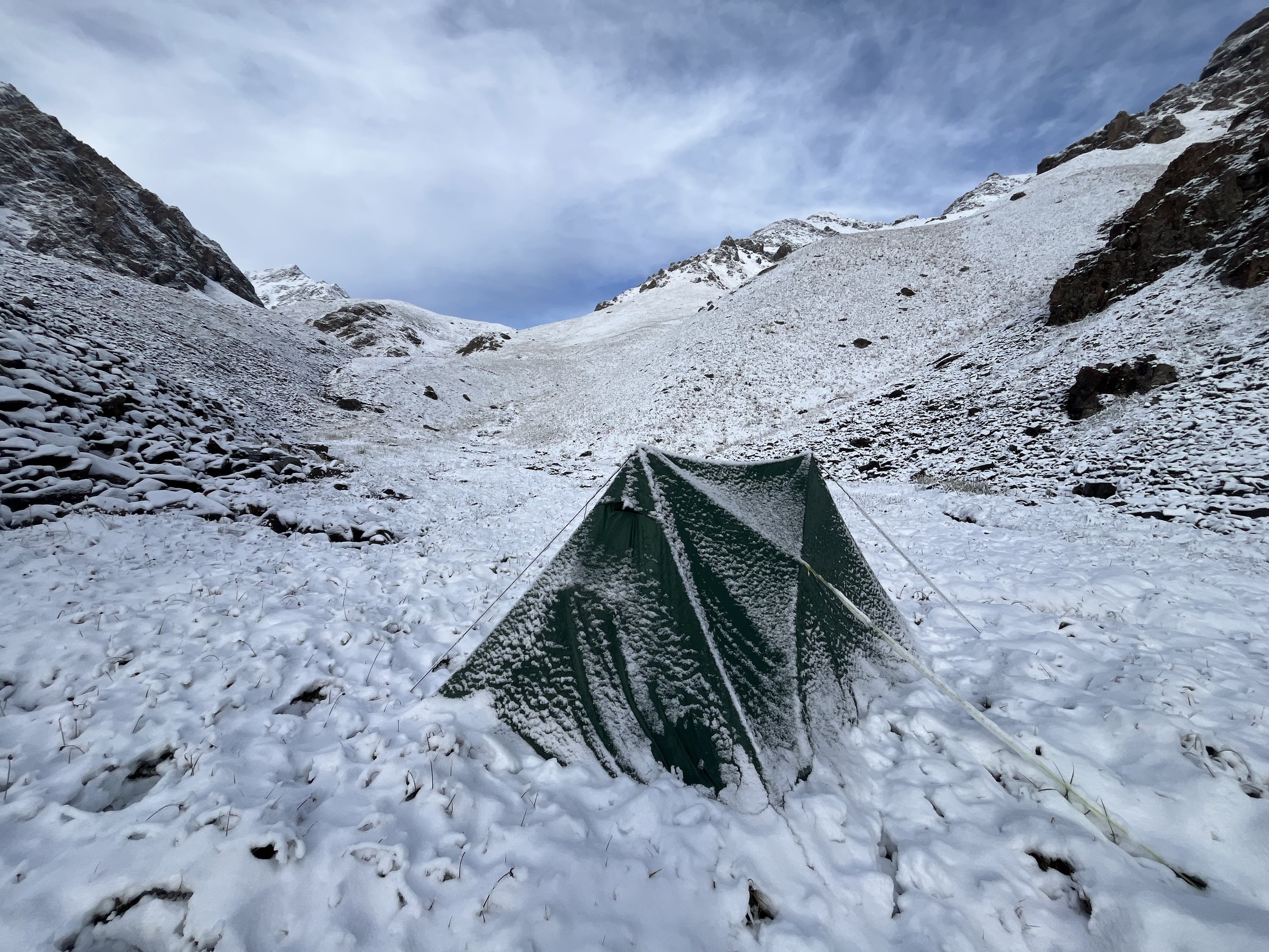
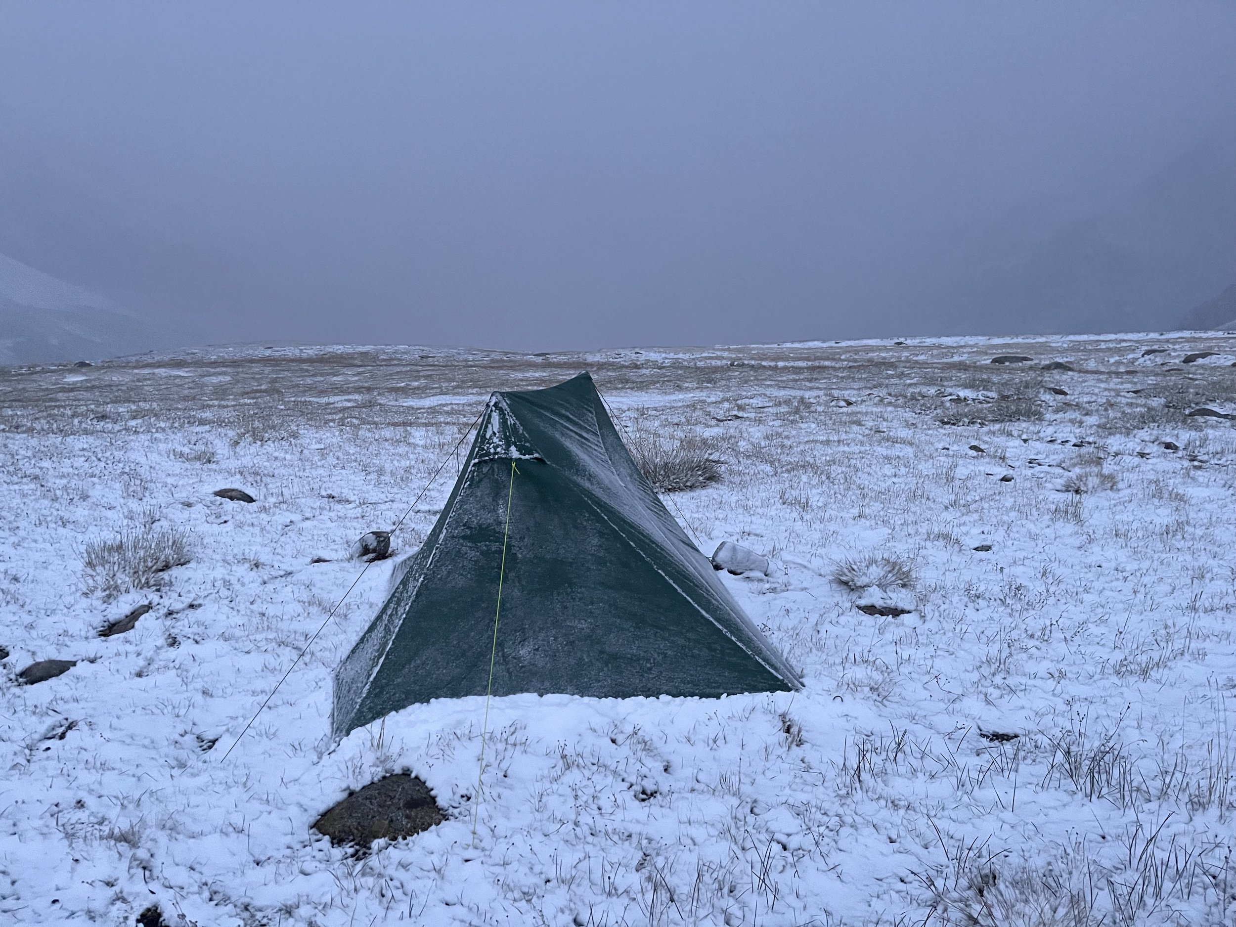
As an example of a challenge snow may present, the video below shows the north side of Tuz-Ashuu Pass (4250 meters). By late September there was permanent snow on the shady north side that would not melt off (unlike the sun-facing south side that was dry and bare). This pass was just barely doable with the level of snow that was there. If it had been any deeper, or icier, or the slope steeper, I would have needed crampons and an ice ax to feel safe.
6. Trail notes, from east to west
You should copy and paste these into a text /note file on your phone for use on the trail.
Special note: There are many livestock trails in Kyrgyzstan. They appear and disappear. Sometimes there are multiple trails at different elevations going in the same direction. Sometimes you will be in open terrain with no visible trail, at other times you will be confused by the presence of a dozen trails in your field of view. In these areas just make sure you are going in the same direction as the GPS track.
Starting in the village of Sopu Korgon (western trailhead)
Section 1: Sopu-Korgon to Kyzyl-Alay (55km)
Withn a steep ascent from Sopu-Korgon there are routes high up on the ridge to Kichi-Kol Lake. However, it is steep and loose terrain and there is no great view that makes it worth the scramble. It's better to roadwalk to the village of Terek and then go on livestock trails through the easy saddle to the lake. I did not do the village route, but it looks easy and with a clear trail. However, villages do change and satellite imagery can be out of date, so the best or exact route through the village of Terek may have changed.
There are yurt camps for local tourists at both Kich-Kol and Chong-Kol Lakes (literally translates to Little Lake and Big Lake). These are not great for accommodation. See my general notes on accommodation.
It's possible to get water from either of the lakes - Kichi-Kol and Chong-Kol, or ideally from the stream that flows into Chong-Kol, but the best water is where the Sogot (Sugut) river emerges, 18km from Sopu-Korgon.
You will soon hike right next to the Pamir Highway. At the Kudaybergen restaurant buying lunch and grabbing a bottle of ice tea or cola from the restaurant.
The next water source is at a convenience store off the route in the village of Uch-Tobo, or from Gejige-Kol Lake. I would both filter and chemically treat the lake water as people swim here and livestock drink here. It's also possible to ask people in the village of Gejige for water. Just smile and wave an empty water bottle.
After Gejige-Kol Lake are some farming fields that keep changing (on my second visit the fences changed position and a new irrigation canal was built). You may need to figure out your own route in this area if anew uncrossable fence is built.
When you finally come down to the Gulcho River you may have clear water in the river, or silty water. I experienced both on different days. There is also the chance of finding some clear water emerging in small side streams. Or you could cross the river (easily in late season) to the spring on the opposite bank).
At the tiny village of Archaly the roadside restaurant may or may not be open. You can, if open, buy bottles of sugary drinks here (Coke, Fanta, iced tea, etc.)
Next you will do a road walk on the Pamir Highway to the turn-off to the village of Kyzyl-Alay. This is where you will need to decide where to do a resupply. See my food resupply notes above.
Section 2: Kyzyl-Alay to Kojo-Keleng (75km)
Kyzyl-Alay sees no tourists and is very friendly (and curious). I turned down a couple of invites for tea and a meal (I was in a hurry that day). I was also offered a place to sleep for the night by different groups of people.
Kyzyl-Alay (Red Alay) is a new name. The old village name that is still used is Chagyr.
After walking through Kyzyl-Alay you need to be aware of hay fields. Do not camp on hay fields or walk through them (any high grass) until they are cut and harvested (sometime in late August). Walk on pre-existing routes only. These may be different than the route I chose. From the edge of the village until the ridge-top trail high above Chagyr-Madaniyat Pass the multiple trails will fade, disappear and reappear.
From Chagyr-Madaniyat Pass I went down to the shepherd summer village of Kara-Jilga and then went up the the ridge-top trail. Don't do this. From the pass your should go straight up to the ridge trail and skip Kara-Jilga. This shepherd camp area is full of manure, wet meadows, mud, bad water and loose rough rocky trails. This means that I did not hike a couple kilometers of the ridgetop trail. So from the pass you should choose your own route according to what makes sense for you. I've just drawn the GPS line based on satellite imagery.
Farther up the ridge-top trail you will get some excellent views - but no water and nowhere to camp. This is a shepherd caravan route and some significant work was done in the past to cut through rock to make the trail easier.
Starting at about 3300 meter the trail will no longer be a single clear route. There trail will often split, fade away, and reappear as you are now in a more open yak and cattle grazing area. You don't need to strictly follow my route until about 3800 meters when you cross the Kara-Konush stream/creek.
The new road you join just above 3800 meters is a bit of a mystery. It was built in the last few years and never used. There is no sign of mining exploration or preparation for a mine. There is no maintenance and it is actively being destroyed by nature (erosion, floods, moving ice, slumping slope). It's possible it was built to make the caravan route easier for the livestock herders to move their livestock to pastures (there is sheep, horse, donkey and yak manure in and near the pass). But it does seem overkill for that purpose. With the degradation it may become a more difficult route in the future.
The pass is named Kichi-Karakol Pass on old maps. This is confusing as it is nowhere near the village of Kichi-Karakol (Karakol is a very common name throughout the country). The name is likely related to the name Karakol that can be seen with a river on the north side of the pass. "Kichi" (small) is used for river and gorges that are on the opposite side of a mountain saddle, or for a parallel tributary.
On the opposite side of the pass the glacier is receding and a road has been cut across the tip of it. But there is still moving ice under the rock and gravel. This road is being very actively destroyed. You may find a very rough walk here above the glacier.
The north side of the ridge is very active with coal miners. You can see the mines at a distance, but not next to the route I've chosen.
I didn't see any people (i.e., shepherds) until I got to the Kashka-Suu valley. This valley is easily reachable from a road. Here I was waved over to a yurt for bread and cream. People here have never heard the name "Kanty-Kashka Suu" that is on old maps. Kashka-Suu means "turbulent river" and is a commonly repeated name throughout Kyrgyzstan - including on this route.
At two different locations in the Kashka-Suu valley you will see two different glacier ice walls if you look south.
As you go down the Kashka-Suu gorge you will enter the first forest on this trip. There is usually a single clear trail, but it is possible to take a split off the main route and then have to search to find the main trail.
You will soon turn a corner and go up the Chong Kashka-Suu river (Big Kashka Suu) and soon have some excellent views. Do not skip the trip to the upper valley by making a short-cut.
In the last week of August there was single flock of sheep and an Uzbek shepherd. From here on all the sheep shepherds were Uzbek. He told me that the shepherd farther along on my route had a sheep get hit by a falling rock and so did a quick prayer to make it halal and butchered it. Later these two shepherds (after Kyzyl-Bel Pass) tried to get me to stay with them for a fresh mutton feast (but I was in a hurry).
I met more Uzbek shepherds at a large camp along a tributary to the Arshan-Ata river/valley. Their dog bit me after I got too close to her new-borne puppies (but not hard enough to drawn blood or puncture my skin). If you want more wild animals to worry about, I saw the first sign of wild pigs digging up the ground in the Arshan-Ata valley (as the shepherds told me I would see).
Going down the Sary-Goy River (AKA Sary-Koy) I saw signs of recent high flow. This was likely from a snow/rain storm earlier in the week. This are had cattle grazing on their own with no herder. In the lower Sary-Goy gorge you will no longer get an accurate GPS signal due to the steep walls and deep gorge. But you don't need GPS. The trail is obvious and you can't get lost.
Sary Goy gorge has cattle at the beginning, then none after the 2nd gate. Very nice. Excellent bridges and clear water (but possible to be silty on certain hot or rainy days), and with many springs to choose from for drinking water.
The Kalta-Boz gorge does not have a trail as clear as Sary-Goy. Sometimes you will walk in a riverside forest, sometimes you will need to get up onto the sidehill. A few times you will need to be right next to the river, almost in the water. There are at times multiple options, as the cows make the trails here. You can't get lost... The good news is that the upper gorge has clearer trails
A Ukrainian group hiked up this gorge in late July and reported that the fords were above their knees. I didn't need to do any fords as I was always able to find a makeshift bridge or rocks to jump across on. Also, the river is lower in late August and the fords would not be that deep.
The upper gorge has quite a few yaks and cattle, but the camps were abandoned in late August. There was also pig rootings in the upper Kalta Boz.
As you leave the gorge up towards Kaltaboz Pass, you will need to carry enough water to get the 7.5km to the spring above Chaty. The closer spring halfway up the ridge has been totally stomped by the livestock. There is clear signs of an old trough that has been discarded. Unfortunately, many springs are not protected (with a built up rock structure) as in Tajikistan or Uzbekistan, but rather left to be a trampeled muddy mess.
Do not descend from Kaltaboz Pass to the road. It is hot, dusty and unpleasant (based on reviews from multiple trekkers). Stay high on the ridge on my route that descends to the village of Chaty.
The summer huts in the Chaty gorge are quite interesting (but abandoned by late August), and you get a great view of the geology in the area. For those of you who want the best photo or video, the geology in the Kojo-Keleng area is much more beautiful in the morning sun. I missed that period. With that low sun the rocks in the are will light up prominently.
Section 3: Kojo-Keleng to Sary-Mogol (57km)
You are now on a popular tourist route (by regional standards) until the village of Sary-Mogol. This is the first time I met other hikers. I joined with another hiker just after Kojo-Keleng and stayed with them until Peak Lenin.
There is not much to say about the route above Kojo-Keleng. It's well-travelled and easy. Note the many tourist yurt camps and guesthouses you can stay at between Kojo-Keleng and Sary Mogol Pass. The guesthouses are always open, but the yurt camps do eventually shut down for the season. They were open on August 29-30, but I did not stop to ask when they take down their yurts for the end of season. Also, don't count on there being available spots inside the yurt. Sometimes large groups have them fully booked (as was likely the case at the camp just before Sary Mogol Pass).
After crossing the large stream at Kosh-Moynok I forgot to take notes on the water sources. It's possible that there is no water flowing in the springs above the village of Ming-Teke and that you won't find clear water until you enter the gorge above the village of Kichi Sary-Mogol. After entering this gorge you no long need to worry about water until almost in Sary Mogol.
The Kichi Sary Mogol area has roadside restaurants - one of them even open 24 hours. These will exist as long as the large coal mine up the road is in operation.
Sary Mogol Pass has the potential to be dangerous - despite the many tourists who visit here. In the Russian alpine grading system the pass has a 1A to 1B rating. The more difficult 1B rating will apply to the northside of the pass until the snow melts out in early August July. The northside is very steep and is the sort of terrain where you would need crampons and ice axes if there is still snow or ice. Also, there may be some rockfall in the early season. If you are here in August or September then you only need to worry about fresh snowfall.
Section 4: Sary-Mogol to Kashka-Suu (74km)
There is a border zone warning sign right across bridge from Sary Mogol. You now need the border permit. This permit is rarely check for (by a mobile border patrol). But in 2026 they did check for permits at the Tulpar=Kol yurt camps and collect fines from tourists. It is possible that the fine is cheaper than the permit. I'm not sure how much the tourists were fined on the spot. But they were not detained, as has happened in border zones farther west (that this route avoids).
Note the distance from Sary Mogol village to the first water source. You will need to cary more than your usual amount of water. The good news is that you are high enough to not be hiking in hot weather.
Also, not that you don't need to walk on the road after the bridge of the Kyzyl-Suu river. The terrain is open and you can choose your own route.
From the yurt camp to Traveller's Pass will be a busy area. You will hike through the climber's base camp and it will get even busier. Pay attention to the water notes in the GPX file. It may be dry all the way up to Traveller's Pass after the water source by the first bridge.
After arriving at Traveller's Pass you might be tempted to tale a shortcut through Reconnaissance Pass. This is not a great idea. Two climbing groups rated this pass as 2A in the Russian alpine grading system: bad scree, steep loose rock sections, and ice axes needed for snow and very steep eroded slopes.
After leaving the area of Traveller's Pass and the Peak Lenin base camp area I no longer met any tourists. The only tourists I encountered were between Kojo-Keleng and Peak Lenin.
The Jipak Suu river crossing was easy when I was there on September 2. The water was clear and low and gentle enough that I crossed in bare feet.
In the upper tributary to the Jipak-Suu river is an excellent camping spot at 3650 meters elevation. It is a large grass meadow with a view of the ice wall glacier on Musa Jalili Mountain.
When descending the Nichke-Suu river valley (another commonly used name) you need to think about taking enough water to get across the Alay Valley to the village of Kashka-Suu.
Last good water is spring at 3450 meters at a spring next to Nichke Suu. This will make for a 24km water carry to Kashka-Suu. The route is fast and downhill, with generally cool weather. So it shouldn't be too bad.
There is clear water in lower Nichke Suu, but it is sheep manure flavored with a side of swampy flavor. The Tashkongey river was chocolate brown when I went crossed over the bridge on that river.
As you cross the Alay Valley on your way to the village of Kashka-Suu you can either walk on the road or go out over open terrain and choose your own route. The terrain changes according to elevation and soil type. Some open terrain is quite nice for walking; some less so.
Section 5: Kashka-Suu to Damjayloo Lakes Loop (57km)
From Kashka-Suu is a loop through Kok-Jar Pass, up the Kosh-Kol and Damjailoos Lakes and then back down to the village. It's recommended but not mandatory. The lakes are nice, but they'll never be world-famous.
If you are curious, you can see photos here (my photos are no good as it was stormy during my time there):
https://maps.app.goo.gl/67sy4bpgivHRjBn18
https://maps.app.goo.gl/Kquug561eN6zdxjp9
https://www.alltrails.com/trail/kyrgyzstan/osh/koshkol-lakes
https://www.instagram.com/p/DcGxnYDDBQO/?img_index=1
I had bad luck with weather in the first week of September and after some light snow on September 5th there was much more snow on the 6th, snowing down to 3330 meters. I left the trail and returned to Osh to give the mountain snow a few days to melt.
Are you curious about the possible shortcut from Damjayloo to Kyzyl-Ungkur? This 4420 meter pass has a 1A grade. You should expect a steep but not technical scramble up scree and talus. There will be no trail through the pass. Expect it to be far harder than any other pass on the Alay Traverse. See photos of this pass on page 32 of this Russian report.
The GPS track of the shortcut is taken from a Russian group. For the few hundred meters the route is drawn manually (not taken form a hike) then the route picks up the hiked route. Once you get to the spring along the Kyzyk-Ungkur River (an important water source) the GPS track is my best guess until you join with the main route.
If you do the shortcut then you will only be doing half of the loop route. I suggest going up the Kashka-Suu gorge (a scenic trail compared to a boring roadwalk on the Damjayloo side).
Section 6. Kyzyl-Suu Riverside Walk (26km)
Next up is a 26km walk along the Kyzyl-Suu River. You may find water; you may not. I found clear water in a small pool left behind after a rainfall sent water down dry river bed. But you may only encounter dry stream beds and chocolate-brown silty water. So start with a good amount of water form Kashka-Suu just to be safe.
Likely you would be blocked by high water during the late spring and early summer melt season or a heavy rainstorm. But September was very easy and I could jump over any streams and creeks.
The village of Jayylma has two guesthouses on the map, but they did not look like they were operating when I drove by.
If you look on recent satellite imagery you will see that a notable feature along this route is a large destroyed irrigation canal. The Ming-Jar River (literally "ice cliff") can be dry, or it can be a large flooding river. A flood cut across the canal and destroyed a large section. It may or may not be repaired in the future. If so, expect new roads to be built in this area.
The walk in this section takes you on old roads that fade away on flood zones, some livestock tracks, and open terrain where you can choose your own route.
This section ends at the highway where the dry Kyzyl-Ungkur river crosses under the road. You will probably need to resupply before starting the next section.
Section 7: Kyzyl-Ungkur to Abshir-Ata (135km)
So you should be starting from the highway by the Kyzyl-Ungkur river (literally "Red Cave"). My route goes on farm roads and then straight through open terrain before rejoining the dirt road and dropping into the Kyzyl-Ungkur gorge. You will soon join a new mining road and travel on that for approximately 5km before the mining road takes a left up into the mountains. You will walk by shepherd camps and farms, but by late September only one farm is still occupied.
You can get water from the Kyzyl-Ungkur river. It is clear enough to filter, but should be manure-flavored with a some swamp water added. But the higher you get the clear the water is. AT about 3450 meters is the last guaranteed water source. It is possible in late season for all water sources to be dry until the other side of Tuz-Ashuu Pass.
As for the trail, at about 3600 meters elevation you should start encountering faded trails and open terrain, with the trail then suddenly reappearing.
Tuz-Ashuu Pass is not difficult, but there may be unmelted snow on the northside in the early season and after a fresh snowfall. It's not too steep on the northside, and some people could go through on snow in a variety of conditions; but others may find it dangerous. I went through on September 22 and the northside still had snow from the previous week. For me personally, it didn't feel too dangerous. But this may depend on the exact snow conditions. The sun-facing southside was completely dry.
Shepherds and livestock use this pass, but it's not well used like Sary-Mogol Pass. So don't expect to see anybody here. Tuz-Ashuu means literally "Salt Pass," but it may have some older different meaning. I saw no salt here.
After descending from the pass you have the choice at about 3800 meters to do some exploring and go up to the unnamed 4200 meter lake in a side gorge. I did not visit as it was snowy when I came through here, but I see relatively easy terrain until the lake. The lake is quite scenic - based on photos from climbing groups.
As you hike down the Tuz-Ashuu gorge you will pass a large shepherd camp at 3500 meters that is unoccupied by about mid-September. On September 21st I met Uzbek shepherds at a much lower elevation on their way to take down the last flock of sheep from the basin of the Western Kichik Alay River.
The river crossings on the Tuz-Ashuu stream/creek are all very easy. I either jumped across, stepped across on rocks or took off my shoes and crossed barefoot. All crossings of the Western Kichik Alay River are on well-maintained shepherd bridges. There are some camping spots along the Kichik Alay River that are really nice: good flat ground under birch and juniper trees with good springs nearby.
At 2400 meters elevation you will join a road - the Uch-Korgon to Daroot-Korgon Road. It has very rare traffic in the upper reaches. It is a roadwalk, but a quiet and scenic one. I did not do the roadwalk from 2400 meters until the entrance to the Tegermech side gorge about 1500 meters. I was exploring elsewhere in on a route that didn't work out. All the camping and drinking water waypoints on the roadwalk are from bikepackers. If you are curious as to how scenic or unscenic this roadwalk is, check out this video start at https://youtu.be/2C5zWbXE-Os?t=791 13:11 and going until 16:37. Also check out the photos at this location: https://maps.app.goo.gl/DkgfjcrjThw19phu6
In the last week of September I started up the Tegermech gorge. My smartphone camera work does not show how exactly steep and deep the gorge is. The walls are quite impressive in the lower gorge. Unfortunately, the shepherd trail that drew me to this location (based on climbers' photos) has now been replaced by a small gold mining exploration road. You will walk 11km on this road before starting on a shepherd trail.
The "river" crossings are very easy - or you still have the option of a footbridge that was built for the previous shepherd trail. The crossings are gentle and at the knee or lower. Farther up the gorge the river is bigger, but there you will find bridges.
Starting at 1650 meters until 1690 the miners have moved the river. They will likely need to refix it after every melt season. When they stop this, the route and crossings will be different from the map. But not difficult.
If the mine starts up, it will be in an area between 1800 and 1950s meters elevation. At the moment it is just an exploration camp and a rarely driven road. I met the geologists on the road, as well as a very friendly father/son shepherd team with a camp in the gorge along the new road. They were delighted that they can now drive to their shepherd camp.
The miners were either drunk and friendly (30%), sober and friendly (30%) or totally ignored me (40%).
I had an experience along the Tegermech that you can expect to get outside of the tourist areas: two shepherds unzipped my tent at 7:30am to say hello. I've once had this happen at 6:15am. I'm used this sort of thing - but I can imagine a woman would not be too comfortable with this sort of thing.
I met about 6 shepherds in the Tegermech gorge, but most camps were unihabited by late September and most of the livestock gone.
The Dastar Ata area has shpeherds on site from early summer into late fall. There are houses here that may or may not be occupied when you pass through. Note that there are some graves and a shrine here with some level of spiritual significance. Don't camp or use the toilet nearby.
Starting at 2460 meters there are multi routes in the juniper forest that you can take. Choose your own route until you are out of the forest.
When you cross the bridge over the Tegermech River at about 2600 meters you should get fully hydrated at the springs on the opposite side and carry some more water with you. I spoke to a shepherd and he said I could find water in the gorge up to Abshir Pass, but I don't know for sure because from this point I did the hike in late May, when there is plenty of water everywhere.
Abshir Pass is easy, but I crossed when there was still snow in late May and had to go slowly and wokr hard to get a secure footing. You may experience the same difficulties on the northside if it has recently snowed.
After getting through Abshir Pass you get on a road at 2900 meters. It is a nice quiet scenic road. The Abshir gorge is full of livestock and shepherd families in early summer, but should have far less by later summer and early fall.
One annoying feature of this gorge is that every time you see a great place to camp, there is a shepherd or farm house nearby. Check my waypoints for private spots to set up your tent.
At 2000 meters the tourist zone starts. Everyone will be a local tourist, as well as from Uzbekistan. There will be picnic areas, alcohol, yurt rentals, cabins, fire pits, small restaurants, and a police station with some of the toughest police officers I have seen in Kyrgyzstan. I had lunch with them and they say the drinking can get out of control and they need to start enforcing the law.
The trail ends at the Abshir Ata waterfall. Check my transportation guide and how to get back to Osh.