Upper Chapdara Pass
Connects: Hazorchashma Lake (Haft Kul/Seven Lakes) to the upper Sarmad gorge (Kaznok-Ishan). Fann Mountains, Tajikistan. A more scenic high elevation alternative to Tovasang (Tavasang) Pass.
Elevation: 4115 Meters
Season: Late July until Late September, depending on snowfall. Early July possible with crampons and ice axe.
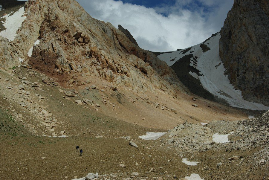
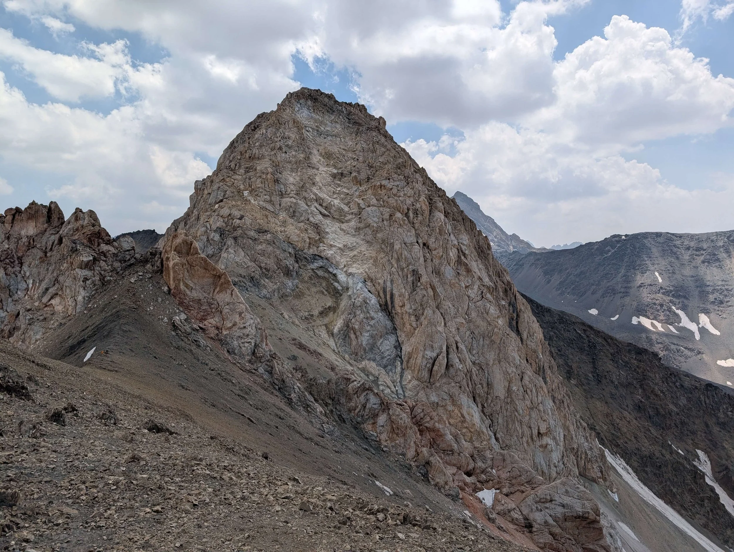
Image above: Vinokurov, 27 July 2010, from a very heavy snow year. View from the western side of the pass. Note that what you see directly ahead is the southern saddle of the triple saddle pass - but it is not the pass you will go through (due to longer lasting snow in the shade and a steep drop on the opposite side). The actual pass is out of view to the left of the sharp rocky ridge in the far background.
Upper Chapdara Pass is snow free sometime in July (it varies from year to year). But in 2021 and 2022 the pass was snow free by the first week of July. Going earlier than July requires crampons and an ice axe due to the steepness.
If you want to check the amount of snow on the pass, you can view the twice-a-week updated Copernicus satellite imagery at this link. As of 2025, this is the only free and easy way to see updated imagery. You can select dates in the browser, but there is no guarantee the view won’t be blocked by cloud cover.
Name: This pass is not used by shepherds, and therefore the name does not exist in local usage. The name was coined by Soviet mountain climbers. If you say “Chapdara” at Hazorchashma lake, they will understand this as the left tributary river/gorge to the lake (in Tajikistan, the left tributary is the opposite of European usage, so it’s the right tributary to European cultures, and the left to people in Tajikistan). Saying Chapdara on the east side of the pass will likely get a confused response. Just say you are going to “Haft Kul” (Seven Lakes), and then explain that you are not interested in going over the far easier and lower Tovasang Pass (the shepherds’ route to Haft Kul).
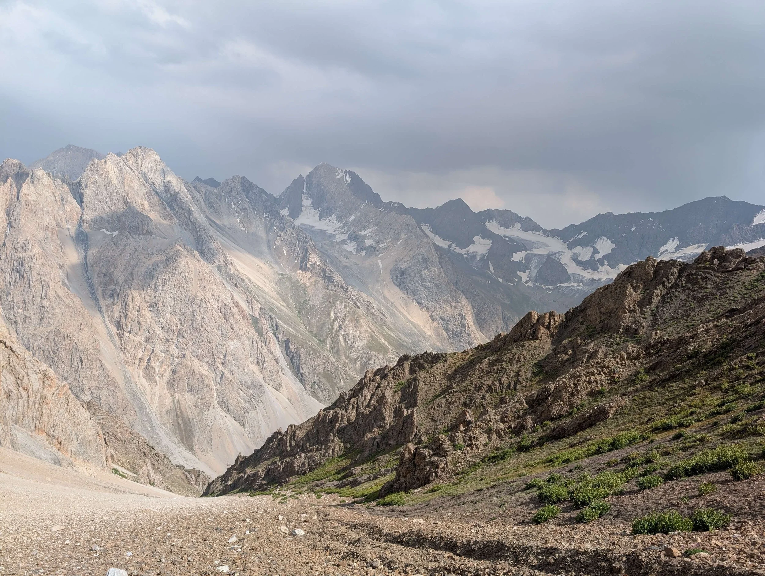
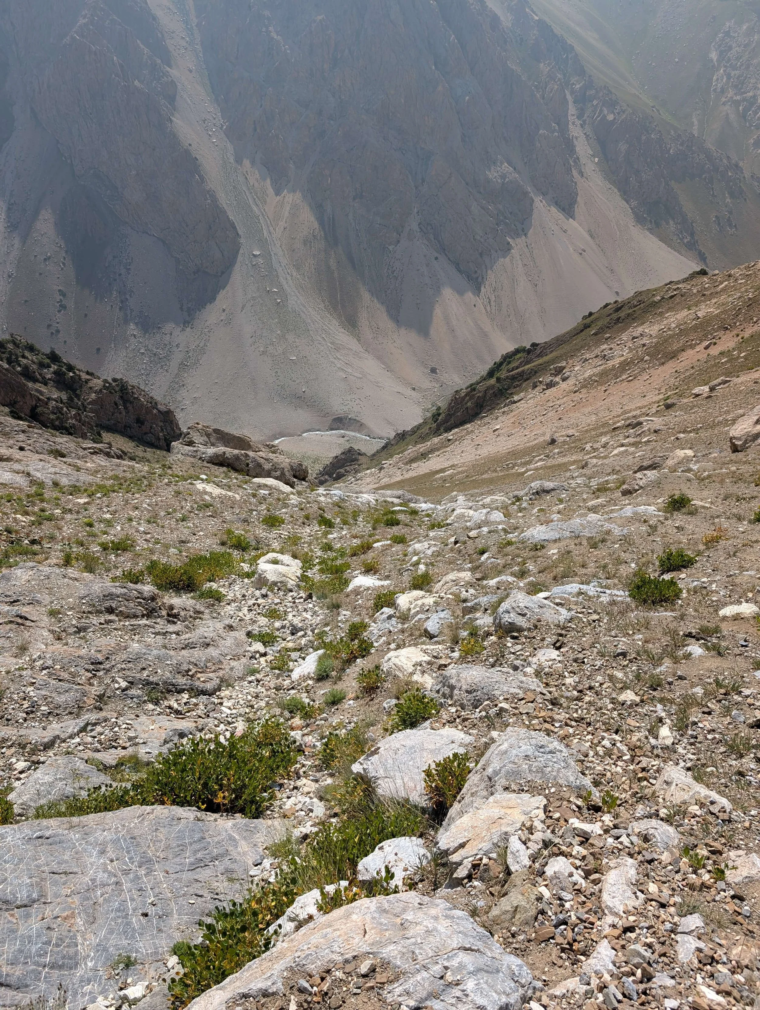
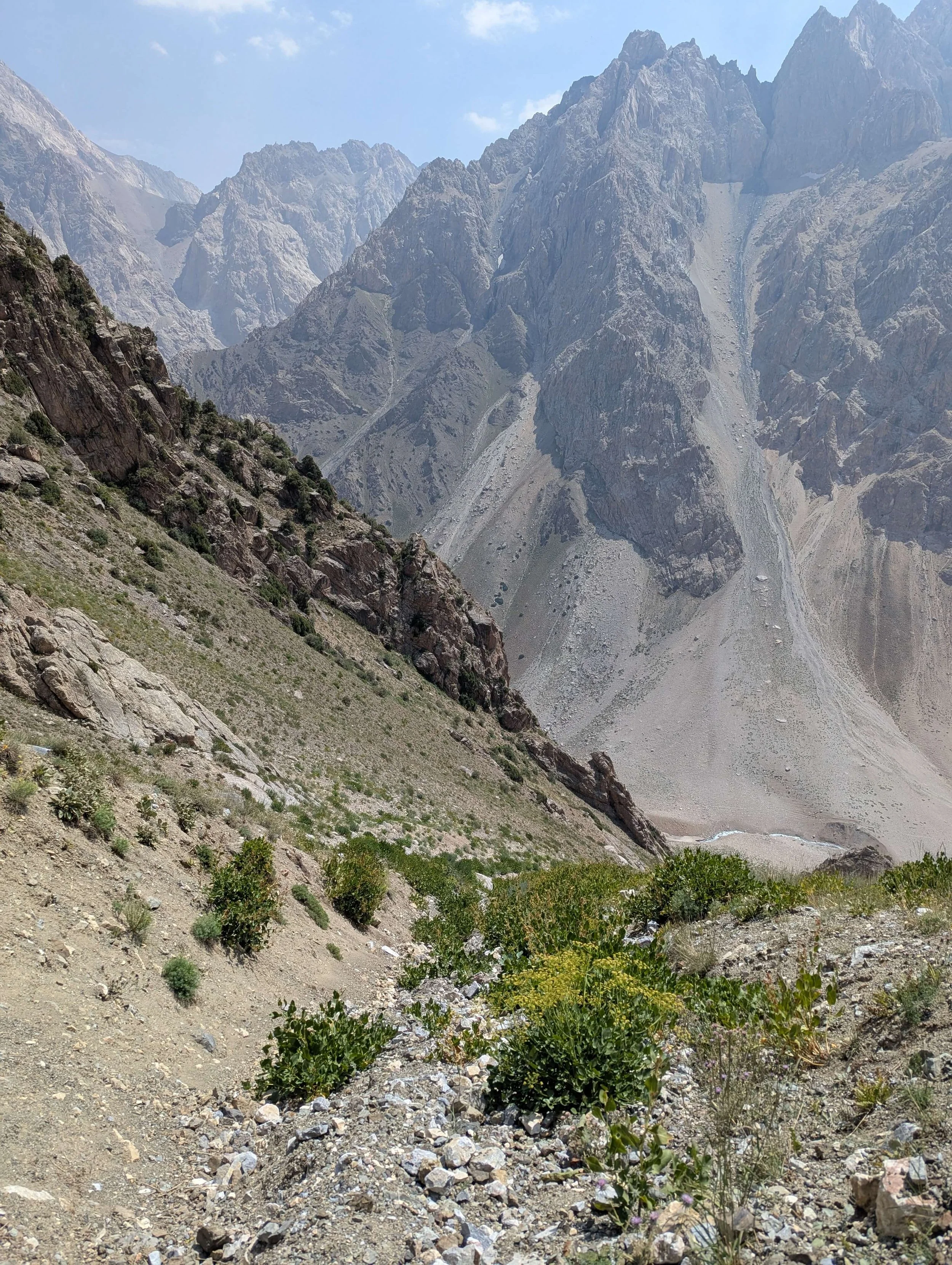
The Approach: On the east side there will be no trail as you start from the Kaznok-Ishan (Upper Sarmad) river (choose your own crossing – upriver should present some easy areas to cross). At the lower altitudes of the ascent there will be livestock trails going in various directions, and eventually you will be on rock and scree, free to choose your own route. The route as marked on the OsmAnd map app is not a strict route – you may choose whatever works for you (e.g., if there is snow that you want to either avoid or walk on top of). On the west side the livestock trails in the gorge will fade away about about 3300 meters.
Water: there are not enough reports to say for certain what access to water will be like when you go. On the west side the highest guaranteed water source is a spring at 3080 meters. After this you will likely need to search for small springs, tiny streams or snow/ice melt. It’s best to carry as much water as you can to be safe. On the east side there is an intermittent stream that dries up sometime in the summer. It’s best to fully stock up on water from the river at the bottom unless you can see water flowing in the gorge that leads up to the pass.
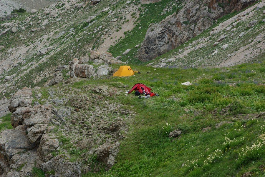
Camping: the east side is very steep and rough. But the Vinokurov (2010) group found a good camping spot on the east side at 3420 meters (image left/above). On the west side I can’t say for sure, but the Vinokurov group made it up from the 3420 meter camp and down the other side in one single day to a good camping site at the bottom of the gorge at 2790 meters. Above this the gorge on the west side is not too steep, so it may be possible to find a spot to camp as high as 3600 meters.
Shepherds: There are no visible shepherd camps on the east side until you are at the bottom along the main river. Vinokurov (2010) saw only yaks grazing (yaks are left on their own to graze, so no shepherds). On the west side the last patch of grazable grass is at about 3600 meters, and the highest shepherd camp is at 2960 meters, and with a temporary overnight shepherd high camp at 3320 meters. These are visible on the OsmAnd map app, but usually not on other apps as they don’t show farm and livestock infrastructure and features.
Area Names: I was in this area in the first week of June and was unable to go up high due to snow, so I haven’t been able to confirm names of rivers/gorges or find out the names of the main shepherd camps.
On the east side the main river is featured on some maps as “Sarimat” (Sarymat in Russian spelling, or Sarmad in its local Tajik naming), but an old Soviet guide to the Fann mountains show the upper river where the ascent to the pass starts as “Kaznok-Ishan.” I doubt the gorge that leads up to the pass has a name.
On the west side as you leave Hazorchashma lake the river/gorge is called Chapdara, but at some point up high the name will change. Old Soviet maps show the upper part of the river as “Darakhtisurkh” (literally: Red Tree), a nonsensical name for a river in Tajikistan. The true name is likely an old Soghdian name: Daragisurogh. Which name is used is unclear, as is the point where the name change occurs. Once you leave the Chapdara/Daragisurogh gorge, you will be in the smaller gorge with the name “Syagrik.” This name is sourced from an old Soviet tourist map, and is also unconfirmed. Also, I doubt its spelling is correct.
Also, to repeat what I said above, Chapdara pass is not used by shepherds, therefore it has no name. Chapdara is a name given by Soviet mountain climbers.
Note that about 50% of geographic names on the mountain sections of the available maps (almost all sourced from old Soviet military maps) are incorrect. The process of correcting them will never be completed. When talking to shepherds, the safest thing to say is your destination (the name of a village or sub-region).
Technical difficulty: The pass has a 1A rating on the Russian/Soviet alpine grading system. That means easy and safe (for mountain climbers) once the snow is melted. In a plain description, this is more difficult that a clear easy trail, but is not so difficult that you will be in any place where a fall is deadly. However, there are – both near the top of Chapdara and Upper Chapdara Pass – sections where you may need to do some scrambling (very easy and safe climbing) when the cornices are blocking the low part of the saddle. Note that the most recent report disagrees with this easy technical rating (read report at bottom).
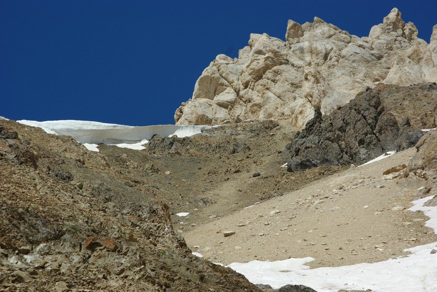
The Image left/above is taken from the east side of Upper Chapdara Pass (Vinokurov, 2010). This was a very heavy snow year and large cornices blocked the two passes. The group went to the right (north), up and around the cornice. You can see what looks like a trail - a lighter colored track between the snow and the black rocks. This may be from ibex passing through (but not from shepherds or domestic sheep).
Dangers: An early season visit will involve walking up/down and across steep snow fields, and a fall could be fatal without crampons and an ice axe. One group of climbers noted that they wore helmets when doing the steep couloir leading up to the lower Chapdara Pass from the east side due to worries about knocking rocks down the steep slope onto team members below. The Upper Chapdara Pass, based on the Vinokurov report, doesn’t seem to have rockfall danger.
The lower Chapdara Pass does, in some years, has a difficult cornice that remains well into the summer. This may block your path. If you approach from the east you will be able to see this from below and make your decision whether or not to go towards the higher Upper Chardara Pass or not. When approaching from the west, you will not (due to the wind direction that shapes the cornice) be able to see how much cornice remains until you are at the top, standing in the lower Chapdara Pass.
GPS tracks: generally we do not provide GPS tracks on this website (as we instead edit Open Street Map data and recommend you use the OsmAnd map app on your phone). But the area around Chapdara Pass is one of a small number of areas in the mountains with some topographical map mistakes/distortions. Some maps are using an extremely distorted and incorrect topography for the immediate area (with up to 300 meters of “disagreements” between various maps). So to be safe (if you don’t use the OsmAnd app or a map sourced from OSM data) you can follow the route of Vinokurov (2010) through the Upper Chapdara Pass: GPX file or KML file. Note that this is the GPS track for the group’s entire route in the Fann Mountains.
Reports: Three available reports are in Russian, with one in English further down the page. Vinokurov (27 July 2010) is online and you can Google translate it. The other two reports are in PDF. Lobanov’s group from St. Petersburg State University went through the lower Chapdara Pass east to west on 10 August 2011. Their report is available at a link on this short summary page or with a direct link to the PDF (a 90MB PDF file). They reported the need to scramble up and over up a rocky step, and warned of rockfall for groups that are spread out.
Smirnova’s group from Moscow used the west side of Chapdara Pass as an acclimatization hike, and then returned the same way without descending to the east side. The report is a 25MB PDF file. However, they went to the far southern saddle, which was not used by either of the two groups mentioned here.
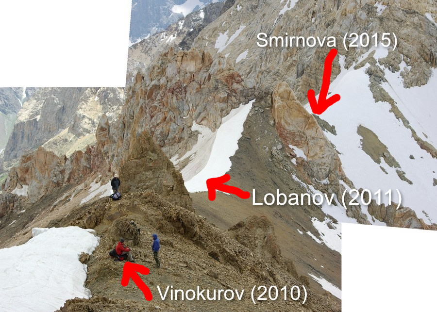
The image above, taken by the Vinokurov group (2010), is from the north looking south. The three people are standing in Upper Chapdara Pass. In the distance, lower down, are the two lower saddles of roughly equal elevation. The far southern-most saddle (Smirnova 2015) should not be attempted by a hiker - the snow and cornice will remain here much longer into the season thanks to the shade from the mountain behind it. The middle route (Lobanov 2011), when there is still a cornice, should only be attempted by a hiker coming from the west side (easy to look through the pass once on top and determine if its better to go up to Upper Chapdara Pass). If you ascend from the east and find that the lower Chapdara Pass is blocked by a high cornice and you don’t like the looks of how difficult the scramble up the rocks are, you will have to go back down quite a ways to head over to Upper Chapdara Pass.
On Open Street Map data the Vinokurov route is Upper Chapdara Pass, the Lobanov route is Chapdara Pass, and the Smirnova route is an unnamed saddle to the far south.
In short: if approaching from the east, take the Vinokurov route to Upper Chapdara Pass (4115 meters). If approaching from the west in the early season, also head towards Upper Chapdara Pass, as the cornice here is smaller and easier to get around than in the lower Chapdara Pass (4060 meters). If it is late in the season and snow free, then the lower Chapdara Pass may be an option for a hiker (NOTE: see comments and a new report below that rule out a hike through the bottom far southern pass, but found that the middle Chapdara Pass AKA Lobanov route was the best choice coming from the west). Note that it’s difficult to give advice that is certain based on only three Russian reports from various times in the summer spread out over 5 years.
How long will the pass take?: This can’t be answered easily for several reasons. At about 4100 meters this may be a hiker’s first high elevation hike, which can greatly slow them down. And asking a person their level of conditioning is not always helpful, as some people in great physical shape can still go very slowly on technical rocky terrain. Can a hiker get from Hazorchashma Lake, through Upper Chapdara Pass, and down to the bottom of the east side (Sarymat/Kaznok-Ishan river) in a single day? I think an acclimatized hiker in good physical shape who does well in rough terrain can make it in a single day with an early start. For all others coming from the west, you may want to consider starting in the morning from a point higher than Hazorchashma lake.
2025 update: new pass report in English: A German-Hungarian couple hiked through Chapdara Pass in 2025 (Lobanov route) and sent in the following report:
Lower Chapdara Pass 4060 m – Fann Mountains – Tajikistan – Hike report
We (German-Hungarian couple) crossed the pass from west to east (from the 7th Lake of Haft Kul to the Upper Sarimat/Sarmad Gorge) on the 24th July 2025. Although we have some climbing experience, this report is written from a hiker’s point of view and we didn’t use any safety equipment for this hike apart from trekking poles.
On the west side, we camped at 3135 m. I added the campsite to OSM with photos. It is only a one-tent site, but our large three-person tent fit without problems. A second spot could be created if needed, though it would take some effort to make it flat and usable. Drinking water is available about 10 minutes downhill (the 3080 m spring is marked on OSM). Even though it would technically be possible to find flat spots at higher elevation, we didn’t find any water above this point during this stage of the snowmelt. To me, a camp without water isn’t a camp.
On the east side, we camped at the well-known 3420 m site, which is very scenic and located right next to a reliable water source (I also added the spring to OSM, as it provided abundant water even after complete snowmelt). Just like on the west side, there is no water higher up here either.
The 5 km distance between the two campsites took us almost 10 hours with a cumulative ascent of 1000 m. We are rather slow hikers, taking many breaks to enjoy the scenery, take photos, and fly the drone. Our backpacks were fully loaded with 12 days of food, and our gear is far from ultralight. Because our water filter had broken, we carried 2 kg of gas to boil water. The total weight must have been over 23 kg each. In addition, my girlfriend is relatively slow on steep downhill sections with loose scree. With lighter packs, fewer breaks, and faster downhill speed, someone could save 2–3 hours, but it would still be a very long and demanding day. In my opinion, it is not feasible to hike between Hazorchashma Lake and the Upper Sarimat/Sarmad Valley in one day. It is highly recommended to use at least one of the above campsites.
Regarding technical difficulty, the west side of the pass has a very gentle slope until about 3800 m. The terrain is straightforward to navigate up to this point. Beyond that, the slope becomes very steep (in places exceeding 70% or 35 degrees). The surface consists of loose scree and talus, making scrambling difficult. There is a clear risk of rockfall on both sides (on the east side possibly extending much lower, even under the 3420 m camp), so it is important to stay close to other team members. The east side is even steeper, and although the terrain changes from scree to large rocks and later mixes with some vegetation, the steep gradient continues almost to the valley floor. Descending with heavy backpacks was very challenging. Crossing this pass is probably easier in the east-to-west direction. Either way, a good option is to follow the dry riverbed between about 3000 and 3200 m, where scrambling on the firm rocks is much faster.
Hikers should not rely on Russian climbing grades, because the 1A classification could be misleading here. In my opinion, the technical difficulty is not comparable with other 1A passes, such as Dugdon Pass. There is no trail, and this should not be a hiker’s first technical pass. A fall with a heavy backpack would be fatal on this steep slope, as self-arrest is very difficult on this type of terrain.
Due to the unusually hot early summer weather (locals spoke about exceptional heat), we did not encounter the snow cornice problems described in previous reports. In fact, we did not find any remaining snow worth mentioning on any part of the pass. As a result, we could choose freely among the three saddles.
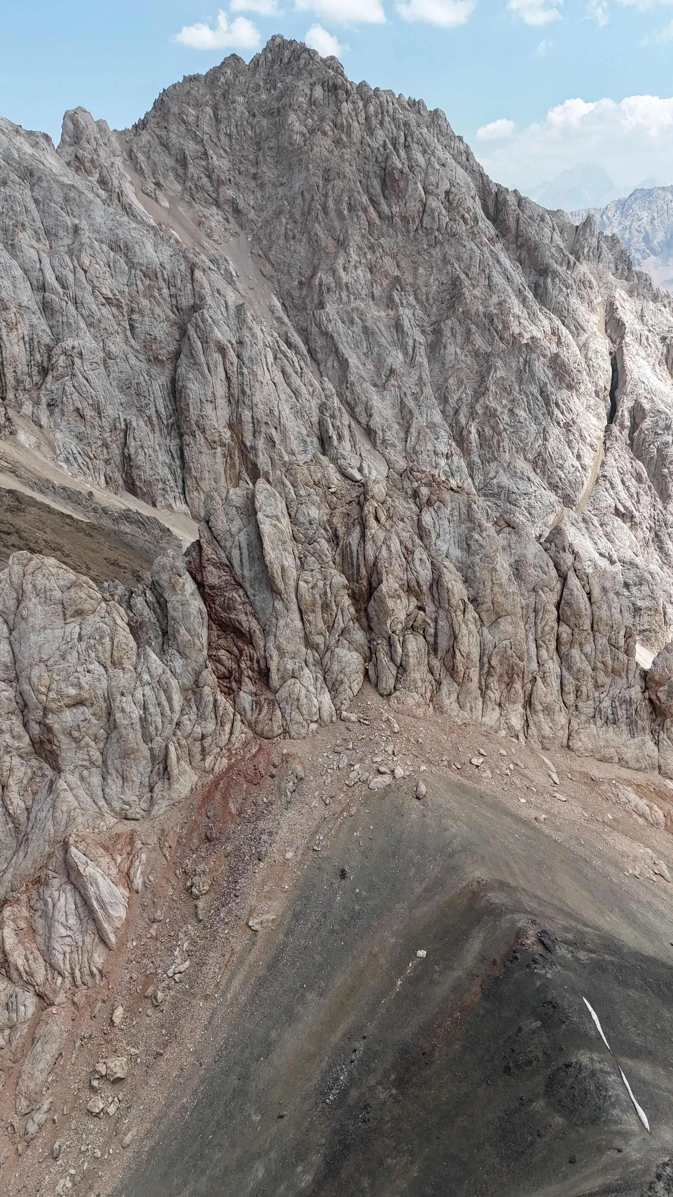
We did not find it necessary to ascend an additional 50 m to the Upper Chapdara Pass, where the best uphill route wasn’t obvious anyway. At first, we attempted the far south ridge, but soon realized it was not a good idea, as it was even steeper than the other two routes marked on OSM. At some point, we traversed north and connected with the route of the Lower Chapdara Pass. On the south side of the gorge, we encountered some larger rocks that were more suitable for scrambling (unfortunately partly loose as well). The best possible route with these rocks is clearly visible on some of the attached photos.
On the saddle, hikers should follow the ridge north (according to the OSM track) and descend where the route connects with the Upper Chapdara path at lower altitude. Descending the on the east side in front of the arrival point from the west side would be more technical and not recommended for hikers.
The 2025 hikers have provided numerous photos from Chapdara Pass (below).
Last updated: 4 October 2025
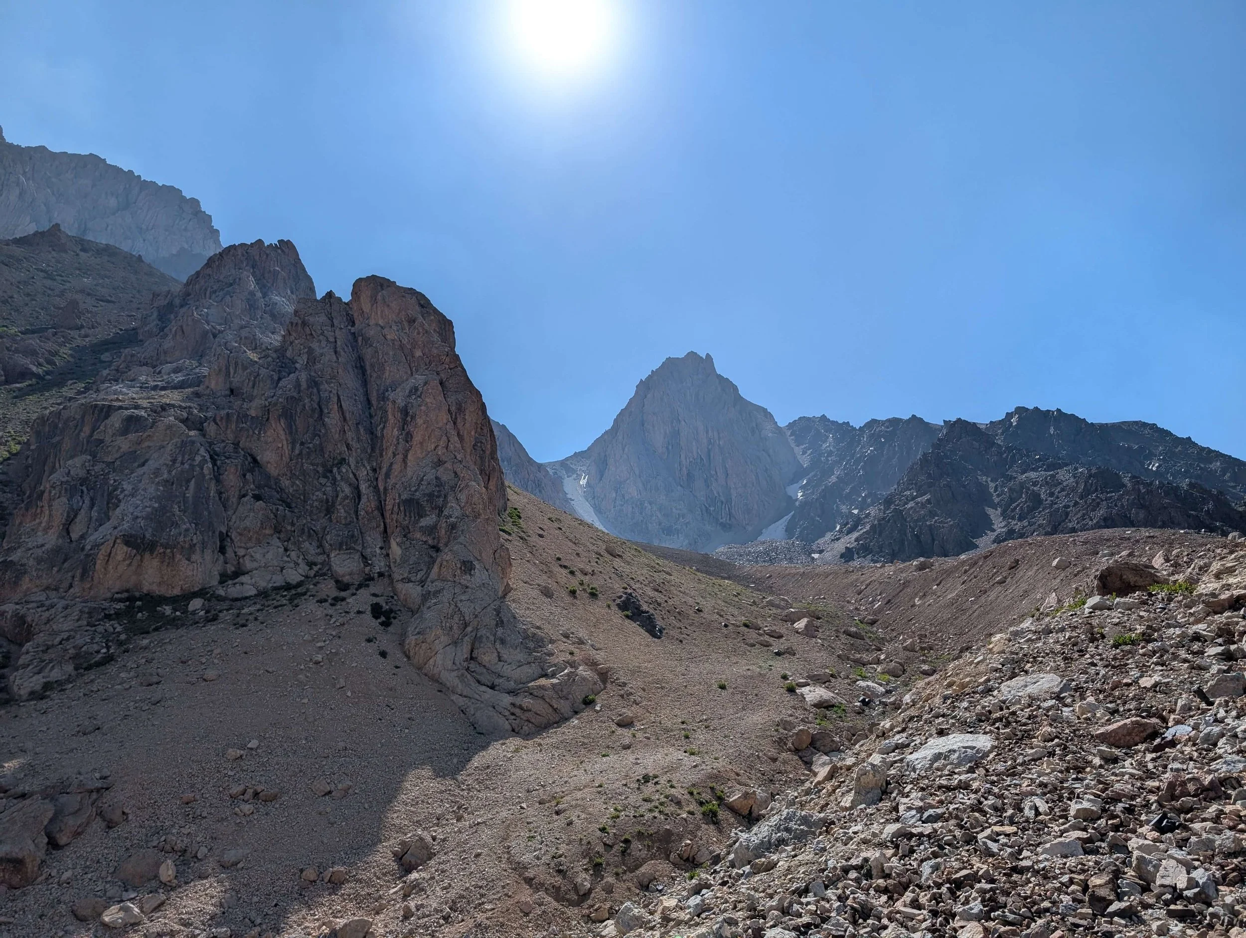
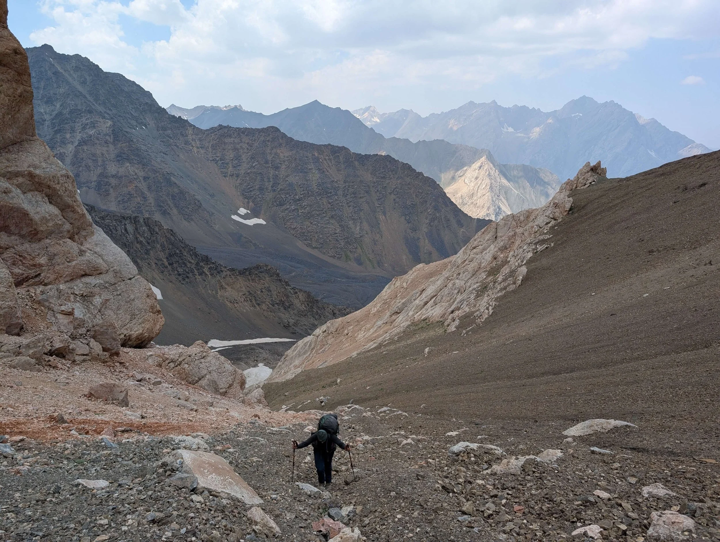
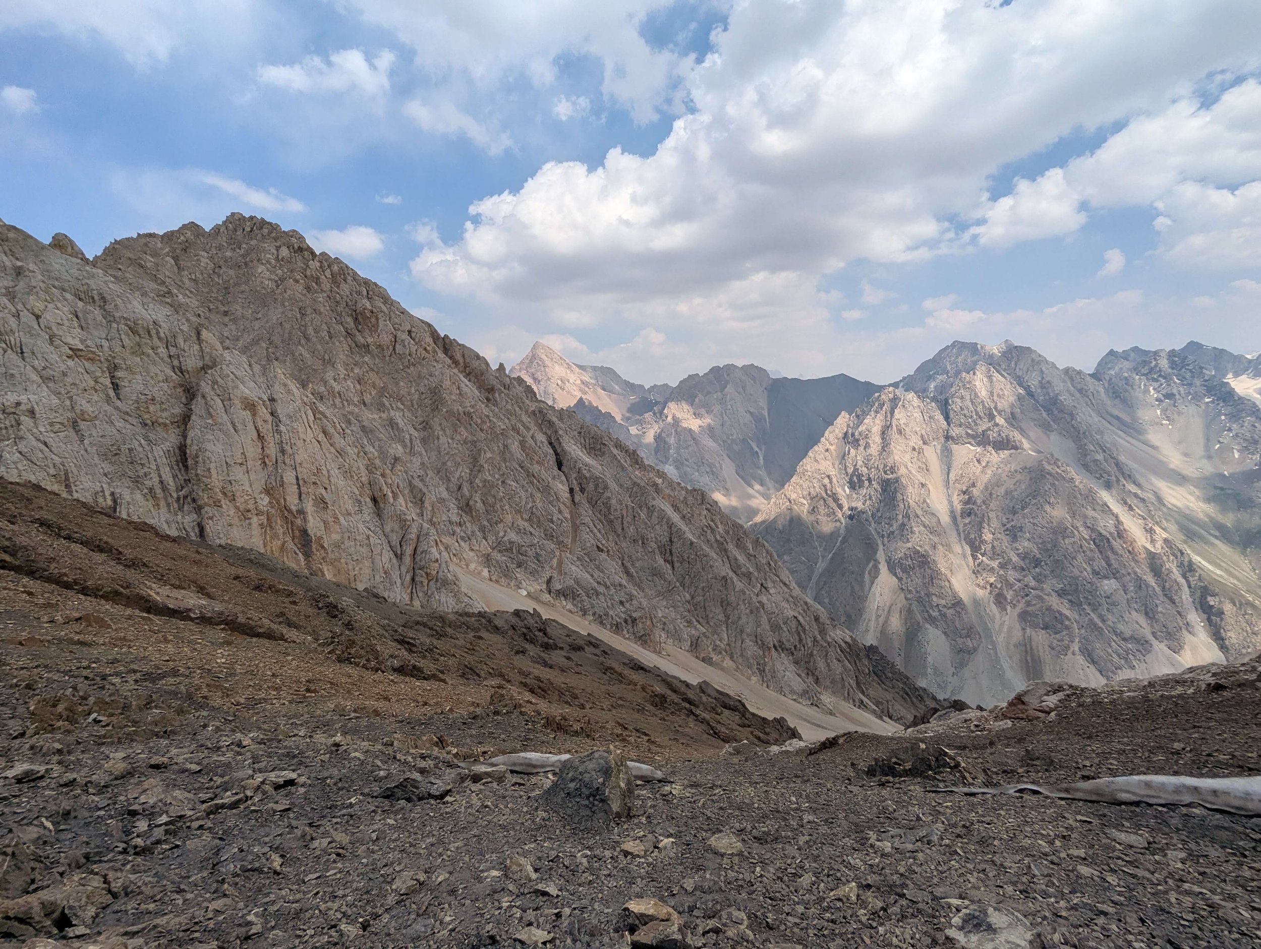
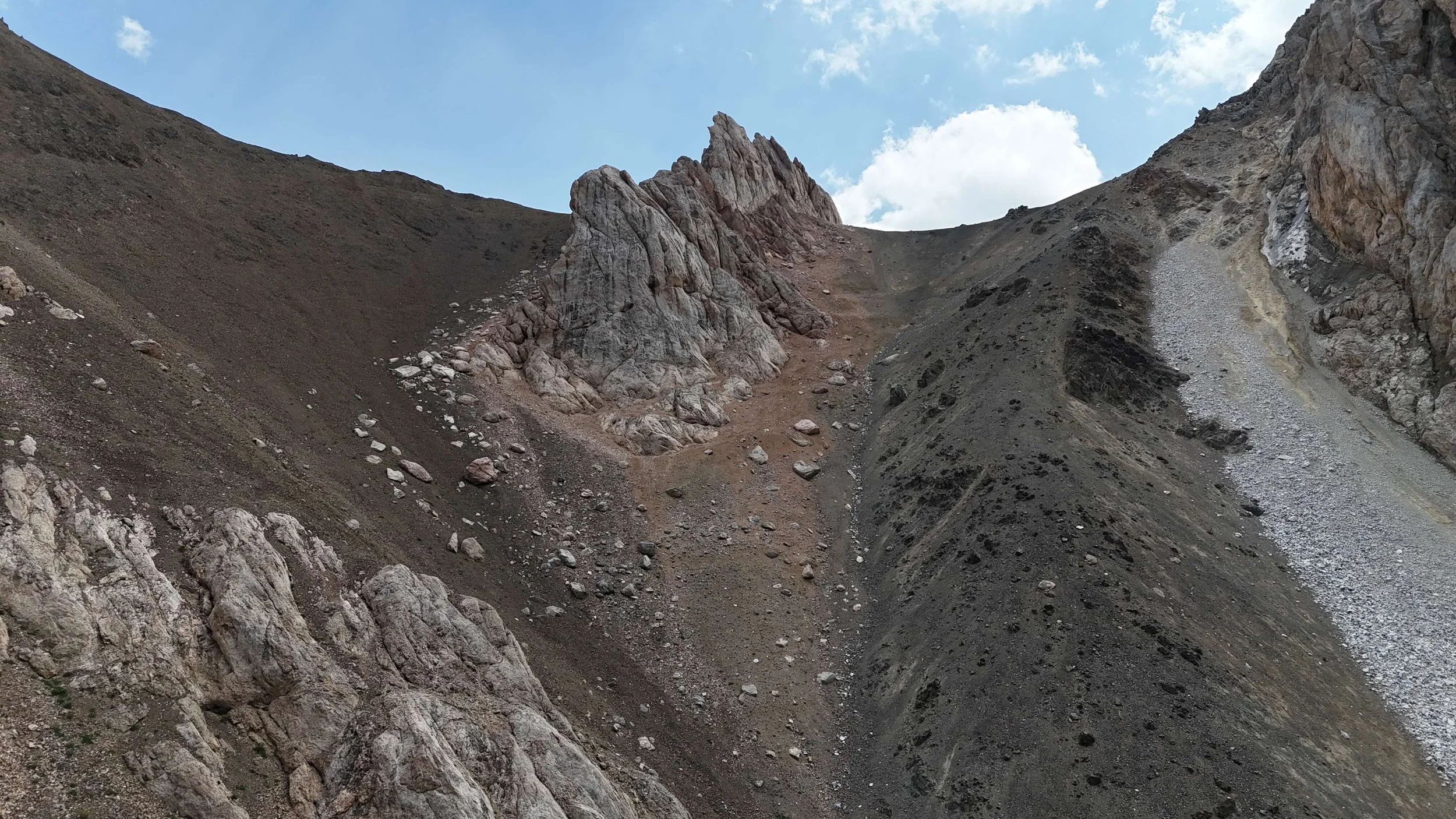
Approach from west - 3500m
Approach from west - 3500m
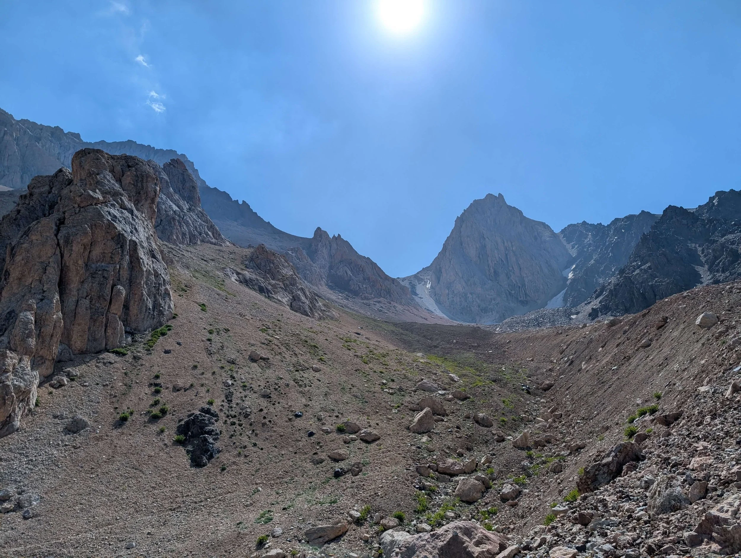
West side -3825m
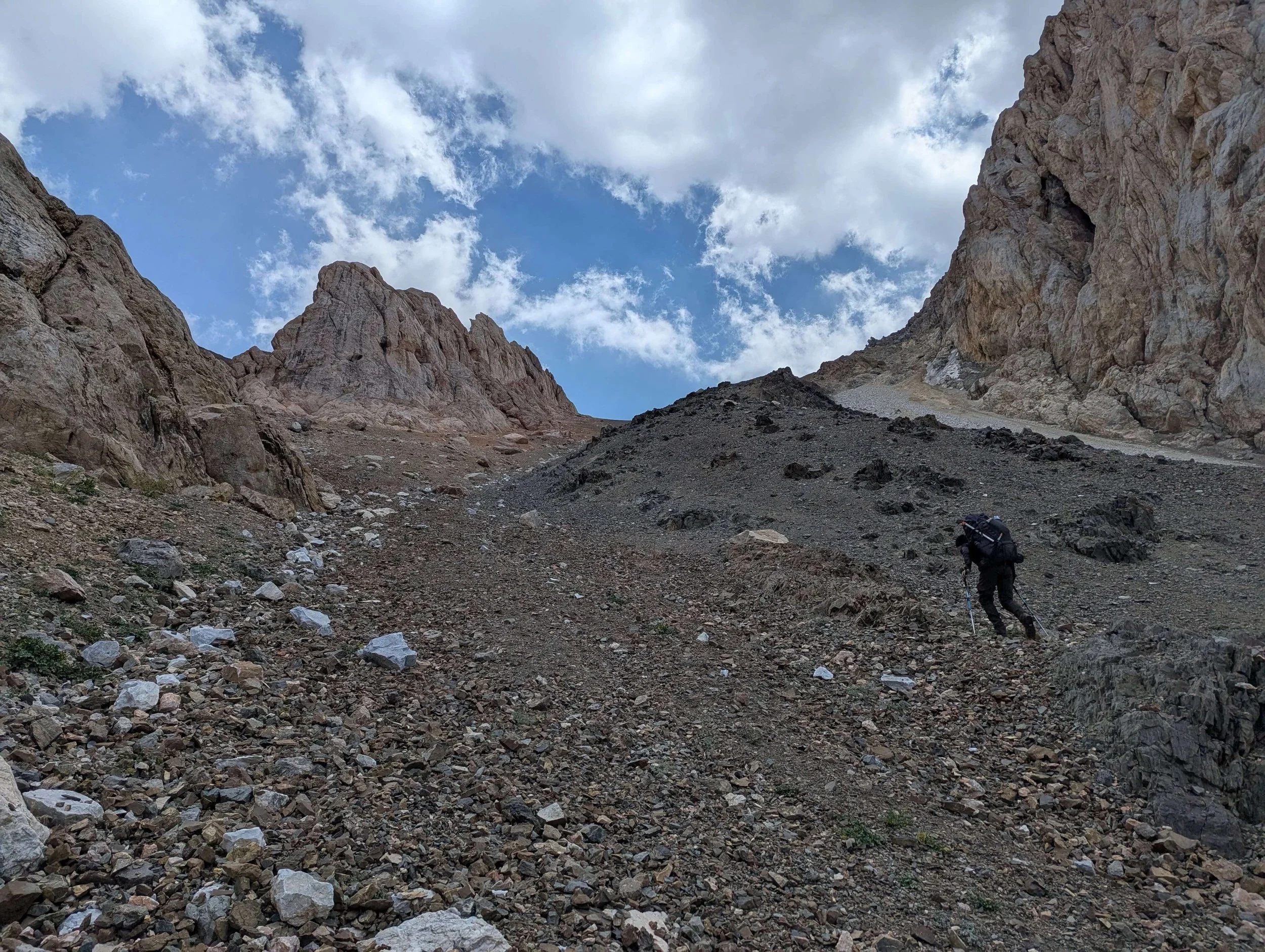
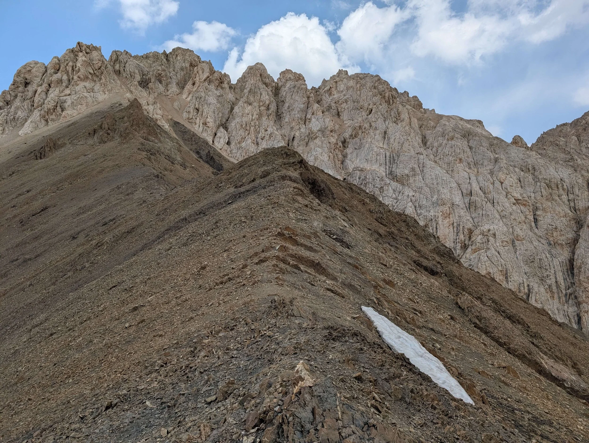
Final ascent looking back - 3940m
Final ascent looking back - 3960m

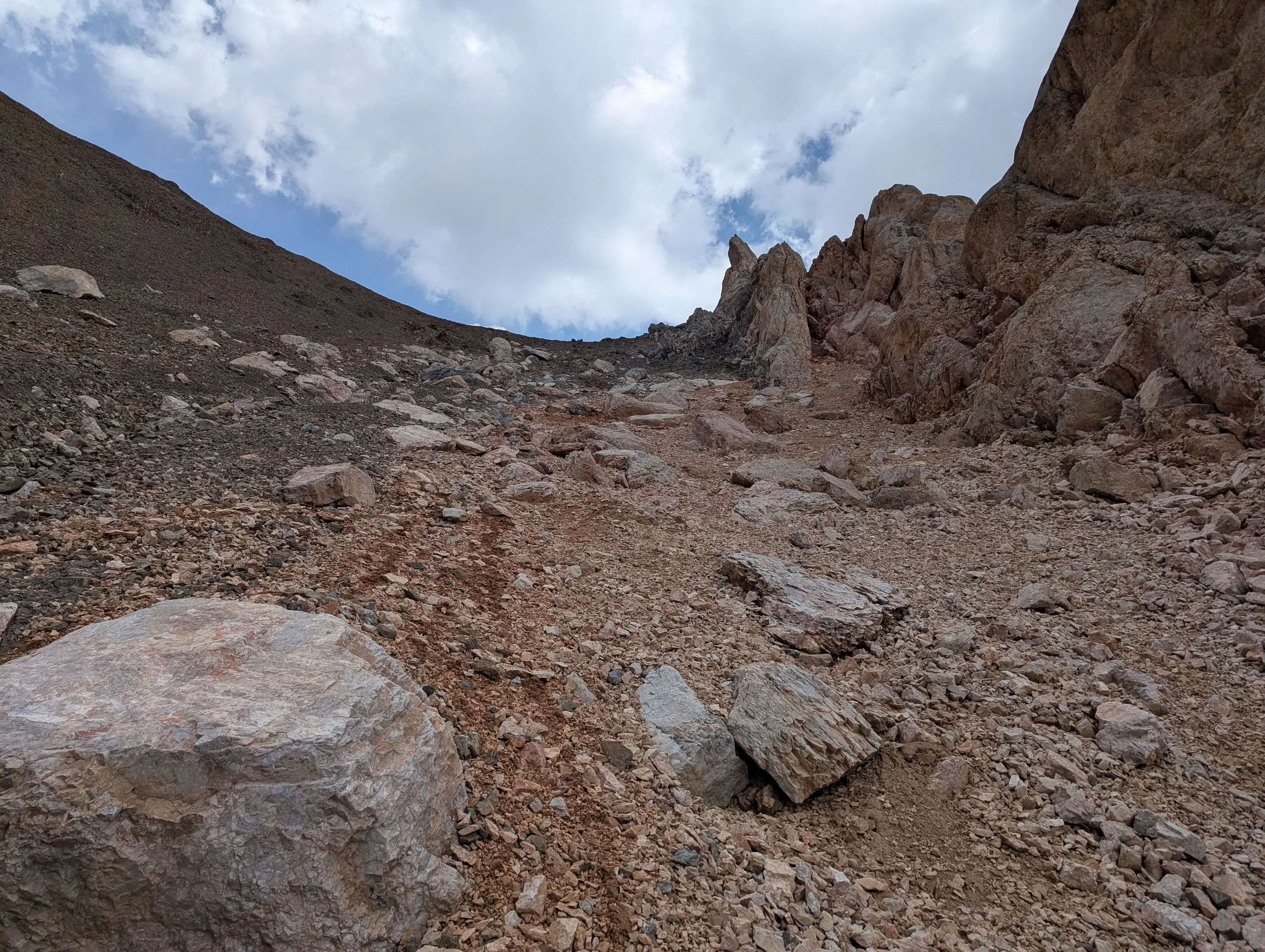
Rocks for scrambling on the right 3950m
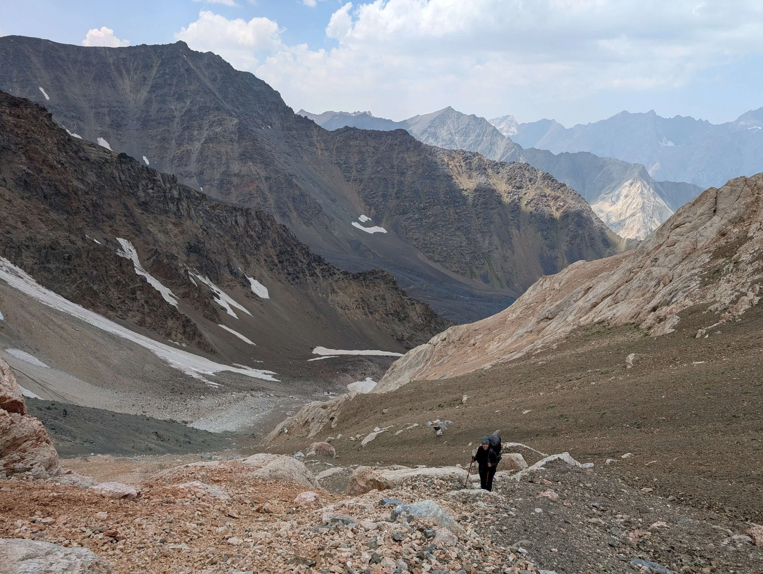
West side looking up
West side looking down
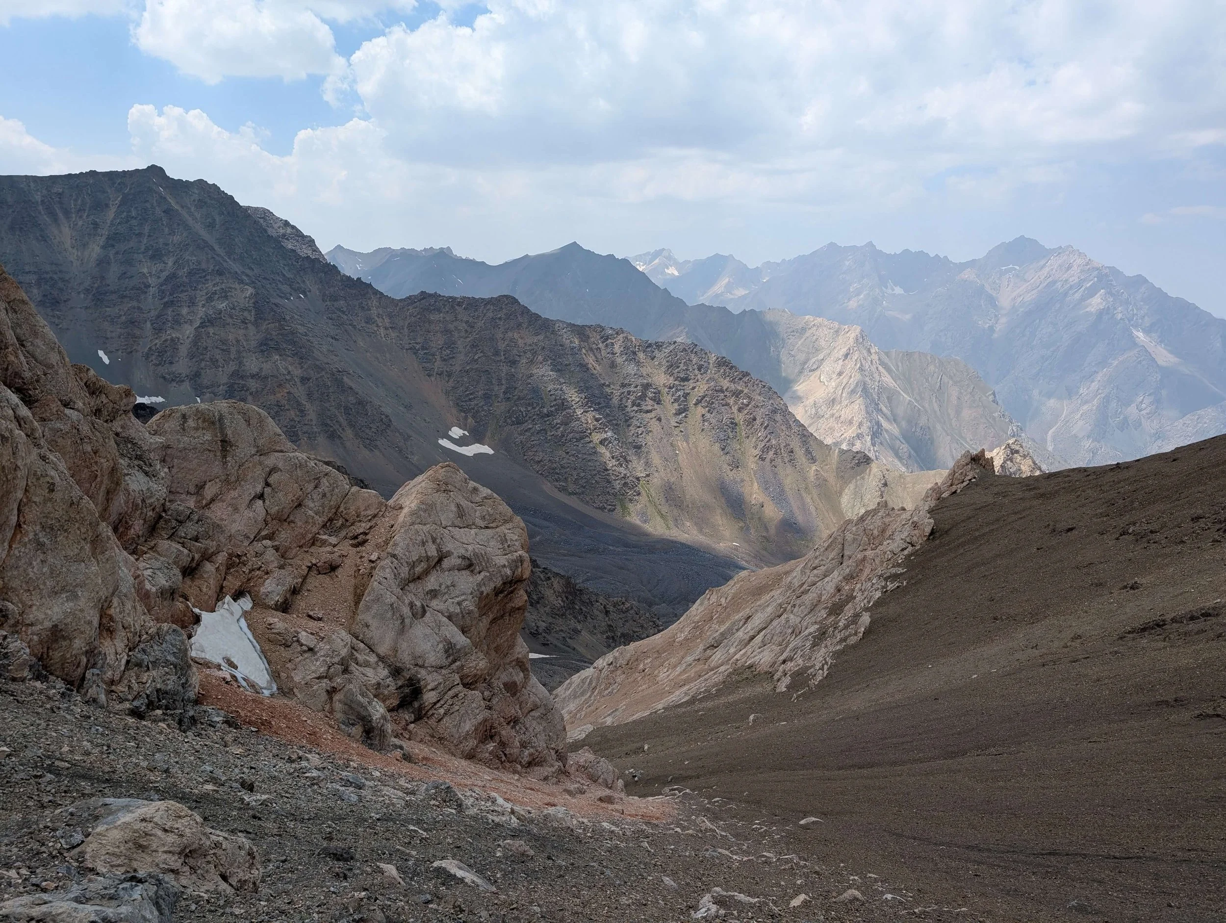
East side - not much snow left
East side - do not go down here
On the pass - follow the ridge north
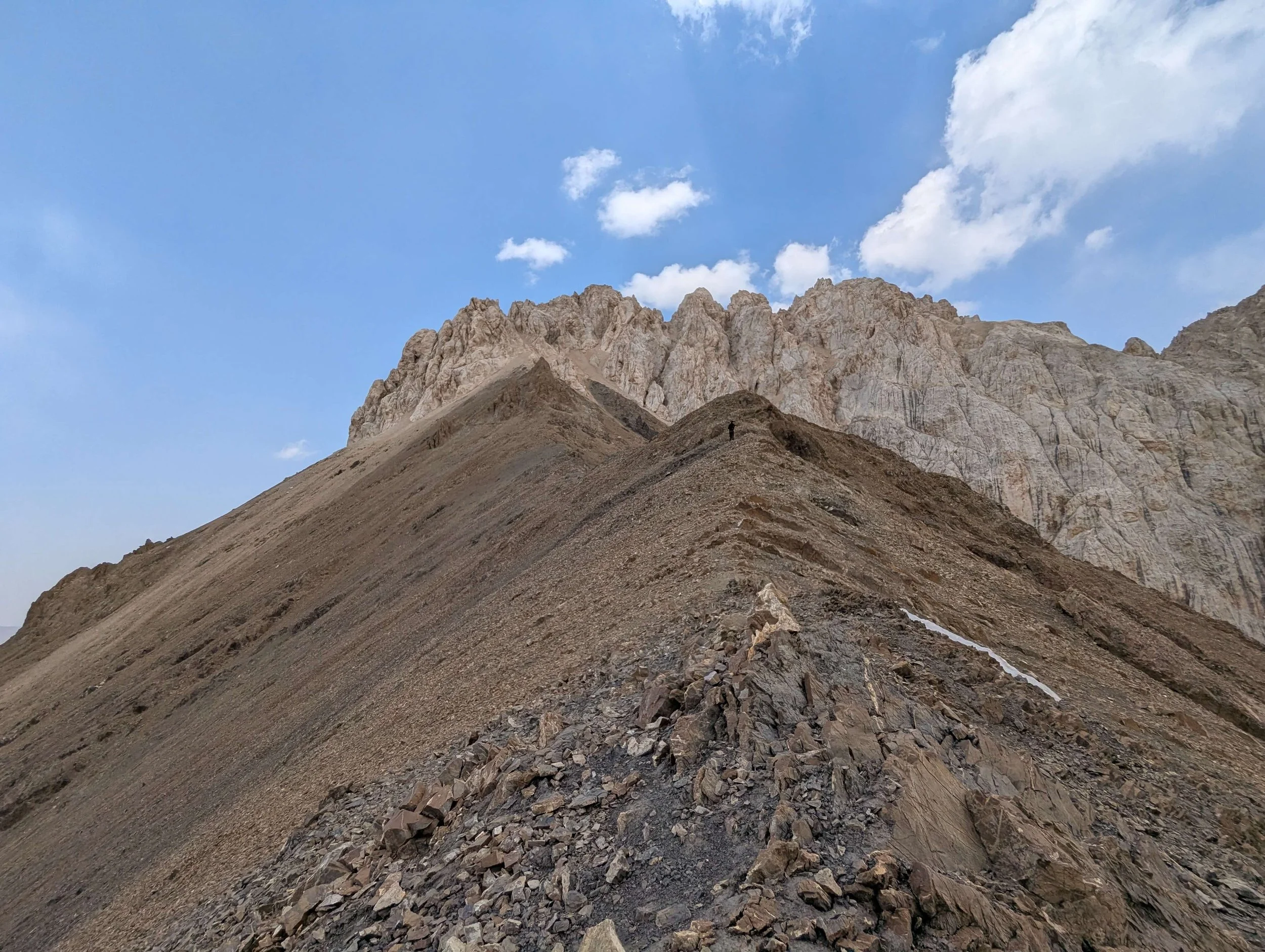
On the pass - looking north

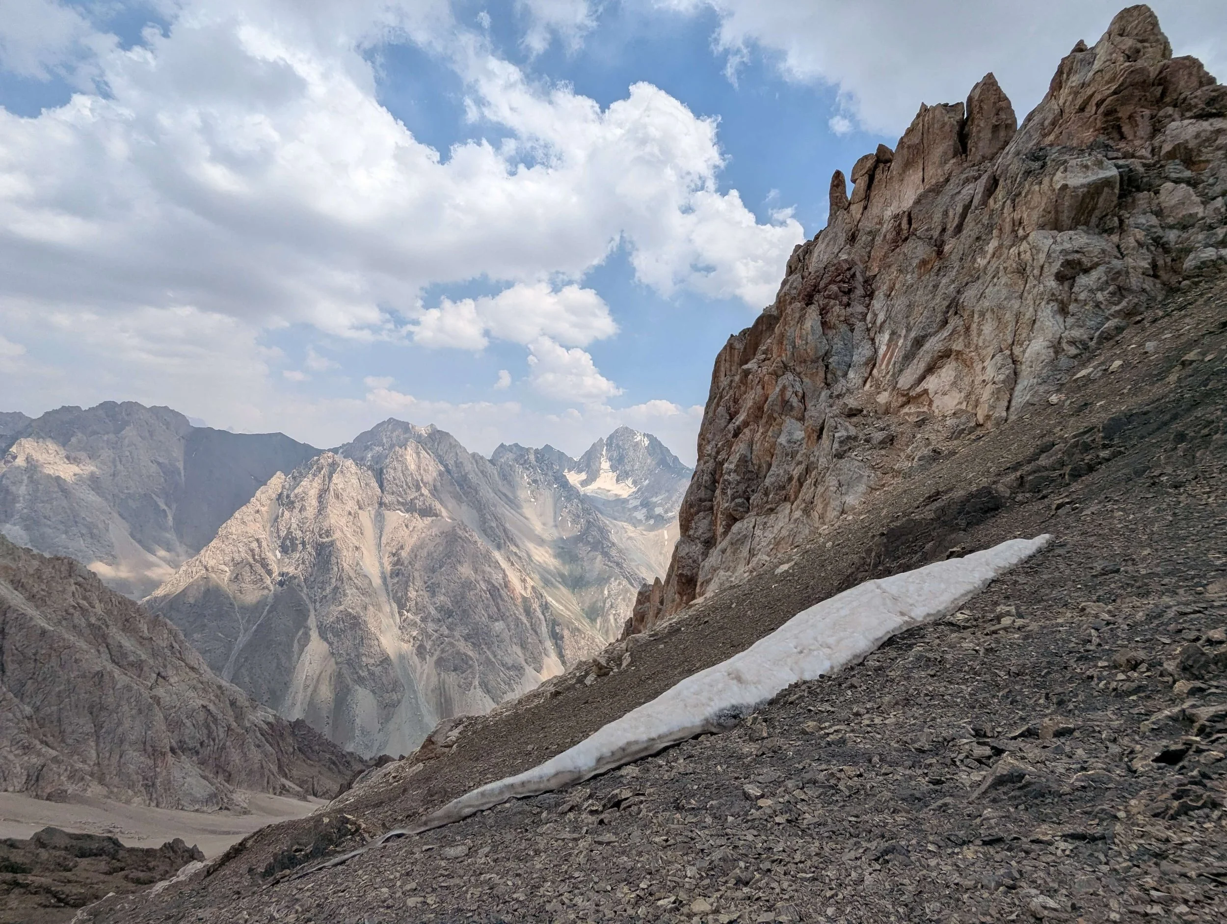
On the pass - looking south
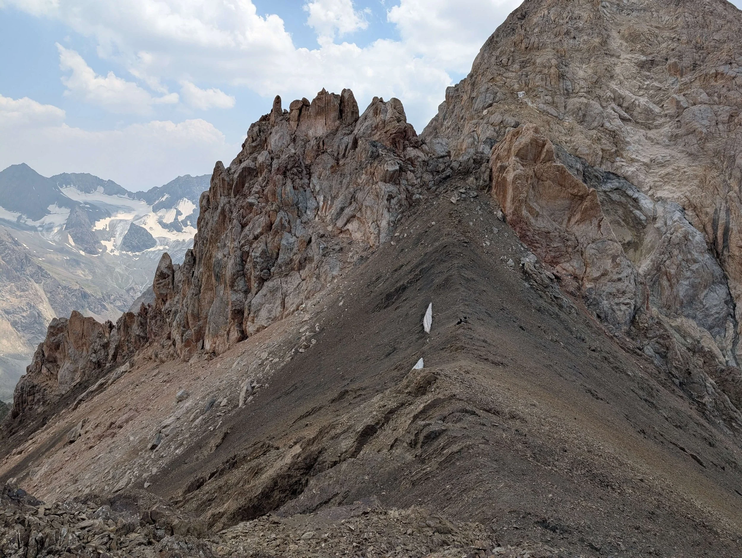
On the pass - looking south

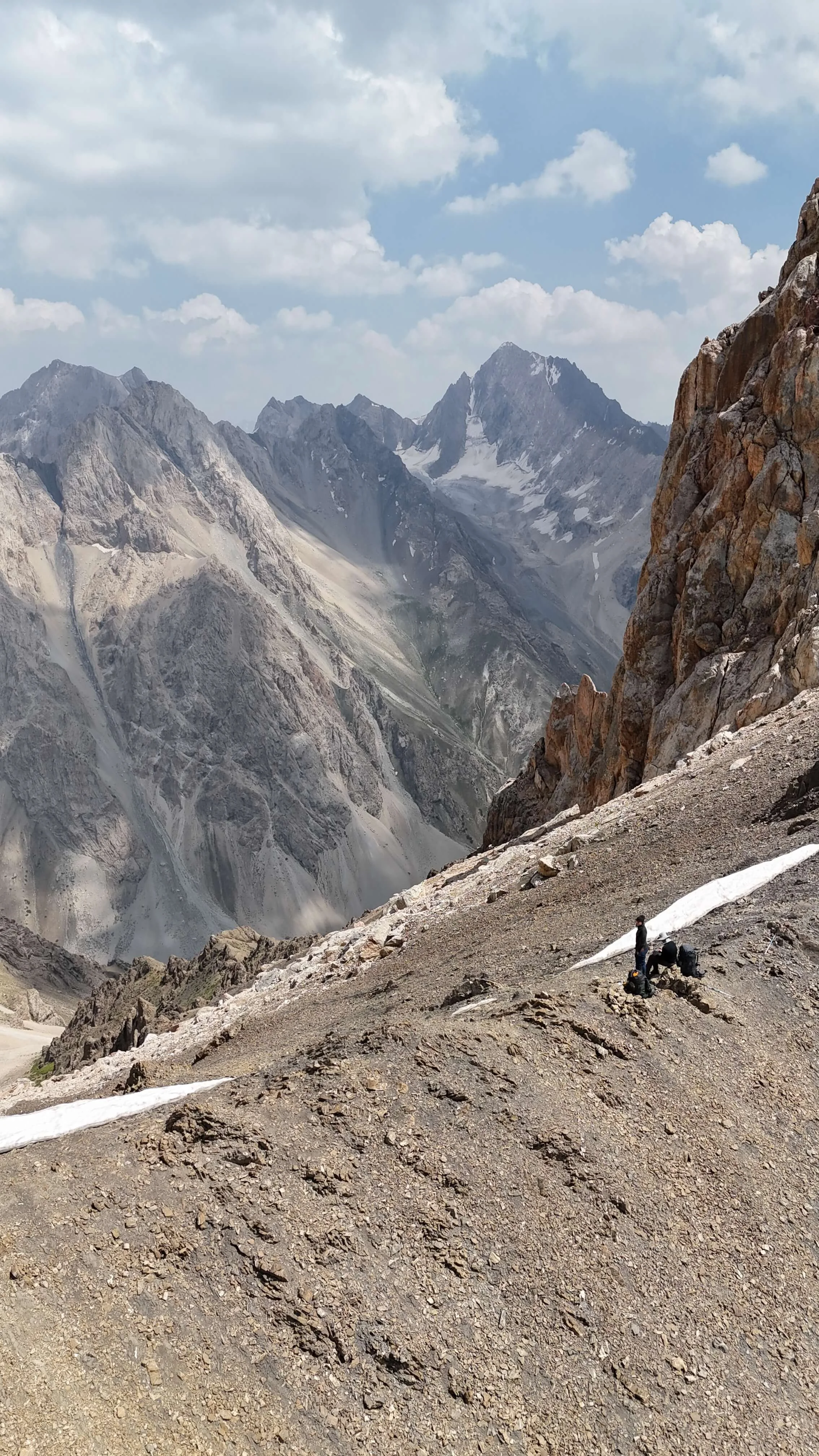
View to south-east

View to south-east - descend here to the left

View to south-east
View to south-west - came up from the right

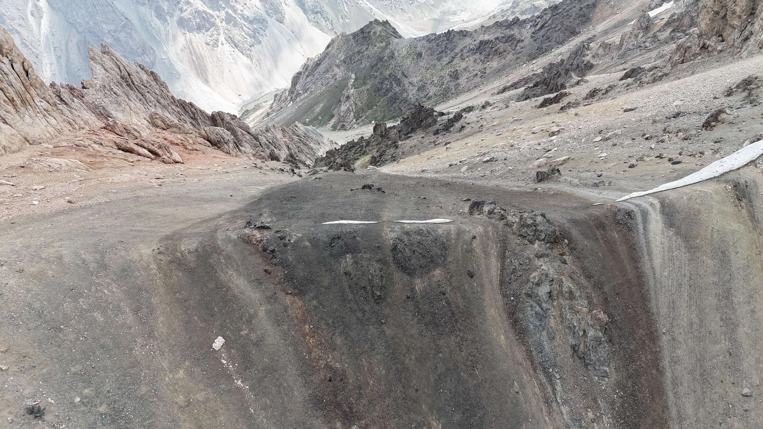
East side - descend route

East side 3936m

East side - looking up
East side - route on the left - 3800m

East side - 3650m
East side - 3300m
East side - loose rocks with some vegetation - 3180m

East side - easy scrambling in dry riverbed - 3000m
West side of lower Chapdara pass on the left

West side of far south saddle on the right - too steep
Far south saddle - looking east
On the top of lower Chapdara pass 4060m

East side of the far south saddle - rappelling down only
Far south saddle - snow free in late July 2025