Tobacco Root High Route
Tobacco Root High Route
Beaverhead National Forest, Montana
This route in the Tobacco Root Mountains was done as part of the Vasquez-Hudson Route from Mexico to Canada. It works quite well as an alternate on the Big Sky Alt or the Butte Super Cutoff - alternate routes on the Continental Divide Trail.
Note that according to linguists (Harvard Dialect Survey) there is no standard American pronunciation for "route," in this area, so you can pronounce "route" to rhyme with "root" or "out and about."
"Tobacco Root High Route" is my name, to differentiate the lower route through the Tobacco Roots that CDT hikers are doing (via North Meadow Creek Road from McAllister). Many others have been through here, but almost nobody has posted a report. There is a higher route done in 2015, "Tobacco Route Traverse," that includes long sections of class 4 scrambling. You don't want to do that. It's basically climbing for the average thru hiker. More info here and here. Note that they did it with small day packs and drove in and drove out of the mountains.
These hikers/climbers noted that a route through the Tobacco Root Mountains could be reduced to an easy class 3 scramble by avoiding Branham Peak. I took that advice, and also removed Mount Bradley from my route based on their photos.
The miles through the Tobacco Root High Route will be slower than hiking on a mountain trail. There is a limited amount of easy safe scrambling, and some off-trail open terrain that can be slow. The high route ends at the Lost Cabin Lake bottom trailhead, but I’ve continued the GPS track and waypoints to Highway 55. From here you can continue on with the various CDT alternate routes.
Wildlife? The usual deer and elk. I saw pronghorns below and one solo male mountain goat, and I saw a massively huge bear scat in South Fork Mill Creek - huge considering that there supposedly are only black bears here. Once home I googled the grizzly situation here and found out that in summer 2024 the first grizzly was confirmed in the Tobacco Roots: Youtube link.
Just give me the GPS file…
You can view the route on the Caltopo map here.
GPS files:
This area looks best when viewed with a Forest Service map base layer. But the roads are inaccurate and the trails are very, very inaccurate on that map. Stick with my GPS track unless you have time for exploring. I’ve edited this area as much as I could on Open Street Map, so the trails and roads that are actually there should now show up far more accurately.
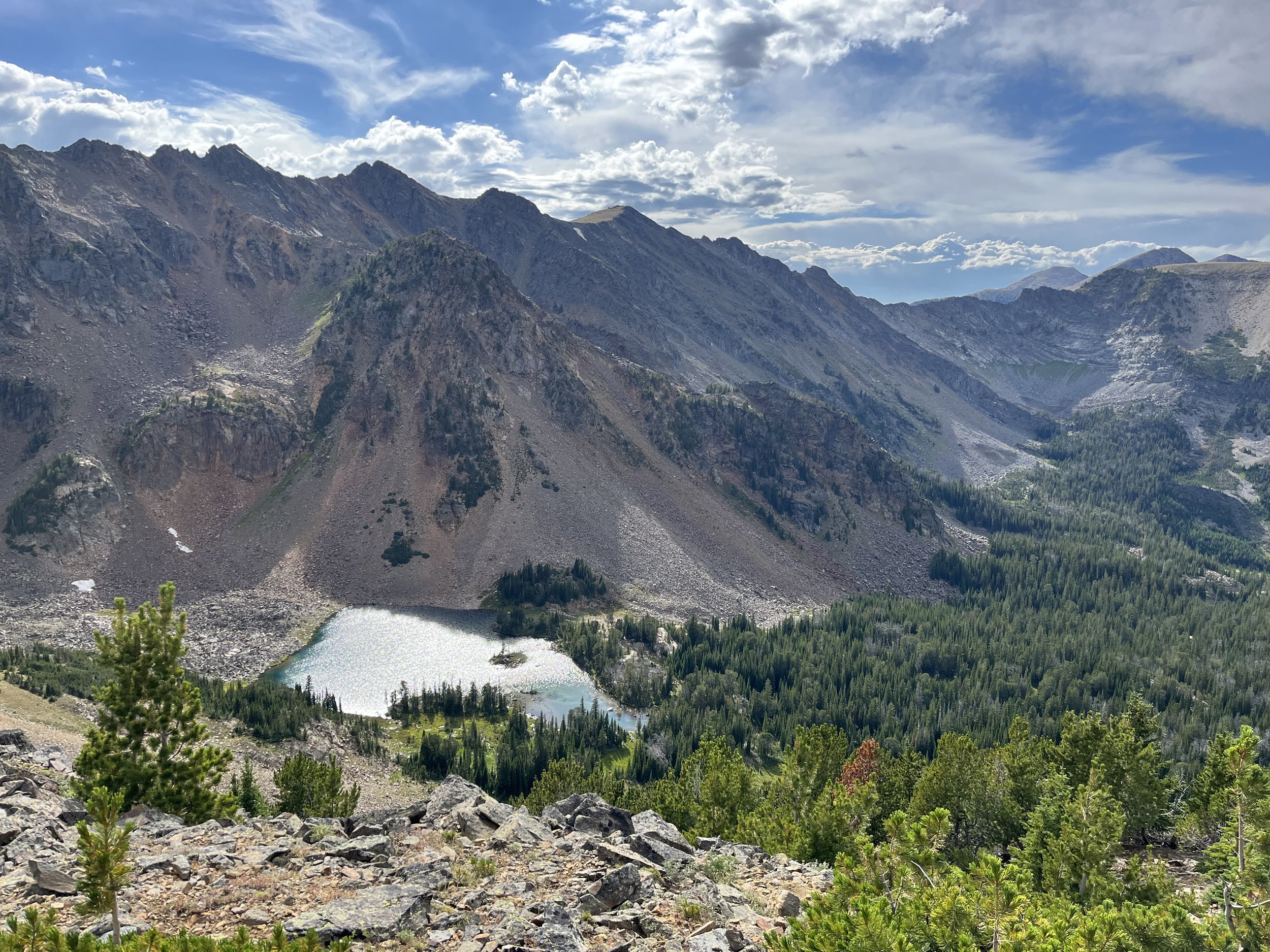
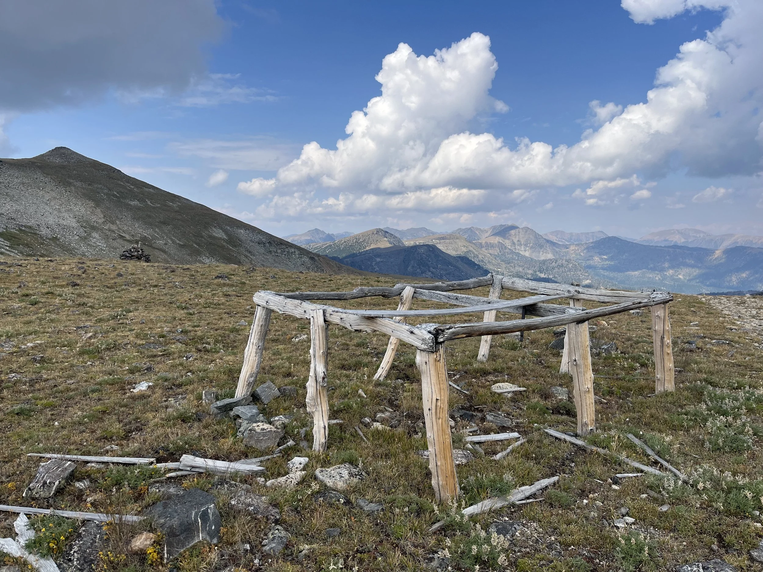
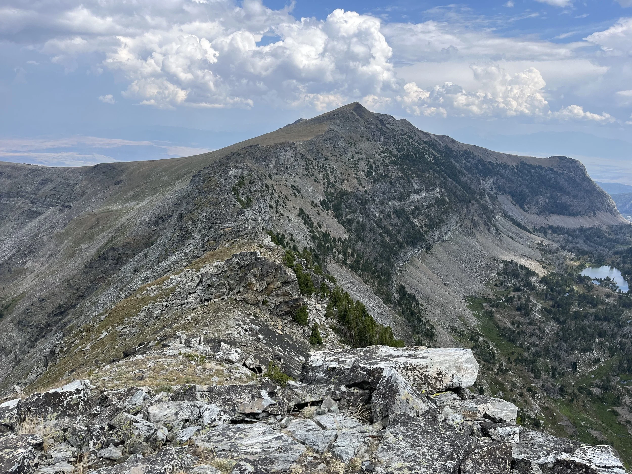
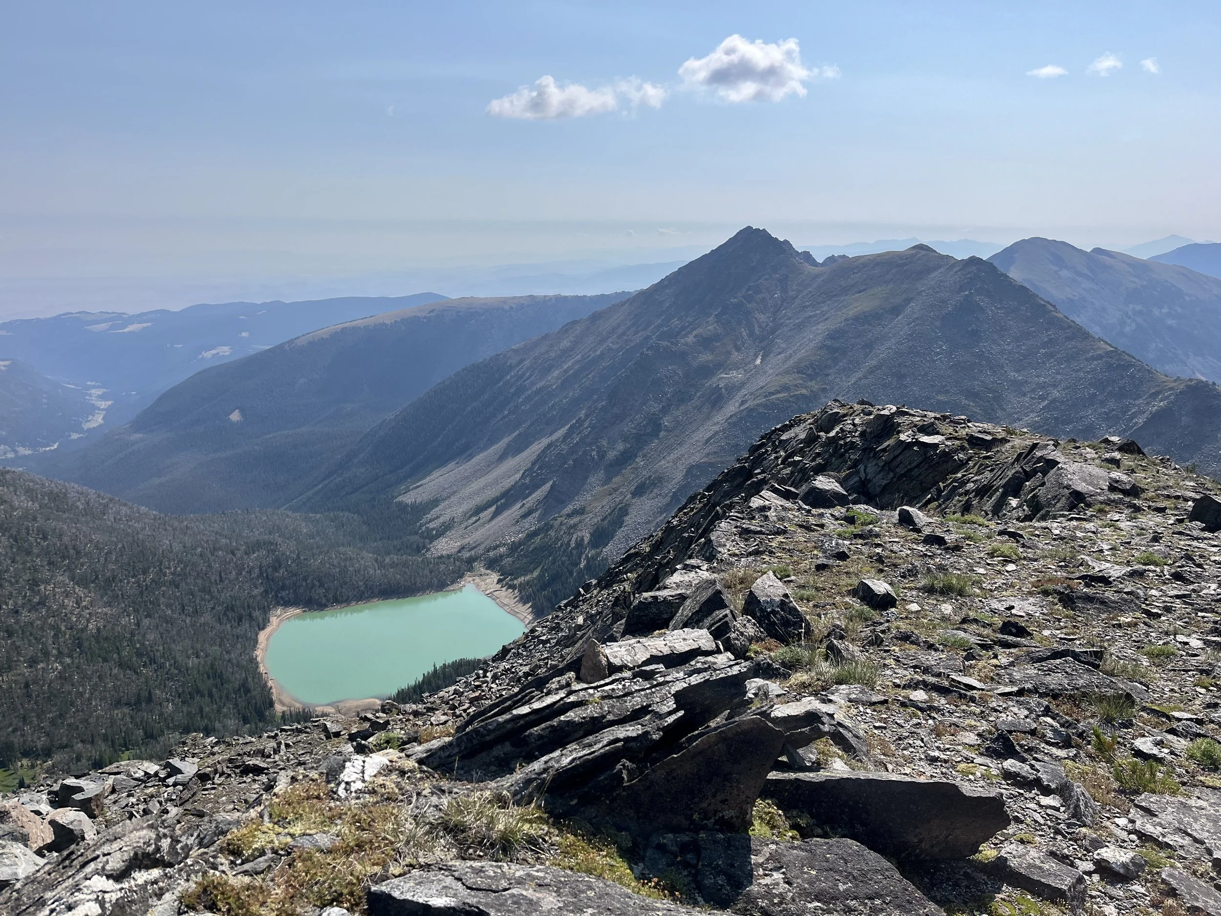
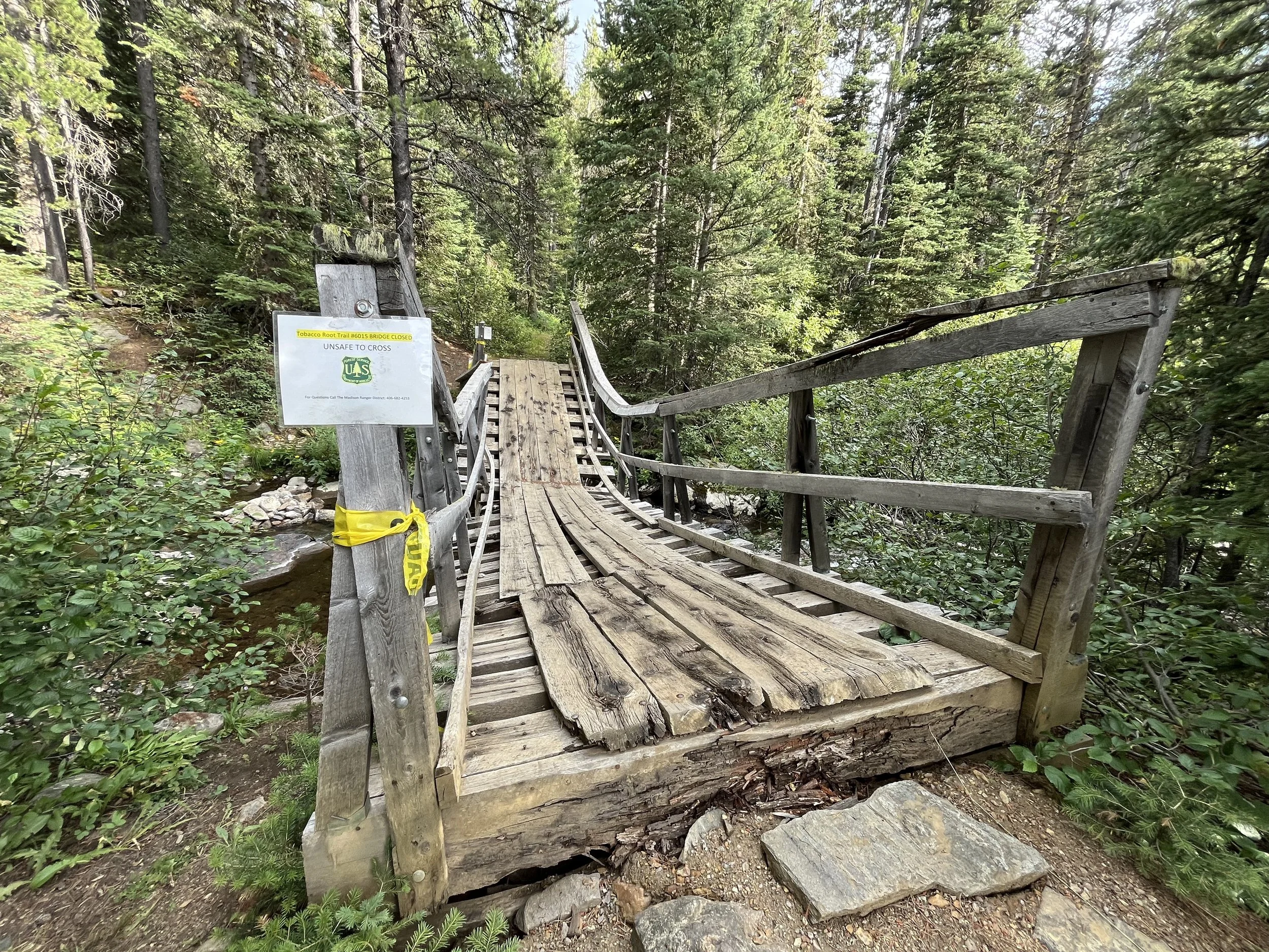
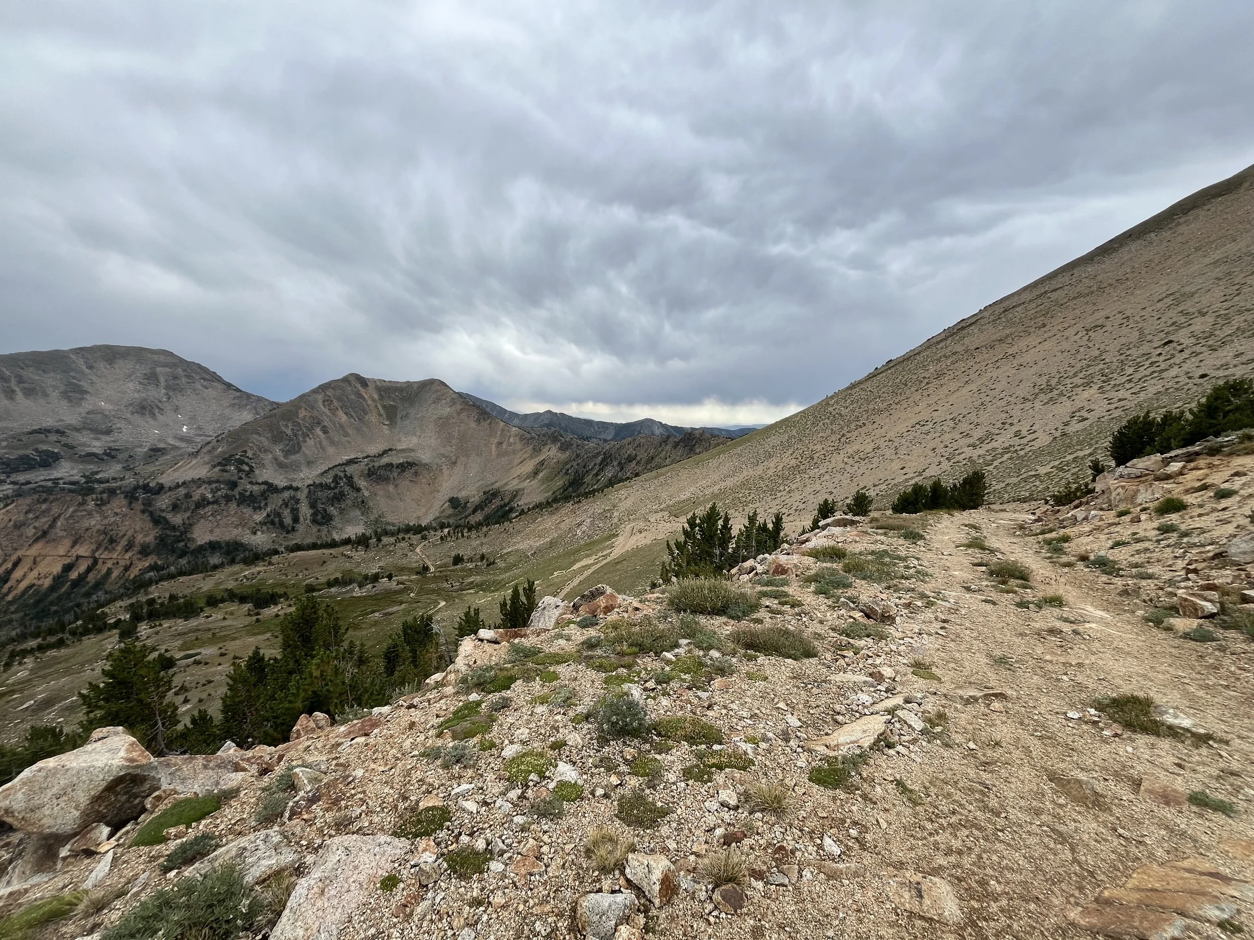
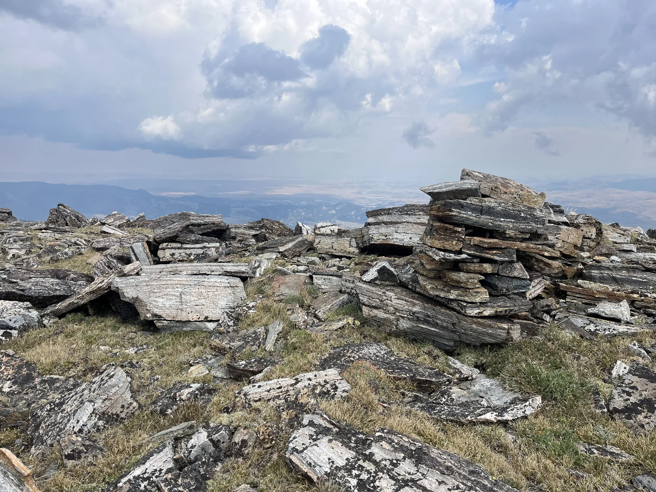
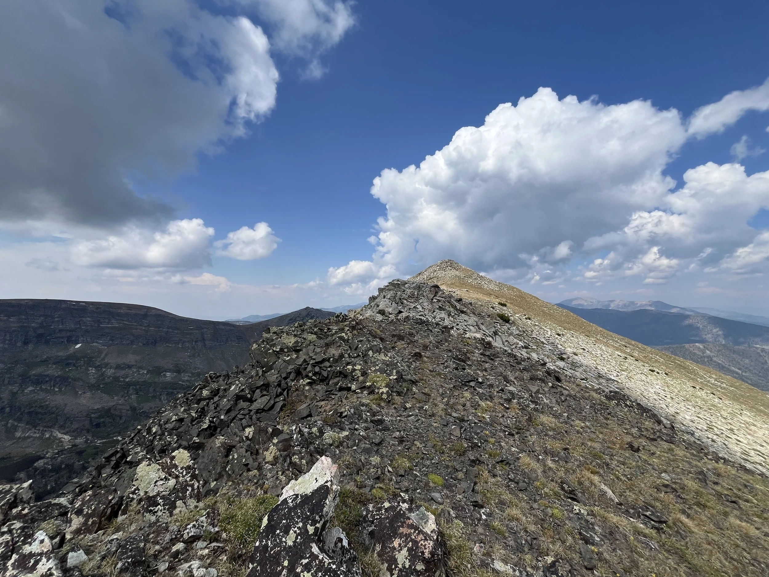
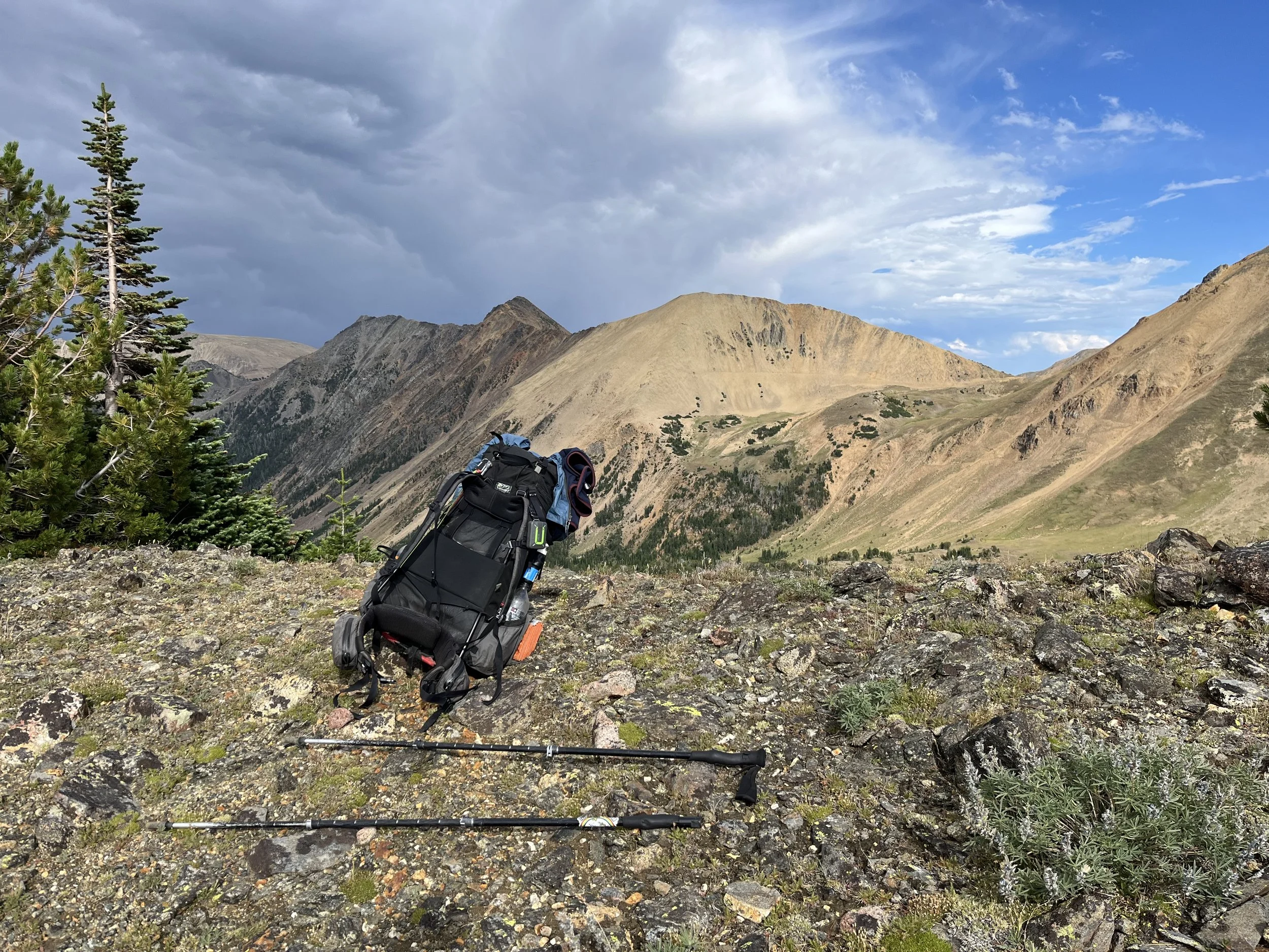
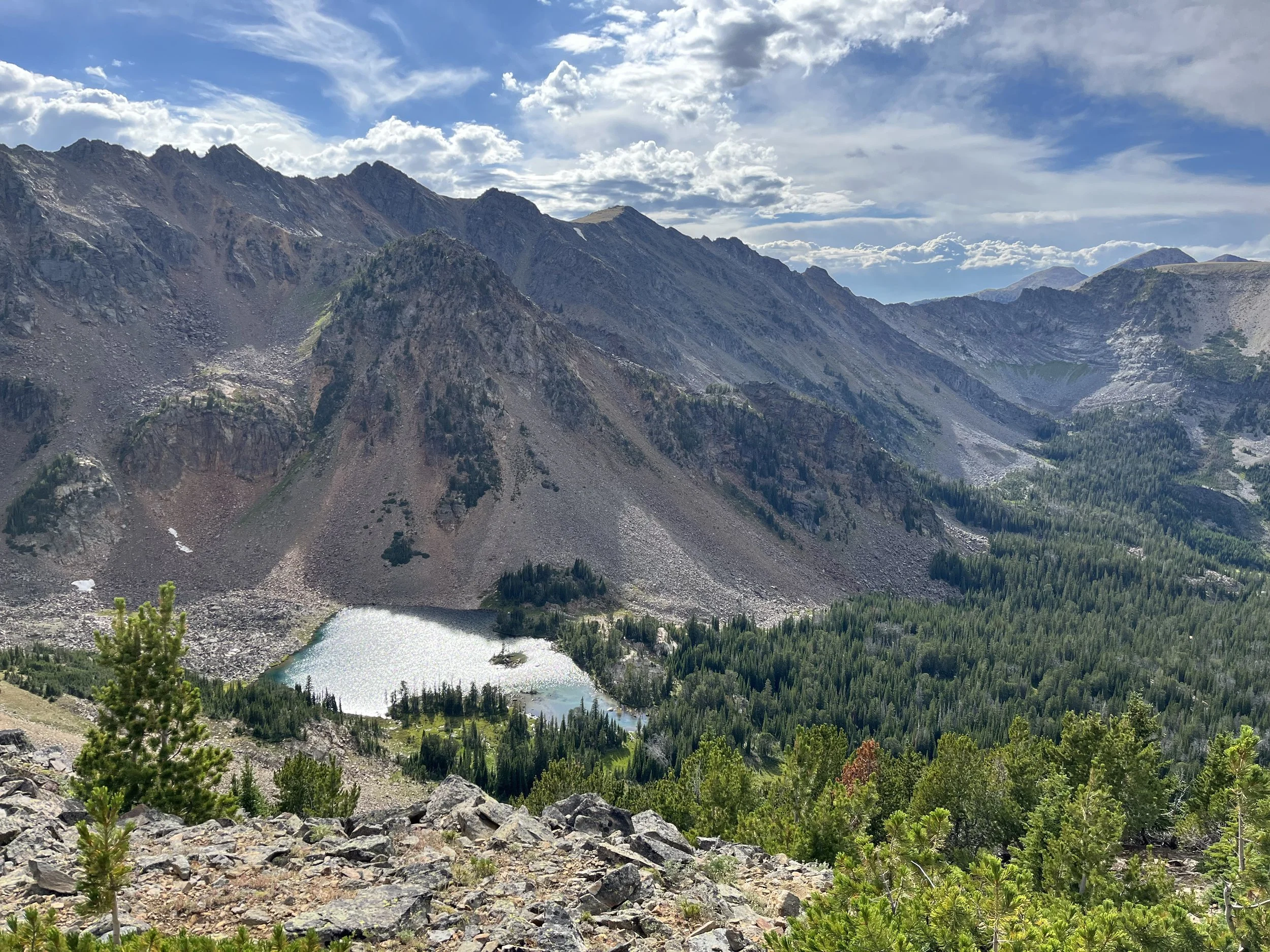
The slideshow below gives an idea of what sort of scenery to expect.
The starting point: Ennis
If you are on the CDT, the town of Ennis is a great place to resupply and to stay the night. The RV park with tent sites (hot showers, electricity, wifi, laundromat) is outside of town to the north, so you need to fully resupply before going to set up your tent if you want to avoid the long walk back into town (one mile exactly between the RV park and the supermarket).
There are also motel options in Ennis that are affordable. Tourism here is mostly fishing and hunting, so fall is actually the expensive season, with cheaper summer rates. Check Google Maps for prices and booking. You will need to click on some websites for rates and reservations.
If you don't stay the night, charging batteries may be difficult (and depend entirely on the public library and its open hours - a place I did not visit). The public park does not have electric outlets.
In Ennis an extremely strong rainstorm hit. It lasted about 30 minutes while I was in the supermarket. I can't imagine the outcome if I got hit by rainfall this bad while above tree line in the mountains. Take that as a warning to be ready for storms (but you know that already).
Ennis locals are very friendly, and I was offered rides while buying a sandwich, walking out of town, on the highway north of town and then later on a small side road. Three of these offers were from women (I'm male). And three of the four offers came from people who knew who CDT hikers were. The "Butte Cutoff" or "Big Sky Alt" alternate routes of the CDT pass through McAllister to the north, and CDT hikers hitchhike to and from Ennis for resupply.
Leaving Ennis you will see the same no trespassing sign over and over again. It's a yellow sign that says "No Trespassing or Hunting. Survivors will be prosecuted!!" It's accompanied by a cartoon of a happy deer and a smoking bullet shell. Menacing? No. It's just in line with the local sense of humor. And it's not for you as you walk by. It's for hunters and fishermen - the real annoyance for local property owners.
After walking out of McAllister for a while you will come to a junction where South Meadow Creek Road splits off from North Meadow Creek Road. Going to the right on the north road is the route described in many Big Sky Alt and Butte Cutoff variations. This is the "low route." My route goes to the left on the south road and heads for the Tobacco Root High Route. After I turned left, a truck stopped and a local asked me where I was going. This is because they are accustomed to seeing hikers go to the low route via the north road. The driver thought I might be lost. I just said I was going up to South Meadow Lake - the most well-known destination up the south road. Ten minutes later a woman got in her ATV and drove out to the road to track me down. She was also concerned I was going the wrong way. She was very hiker friendly and asked me if I had updates on some southbound hikers she had met and given rides into Ennis.
Soon you will be in the national forest. There are plenty of friendly but skittish cows grazing here, and lots of camping options (see the waypoints).
Eventually you get on an old mine road and pass by the interesting ruins of the Missouri Mine millsite. It’s a large piece of metal that is probably going to be there for a very long time. Nearby you need to take enough water to get through a long dry section. The waypoints show that all clearly.
Finally, you leave that road when you get above tree line. This is the start of the Tobacco Root High Route.
There is little about my high route to say that is not included in the waypoints. The high route is a mix of open terrain, short easy scrambles, trails and short road walks. You'll probably only see people at Branham Lakes, and once you are hiking down from Lost Cabin Lake. Just watch for incoming bad weather and be prepared to leave exposed terrain up high for a safer spot downhill off the route.
The only thing I would do differently would be to summit Granite Peak. The weather was unstable when I was there and I wanted to get to a camp spot at Lost Cabin Lake before the end of the day, so I chose to stay low. If your weather and timing works out better, it is mentioned online as a fun scramble with a great view. There are three ridges up/down Granite Peak – note that I think one of them is too hard for hikers (but you never know until you are actually there). See the waypoints.
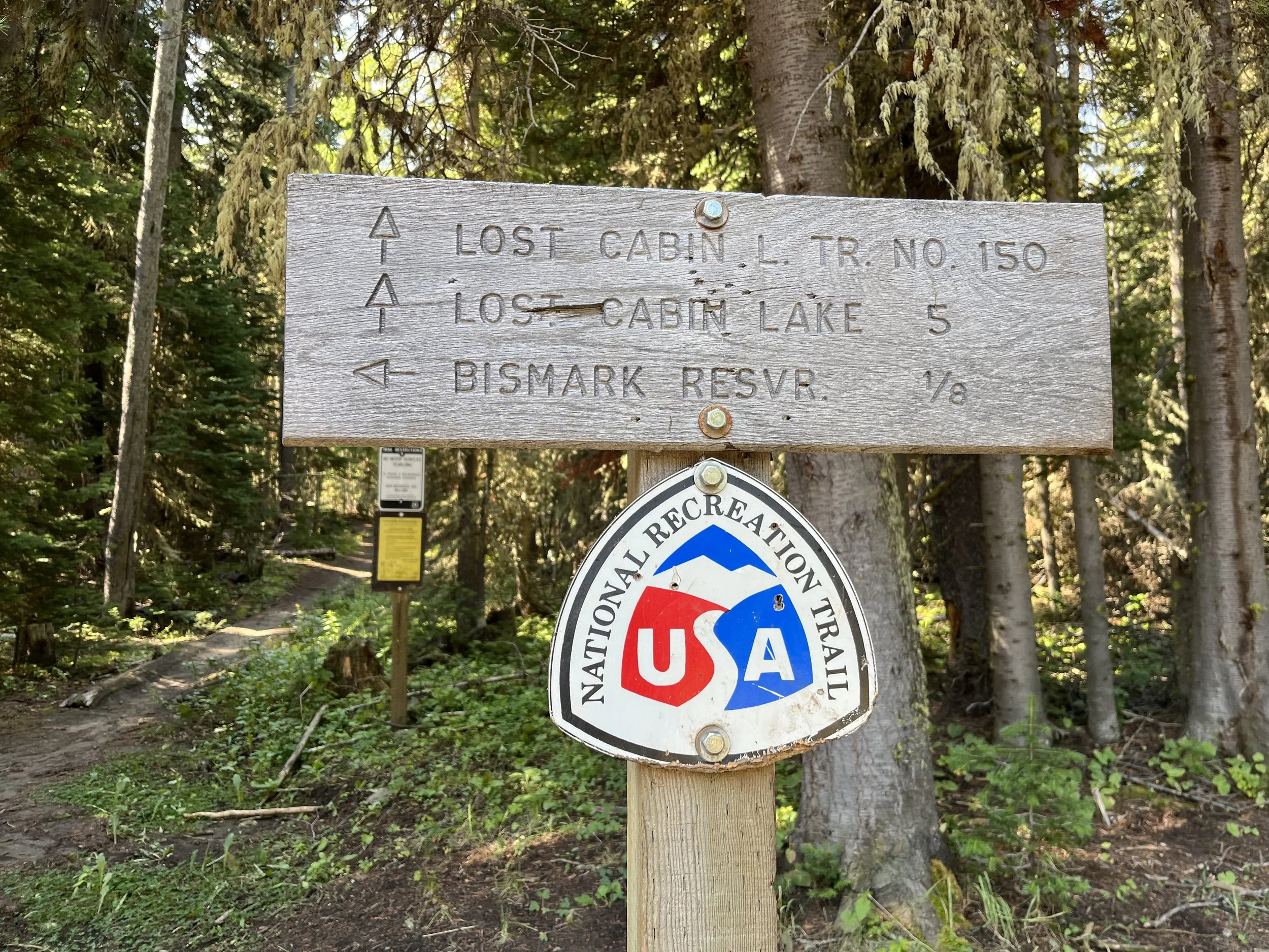
The Lost Cabin Lake National Recreation Trail is well built and well maintained. It's a fast downhill with no further need to be checking GPS to confirm your location.
The tiny town of Mammoth is an old mining settlement that has been sold off as summer homes. There are no services here.
After a road walk you turn onto the Rock Creek Trail, then go through a pass and down the Mill Creek Trail. These trails are built to motorbike standard and they are fast. Don’t worry, I only saw one group of three bikers.
The road walk down the Mill Creek Road is nice and deserted. Nobody is car camping here. Note the map to see where private property begins. In the lower gorge you need to stay on the public road and you can’t camp nearby. As you enter the wide valley below there is a short section of BLM land where you can camp. This was occupied when I walked through by a family from the nearby town of Belgrade (super friendly, I stopped for a beer).
Right before Highway 55 you can camp or take a break at "Lost Tomahawk," right after the bridge over the Jefferson River. This land is owned by the Jefferson River Chapter of the Lewis and Clark Trail Heritage Foundation, a non-profit organization. This land was purchased to help boaters, canoeists and kayakers find camp spots along their route, and to provide access for fishing, bow hunting and other recreation. But I'm quite sure a hiker would be welcome.
From here you can walk into Butte or hitchhike into Whitehall. For a continuation into Butte, check out my route in the Vasquez-Hudson Route, or reference this Caltopo map of alternates in this area.
The video below has the basic highlights of this trip.