Saymaluu-Tash Petroglyphs
Saymaluu-Tash Petroglyphs Trip Report
Also spelled: Saimaluu-Tash; in Kyrgyz: Саймалуу-Таш
The Saymaluu-Tash petroglyphs can be reached with a 7.5km hike from what will soon be a major highway in Kyrgyzstan between the town of Kazarman and the city of Jalalabad (pending the completion of a road tunnel in 2026). The hike starts at around 2000 meters in elevation and ends at about 3100 meters. It’s not an easy route, as there are some steep slippery sections and plenty of very tall vegetation and vague, hard-to-find trails (in the early summer; in late summer the vegetation dies down and the trail is more clear). There is also snow that accumulates in the gorge over the winter and remains there into the summer.
In 2025 (July 1-2) I hiked up to the petroglyphs and edited the route in Open Street Map (the data source for almost all offline map downloads). The old route on the map was not always accurate. This editing was done in January 2026, so it won’t like appear on your map for a while. You may need the GPS track:
The trip took me 6 hours from the parking lot, but I was carrying a very heavy bag and had already been hiking most days for the last two months (and I made many stops and breaks on the way up). A day or overnight hiker who is in good shape should be able to do it in 4 hours or less (and then 2 hours going back down). The vague trail, overgrown vegetation, steep slope and elevation should slow you down.
At the beginning some of the annual vegetation is up to 3 meters high. This includes thistles, wild rose bush thorns, and maybe even some stinging nettle and burrs. I had plenty of “micro stab wounds“ from thistles on my legs, hands, arm and stomach. I also had slight allergies from the weed pollen (some sneezing, itchy throat and stuffy nose). The higher you go the shorter the vegetation becomes. I suggest that you wear pants and long sleeves here.
A local guide who was headed down with a group told me that the snow sections in the gorge would be dangerous. But I found them safe (from the perspective of someone who often hikes across snow and ice). Your experience may vary… However, when the snow bridge over the creek/river melts out later in the summer you may not want to be walking on it as it will be in a state of collapse. If this is the case, follow the routes farther up the slope on dry ground.
The river crossing location at about 2760 meters was on a snow bridge when I was there, but later in the year you may need to venture upstream for a safer crossing location. There is no glacier here, so once the snow melts out the river may be very easy to cross.
The main river Kök-Art at the beginning is very silty/dirty. After this all the streams and water sources were clear and fresh (easy to filter, or fresh spring water).
How to get to the trailhead
I walked to the highway outside the town of Kazarman, hitchhiked and caught two different rides - one from some hay farmers and another with a road construction worker. Both rides refused to take money. Arranging a ride from Kazarman with a driver will makes things go much more smoothly. With the 2026 completion of the road tunnel, you should be able to find transportation in Jalalabad (pay for the full ride to Kazarman, and get out early at the trailhead).
Camping
I camped right below the petroglyphs and experienced some strong short gusts of wind in the early evening - but at night it was calm. Don’t camp up this high if you are not confident of your tent. The nights can get cold.
Paid Entrance
There is a fence next to the parking lot with a locked gate. The park ranger/attendant saw me arrive and walked over to open the gate and collected 300 Som from me. Other tourists have reported 400 Som entrance + 300 Som to pitch a tent. One solo tourist was given quotes in Kazarman for transportation plus guide for a day trip that were between 4000-9000 Som.
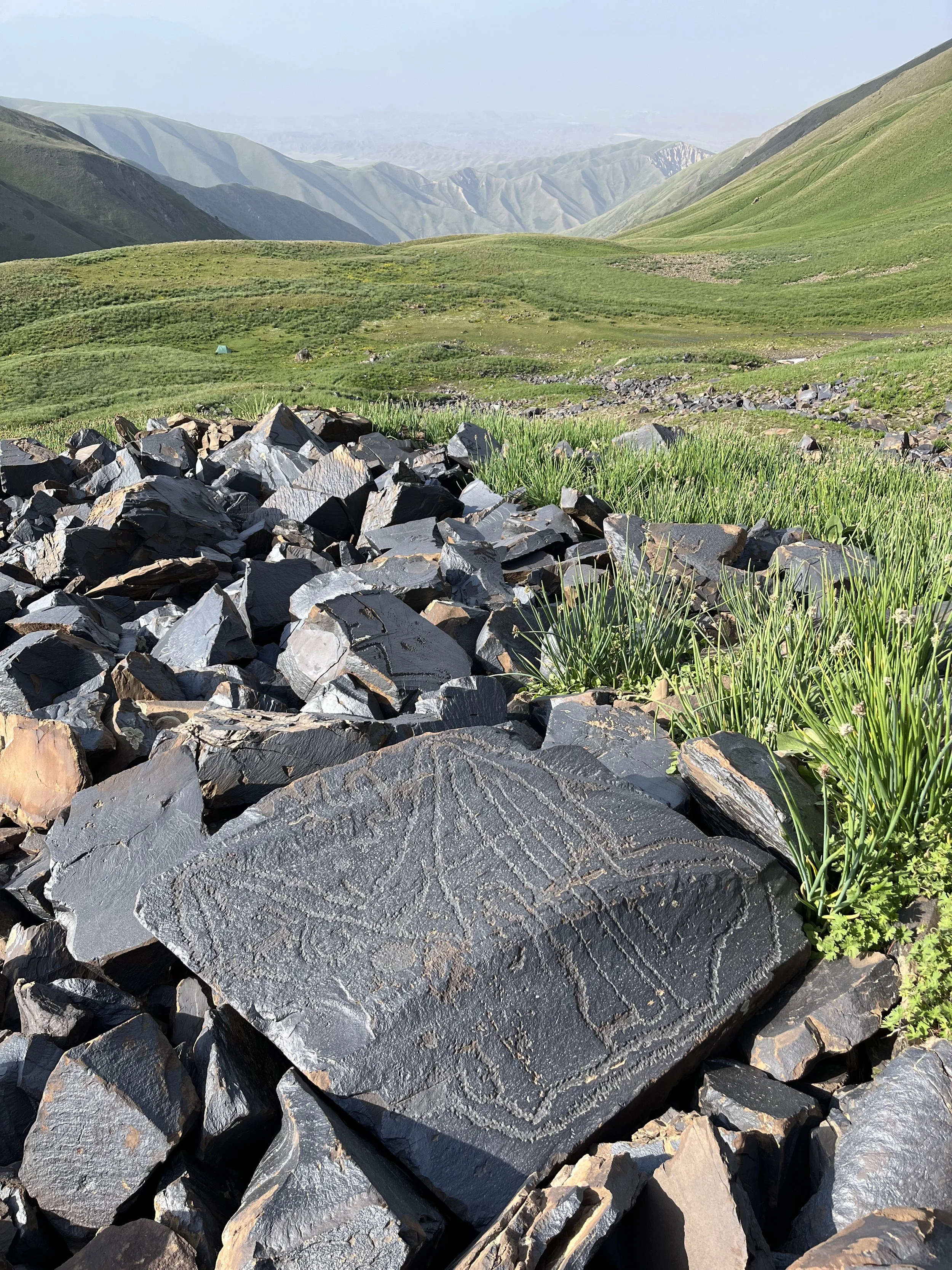
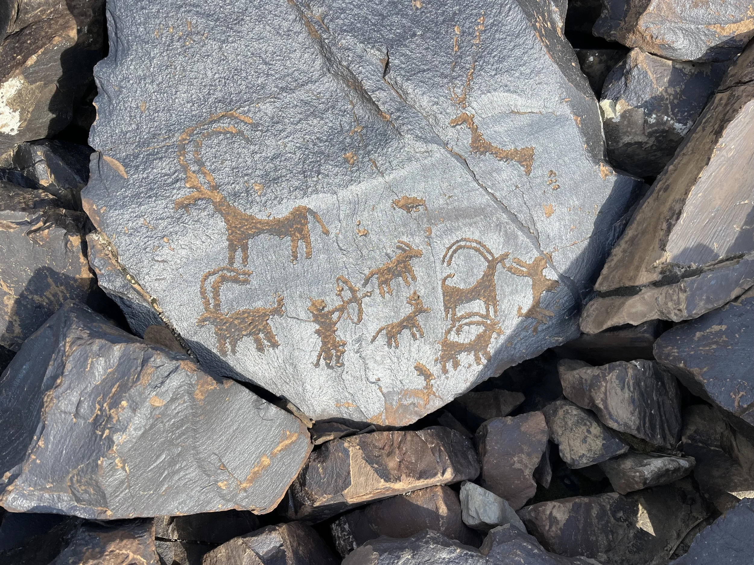
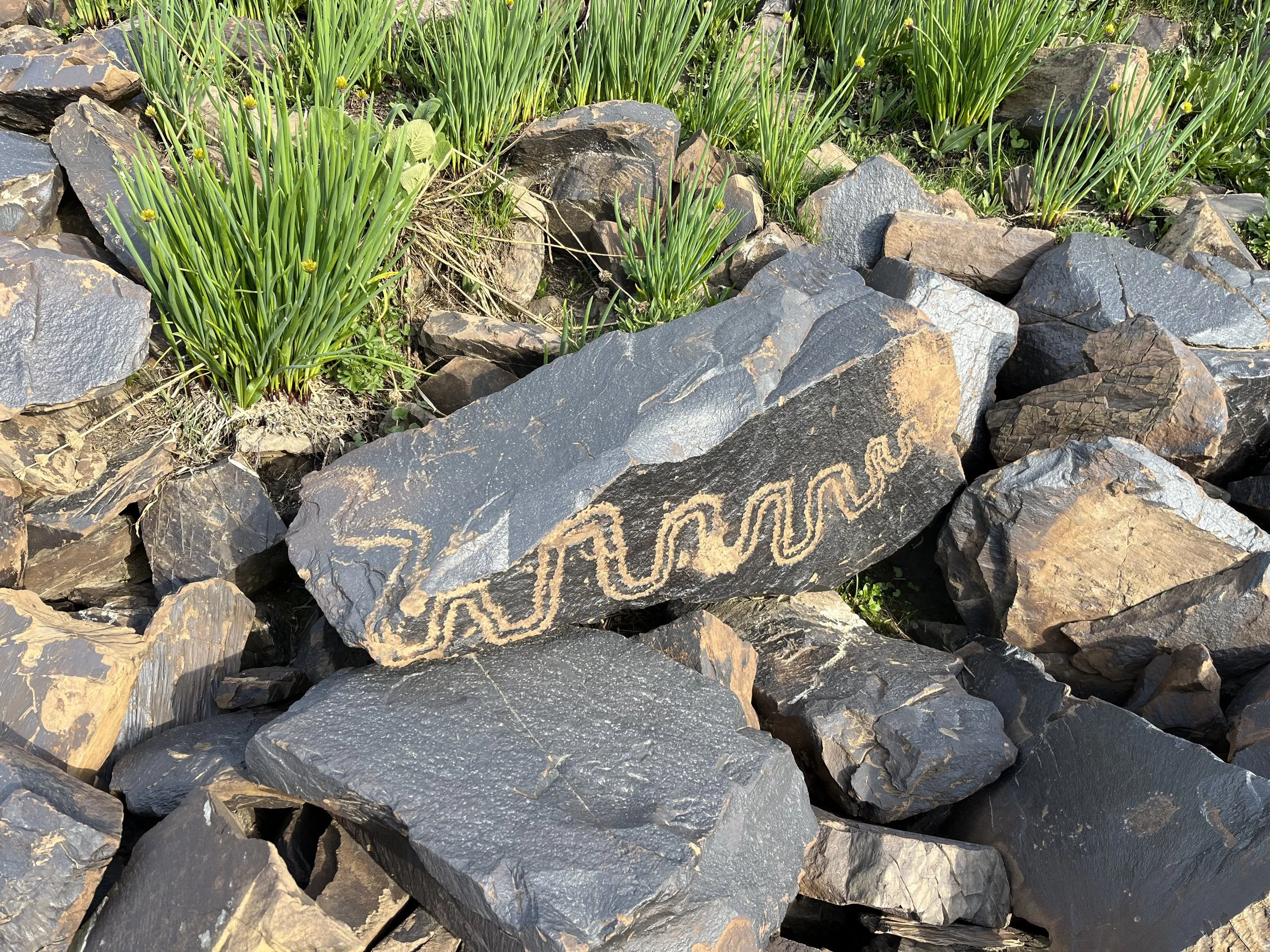
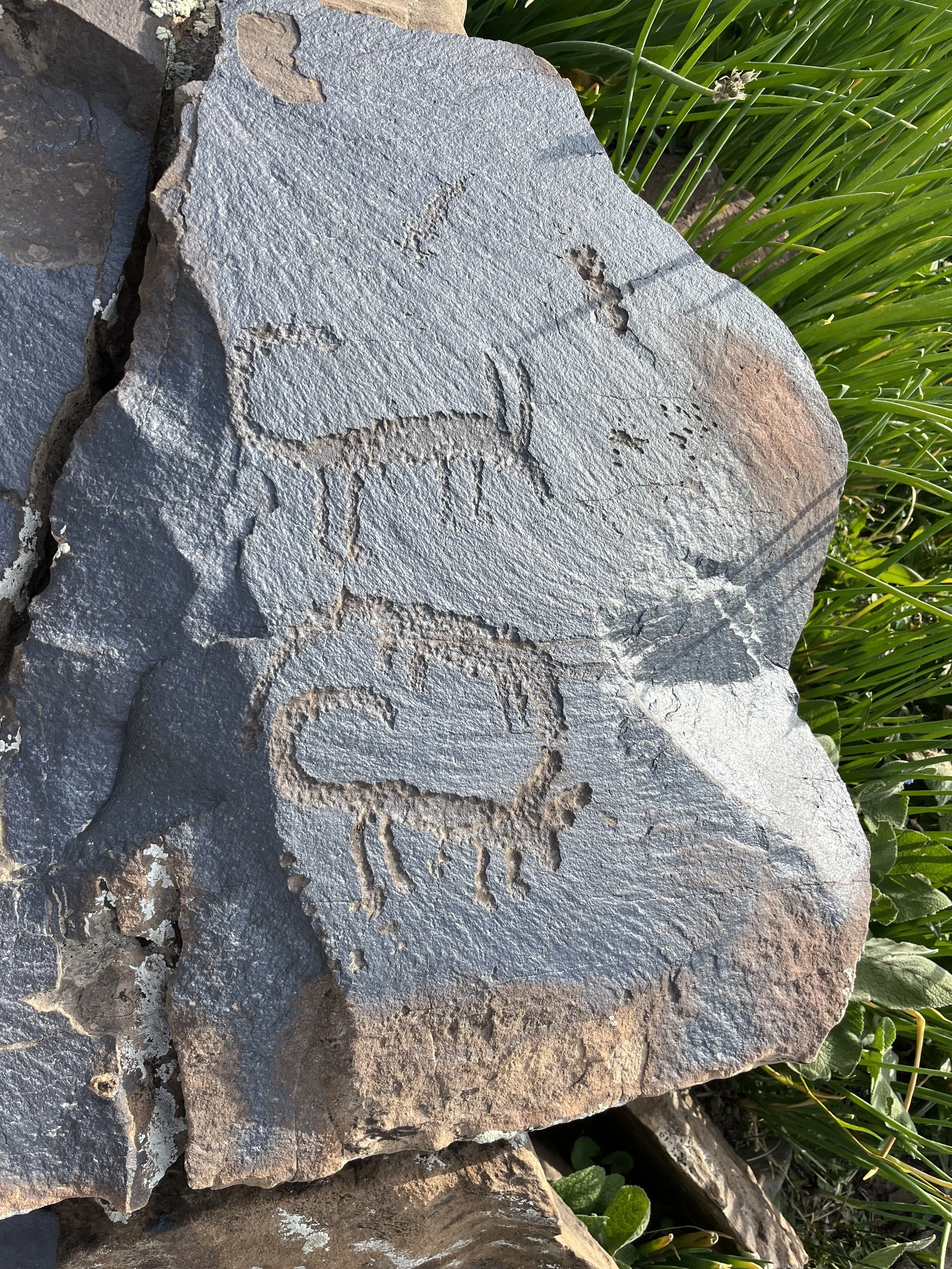
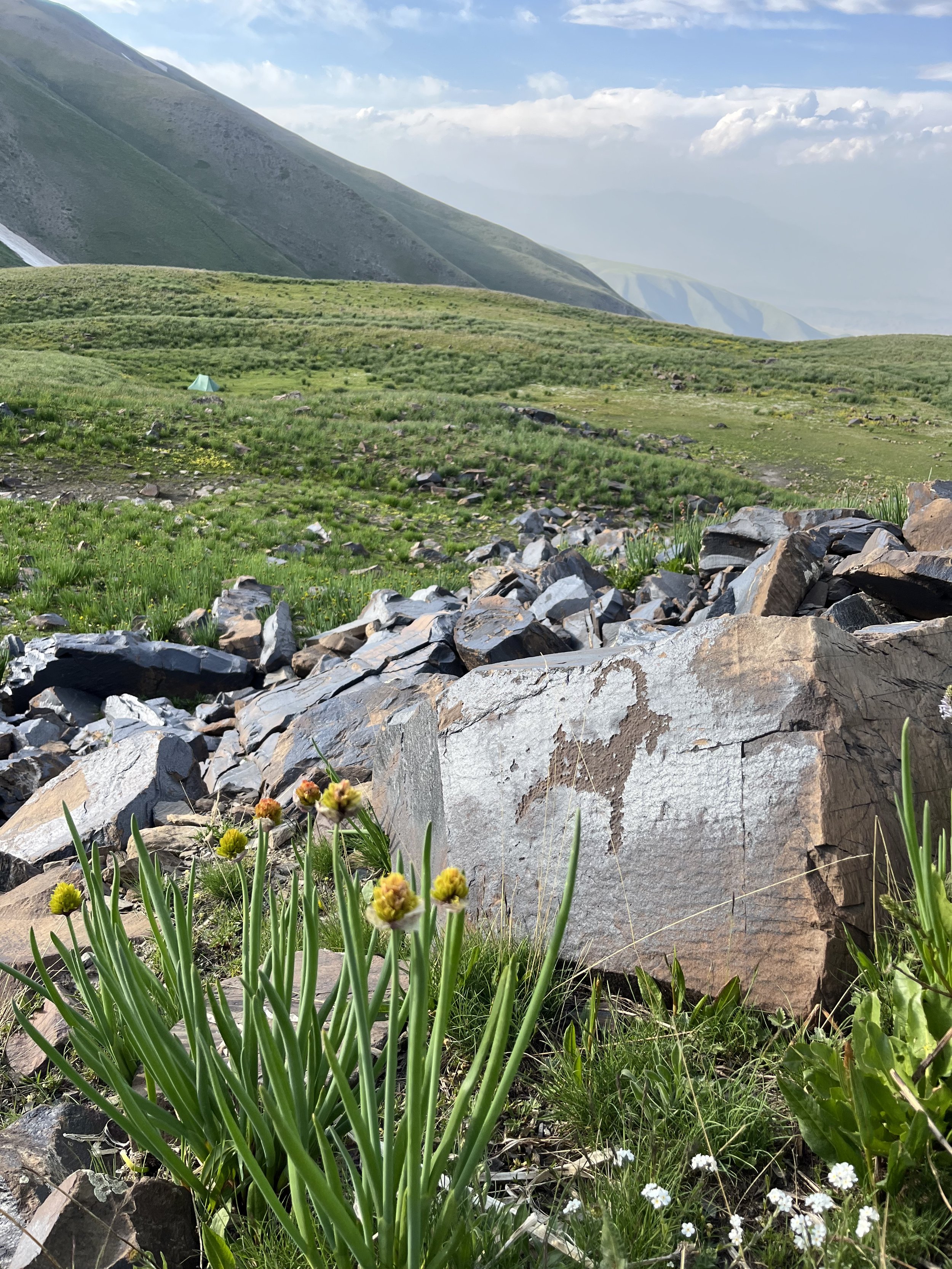
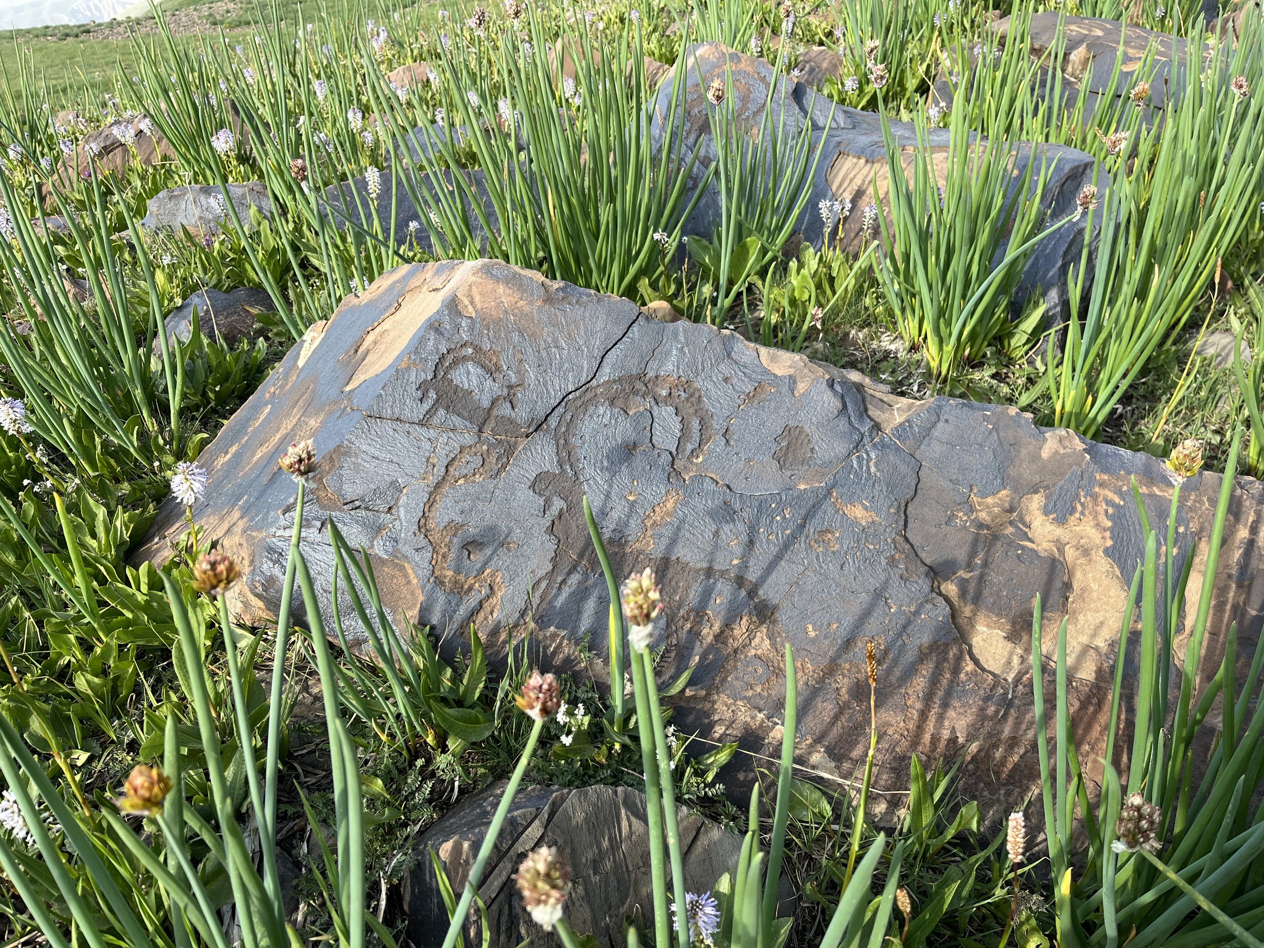
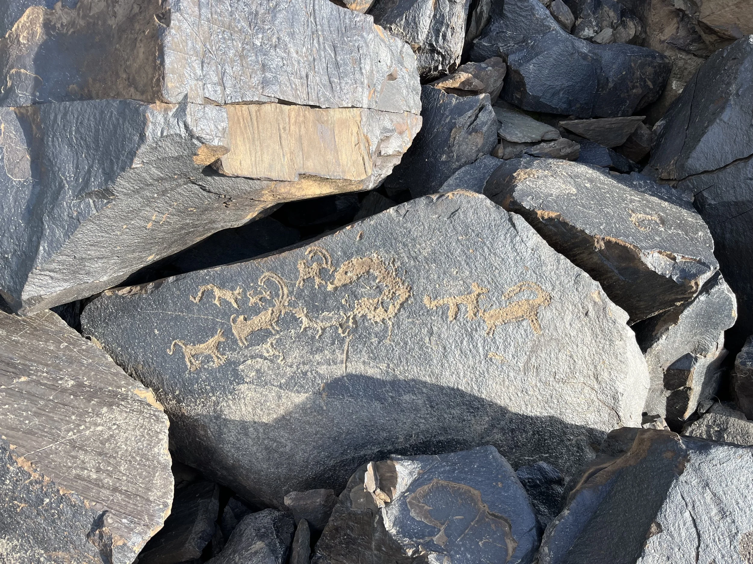
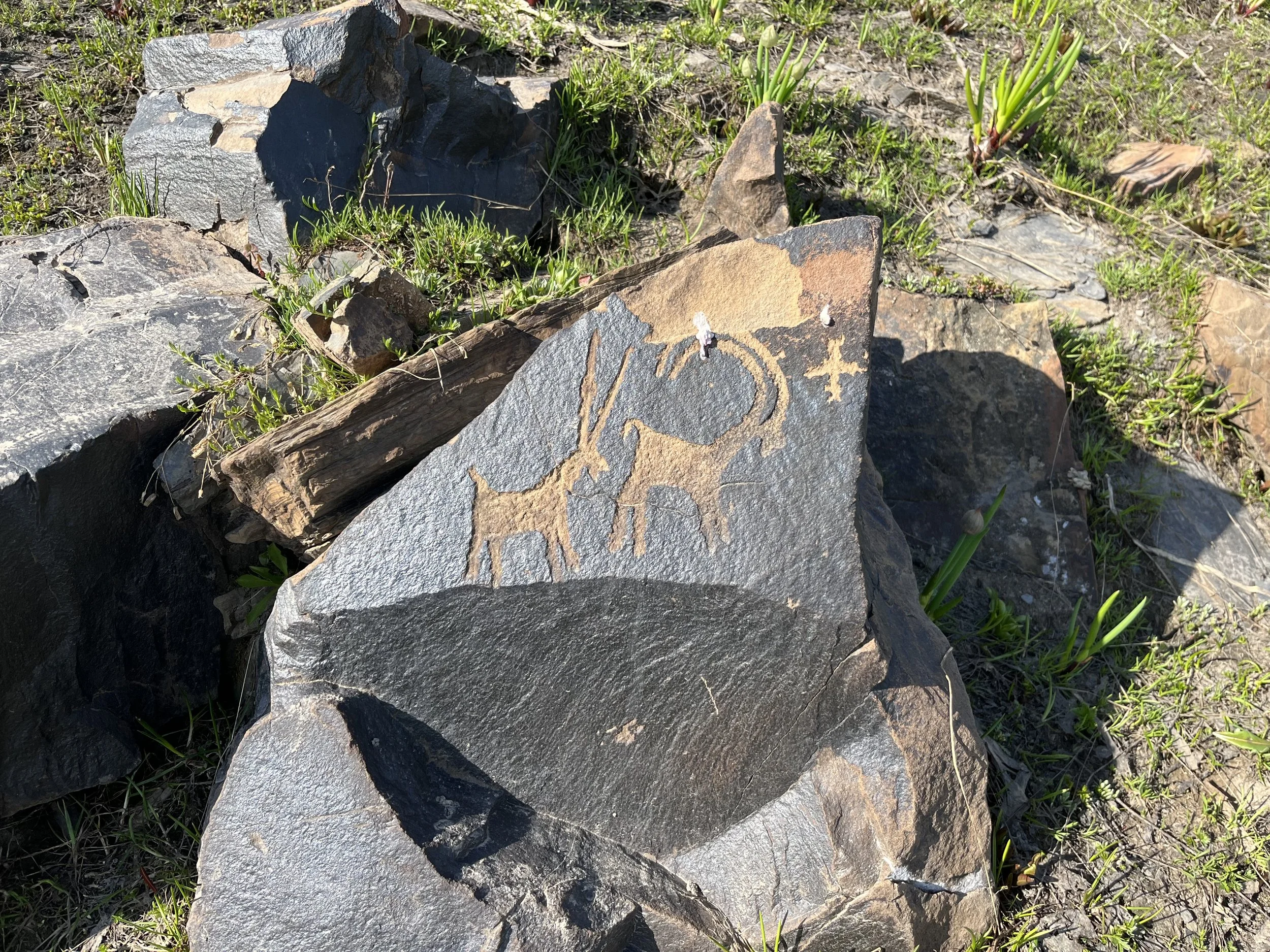
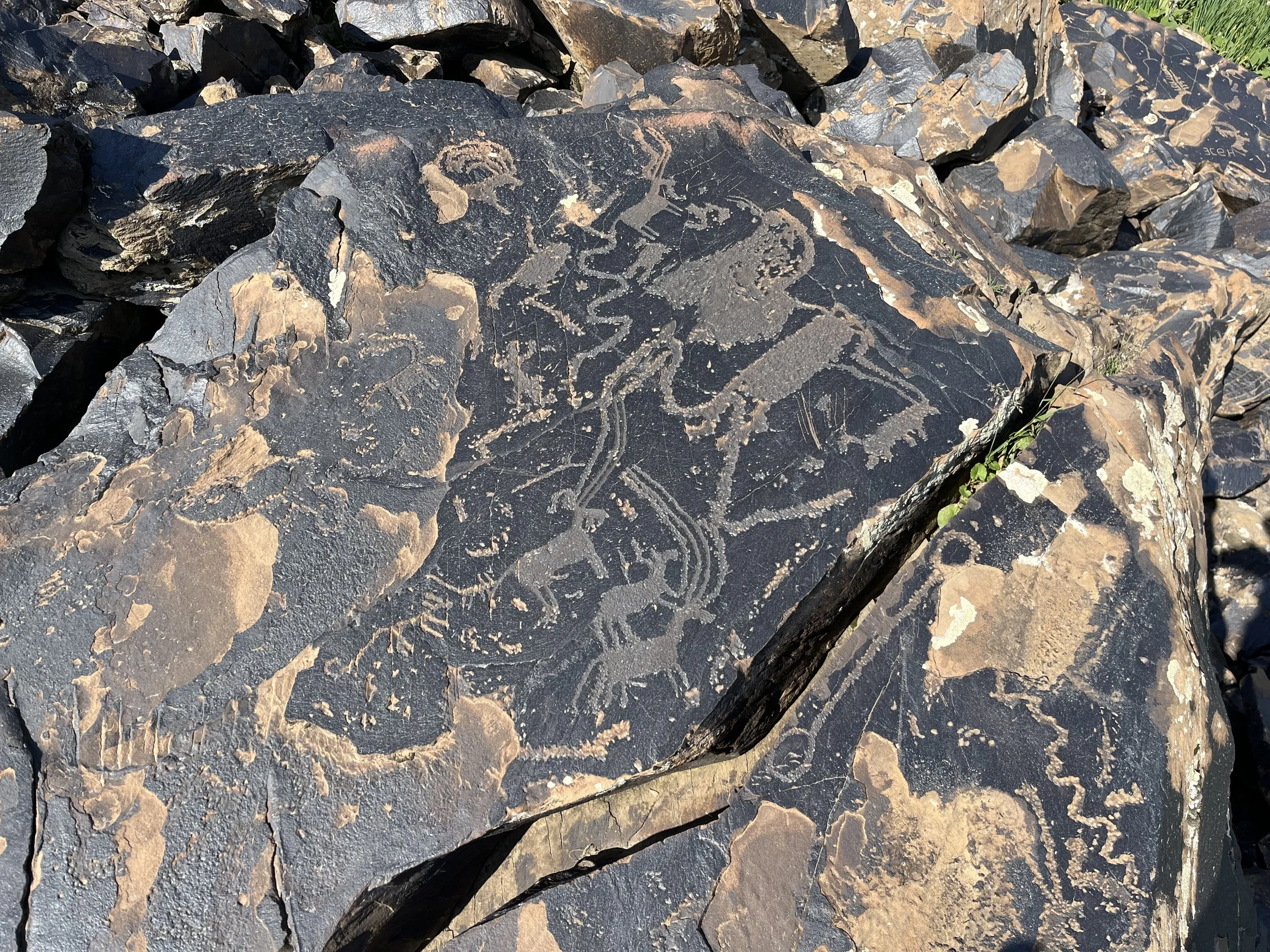
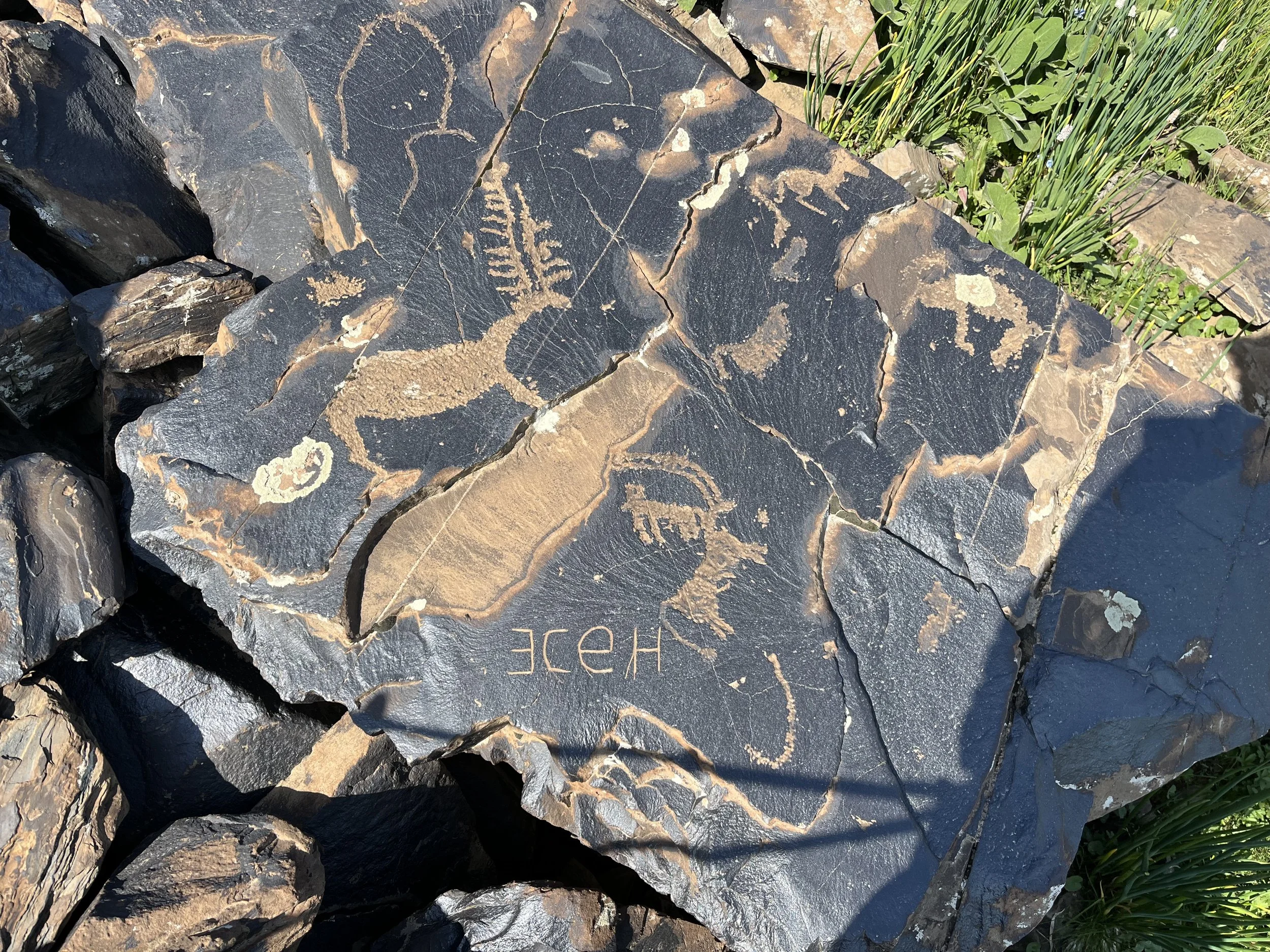
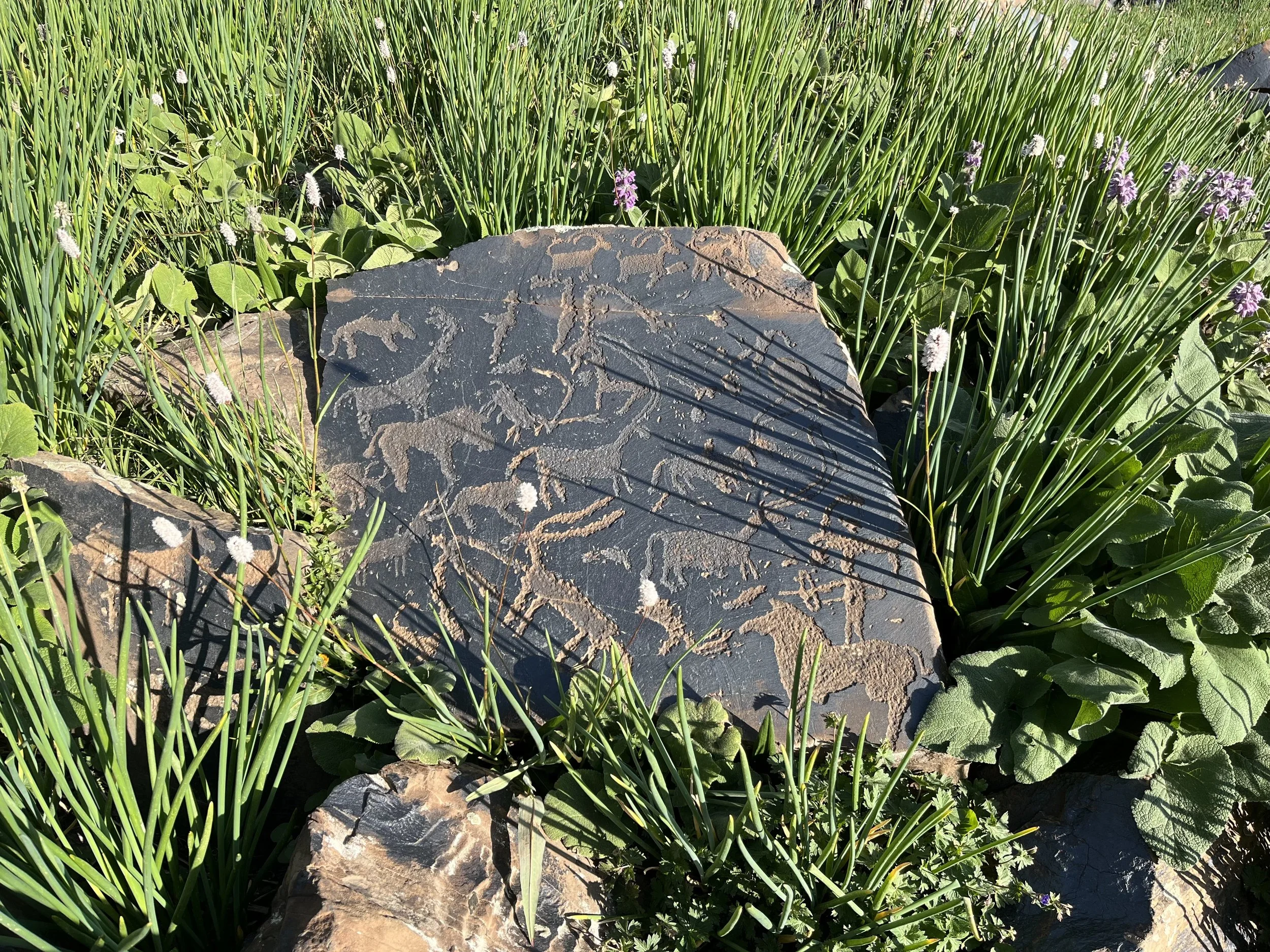
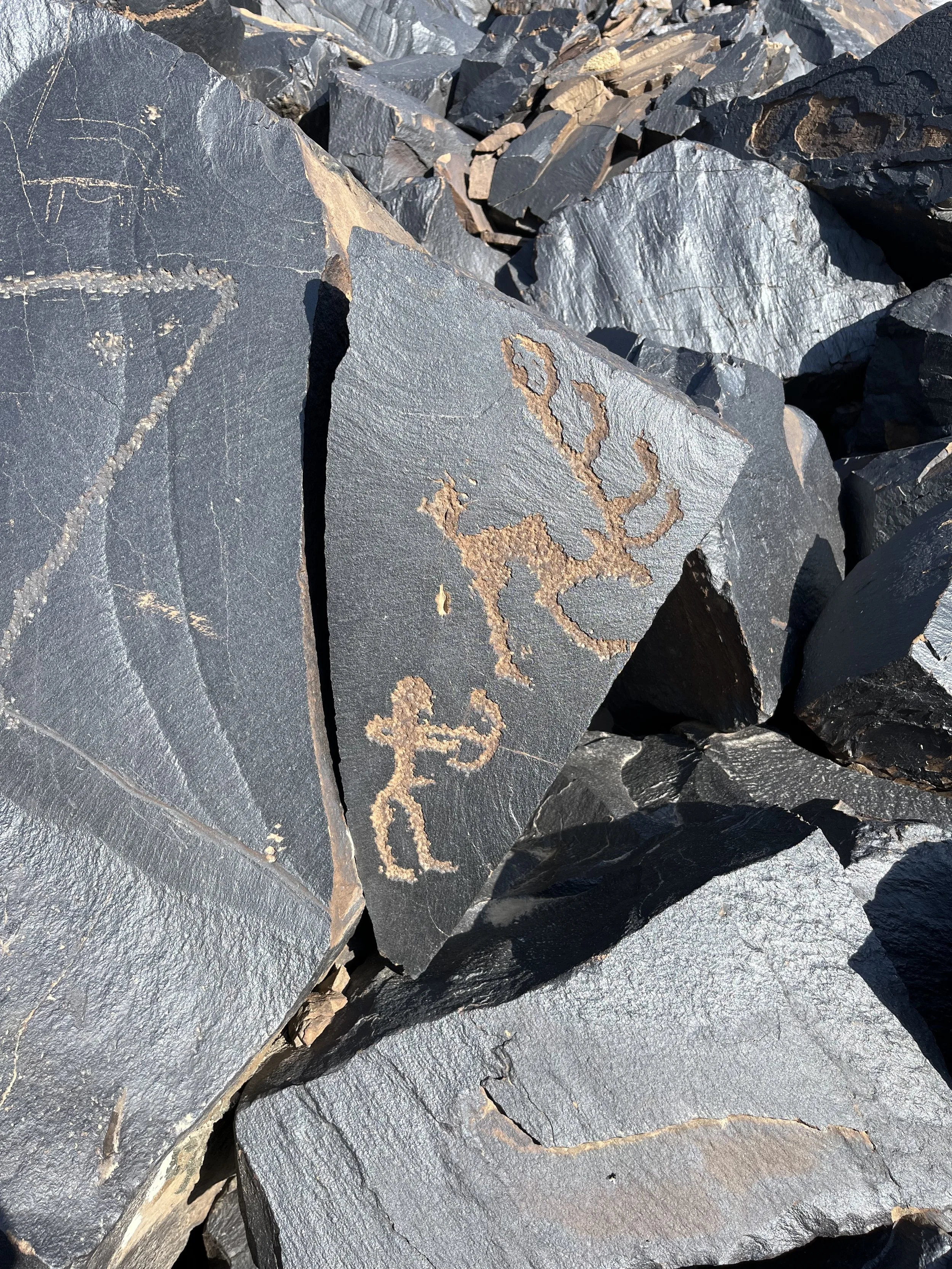
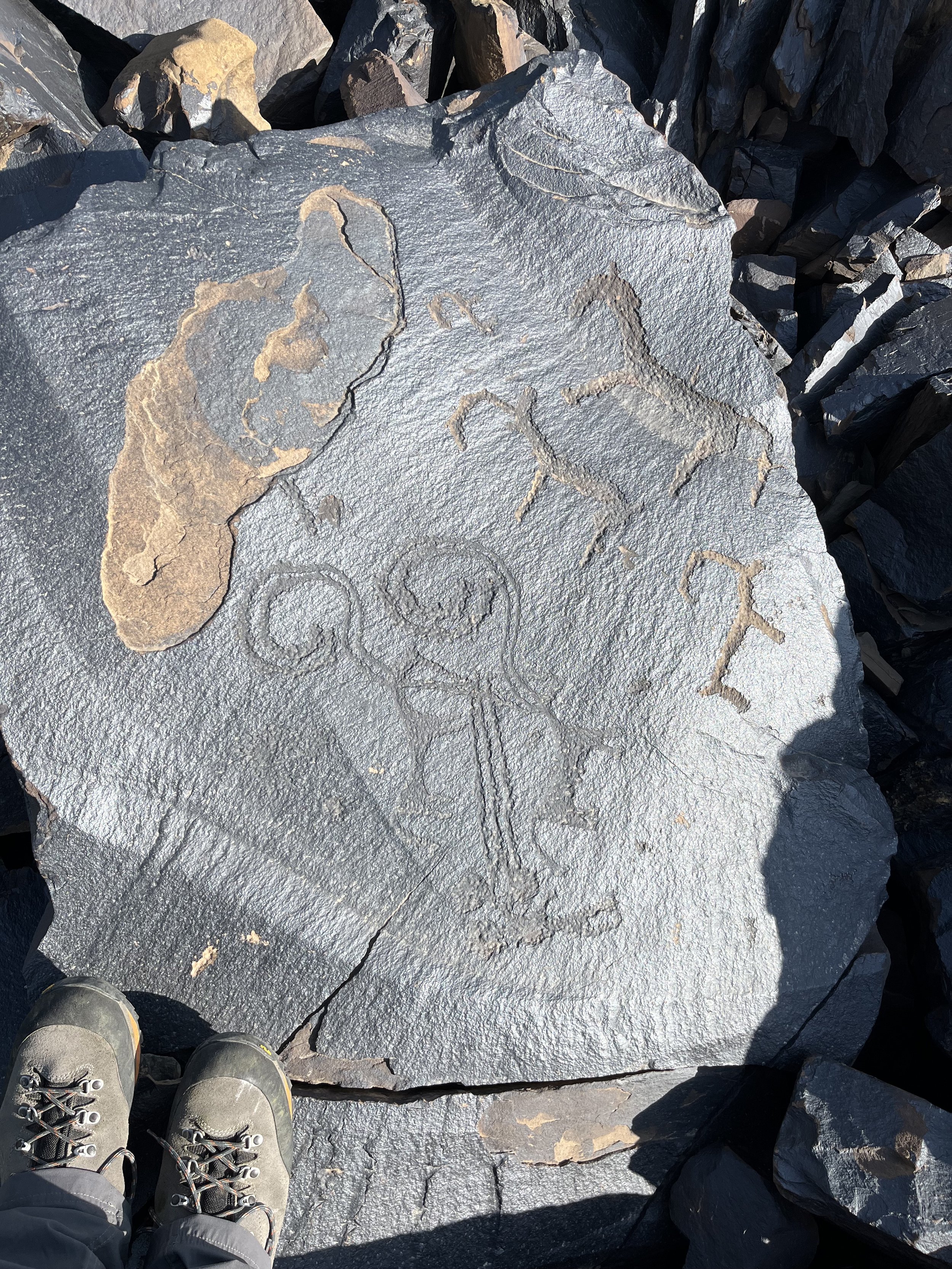
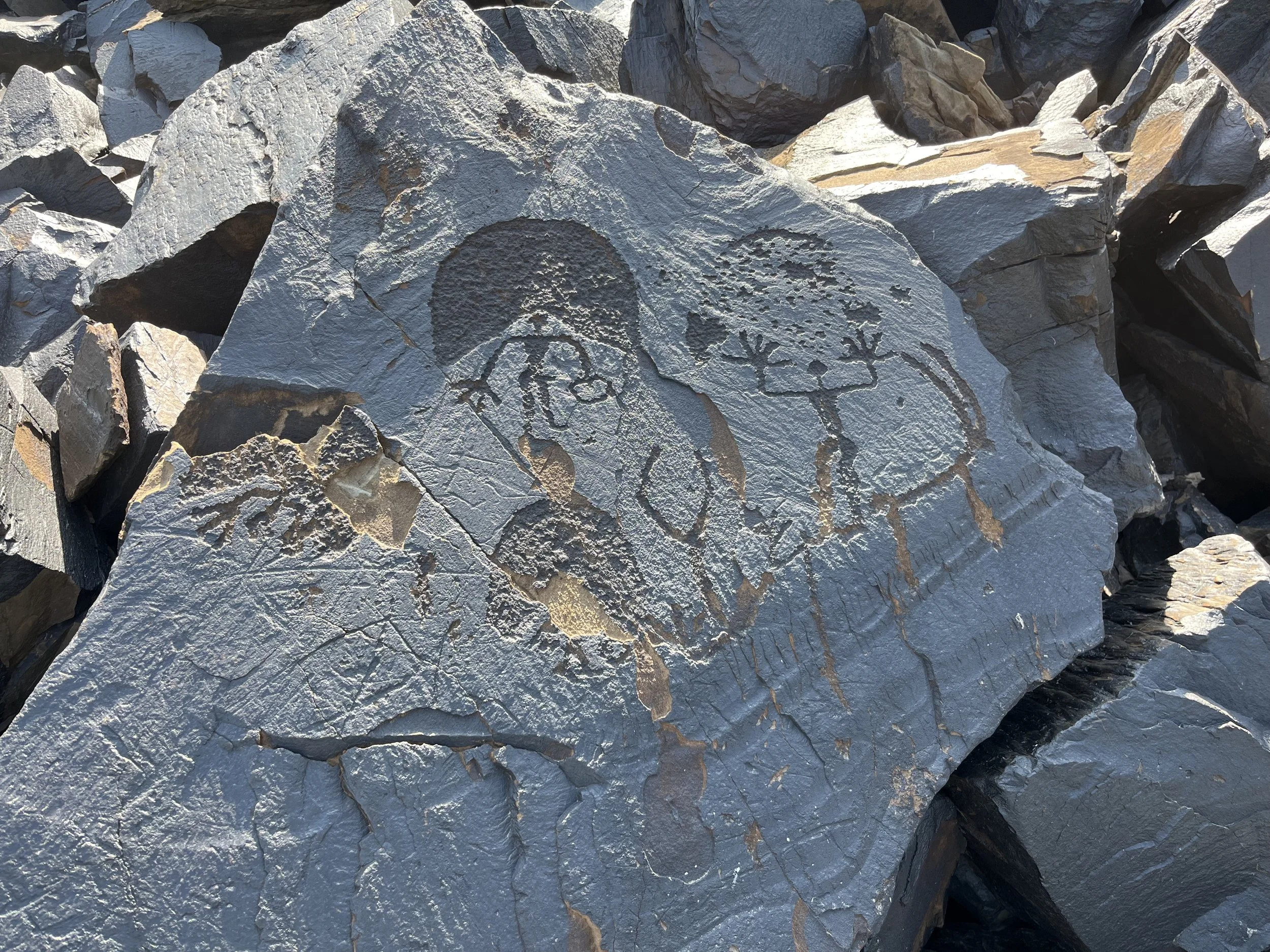
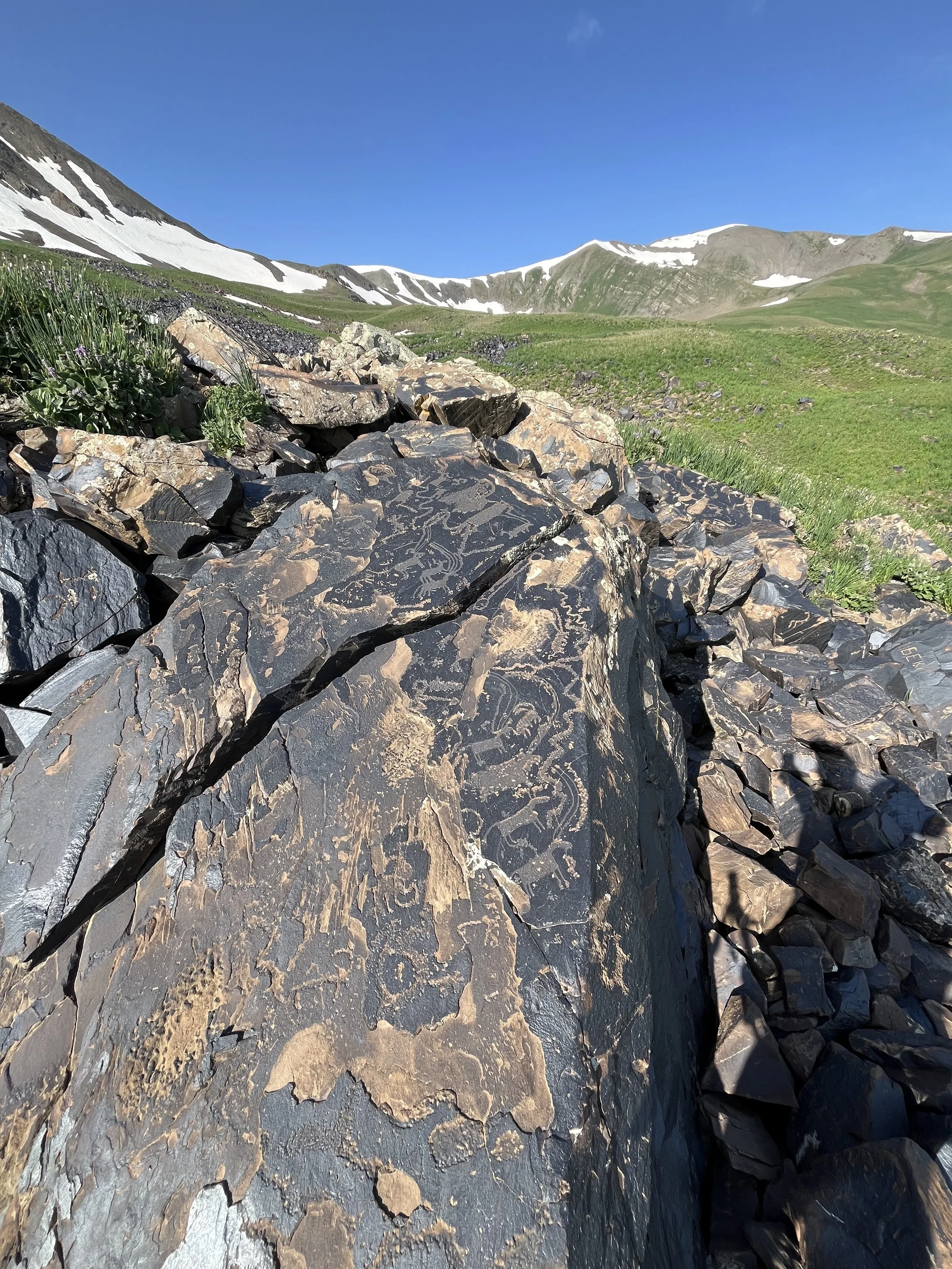
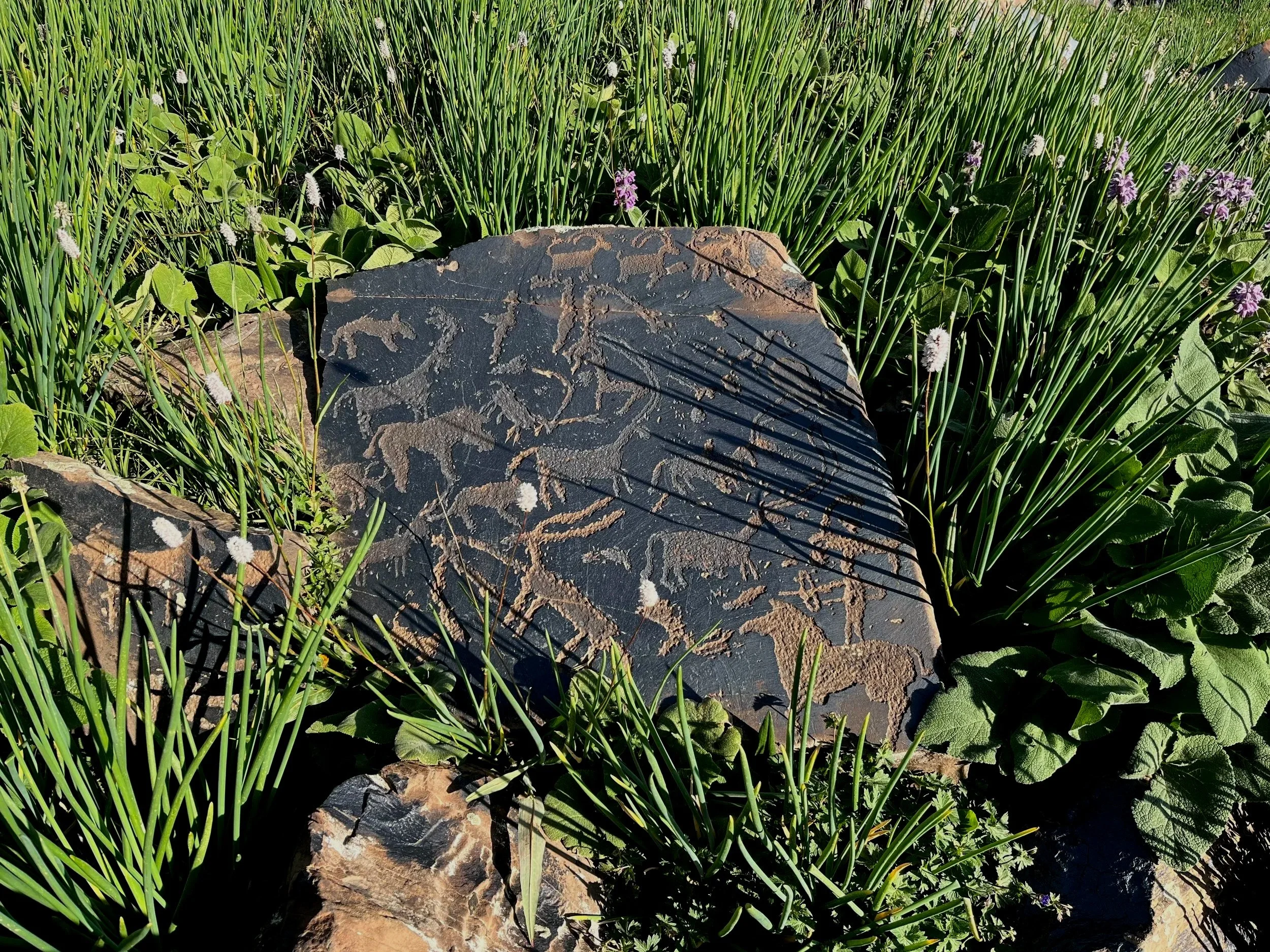
The Petroglyphs
The photos and video are the best of what I saw. However, after going online and looking at other people’s photos it seems I missed some (but with only 2 hours of searching over a large area). A local guide will make sure this won’t happen to you. Use the photos in this article as a reference for the best petroglyphs you should be looking for. With as many as 98,000 individual images it may take you a while…
Vandalism
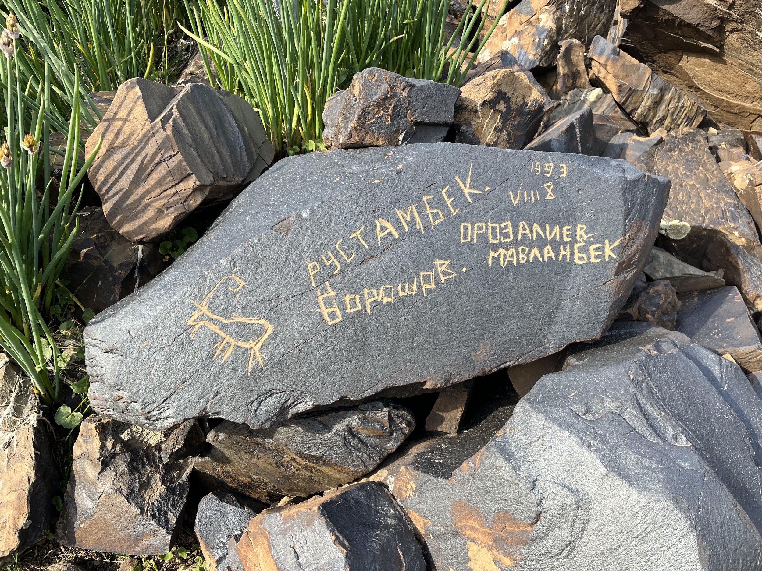
Plenty. It is entirely modern vandalism and done by local people (who have often etched their names onto the rocks next to the petroglyphs, sometimes complete with the date and name of their home town). There was also some smashing of petroglyphs where the rock varnish layer was destroyed.
When should you go?
I hiked up on July 1st, and there was some snow in the area, but not on the petroglyph rocks or in the flat area where you can pitch your tent. The ground was not wet. In a heavy snow year a trip at the same time may result in snow and disappointment. 2024 and 2023 had late unmelted snow and you would have had to delay a trip until mid-July. So it varies year from year, but mid-July or after should be safe.
Onward, or back down?
I didn’t want to go back down to the trailhead or back to the town of Kazarman, so I went up and over a pass across the ridge to the southwest. Eventually I was able to get back on the highway and make my way to Jalalabad and then Osh. The 3430 meter pass itself is easy, but on the other side I found the terrain ugly, difficult and boring. The steep loose slope was covered in ugly weeds and livestock manure, and the Aubek river below had recently had some bad flood destruction and I had to walk in boulders and rocks for most of the way before fording the river. The area below the road is the recipient of garbage and road construction waste from above. I can’t recommend this side of the pass.
Once the tunnel is completed in 2026 (hopefully), you should be able to easily find a ride at the parking lot where the hike began. This road will now be a major north-south route for locals, so you could access the petroglyphs from either Kazarman or Jalalabad.
+++
The videos below are from the hike up Saymaluu-Tash gorge, and from the petroglyph site.