Basid Gorge
A Bartang Valley Sidetrip
Basid Gorge
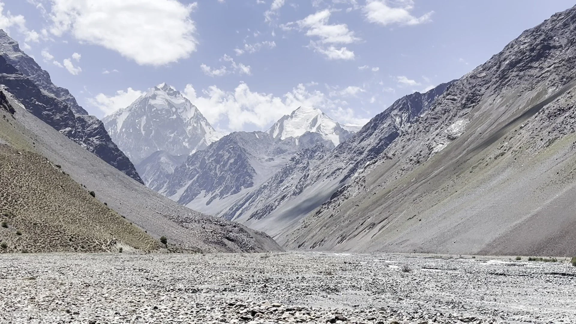
The Basid Gorge, or Basiddara in the local language, is an easy hike up a side valley from the Bartang Valley, starting in the village of Basid. You can do an up-and-down hike in a single but very fast and very long day, or do an overnight in the upper gorge. There is also the possibility of connecting over a very high pass to Bardara for those with some climbing skills.
It’s a very simple route. I hiked it in summer 2025. Here’s a GPS track with some waypoints for drinking water and camp spots: Download GPX Track.
At times there are multiple trails to choose from (livestock grazing tracks) and sometimes the trail disappears in open grazing areas and farm areas. But it’s impossible to get lost here.
As for the far upper reaches of the gorge, after the shepherd hut at Ovoz there are two tributary rivers: Zaryez and Shamshayons. The shepherds say there is no route up the Zaryez gorge to Ravmed or the Ghund Valley. But they did say that a couple of foreign mountain climbers descended from the gorge to meet a search and rescue team, one with a bad injury. It’s a serious mountaineering area in the upper gorge, with all passes and peaks having high climbing difficulty ratings.
After doing some online searches, I found trip reports by the climbers: here, here, here and here. Lesson learned: there is no helicopter coming to rescue you unless you are on a nice flat glacier or at a lower elevation in a wide open area - but your emergency satellite device will summon a search and rescue team on foot.
However, the shepherds did say it is possible to go from the Shamshayons gorge to the Bardara gorge over a high pass. We didn’t discuss it in high detail, but they did say that people from Basid have done that route in the past. Based on the topography and map imagery, and if it is in the location I think it is, the pass is just over 5100 meters and involves and steep scramble of unknown difficulty and glacier travel. If it is not where I think it is, and if it is this pass, then I think a shrinking glacier may have made its 2A difficulty rating out of date (i.e., an easy glacier trip is now steeper ice and with exposed crevasses and seracs).
So it’s not for the casual hiker…
Random notes: The hamlet of Marsor has far fewer families than there are houses seen on aerial/satellite imagery. Yarziv is still being farmed, but there is nobody living there in the abandoned houses. I explored up the Zaryez gorge, as a shepherd was taking some cattle up to pasture there when I was passing by - but my GPS track above goes up the Shamshayons gorge, where I didn’t explore (so my GPS track has been hiked as far as the bridge crossing above Ovoz). There were two very friendly shepherds at Ovoz in a hut. I don’t speak Bartangi, but they spoke some Tajik and some Russian.
Note that old maps have inaccurate names: “Geydara“ does not exist; it is Zaryez. Shepherds have no idea what “Geydara“ is and it doesn’t sound like any name they use for any place in the gorge. Some maps label the main river as Devlokhdara or Devlekhdara, rather than Basiddara. This is not wrong, it is just a descriptive name as “devlokh“ means high pastures - so they may use this name in addition to Basiddara (note that “-dara” means gorge). The problem is that everywhere in the Pamirs has a “devlokh,“ just as everywhere in Kyrgyzstan has a “jailoo“ and many places in western Tajikistan and Uzbekistan have an “ayloq“ or “dasht.“ Basid is the name of the main village, so Basiddara is far more exact and clear.
Accommodation: There are two guesthouses in the village of Basid. I didn’t visit any of the tiny village shops, as I resupplied elsewhere. Electricity is on and off and unpredictable. Someone added a guesthouse to the map in the hamlet of Marsor. I walked by and waved at the family in this house, but they didn’t indicate that they were operating a guesthouse. Sometimes tourists add random houses to the map as a guesthouse based on being invited in to stay the night. Many of these guesthouses do not exist, especially in the Pamirs.